Welcome Back to New Mexico

With the FMCA Rally over, it was time to move. We had come as far west as we were going to for this part of our travels and it was time to head east, once again. Our entire spring travel was built around 2 required destinations. The first was the FMCA Rally and the second was Waco, TX to meet up with friends for the solar eclipse on April 8th.

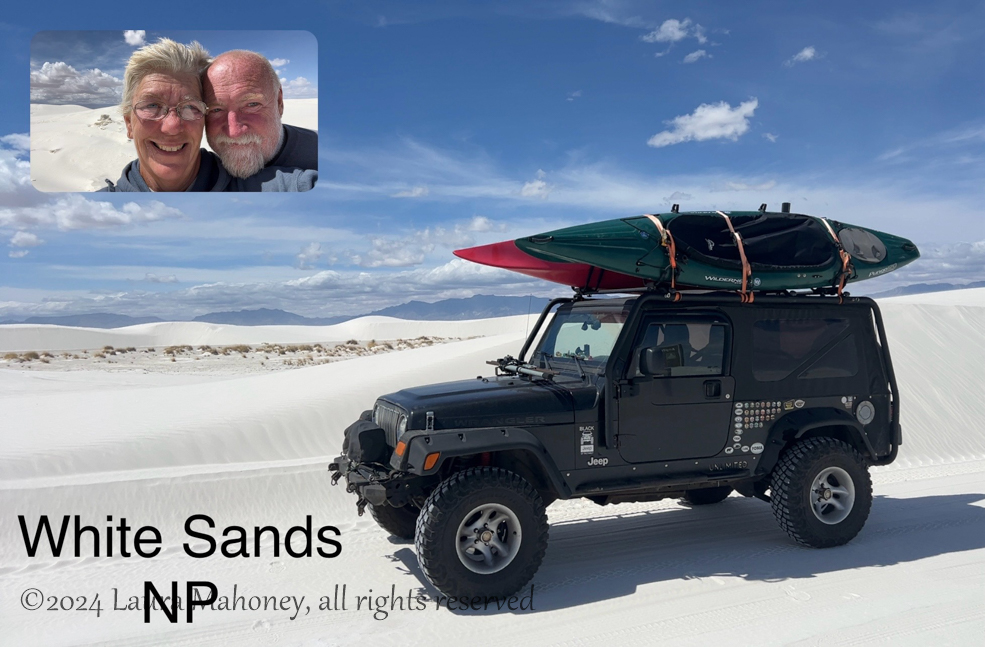
I planned on 4 nights in Alamogordo, NM to visit White Sands National Park, Pistachioland and Truth or Consequences, NM. It was going to be a lot to pack into 4 days, especially when I discovered SO many other things to do in the area.

We knew we were getting close to Alamogordo when we saw a roadside monument for the White Sands Missile Range…

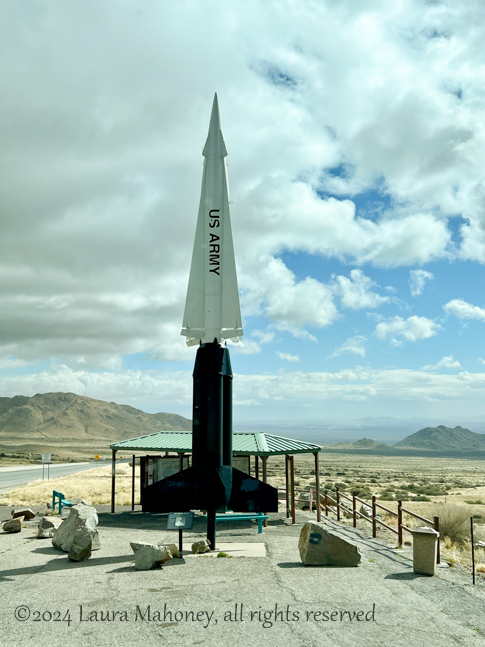
What we didn’t know at the time is that when they are actively firing missiles, the road we came in on would be closed for hours at a time. White Sands NP has a page of their website with scheduled closures. Luckily, we didn’t run into that situation, but were told it happens quite frequently. I guess we really dodged a missile. Lame joke, I know, but it was funny at the time.

The missile we didn’t dodge was the Zia Skies RV park. I knew we were in trouble when we turned onto Lemin Street…

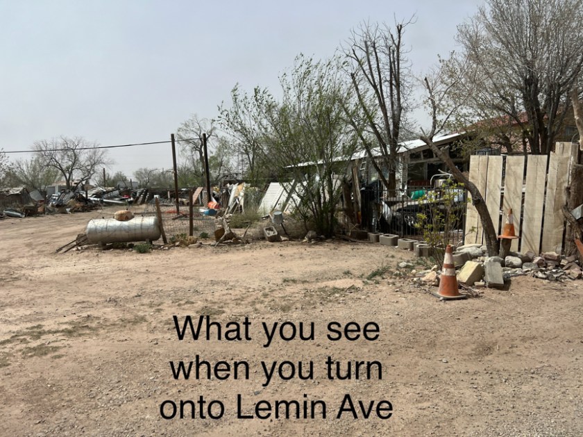
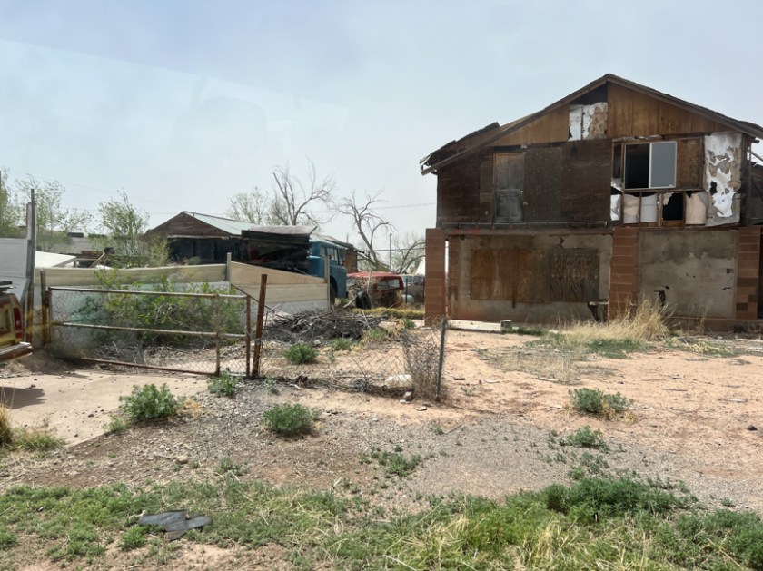
Their website mentioned a locked gate, but this wasn’t the neighborhood I was expecting! What would have been really nice is if they had sent us the gate code, since there was no office at the park. And if there hadn’t already been someone in OUR site. It is the only RV park I have ever left a review for with the heading “DO NOT STAY AT THIS PARK!”

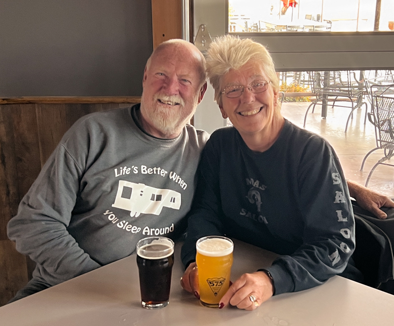
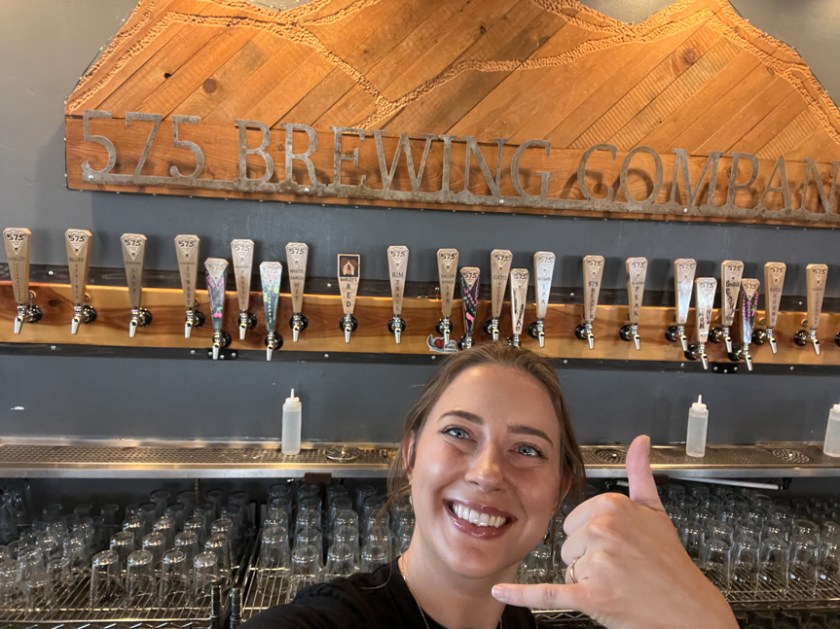
The weather was chilly and the wind just would not quit. That explains my hairstyle when we went to the 575 Brewing Company out first night in town…

Another selfie taking server

Our first full day in Alamogordo was spent at White Sands National Park. From 1933 until 2019, it was known as White Sands National Monument. The NPS still hasn’t found the funds to update the signage…

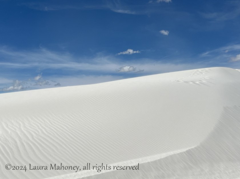
The dunes at the park make up the world’s largest gypsum dunefield and are visible from space. A 16 mile (round trip) road leads you into the heart of the dunefield. I had no inclination to hike the dunes nor to sled on them, but it was fun to watch from the Interdune Boardwalk trail…

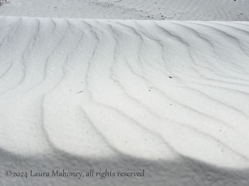
As we walked along the boardwalk, I marveled at the windswept patterns in the sand…

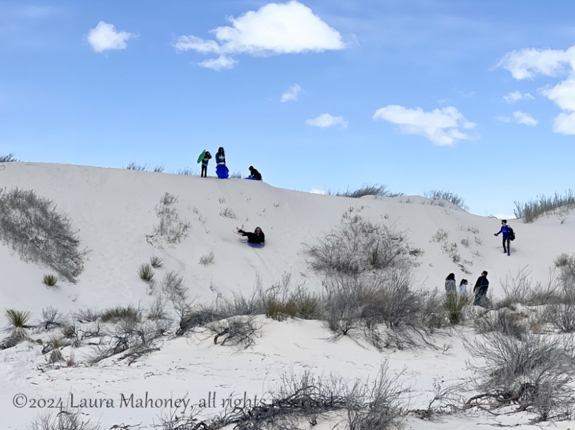
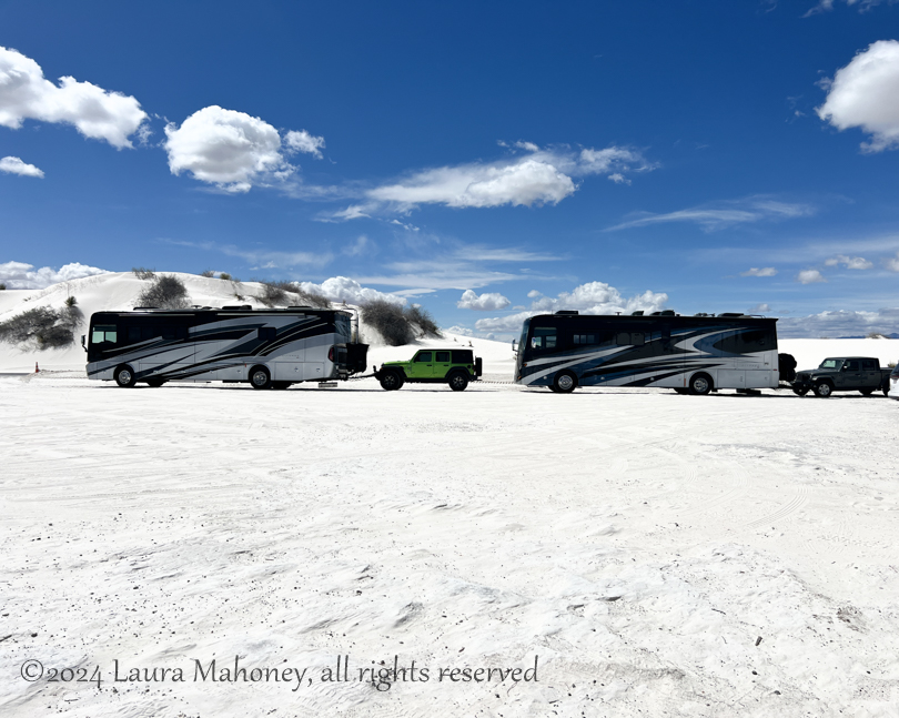
I was surprised so many people were sledding these particular dunes with all the scrub growing up when they could have driven a bit further to get to taller dunes with much less scrub. I was also surprised to see motorhomes with toads in the boardwalk parking lot…

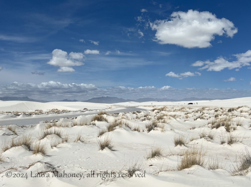
As we drove further into the dunes, the views changed rapidly. We went from dunes with lots of scrub to acres and acres of tall dunes…

The most perplexing thing I saw was a sign where the road turns from pavement to packed sand…

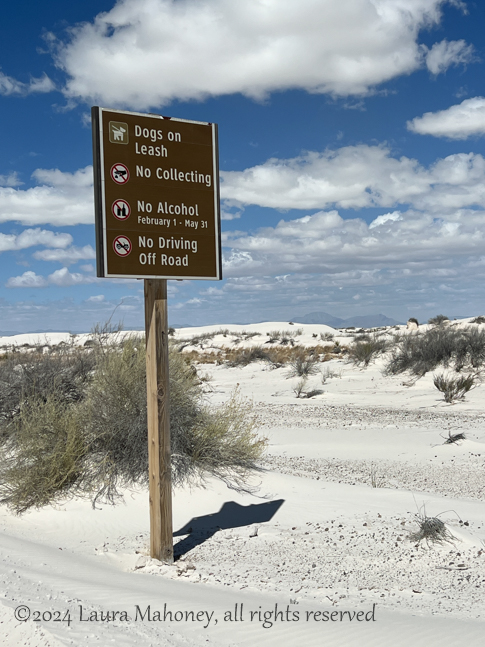
Look closely at rule #3. Apparently, from Feb. 1-May 31, alcohol is prohibited, but it is allowed from June 1-Jan. 31. My guess would be Feb-May are the months of peak visitors. Extreme heat in the summer and snowy conditions in the winter would make visiting less appealing from June to the end of Jan. It was March when we visited, so no picnic with beer for us at the dunes.

I did see a really cool Utility RV in one of the parking lots. Given the shape of the license plate, it definitely came from another country, but I love the mural on the back…

As we were leaving the park, we stopped to take a picture of a dunes climber and his dog taking a break…

The weather took a quick turn for the worst when we got back to Waldo! I was happy we weren’t still driving around the dunes when it started to snow/sleet…

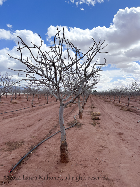
With another National Park off the bucket list, the next day we opted to knock an Atlas Obscura item off the list – Pistachioland! I love pistachios and almost always have a bag of them in Waldo for travel days, but eating pistachio ice cream in front of the world’s largest pistachio will only happen once in my lifetime!

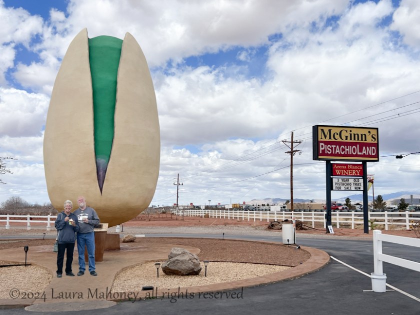
The United States has the largest share of pistachio farming in the world, producing almost 40% of the crop worldwide. The trees at McGinn’s farm were still in the dormant stage. It would be neat to see them loaded with one of my favorite nuts!

Thank you for coming along. Have you been to White Sands NP or Pistachioland? Let me know in the comments below!

Coming up…

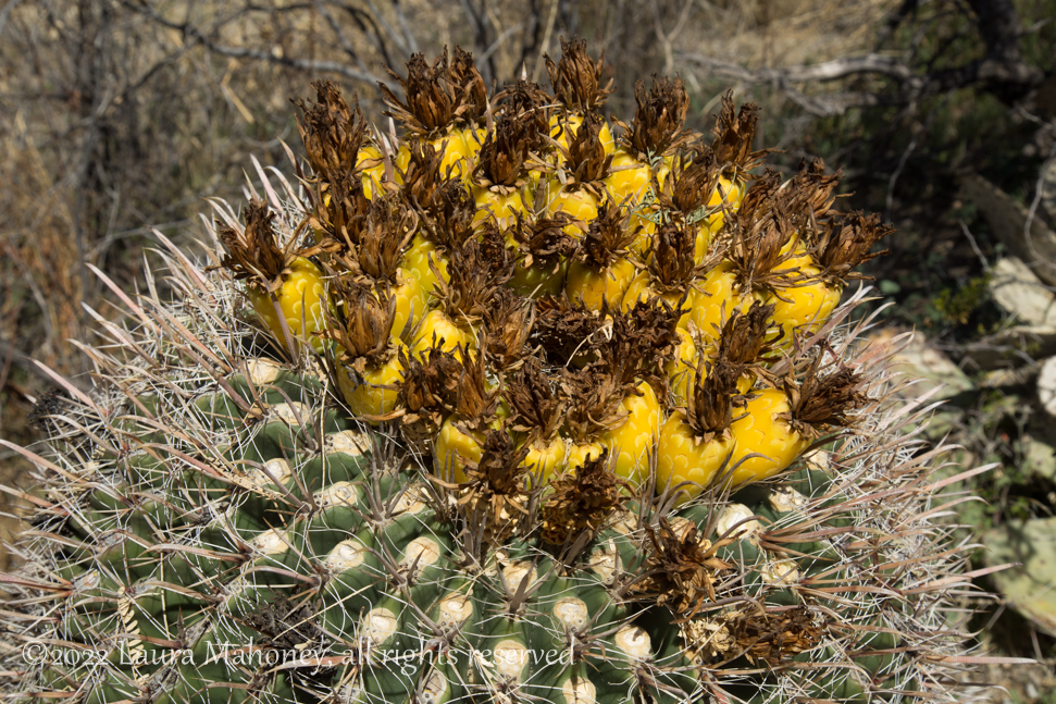
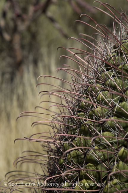
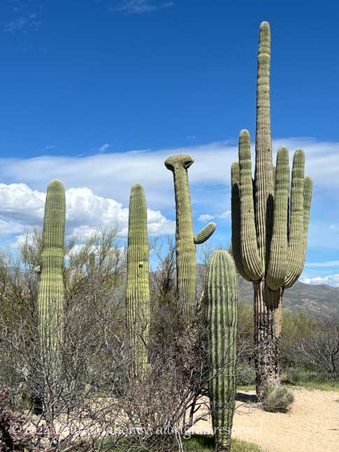
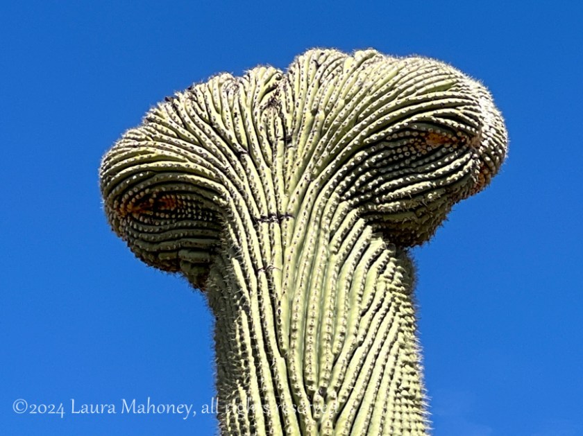
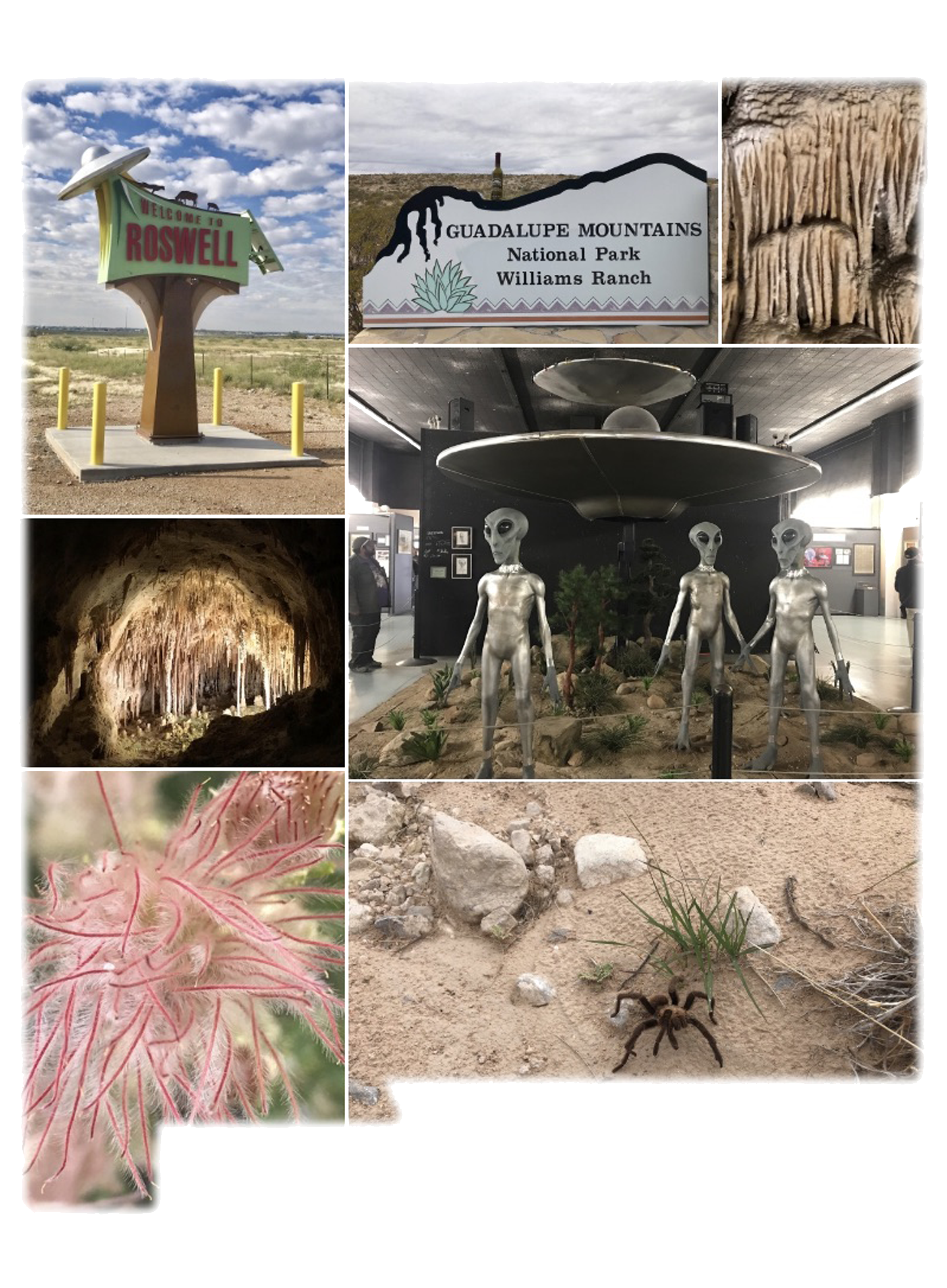
An unexpected surprise just outside Alamogordo!

Adventuring Solo

Ever since leaving Florida, we have been making our way westward with the goal of reaching Tucson on March 18th. Steve would be working for Briter Products, a lithium ion battery company at an FMCA Rally. Since what I know about installing batteries, inverters and such is zilch, I would have several days on my own.

My first priority was to head to the post office to get those “special bolts” I’d been waiting for. When Steve ordered them, I looked up the closest post office to the Pima County Fairgrounds, where the rally was being held and told him to use that address. Silly me!! A little about Tucson Post Offices: there are 5 of them, one of them is within the Davis Mountain Air Force Base, completely inaccessible to non-military personnel, and only one of them accepts general delivery I was told. Guess which post office is closest to the fairgrounds, yep, the one on the base. Guess where my bolts were, on base! Long story short, I re-ordered the bolts, under my name because I couldn’t pick up mail addressed to my husband, and had them sent to the only post office accepting general delivery. Sheesh! Who knew this would be such a PIA!?!?!?!?

Interesting side note about Davis Mountain Air Force base, it has the world’s largest military aircraft cemetery.

Partial view from GoogleEarth

Anyhow, we already established I couldn’t get on base, so I only got to drive by it. Miles and miles of planes!

In 2022, Steve and I visited Saguaro National Park, I didn’t tell you about it since I was slacking on writing blog posts. I really love the desert southwest, so I decided to revisit. Since we were there in March of 2022 and I would be there, also in March, I’m including some of the pictures from both visits.

I drove the loop trail again and stopped at many of the same locations. March is a great time to visit since it isn’t too hot and the wildflowers are blooming…

Fairy Duster
The Asian beetle blends in almost perfectly on this Brittlebush flower

But cacti were what I went to see!

One of the largest saguaros I saw

Or, how about cacti AND wildflowers…

The barrel cacti had already bloomed, but the fruits were still forming…

You definitely do not want to fall into one of them!

Road runners are one of my favorite birds, but hard to get a good picture. I did see one, resting atop a dead saguaro…

As I was driving along, I thought I saw a saguaro in bloom. Knowing it was pretty early in the year for blooms, I almost didn’t stop to investigate, but I’m sure glad I did! As I was walking back to take a picture, I met a lady, Liz, who also seemed interested in the wildflowers, so I told her what I thought I had seen. Together, we walked a bit further and, sure enough, it was just starting to bloom.

On our walk back to the parking area, I told her all about our nomadic life and adventures. She gave me lots of suggestions of things to see and places to visit while we were in Tucson. She told me about her family and suggested maybe one day while I was there we could adventure together. We swapped phone numbers then she followed me on FB and IG. We said our goodbyes and I headed out.

I took the side road, which goes to a picnic area, and saw my first cristate or crested saguaro

Zoomed in, I though it looked like an alien. Scientist still aren’t sure what causes this mutation, but I though it was pretty cool. If I had read more on the NPS website, I would have been able to find others in the park.

I was about 3/4 of the way around the Cactus Forest Auto Loop when I received a message from Liz. She and her son were at Javelina Rocks and was wondering if I’d be along soon. I let her know, I was only a few minutes out. When I arrived, it wasn’t hard to spot Liz and her son…

Liz was kind enough to come down to show me the easiest path to climb the formation. Once she pointed it out, she offered to stay below and take a picture of me…

Then she rejoined us and we admired the outstanding view…

It had been a great day. A visit to one of my favorite landscapes and a new friend!

Liz

Coming Up…

The Sky Island Scenic Byway

Canyonlands National Park

A mere 28 miles from the entrance to Arches lies another, lesser known or visited park, Canyonlands National Park .

Canyonlands is divided into 4 districts, the Island in the Sky, the Needles, the Maze, and the Rivers (the Green and the Colorado). Island in the Sky is the most accessible with paved roads, scenic vistas and easy to reach hiking trails. Reaching the other districts requires 4×4, horses, overnight hikes into the backcountry and a special permit.

We only had one day to visit Canyonlands and decided to take the Islands in the Sky Scenic Drive. We chose to drive to the end and work our way back to the entrance. The park rangers has warned us about limited parking at the Mesa Arch Trailhead and , as expected, it was packed when we drove by. With stunning scenery at every turn, it’s hard to take it all in. From deep canyons to vast mesas, the views just keep coming…

The cyclist in the above picture, yes, that minuscule black dot, provides a sense of scale.

When sensory overload begs you to find a seat and just take it all in for a moment, find the best one you can!

If you think I’m crazy, at least I don’t have my back to the edge of the cliff while someone takes my picture…

While you are gawking at the landscape, don’t forget to take in the things at your feet…

In my opinion, cacti create some of the most beautiful flowers. You’re not going to pick a wildflower bouquet, but you might end up with a hundred or so pictures on your phone.

It was around 4pm by the time we made it back to the trailhead at Mesa Arch. With only a handful of cars remaining, we easily found a spot and hiked the .6 miles to the arch. While Canyonlands NP is obviously named for, well, its canyons, it does have 80 or so arches. In comparison, nearby Arches NP boasts over 2000 arches (the highest concentration in the world). We had no problem finding someone to take our picture…

Or taking crowd-less pictures of the landscape…

We still had a few hours of daylight left when we finished the Island in the Sky drive, so we decided to take the long way back to Waldo via Pucker Pass 4×4 trail.

We weren’t very far down the trail when we came across a possible problem. With the kayaks on the top, I wasn’t sure there would be enough clearance. Plus the trail at this point had turned a bit rough…

While we made it though without any problems, the vehicle you can see behind us turned around. Soon, we were back to switchbacks and more amazing scenes…

If you look closely, you can make out the trail near the bottom of the canyon. We found an area to pull off the trail and take the required selfie…

Moonrise over the cliffs signaled the impending sunset…

As the shadows began to lengthen, we knew it was time to move along…

The Colorado River signaled the end of the trail and our day’s adventures…

It would be easy to spend a week or more exploring Canyonlands. Maybe next time!

Up next – The Area Surrounding Moab

Thanks for coming along, I’d love to hear your thoughts on our adventure.

Arches National Park

Last year, we visited Arches National Park. OK, so I’m a little behind in posting but, in my defense, we did just spend 6 weeks with very limited connectivity. Anyhow, back to Arches. We stayed at Ballard RV Park in Thompson Springs, Utah. We chose Ballard because it was close to everything we wanted to see, but didn’t have the Moab crowding.

We drove into Moab to pick up information about Jeep trails and National Parks so we could plan how to make the best use of our week in the area. We were disappointed to learn the entrance to Arches was generally closed by 11am due to overcrowding in the park and usually reopened in the late afternoon. We passed the entrance to Arches on our way back to Ballard’s and the car lining up to get in for the afternoon was nearly a mile long. We weren’t too keen on the idea of sitting in line for hours!

The next day, we decided to take a BLM road that looked like it went all the way into Arches from the back side. As we rode along, we were treated to some of Utah’s wildlife…

As well as some wildflowers and incredible scenery…

When we reached the boundary of the park, we were quite happy to find an open gate and a sign stating this was a fee area. Since we have a National Park pass, we drove on in!

Our goal was to spend the day exploring and deciding which arch we wanted to photograph at sunrise a few days later. We drove the entire length of paved roads in the park and saw some amazing arches and a very appropriate warning…

Our sunrise photography decision was Turret Arch as seen through North Arch. With our decision made, we headed back to Waldo via paved roads. As we exited the park, I made a time lapse video of the line of cars waiting to get in…

Dang!!! Luckily, to get there and set up for sunrise photography, we’d be coming into the park at 4am, shouldn’t be too bad at that hour.

We arrived back in the park a few days later, well before sunrise. There were lots of cars in the parking lot, but the ranger had told us many of those would leave as soon as the sun rose above the horizon…

We to the base of North Arch in the dark and took up our wait for sunrise. As expected, there were lots of people waiting with us…

But, 10 minutes after the sun broke the horizon…

The crowd began to thin. Steve found a place he wanted to be and so did I. Two very separate places!

My patience paid off with my favorite shot of the morning…

Turret Arch seen through North Arch. Notice the lack of people!

With sunrise behind us, we set off for our next adventure…

I love my Jeep!! The pictures I took don’t really show how bad the road was…

But the road was definitely worth the views!

The only other way to get to Tower Arch is a 10 mile hike ~ no thanks! It was nearing noon, so Steve and I found a place for lunch…

Not a great picture, but you get the idea. We had about 5 more miles to go before we reached the park boundary and the scenery just kept being amazing…

We finally made it back to paved roads and called it a day.

Whether you are a hiker, a 4×4 enthusiast or a see it from the car kind of person, Arches National Park has something for you!

Up next…Canyonlands National Park

Horsing Around on Cumberland Island

Since nobody seemed to be a fan of kayaking with alligators, I thought I’d go with something cuter. Our last adventure in Georgia was one I had been waiting for for a very long time. Cumberland Island National Seashore has been on my list of “must visit” places for years. Every time I drove from New Hampshire to Florida I wanted to fit it in but just never could. Since we were already adventuring in Georgia, I would not be denied! Cumberland Island or Bust!

Cumberland is the largest and southern most of Georgia’s barrier islands. We would only have one day to explore and I was determined to make the most of it. We boarded the 9 am ferry in St. Mary’s and began our relaxing 45 minute journey to the island. Our fellow 148 passengers were quite a diverse group. There were cyclists, campers, hikers, fishermen and even a couple getting married.

After disembarking, we started out on the River Trail…

Cumberland Island-1996

We stopped near the edge of the sound and watched as the Cumberland Queen II headed back to St. Mary’s…

Cumberland Island-2004

The trail ends at the Ice House, this is where we got our first glimpse of the famed wild horses of Cumberland Island…

Cumberland Island-2017

Horses were originally brought to the island in the 1700’s. Now, a herd of feral horses resides on the island. They are left to there own device with no help from the National Park Service. Some of the horses we saw seemed a bit thin, but overall looked to be in decent health. And obviously are healthy enough to mate and produce colts. Steve sat down to watch at one of the picnic tables and I noticed how huge the live oak tree next to him was. I had to back up so far to get most of the tree in, you can hardly see him…

Cumberland Island-2008

You are warned to keep at least 50′ from the horses, after all, they are wild. But what do you do when you are taking a picture of the beautiful lane, lined with spanish moss laden trees…

Cumberland Island-2013

And the horses suddenly decide to cross the road, right where you are standing?

Cumberland Island-2020

You do what I did and hide behind a tree! We continued on towards the ruins of the Dungeness Mansion. Since it was nearly noon, we stopped at a picnic area and had our snacks. As I was reading the signs about the wildlife, another group of horses came by. This foal couldn’t have been more than 6 weeks old…

Cumberland Island-2066

In 1736 James Oglethorpe built a hunting lodge he called Dungeness. In 1796 Phineas Miller and his wife built a 4 story mansion on the site and named it after the lodge. In 1884 Thomas Carnegie, brother of steel magnate Andrew Carnegie, and his wife Lucy bought Dungeness and raised 9 children there. Today all that remains of Dungeness is a sprawling shell …

Cumberland Island-2071Cumberland Island-2074Cumberland Island-2094

There was a time, it looked like this…

Dungeness Mansion

Some of the outbuildings remain, as well as some of the statues…

Cumberland Island-2083

Cumberland Island-2078Cumberland Island-2093

There are several other buildings from that era which are still in use. While we were walking around the mansion, I spied another family group of horses. I thought the colt was beautiful and spent lots of time taking pictures of it…

Cumberland Island-2056Cumberland Island-2061

We were almost done checking out the mansion when an altercation broke out between the horses, I have to tell you, the horses scared me way more than the alligators!!!

Cumberland Island-2100

We continued on to the Dungeness Beach boardwalk…

Cumberland Island-2111

I watched as the fiddler crabs defended their territory in the marsh…

Cumberland Island-2108

At the end of the boardwalk, sand dunes create a barrier to the interior of the island…

Cumberland Island-2110

When we finally reached the beach, it seemed deserted. One of the benefits of limiting the number of visitors to the island each day is you get to see this…

Cumberland Island-2113

Unspoiled, salty air bliss. We walked over a mile and a half on the beach and only saw a handful of other people. We did see a horseshoe crab skeleton…

Cumberland Island-2114

And one of the few people we did see was kind enough to take this picture for me…

cumberland

As we neared Seacamp Beach Campground, I stopped again to marvel at the gnarled live oaks and their spanish moss adornments…

Cumberland Island-2118

Our day was nearly over, the 4:45pm ferry would soon take us back to the mainland. Cumberland Island was everything I had imagined and more. We had walked about 6 1/2 miles and taken countless pictures to go through later.

If you’ve been thinking about visiting Cumberland Island, all I can say is DO IT! Hopefully we will return again another time to see the north end of the island.

My friend Dawn, from Random Bits of Trial and Error wrote a lovely post about her adventures on Cumberland Island, read about it here.

Thank you for coming along.

I’m a couple weeks behind, we are currently at our summer job in Wisconsin. I can’t wait to tell you about it!

What are you more afraid of feral horses or alligators?

Kayaking with Aligators

We only had 2 days to explore the Okefenokee National Wildlife Refuge, not nearly enough time considering it covers 630 sq miles. The swamp is only part of the Okefenokee experience, there are also vast wet prairies, pine uplands and cypress forests. This mosaic of habitats makes the Okefenokee a “Wetland of International Importance.” The swamp itself is 38 miles long and 25 miles wide and remains one of the most well preserved and intact freshwater ecosystems in the world.

Day One

We stopped at the visitors center and asked about the 120 miles of water trails. Like hiking trails, they range from easy to difficult. We wanted to plan an easy paddle, maybe 4 or 5 hours in total. A trip to the Cedar Hammock canoe shelter sounded just right.

With the next day’s kayaking plan in place, we had the rest of the afternoon to explore. We took the 7.5 mile Swamp Island Drive. The ranger told us to be on the lookout for several species of carnivorous plants and orchids blooming along the borrow ditch. She explained the ditch was created when workers “borrowed” the material to build the road.

Okefenokee NWR-1944
Rose Pogonia

Okefenokee NWR-1945
Butterwort

Okefenokee NWR-1938
Pitcher plant


We crossed onto Chesser Island, which was named after the family who settled there in 1858. A short path led us to the homestead…

Okefenokee NWR-1913Okefenokee NWR-1914


It’s hard to imagine what life was like in 1927 when Tom and Iva Chesser built the homestead. The yard was kept free of vegetation to reduce the fire hazard and  to increase the chance of seeing any snakes that might wander by. There are many remnants of family’s life on the island…

img_7436img_7440

img_7438
Cane syrup hearth

Our final stop on the Swamp Island Drive was the Chesser Island Boardwalk…

Okefenokee NWR-1917Okefenokee NWR-1919

We kept our eyes open for wildlife. The ranger told us a bobcat had been hanging around the boardwalk, but alas, I had to settle for lizards…

Okefenokee NWR-1923Okefenokee NWR-1924

We climbed the 40-foot Owl’s Roost Tower for a view of Seagrove Lake…

Okefenokee NWR-1929


Day Two

Our first plan was to be at the refuge early, but when I woke up, it was a chilly 63 degrees. I decided I wasn’t in a hurry! It was almost 10am when we arrived warming up quickly. We signed the paddlers’ log, we began our adventure.

We followed the Suwanee Canal for about a mile and a half before finding the entrance to the Cedar Hammock trail. Along the way, I marveled at the reflections in the tannin rich waters…

Okefenokee NWR-1960Okefenokee NWR-1964

We saw a few alligators in the canal. Despite being in a kayak, I did not feel threatened by their presence.  Okefenokee NWR-1990

Although, one surfaced so close to the front of my kayak, I could see it’s eyes but not it’s snoot. A little too close.

We left the motorboats behind when we entered the trail. They had all been courteous, slowing down to no wake speed when they passed, but I was happy to head deeper into the swamp…

Okefenokee NWR-1966Okefenokee NWR-1969

The trail was peaceful, with scores of water lilies blooming along the way…

Okefenokee NWR-1973

At the end of the trail there is an overnight shelter and outhouse.

Okefenokee NWR-1975

I got out to stretch and watch the alligator swimming by…

Okefenokee NWR-1977

As we were leaving, I noticed a baby alligator among the lily pads…

Okefenokee NWR-1982

Steve took the lead on the way back to the canal. I wonder if he saw this guy…

Okefenokee NWR-1983Okefenokee NWR-1986-Edit


I loved every minute of our paddle! From the anhinga…

img_7457

To the turtle…

Okefenokee NWR-1991

It was amazing!

Would you kayak with the alligators? Do  you think we’re nuts?

A Trip to Canaveral National Seashore

Nature in harmony with science make Florida’s Space Coast an adventure not to be missed. I have been to the Space Coast twice, the first time in 2012 and again last week with Steve. There are several components making up the coast, you have the Canaveral National Seashore, consisting of 57,662 acres, the Merritt Island NWR, consisting of 140,000 acres which includes NASA’s Kennedy Space Center.

On both occasions, my main objective was to visit Merritt Island NWR, specifically the Black Point Wildlife Drive. Both of my visits were in late March and I was surprised by the differences. The water levels were much higher in 2012 and my visit coincided with a prescribed burn.

2012March30-120330-2502012March30-120330-241

It’s natural for the water levels to fluctuate and we haven’t had a lot of rain this winter.

Merritt Island NWR is home to over 1500 species of plants and animals, including 15 federally listed species. It is also an important stop on the Atlantic Flyway. You never know what you might come across during a visit.

The wildlife drive is a 7 mile, one-way road through various habitats, from shallow marsh impoundments to pine flatwoods…

2012March30-120330-025

With spring in the air, wildflowers are blooming, attracting lots of butterflies…

2012March30-120330-0432012March30-120330-0472012March30-120330-0612012March30-120330-242


In 2012, I was lucky enough to be visiting when a large flock of white pelicans were resting in the marsh…

2012March30-120330-191

This year, we saw quite a few northern shovelers which are in the spoonbill family…

Merritt Island NWR-1362

While we were photographing them, a grackle made his presence known. He was finding a meal in the fallen palm fronds. When I got too close, he retreated to my spare tire.

Merritt Island NWR-1662Merritt Island NWR-1657


We saw flocks of blue billed ducks. I haven’t quite identified them yet…

2012March30-120330-015

And tons of coots…

Merritt Island NWR-1670

The one animal you are almost guaranteed to see is alligators…

Merritt Island NWR-16952012March30-120330-0872012March30-120330-114

After we finished the drive, we decided to head over to Canaveral National Seashore. On the way, we were lucky enough to see a sandhill crane with its chick…

Merritt Island NWR-1707

Using our America the Beautiful Pass, we entered our first national park of the year. I don’t think we will visit as many parks this year as last (15 in total), but we love not having to pay the entrance fees.

Our first wildlife encounter was with an armadillo. I’m fairly sure this little guy was completely blind. He was unfazed by my presence and at one point nearly walked into me…

Canaveral National Seashore-1732

We also saw what I think was a box turtle on the side of the road…

Canaveral National Seashore-1734

Only one of our encounters came with its own warning sign…

Canaveral National Seashore-1739

I have to admit, we were a bit surprised. The seashore has 5 areas with beach access and apparently clothing is optional at beach 5. Who knew?!?!?

The one area we haven’t visited yet is the Kennedy Space Center. I’ve heard you can spend the better part of a day there, so it will have to wait until next time.

I’d love to hear your thoughts!


Out With The Old

Almost all of the bloggers I know do a special post to mark the end of the year. I always enjoy reading them. Inevitably, it makes me reflect on our own travels, trials and triumphs.

2018 held lots of promise for us as we began our first full year of RV living and working. We knew we’d be starting in Florida, but had no way of knowing for sure December 2018 would find us back there. Hell, there were times when we were broken down, I didn’t think we’d ever make it back to Florida. But we did. We met so many wonderful people along the way. People who changed our lives, possibly without ever knowing so.

I count us a dang lucky…our adventures have been many and our trials have been relatively few, given our lifestyle.

I thought long and hard about how I was going to commemorate 2018. Usually I end up trying to pick a favorite picture from each month – a top 12, if you will. 12? Who was I kidding? We took pictures in at least 13 states, visited 15 national parks/monuments/preserves and drove through western Canada. I couldn’t possibly narrow it down to 12!

My solution was a collage made from every state we spent any real time in (and Canada will just  have to forgive my exclusion of them in this post). The following collages are in alphabetical order, not the order we visited. So without further ado, here is 2018 in review…

Arizona

Alaska Collage

California

Florida

idaho

Louisiana

Nevada

New Mexica

Texas

Washington

Wyoming

I don’t know for sure what is in store for us for the next year. We have some tentative plans and lots of hopes.

I sincerely hope 2019 brings health and happiness to you and yours! Thank you for wandering along with us.

Wild About Wyoming – Yellowstone NP

I don’t even know where to begin. We have never been to a National Park with as much diversity as Yellowstone. To quote for the National Park Service website

Marvel. Explore. Discover.

Visit Yellowstone and experience the world’s first national park. Marvel at a volcano’s hidden power rising up in colorful hot springs, mudpots, and geysers. Explore mountains, forests, and lakes to watch wildlife and witness the drama of the natural world unfold. Discover the history that led to the conservation of our national treasures “for the benefit and enjoyment of the people.”

Yellowstone has been a national park for 146 years. Founded in 1872, it truly has something for everyone. We spent 3 days exploring and we could have spent 30. I doubt a lifetime would be long enough to see and experience everything. One of the things I loved about it was how much of it is accessible by vehicle…

img_6964

There are 5 entrances into the park and the main road is laid out in sort of a figure 8. We were staying at Henrys Lake State Park in Idaho (a place I sincerely recommend), so we always came into the park through West Yellowstone.  Visiting in late September was perfect, a light jacket was all we needed and the throngs of tourists who flock there in the summer had mostly vanished.

Within minutes of entering the park, we saw out first wildlife…

Yellowstone NP-0509


The west entrance follows the Madison River and pullouts on the road allowed for photography without obstructing traffic…

Yellowstone NP-0020


We drove along Firehole Canyon Drive to enjoy the first of several waterfalls…

Yellowstone NP-0036

We spent the rest of the day checking out many of the geothermal spots. Between geysers, bacterial mats and boiling mud I was pretty much left speechless…

When we made it to Yellowstone Lake, we walked along the boardwalk. We were nearly done the loop when we came across a small herd of female elk and their young ones…

Yellowstone NP-0310

Unfortunately,  there is an idiot in every crowd and a 20-something stepped off the boardwalk (for a better picture naturally) and spooked the herd. They moved down into the hot springs area and stayed there…

Yellowstone NP-0337

On the way out of the park that evening, we were lucky enough to see a pair of bull elk not far from the road. We were the first to pull over and get a few shots. What I hadn’t immediately seen was the Great Grey Owl in the tree above them…

Yellowstone NP-0345Yellowstone NP-0364

It didn’t take long for the roadside to be crowded with cars, so we moved on before someone caused an accident.

The next day, we drove north after we entered the park, heading to the Mammoth Hot Springs area. When we passed Thundering Mountain, I had to stop and get a shot. Yes, I know you aren’t supposed to take pictures looking into the sun, but it was nearly blocked out by the steam. And, yes, that is a layer of frost on the ground…

Yellowstone NP-0390

Just down the road, the scenery was such a contrast to the steaming mountain…

Yellowstone NP-0400

We finally made it to the Mammoth Hot Springs and took some time to explore.  I was intrigued by the dew…

Yellowstone NP-0430

Millions of tiny droplets covered the plants. And I caught a chipmunk having a mid-morning snack…

Yellowstone NP-0419

But the colorful formations are what took the cake…

Yellowstone NP-0413Yellowstone NP-0421Yellowstone NP-0441

Our final destination for day 2 was South Rim Drive. This lead us to the “grand canyon” of Yellowstone, complete with an amazing waterfall…

Yellowstone NP-0488Yellowstone NP-0494

Knowing it would be our last day in the park, we set off early to try and catch more of the wildlife. Of course I couldn’t pass up another waterfall…

Yellowstone NP-0450

Just as we were passing by, these 2 buffalo decided to but heads…

Yellowstone NP-0537

After watching them for a while, we headed towards Lamar Valley. From everything we had read, this was the best place for wildlife viewing. Also it was noted for being a well traveled wolf route. It wasn’t hard to know were the wolves were expected…

Yellowstone NP-0567

Unfortunately, we arrived about 20 minutes after the wolves. They had already laid down for the day and wouldn’t become active again until late in the afternoon. It was interesting to note most of the tripods held spotting scopes, not cameras.

We spent most of the rest of the day just watching the buffalo and enjoying the scenery…

Yellowstone NP-0571Yellowstone NP-0578Yellowstone NP-0580Yellowstone NP-0582

We couldn’t leave Yellowstone without watching Old Faithful erupt. We got there early, found a seat and waited. It didn’t take long for the crowds to arrive…

Yellowstone NP-0590

Old Faithful was as punctual as predicted and we watched her amazing 4 minute spectacle with awe…

Yellowstone NP-0604


Steve and I  often talk about which of the national parks we have visited is our favorite. We almost always agree, you can’t possibly pick one over the other because they are all unique. Each one offers something special. But, I think Yellowstone’s diversity makes it my top pick!

I’d like to thank Laura over at Chapter 3 Travels. She and her husband, Kevin, visited Yellowstone a few months ago and wrote a fantastic piece about it. They stayed at Henrys Lake SP, which is how I found out about it.

Next up…Grand Teton National Park

Do you have a favorite national park? I’d love to hear about it…

Joining the 30% Club

We feel downright privileged to have been inducted into the 30% club! When we first arrived in Alaska, we had no idea such a club existed. The chalets where we worked were usually the final destination for our guests. They had already explored Fairbanks, Denali National Park and Anchorage. The Kenai Peninsula was the end of their adventures. Time after time, we heard stories of visiting Denali NP only to be terribly disappointed they didn’t get to see Mt. Denali. I mean, after all, it IS the tallest mountain on the continent – how can you not see it?!?!?

Mt Denali is 20,310 feet tall, that’s about 3 1/2 miles. Its 2 peaks are over 2 1/2 miles apart. It’s hard to imagine you couldn’t see it! But the fact is, given its location and size, it creates its own weather.

“Denali is so massive that it generates its own weather; much the way a huge boulder submerged in a river creates whitewater rapids. All mountains deflect air masses and influence local conditions, but Denali rises so abruptly and so high that this effect is more dramatic here than perhaps anywhere else on Earth. Storms barrel in from the Gulf of Alaska and the Bering Sea and collide with Denali’s towering mass. Weather can quickly change from sunny and clear to blizzard conditions with fierce winds, intense cold, and heavy snowfall.”

                                                         From The Alaska Range and Denali: Geology and Orogeny

This pattern of weather convergences means it can be sunny and 70˚ in town and Mt Denali could be obscured by fog and clouds. It’s estimated only 30% of visitors actually get to see Mt. Denali. We were in that 30% – FOR 3 DAYS IN A ROW!!!!   Denali means “the high one” in Koyukon, a subset of the Athabaskan language family, sometimes thought to mean “the great one.” Every time we got to see Mt Denali, I was in awe.

The park has an incredible history and many of the stories can be found here.

The First 15 Miles

a map showing the predominately east-west road through denali national park

Private vehicles can only be driven on the first 15 miles of the 92 mile park road. To go beyond Savage River, you must take the park shuttle or hike. We spent our first day driving those 15 miles and seeing all we could see…

Denali NP-9232
The view on the left side of the road

Denali NP-9244
Compared to the view on the right side of the road

It was strange how the left side of the park was in bathed in dappled sun while the right side was shrouded in clouds. There would be no view of Denali today, but, we did get to see some informative signage…

Denali NP-9242

And when we made it to Savage River, we were treated with a surprise…

Denali NP-9238
A rainbow over Savage River

We weren’t worried we didn’t see any wildlife on the first day. Guided by the weather forecast, the next day we planned a trip on the shuttle to the Eielson Visitor’s Center – Park Road Mile 66.

The First 66 Miles

We opted for the transit bus, as opposed to the narrated tour bus. The up side of the transit bus is you can disembark, hike, then grab another bus, while you have to remain on the tour bus. We promptly departed at 7:30am, along with 58 of our newest friends. Our shuttle driver Annie filled us in on what to expect, she said we’d stop for all wildlife sightings and several scenic overlooks, in addition to potty breaks for the 8 hour ride.

Denali NP-9247

Our first view of Mt Denali was over the mist settled in the valley. But, we had seen it! Already a member! As the morning worn on, we stopped for several wildlife encounters…

Denali NP-9262
Meet Mr Caribou

Denali NP-9289
Those 2 black dots at 2 o’clock and 8 o’clock are grizzly bears

It was a bit frustrating for me, jostling for a view out the window, but we made it work.

Denali NP-9295
Those white dots in the center are Dahl Sheep

Are you noticing a pattern? Lots of dots. The colors on the mountains reminded me of Death Valley, except this color came from brightly colored fall foliage instead of minerals…

Denali NP-9299

Denali NP-9302
The park road winds past colorful mountains

A good part of our day was spent taking pictures like this…

Denali NP-9307

At mile 46, we stopped to check out Polychrome Overlook. The myriad of colors were astounding…

Denali NP-9309Denali NP-9321

Denali NP-9318
Lots of buses filled with tourists

We also stopped along the route for the iconic picture of the park road with Mt Denali in the background. Yes, everyone else has taken this picture, but I couldn’t resist…

Denali NP-9374

We did get a closer view of some grizzly bears, but unfortunately, the sun was shining toward us and the bears ended up with a halo…

Denali NP-9360Denali NP-9356

We also saw a couple moose in the distance…

Denali NP-9327

And lots more “dots” on the mountains…

Denali NP-9343Denali NP-9336

I loved watching this group of caribou. With winter around the corner, they are beginning to shed the velvet covering their antlers. It’s  not a good picture, but the antlers were almost orange…

Denali NP-9392

The views, despite being out the window, were breathtaking…

Denali NP-9322

When we arrived at the Eielson Vistor’s Center, Mt Denali provided an amazing backdrop…

Denali NP-9399Denali NP-9403Denali NP-9411

We decided to stay at the vistor’s center and catch a later shuttle. We were treated with a couple minutes of solitude before the next bus arrived. While we were basking in the splendor of Mt Denali, some of the wildlife posed for a closeup…

Denali NP-9427
An Arctic Squirrel

Denali NP-9423
Munching away on an apple peel someone had carelessly or purposely dropped

The park rangers go to great length to educate the public about the dangers of feeding ANY of the animals. Annie had reminded us time and again, it was best to eat on the bus so as not to leave so much as a crumb for the critters. But, you know people, some of them just can’t help themselves.

We walked along the trail and looked back at the visitor center…

Denali NP-9435

And ahead to the 33 more miles to the base of Mt Denali…

Denali NP-9434
Hard to imagine, Mt Denali is still 33 miles away!

One of the interesting things about Denali NP is the fact it is a “trail-less” park, with a few exceptions near the entrance. People are encouraged to find their own path. Go out and walk on the tundra. Feel the springiness of it under you feet. Enjoy it in your own responsible way.

It was time to head back. We had seen everything we had hoped to except the wolves. Pretty darn good day!

Up next…Cruising the Denali Highway and Abandon Igloos

Are you a member of the 30% club? Did you even know there is such a thing? I’d love to hear your thoughts.