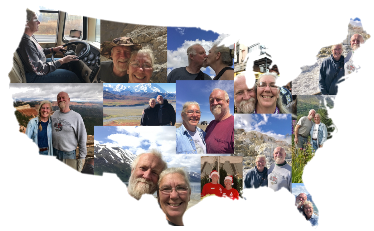
Almost all of the bloggers I know do a special post to mark the end of the year. I always enjoy reading them. Inevitably, it makes me reflect on our own travels, trials and triumphs.
2018 held lots of promise for us as we began our first full year of RV living and working. We knew we’d be starting in Florida, but had no way of knowing for sure December 2018 would find us back there. Hell, there were times when we were broken down, I didn’t think we’d ever make it back to Florida. But we did. We met so many wonderful people along the way. People who changed our lives, possibly without ever knowing so.
I count us a dang lucky…our adventures have been many and our trials have been relatively few, given our lifestyle.
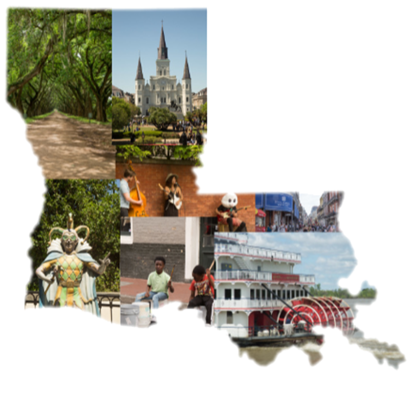
I thought long and hard about how I was going to commemorate 2018. Usually I end up trying to pick a favorite picture from each month – a top 12, if you will. 12? Who was I kidding? We took pictures in at least 13 states, visited 15 national parks/monuments/preserves and drove through western Canada. I couldn’t possibly narrow it down to 12!
My solution was a collage made from every state we spent any real time in (and Canada will just have to forgive my exclusion of them in this post). The following collages are in alphabetical order, not the order we visited. So without further ado, here is 2018 in review…
I don’t know for sure what is in store for us for the next year. We have some tentative plans and lots of hopes.
I sincerely hope 2019 brings health and happiness to you and yours! Thank you for wandering along with us.
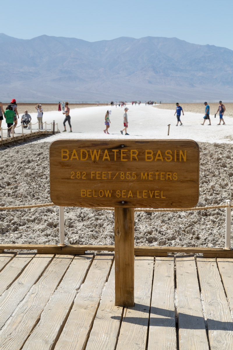
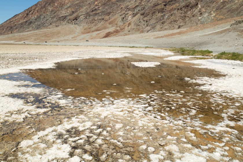
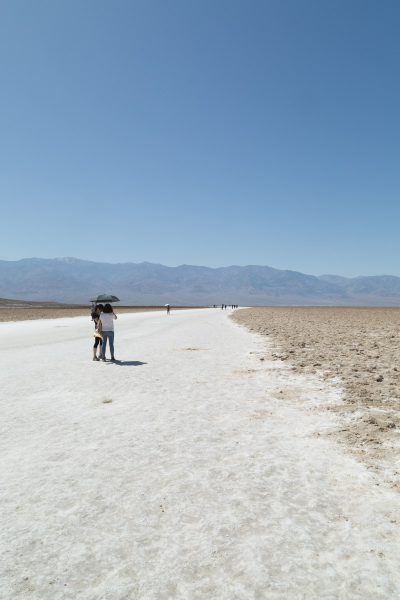
If you missed part 1 , you can catch up here. Badwater Basin is the lowest point in the United States, at 282 feet below sea level. The walk to the actual spot (about 1 1/2 miles from the marker sign) is along a salt packed trail. The shallow pools of water will evaporate over the summer leaving crusty salt mounds as far as you can see…
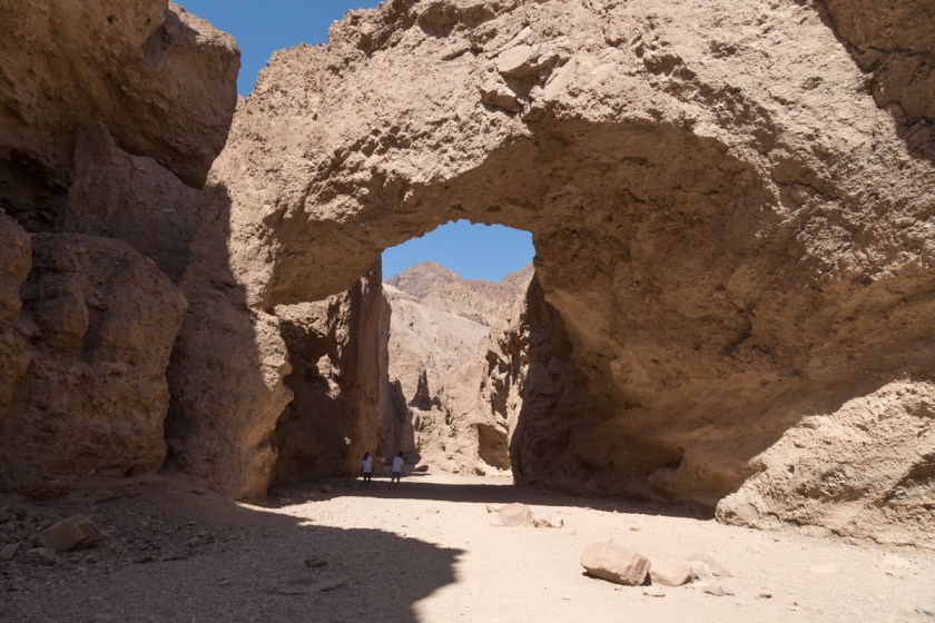
Since there was still so much we wanted to see, we didn’t walk all the way to the actual spot. We still had a couple hikes we wanted to do and with the temps pushing 90 degrees at 10 am we decided to move on. Our next stop was the natural bridge. It’s a fairly easy walk, despite being uphill. I can’t imagine the force of the water needed to carve such a bridge…
See the 2 hikers in the shadow of the bridge?
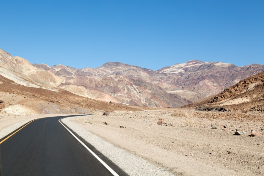
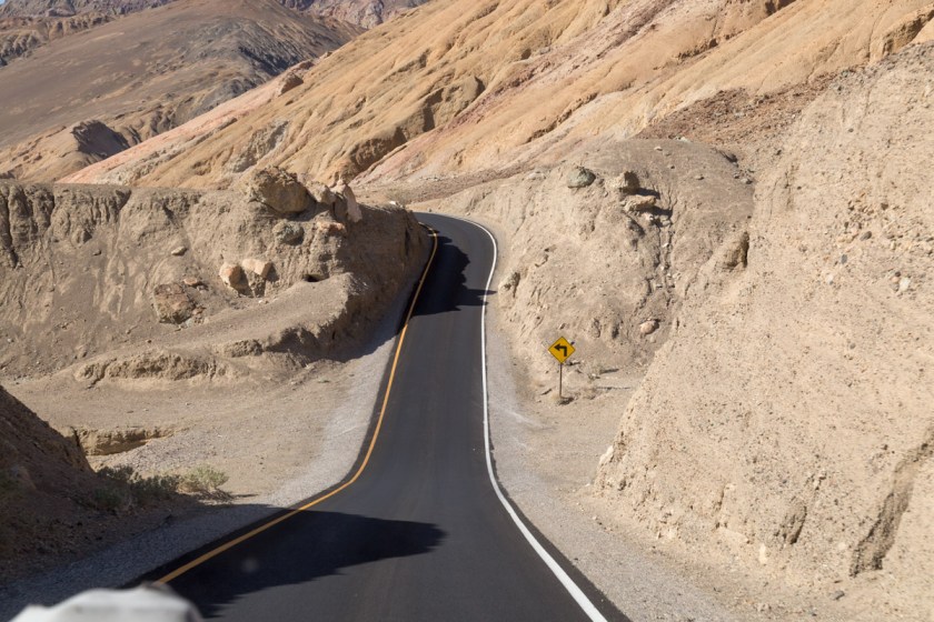
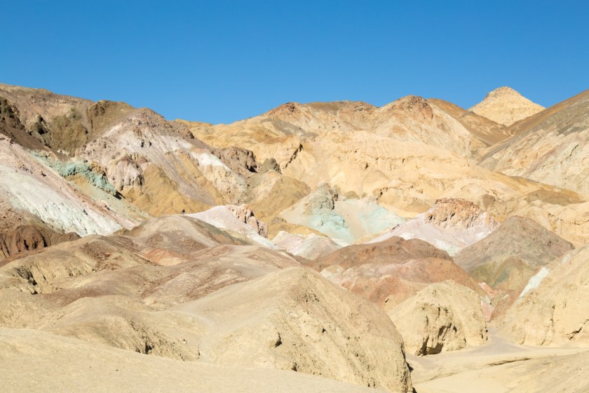
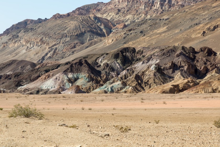
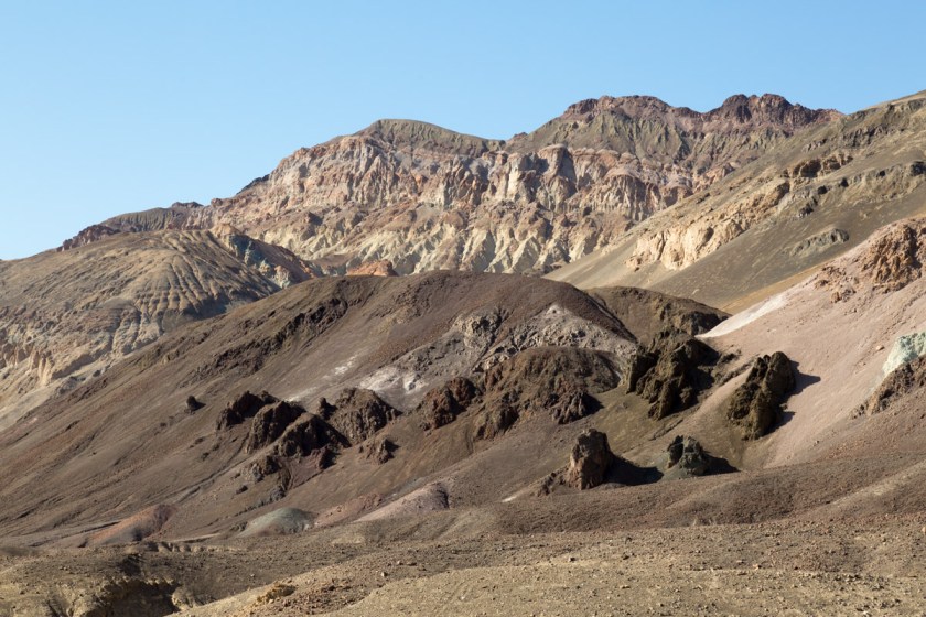
The National Park system did a great job of designing the scenic drives through the park. Most of them are one way and loop back to the main road. One such route is called Artists Drive. It is a 9 mile loop through some of the most colorful formations in the park. The narrow road winds through multi-hued volcanic and sedimentary hills…
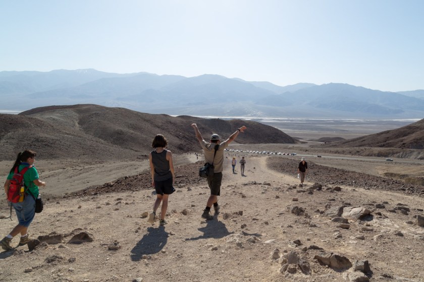
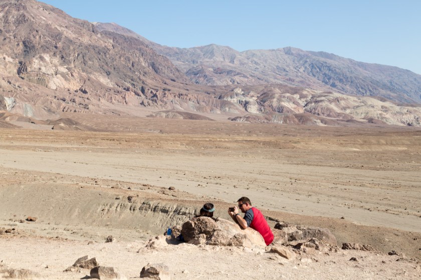
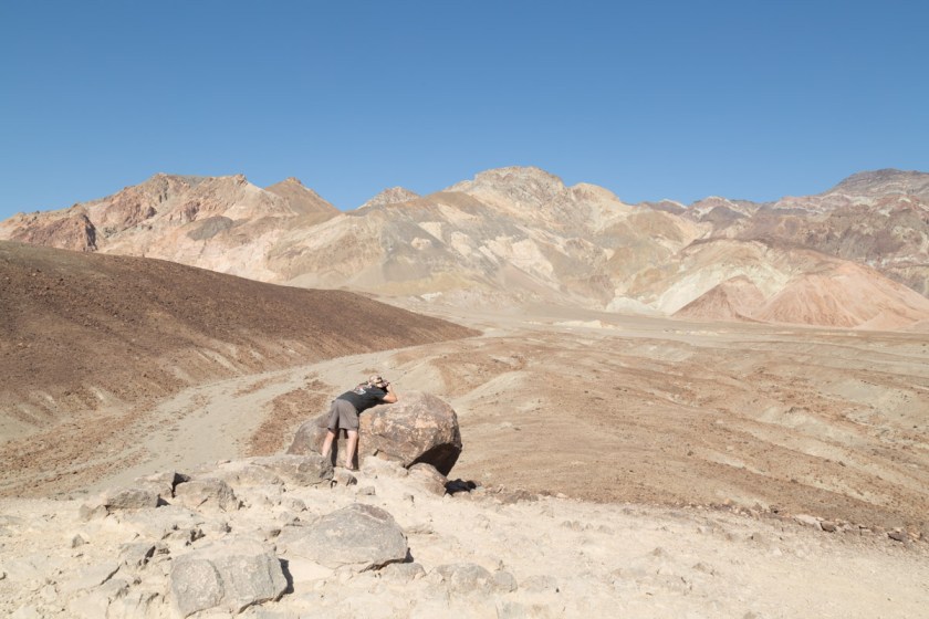
At the first pullout, we walked to the top of a fairly steep hill to get a better view of the landscape…
A great location to snap some memoriesSteve – finding his focus
Back on the road, I looked over and Steve was grinning, ear to ear. The twisting road had him itching to test the laws of gravity…
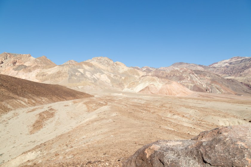
The next pullout is at a spot appropriately named Artist’s Palette. The colors were amazing. It’s like Mother Nature filled her paint brush with reds, browns, tans and greens, then spattered the colors much like a child fingerpaints…
As we were exiting the drive, the scenery changed yet again…
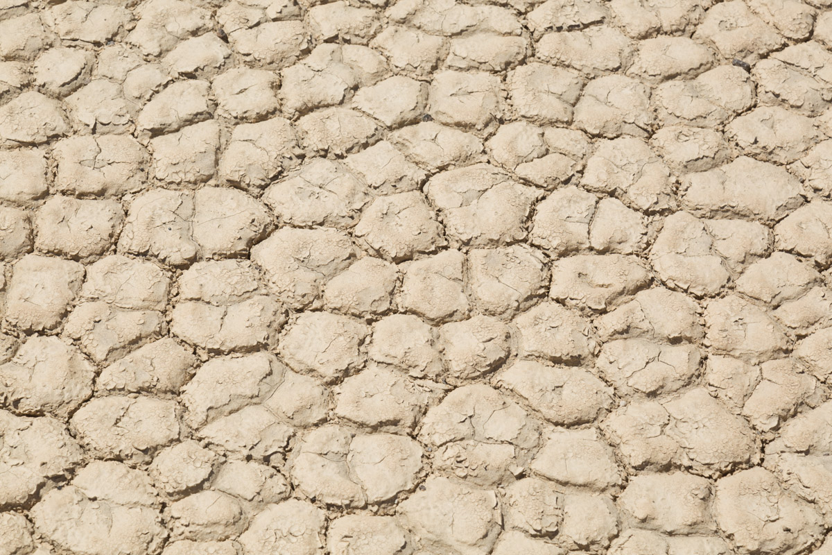
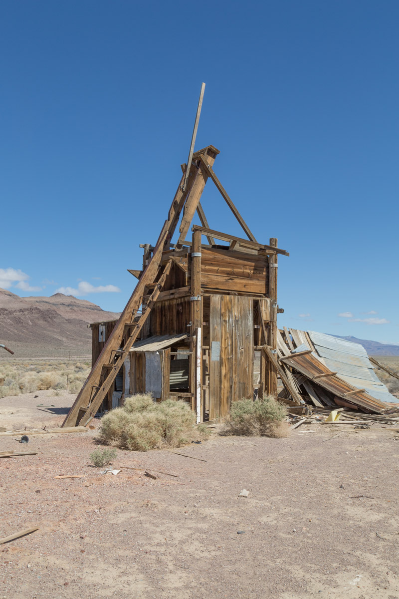
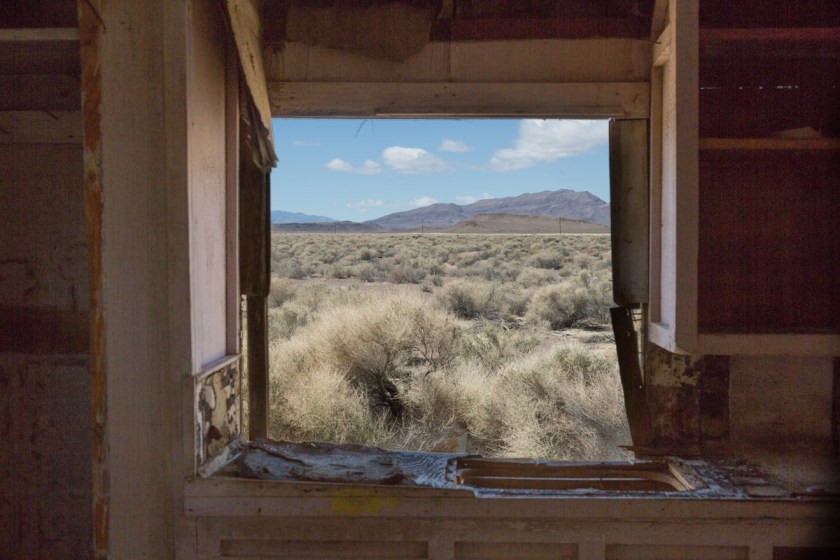
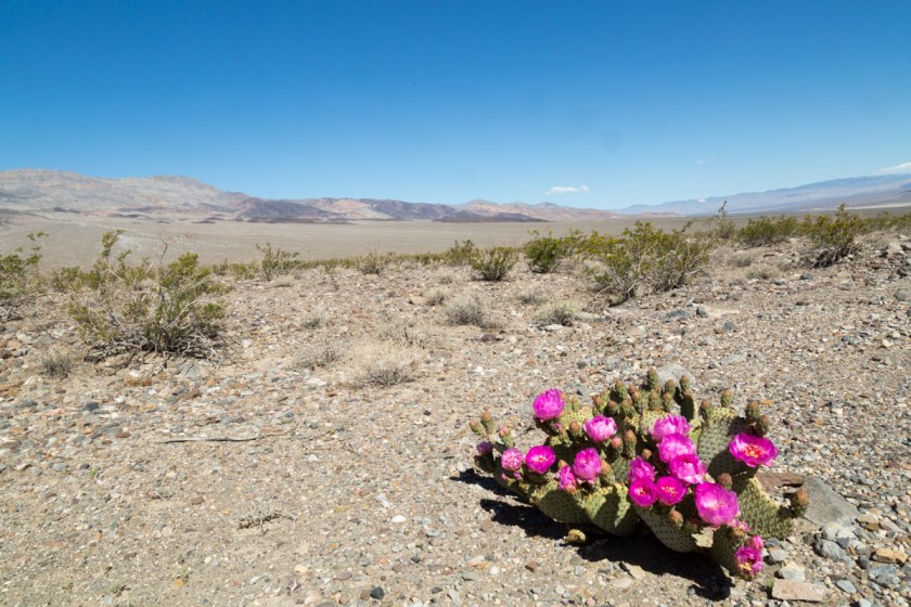
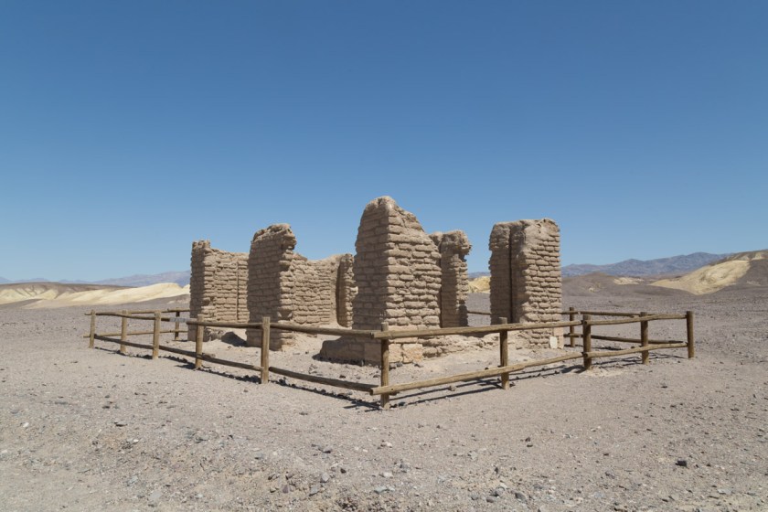
We were running out of time at Death Valley, but there was on more place I HAD to see – Racetrack Playa! (Read more about the interesting history and geology here) A playa is a dried lake bed and the Racetrack is nearly 3 miles long and 2 miles wide. Scientists estimate the dried beige mud is at least 1000 feet thick. The surface is so flat, it only varies 1 1/2 inches from end to end. We first attempted to reach the Racetrack via Scotty’s Castle Road. We were hoping the road closure signs meant the road was closed somewhere beyond the turn off to the Racetrack. A freak flood event happened in 2015 and destroyed the road and caused severe damage to Scotty’s Castle. (See pictures here). Of course, the road was closed prior to the turn off, so we had to settle on seeing more abandon buildings (I know, poor us, huh?)
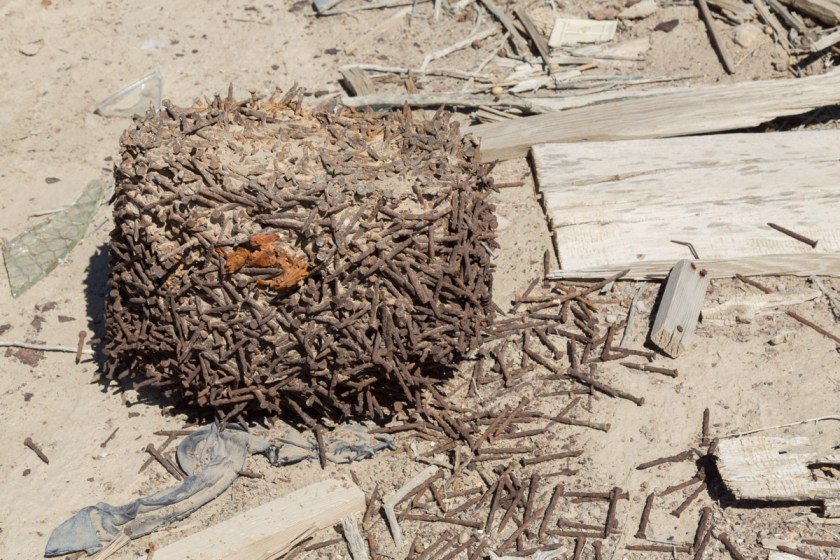
You know I had to go inside and look aroundHow long do you think these nails took to fuse together like this?
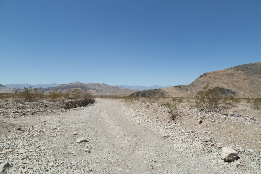
We had one more day and I was determined to get to the Racetrack. We checked the map and found an alternate route. One that comes with a warning…
“Caution: Rough and Remote Road
The road to the Racetrack is rough, and good tires, 4×4 and high clearance are usually required. Standard rental vehicles are not recommended, and often get flat tires. Use extreme caution on this road in the summer heat. There is no cell phone coverage in the area. Drive time from Furnace Creek is at least 3.5 hours each way. Other access roads make for even longer and more remote adventures. Driving offroad is strictly prohibited.”
OK…let’s go! When we left the pavement, the adventure began. I was finding it incredibly difficult to make any time. I kept having Steve stop the Jeep so I could take pictures…
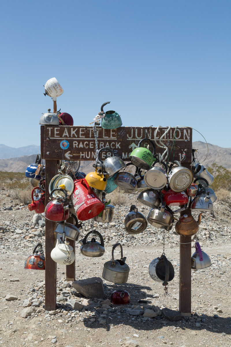
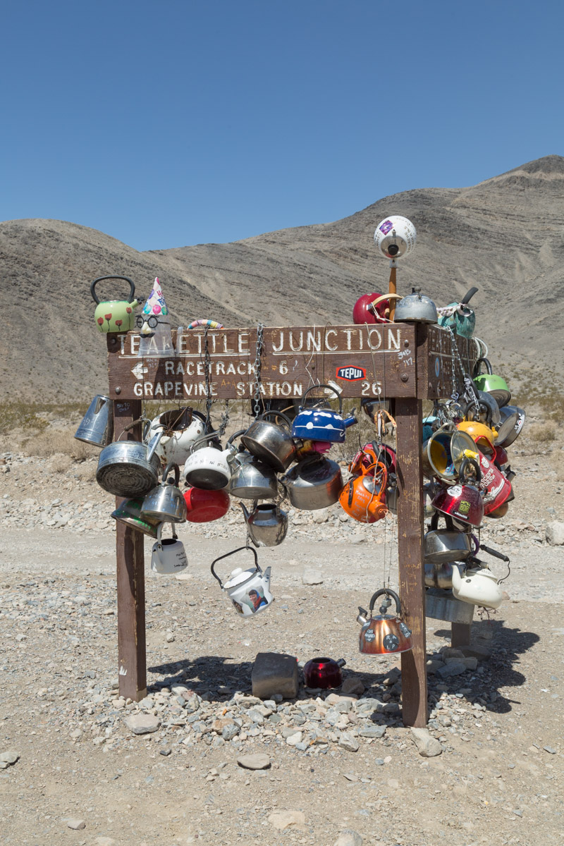
There is only one sign along the 26 mile route and I found it rather bizzare…
Legend says early travelers to the area put the first teakettles there to let others know there was water nearby. I don’t know if it is true or not, I never saw any water.
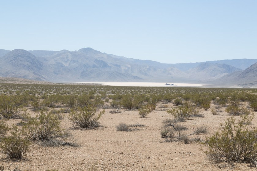
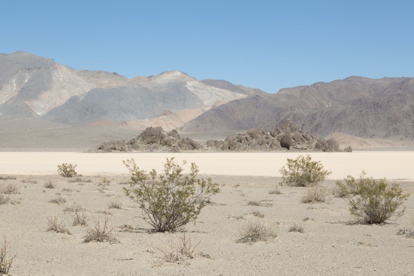
We were still 6 miles from the Racetrack, so off we went. As we rounded one curve in the road, we got our first view of Racetrack…
The outcropping of rocks in the middle is called the Grandstand…
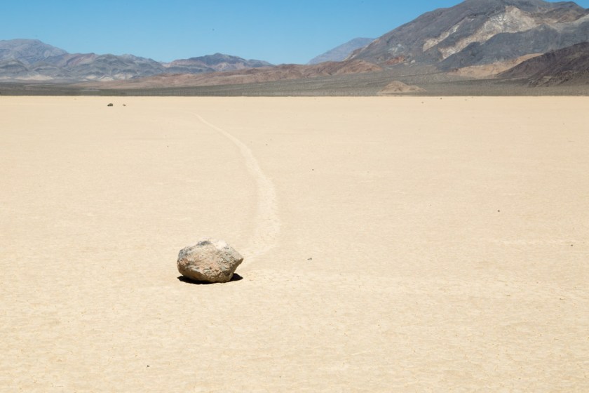
What is so fascinating about Racetrack is the mysterious moving rocks. Although the mystery of how/why the rocks move was solved in 2014 (Read about it here), it still boggles my mind…
See the tracks left by the moving rocks?
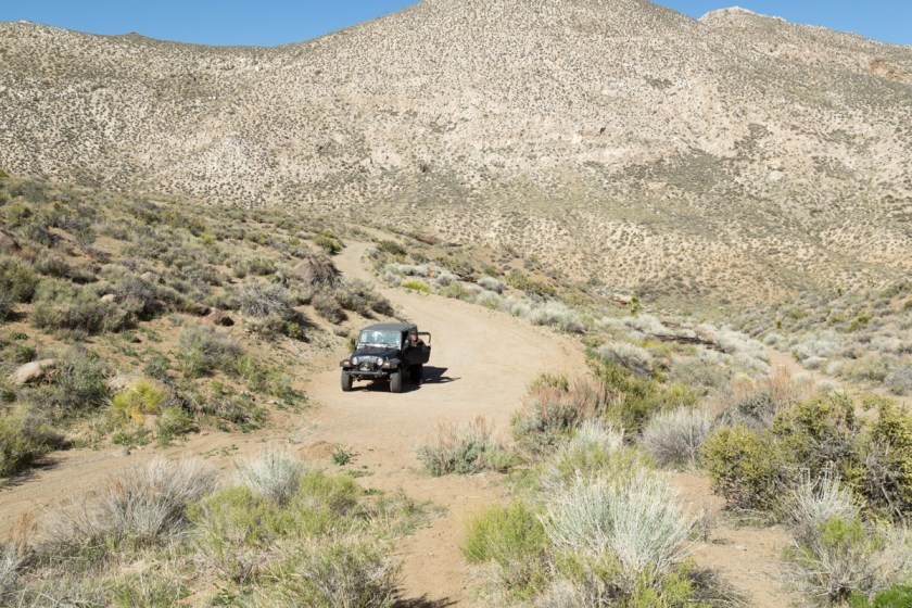
Two NPS Rangers were at Racetrack replacing a sign and we talked to them for quite a while. One of them said they have seen the playa completely under water and a day later, not a sign of water could be seen. He also said if people walk on it when it is wet, the footprints can stay there for years. The Jeep was just over half a tank of gas and we wondered if going back the same way we came was the best route. The ranger told us Hunter Mountain Pass was a drive we shouldn’t miss and we wouldn’t have a problem with 1/2 a tank of fuel. OK – Hunter Mountain it is! We drove back to Teakettle Junction and headed into the wild. As I mentioned before, there aren’t any road signs in the back country. Our GPS said we were on Hunter Mountain Road and I figured as long as it said that, we would be fine. Hmmm. When we came to the first split in the road, we went the werong way. That was ok, because it quickly dead ended at an abandon mine…
End of the line
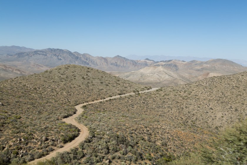
We got back on what we hoped was the right road and continued on. I could see the road off in the distance as it began to climb Hunter Mountain…
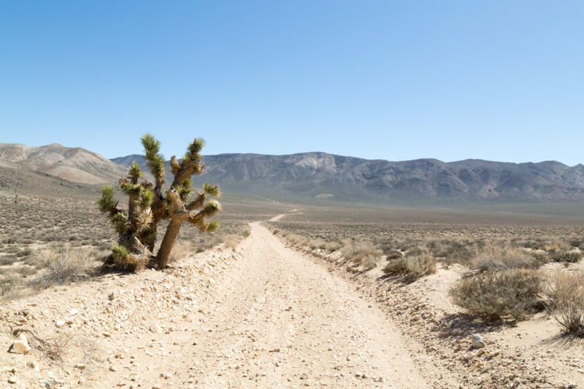
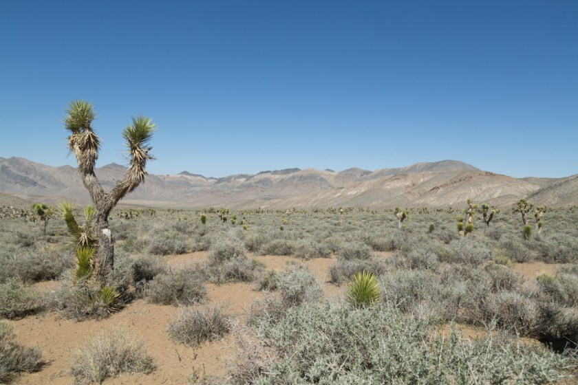
We passed a large area full of Joshua Trees…
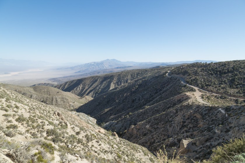
And began the climb. The road was barely wide enough for the Jeep and was a continuous set of switchbacks. The summit of Hunter Mountain is 7168 feet and the view is stunning…
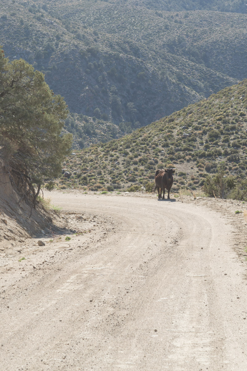
I was beginning to worry we were on the wrong road and were bound to run out of gas. I had no interest in being stranded, with no cell service, miles from anywhere! Finally, we passed another vehicle. The folks assured us we were on the right road, but it was still 30 miles to Panamint Springs. We got a bit of a surprise as we rounded a corner – free range cattle in the middle of the road…
When we made it back to the pavement, we made a beeline for Panamint Springs and fuel. When we saw fuel there was $4.99 a gallon, we made the call to continue to Stovepipe Wells -another 28 miles. We made it just after the idiot light came on. But, I have to say, I was beginning to hold my breath a bit! Fuel was still $4.17 a gallon, so we only put in enough to get back to Beatty.
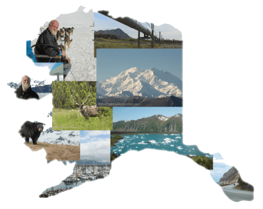
Our time was up in Death Valley. We had only seen about half of it, but we had a time-table to keep. We still had 3344 miles to go to get to Moose Pass, AK. I hope to go back and explore more some day!
Thanks for coming along, I hope you enjoyed our take on Death Valley!
It was kinda of sad leaving Sunny Valley. We had such a great time with Mike and Dawn (read Dawn’s take on our meeting here), it was hard to say “until we meet again”.
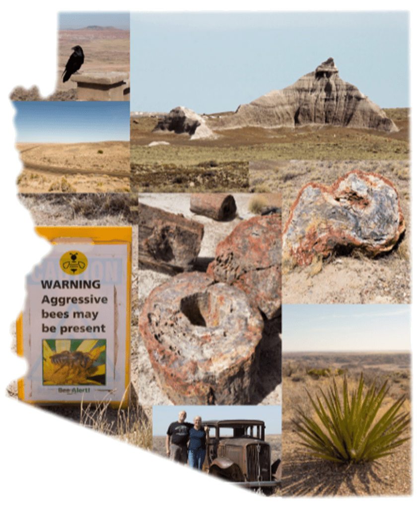
We spent the night in Kingman, AZ so we could have dinner with family…
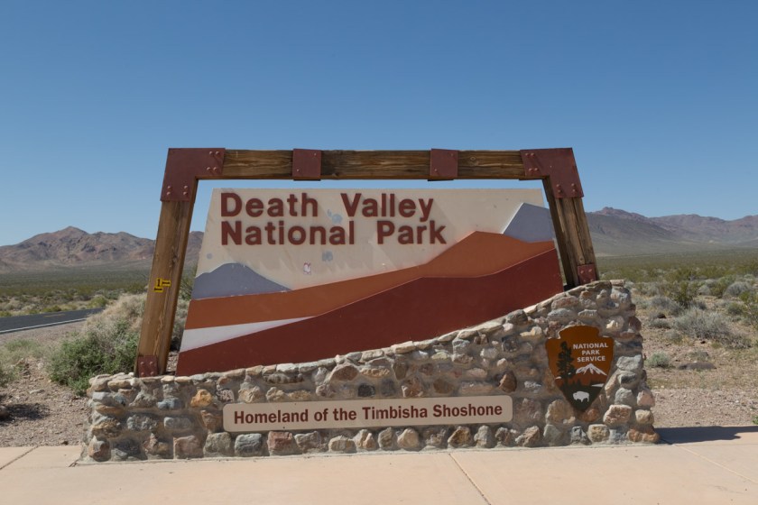
Our plan was to spend the next week exploring Death Valley. Death Valley is the 5th largest National Park in the United States and the largest in the lower 48. It covers 5262 square miles (roughly 3.4 million acres). It is 140 miles long and about 75 miles across at its widest.
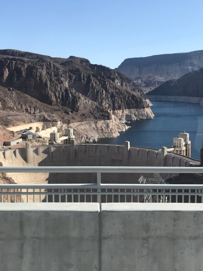
We decided Beatty RV Park in Nevada would be the perfect jumping off point for our explorations. On our way to Beatty, we passed the Hoover Dam…
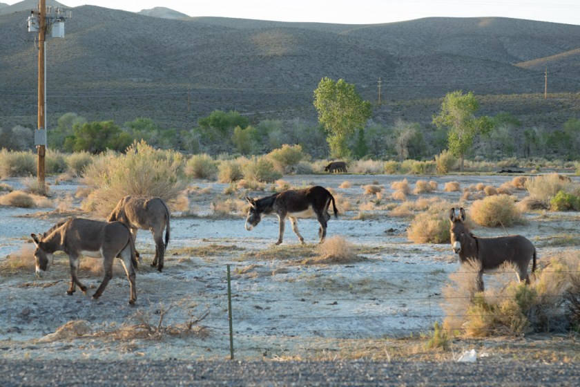
And drove through Las Vegas. It was noon when we pulled into the park. We got set up in our site and headed into town, actually, to be completely honest, we were looking for a liquor store. The camp host told us we could probably buy liquor at the casino. My first thought was, yeah, what would THAT cost. After we drove around town a bit, we headed to the Stagecoach Hotel and Casino. Just for fun, we put $6.00 (big spenders, right?) into the one-armed-bandit and hit on the 3rd pull. Woohoo. Let’s cash out of this machine! And so it went. A few bucks here, a few bucks there and at the end of the afternoon, we were up enough to cover the cost of the bottle, which wasn’t as expensive as I imagined. When we got back to Waldo, there were wild burros across the street, which I thought was really neat…
I can just hear the burro, “What, haven’t you ever seen an ass before?”
The next day, we headed into Death Valley…
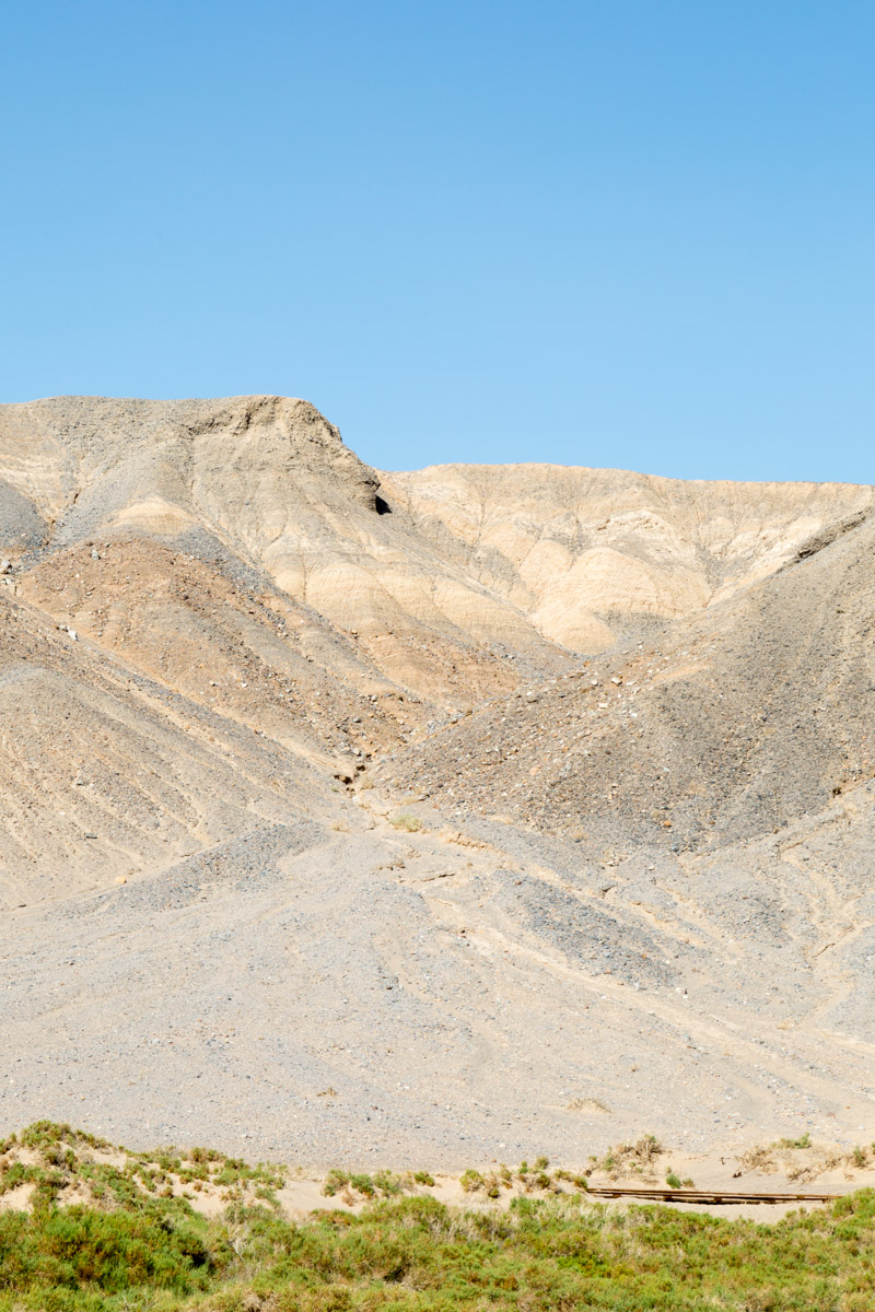
Once we passed through Hell’s Gate, the temperature started to climb. It was 58 degrees in Beatty and 75 degrees on the valley floor. The wind had been kicking up for days and it was really noticeable in the valley. I knew it would be hard to get great pictures of the overall landscape because of the haze…
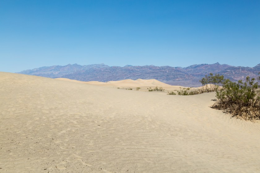
Mesquite Flat Sand Dunes
So, I tried to focus on the smaller scenes…
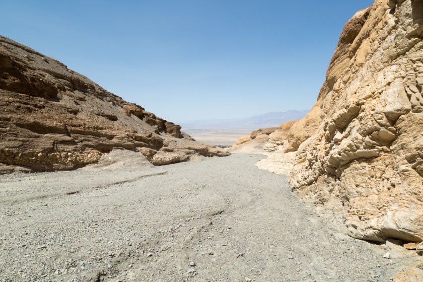
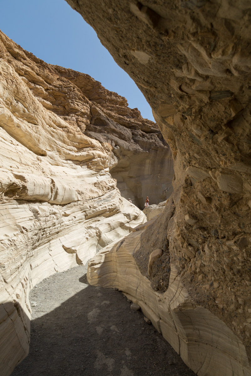
Our next stop was Mosaic Canyon, a 4 mile round trip through narrow slot canyons and polished rock walls…
Looking back toward the parking areaThe canyon walls, smoothed by rushing watersSteve getting a picture of the landscape
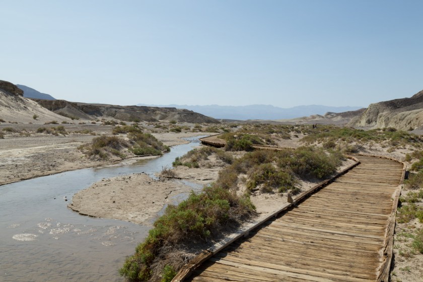
From there, we walked the Salt Creek Interpretative Trail.
Since it was only April, there was still plenty of water flowing. The water is 4x saltier than the ocean. In spite of that, it is home to the Salt Creek pupfish…
Not a great picture, but you can see several pupfish
April is the beginning of mating season and the males were a beautiful shade of blue. As we were walking along, I could have sworn I saw a gorilla face in the mountains…
Do you see a gorilla or was I imagining it?
I was in sensory overload, it’s hard to take in all the naked beauty at once.
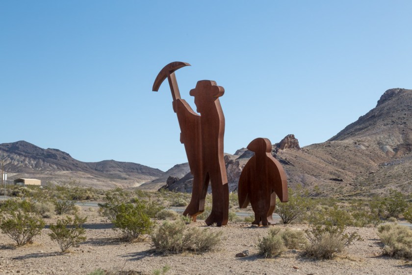
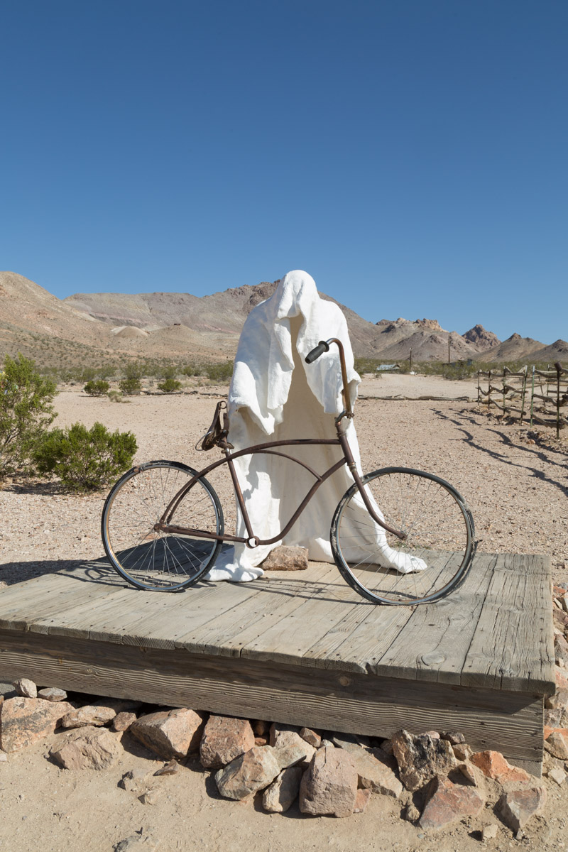
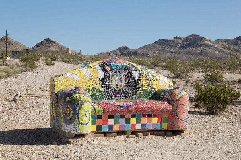
It was several days before we got back to exploring. Before you get into Death Valley, there are 2 must see places. The first is the Goldwater Open Air Museum. It seems a strange place for an art museum, in the middle of nowhere, but it is definitely worth the stop…
Fred Bervoets’sOde to Shorty Charles Albert Szukalski‘s Ghost RiderCharles Albert Szukalski‘s TheLast SupperA very large metal origami craneDr. Hugo Heyrman‘s Lady Desert The Venus of NevadaOnny Huisink’s The Beauty of DecaySofie Siegmann‘s Sit Here
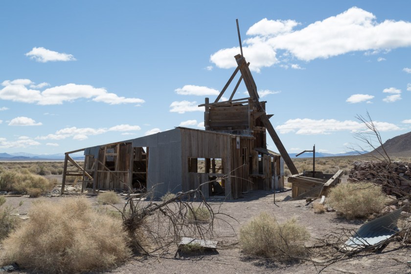
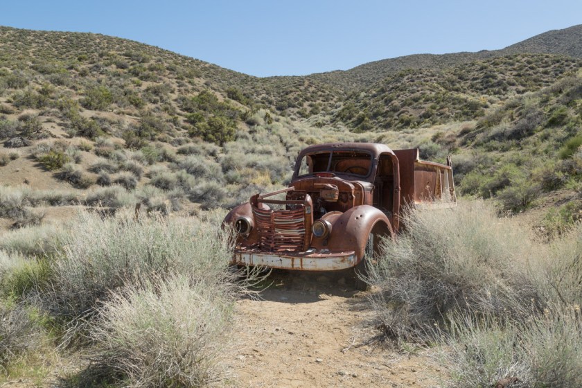
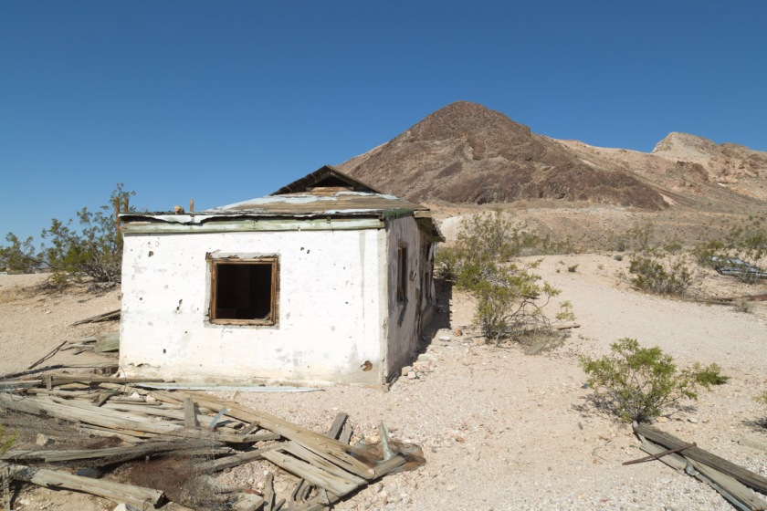
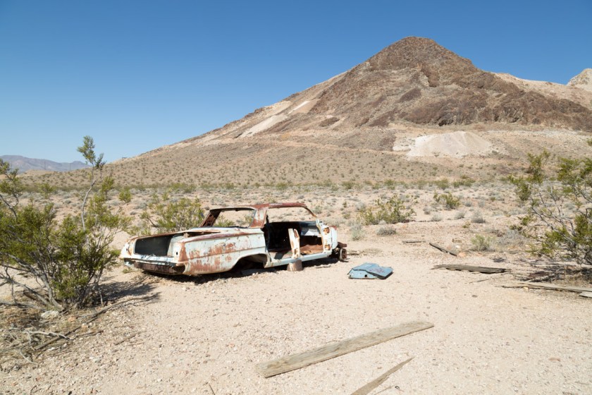
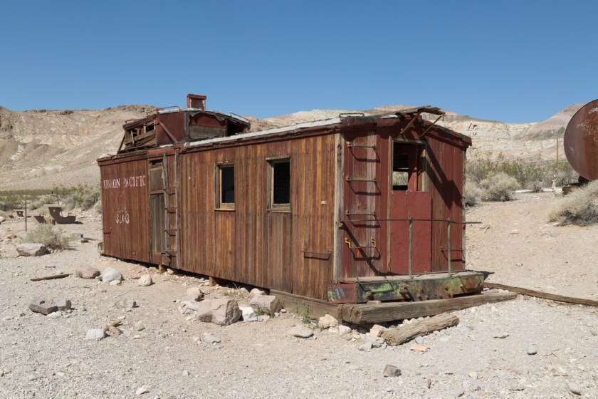
Just passed the museum we discovered several abandon homes and vehicles…
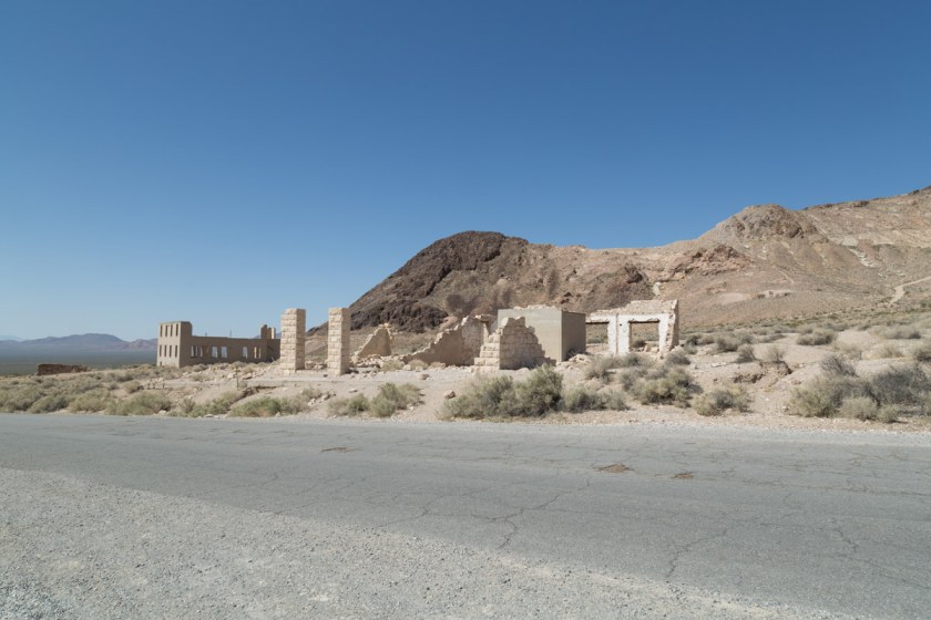
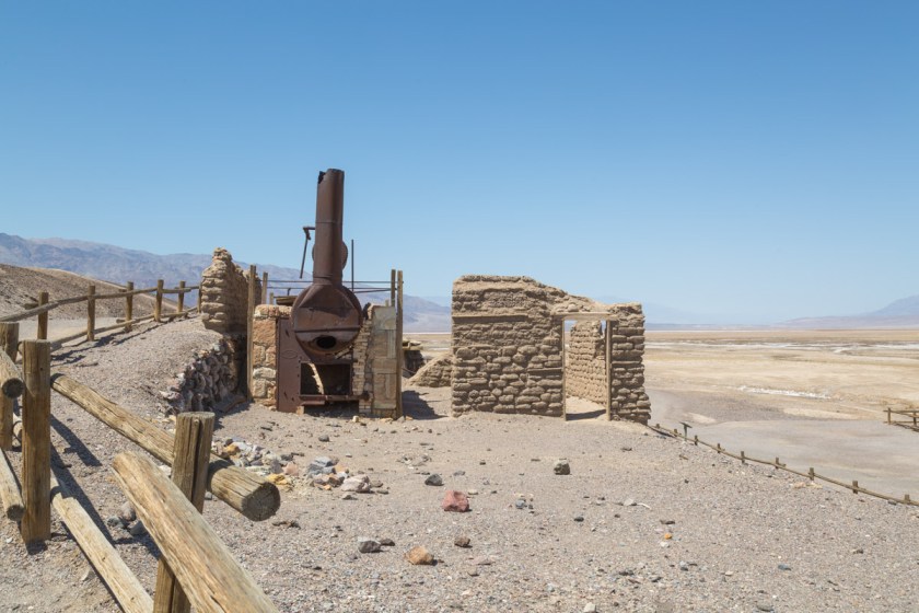
This was a prelude to the ghost town of Rhyolite. The town boomed into existence in 1904 and had burnt itself out by 1916. Remains of several of the buildings give us an idea what town was like in its heyday…
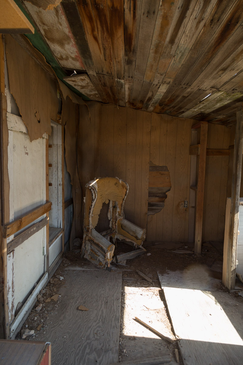
I thought one of the neatest buildings was Tom Kelly’s bottle house…
Despite the fact electricity to the town had been shut off in 1916, the last tenets of the house lived there until 1969. Tommy Thompson and his family added miniature houses to the property…
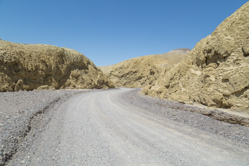
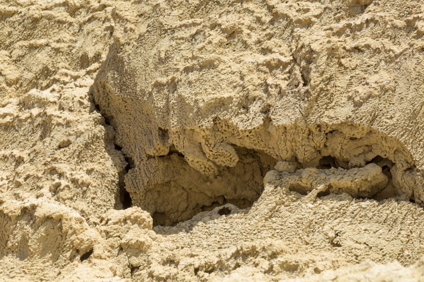
From Rhyolite, we headed back into Death Valley. We drove along Mustard Canyon Road…