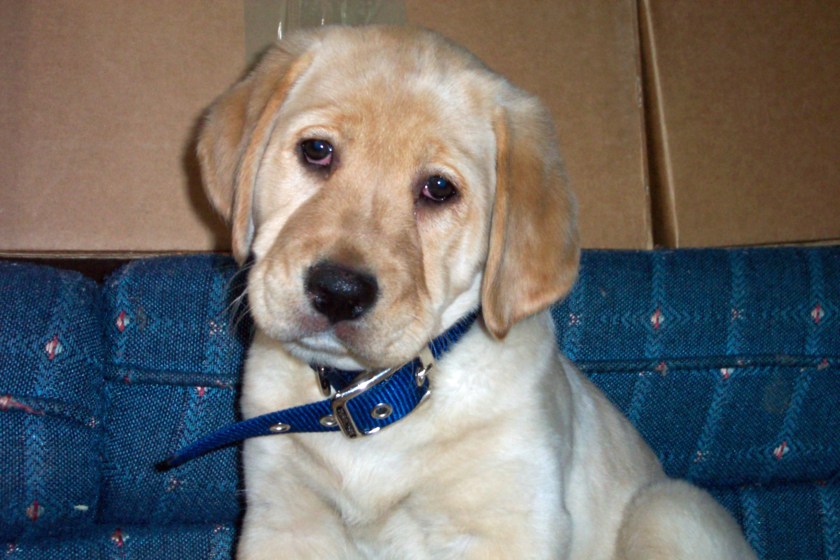
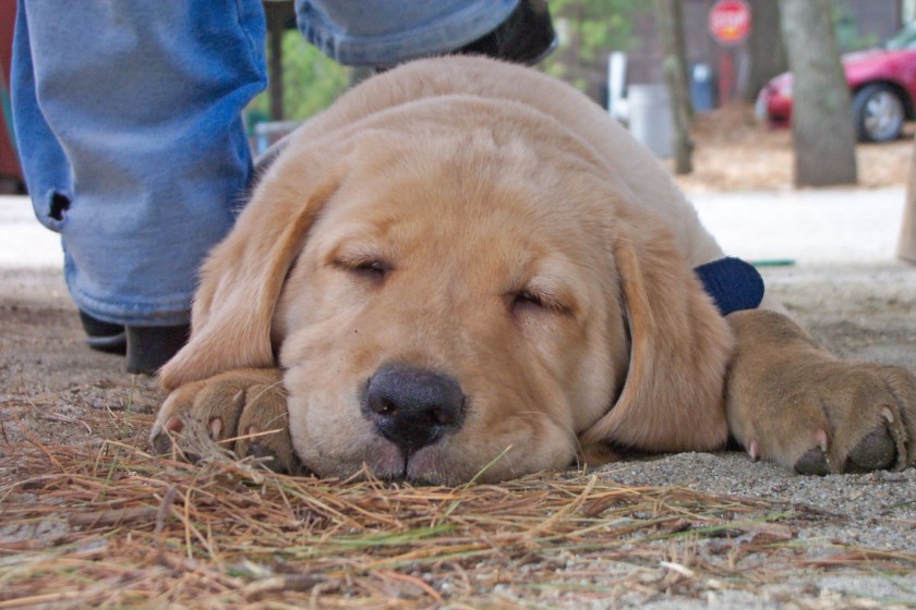
For those of you who don’t know me, I’m Diesel. This is a picture of me when I was just a young pup. It was taken a long time ago, 14 years to be exact. Wasn’t I cute? Back then I had boundless energy, but I loved to nap too.
I started out life in New Hampshire and life was good! I loved to go out and play with my dad…
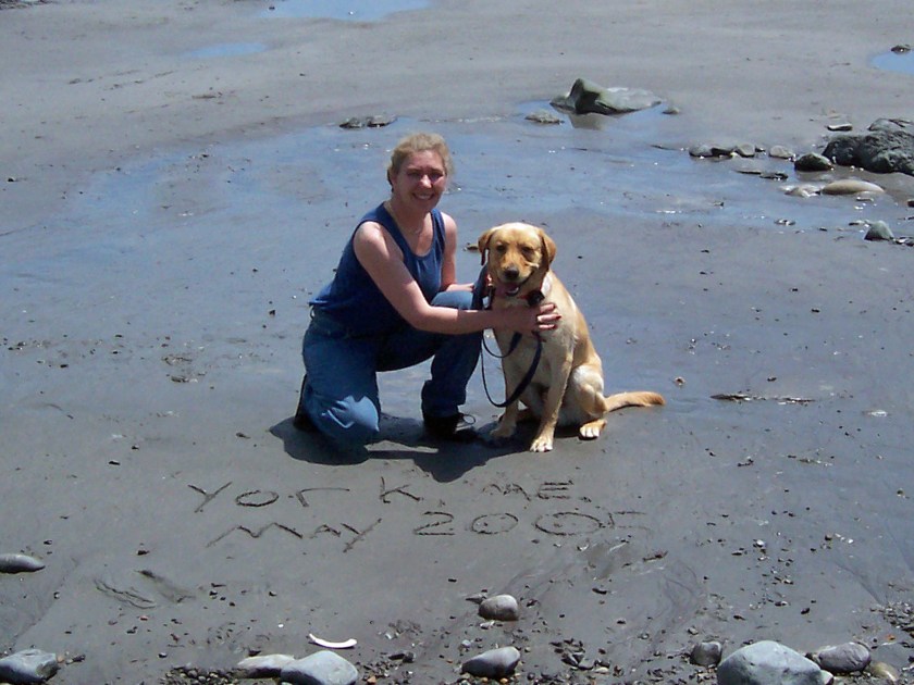
I was about a year old when I got to go to the beach for the first time…
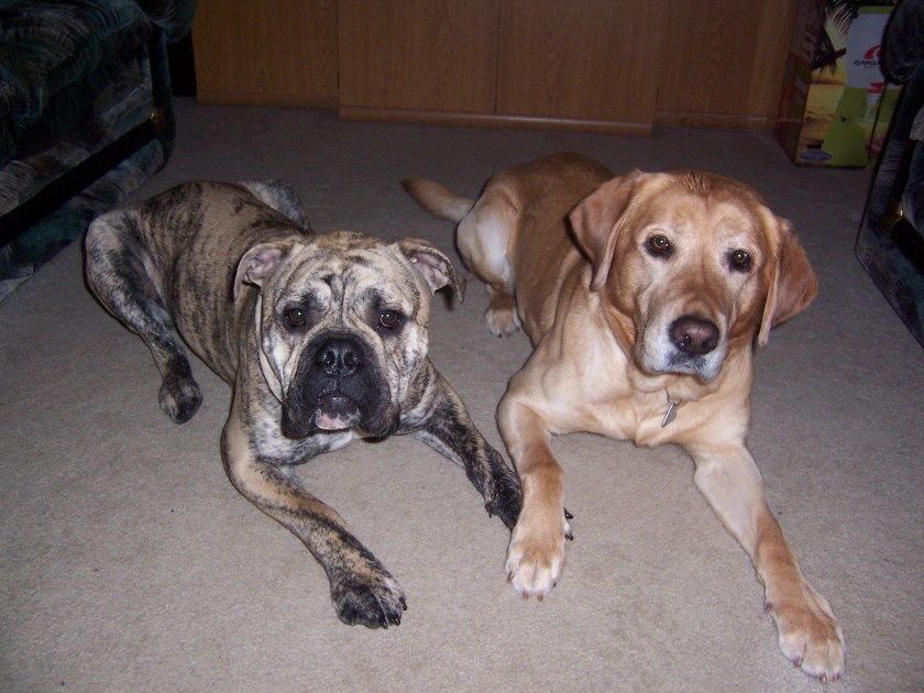
I have to say, I wasn’t a big fan of the salt water! Yuck! When I was a few years old, mom and dad got me a little brother. Look how sweet we were posing…
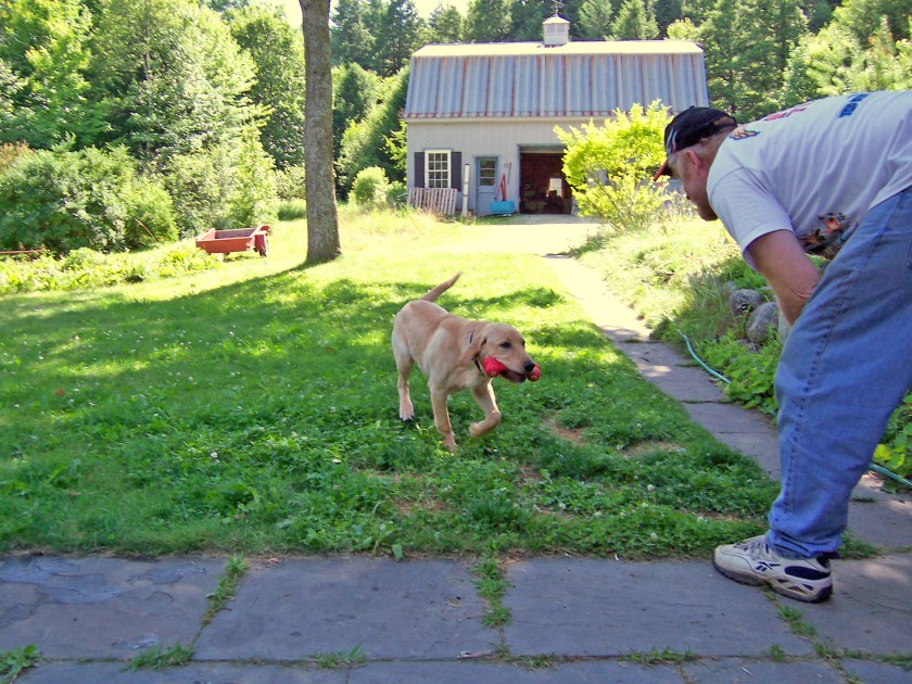
You must know, it’s only because mom was holding a cookie and we wanted it! My brother’s name was Turbo. Mom and dad thought they were so clever, now they had Turbo Diesel. Hahaha. Turbo didn’t hang around too long. But that was ok, I really liked being an only child!
When mom started her other blog, TouringNH I got to go to lots of places. It was my first experience in that thing the call Waldo.
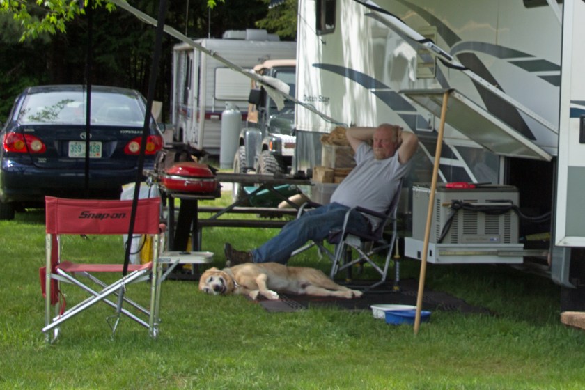
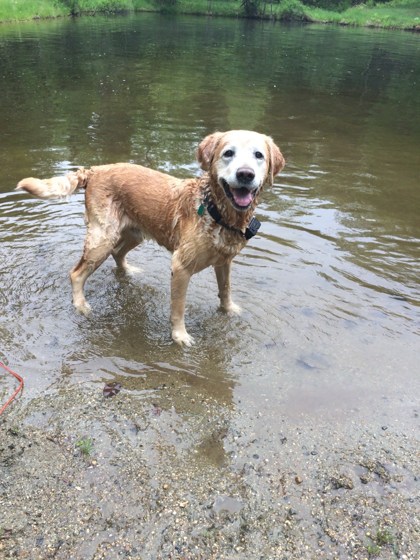
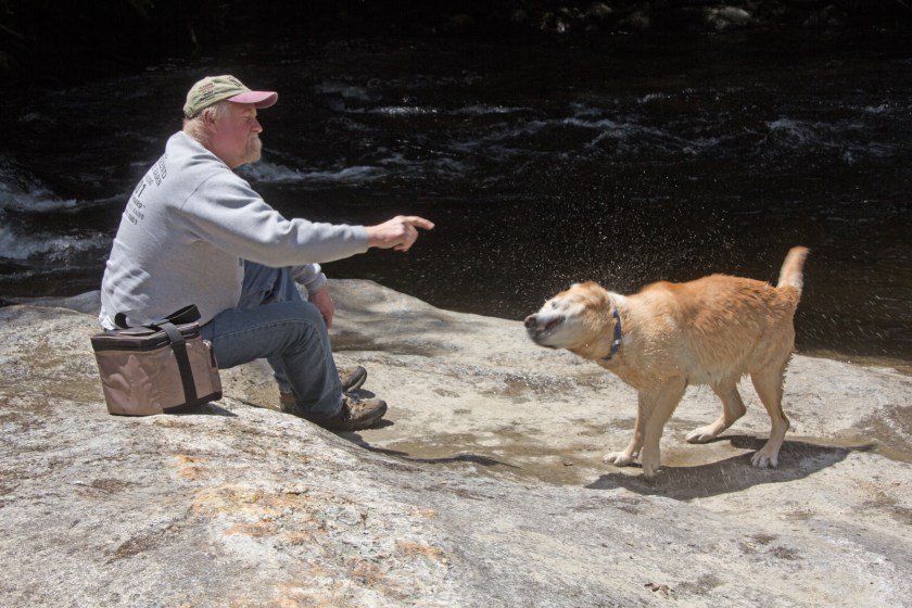
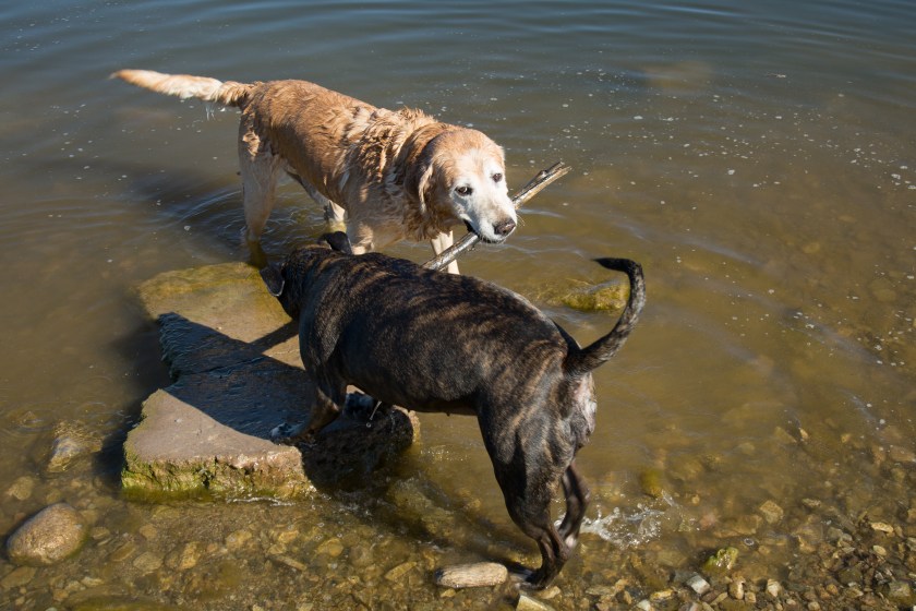
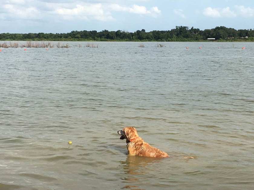
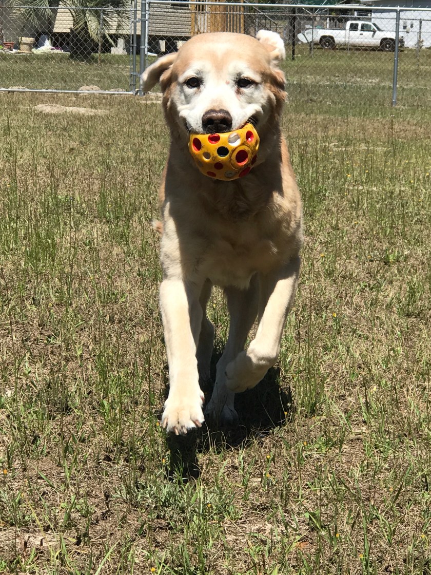
As you can see, I took right to this camping life! They always took me swimming when we went camping. You know, swimming is one of my favorite things to do…
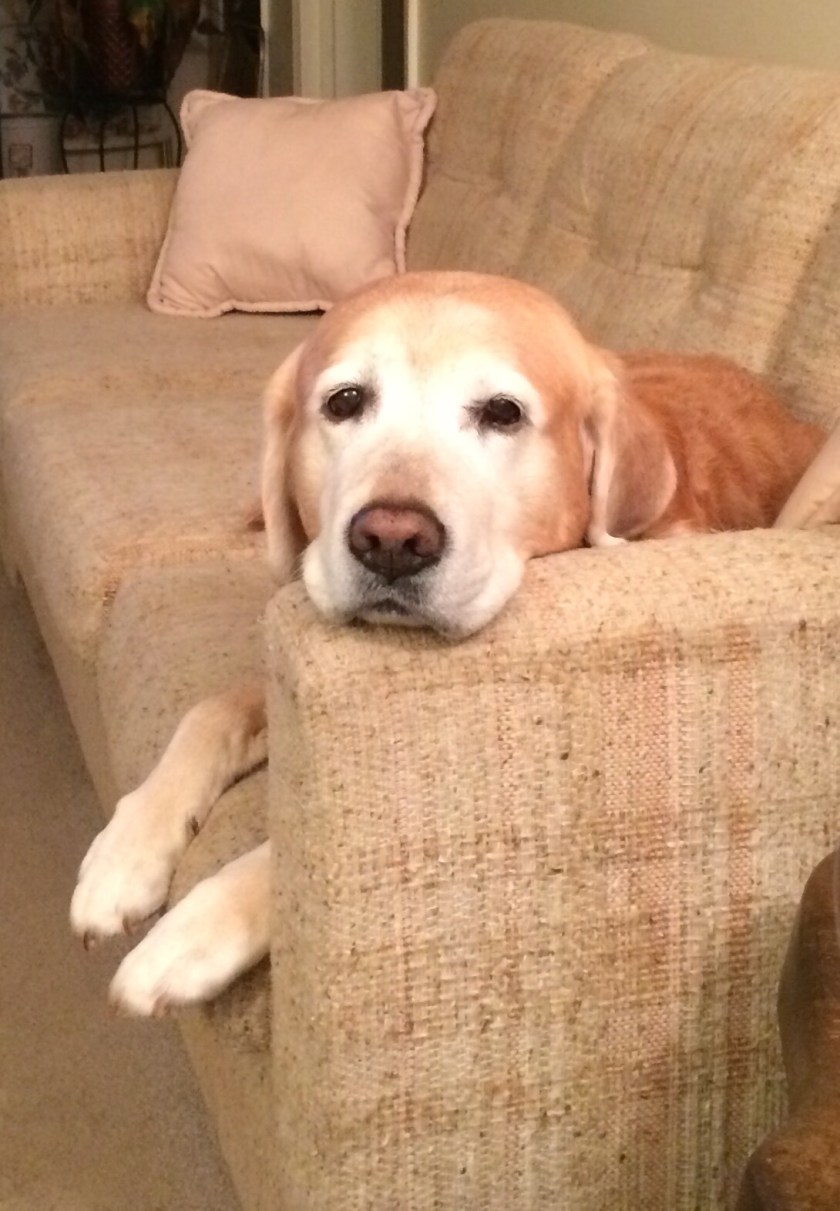
Laying on my couch is pretty good too…
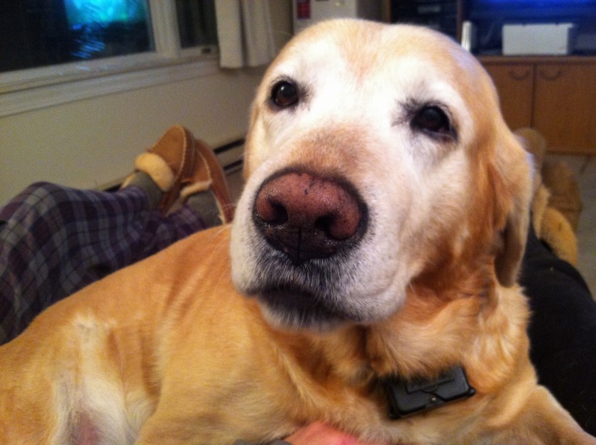
But not near as good as getting on mom’s lap…
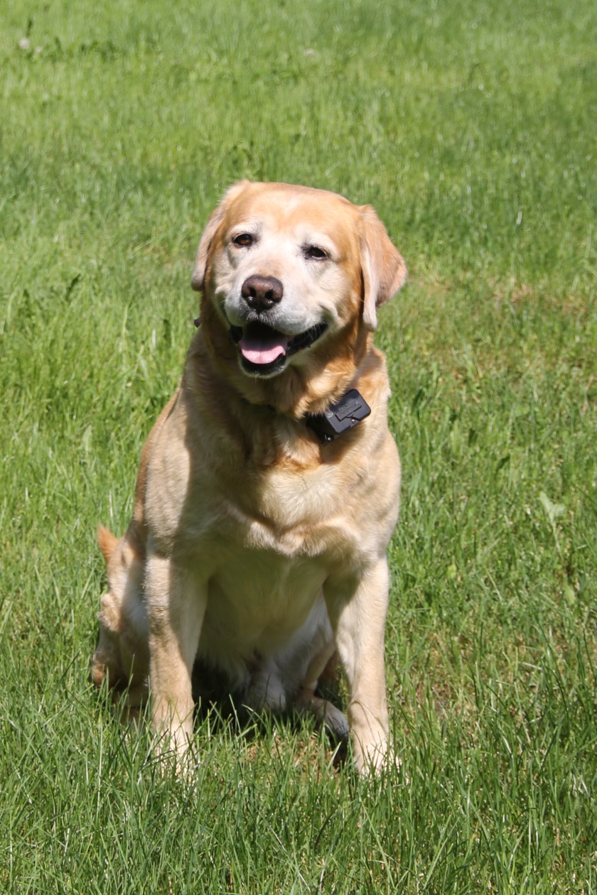
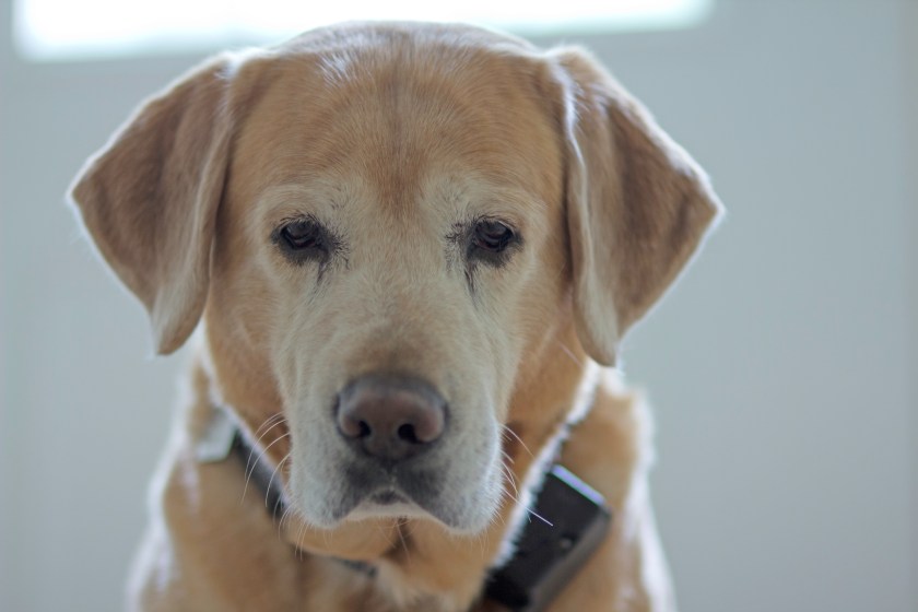
Mom loved making me sit nice and pose for her…
I loved winter in New Hampshire.
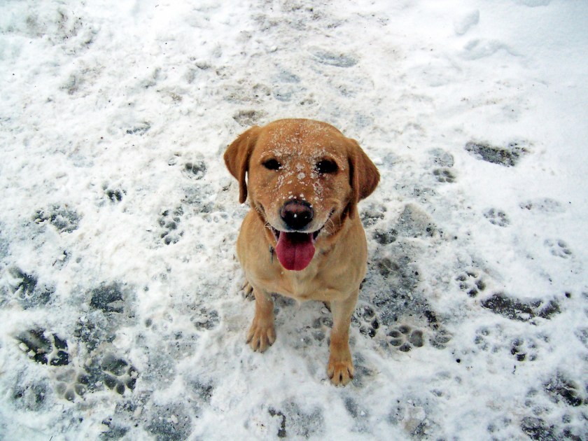
I would pester mom until she let me outside. I would pretend I needed to pee, but really I just wanted to eat some snow…
Because I’m a lab, I shed a lot! I mean a real lot! But mom helps me to my shedding outside. Can you tell I REALLY enjoy it?
When I was about 10 years, I got to go to Florida then on to Arizona. Before we left, mom bought these silly booties for me. She thought my feet would get hurt out in the desert, but I fooled her, I wouldn’t wear them…
Weren’t they silly looking? While we were in Arizona, I got to play with my grandpa’s dog Molly. She sure likes to play tug of war!
She sounds all vicious when she tugs, but it’s all an act…
Last year, mom and dad decided we were going to move into Waldo full time. They had a lot of things to do to the house before we could leave, here’s me helping…
Ok, maybe I wasn’t helping that much. At first I was a little sad we were leaving, but I got over it…
We spent some time in Florida, then we got to go to Texas. Woohoo, a new place to swim. Did I mention I love swimming?
And I got to go for rides on the golf cart…
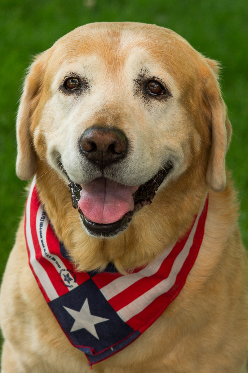
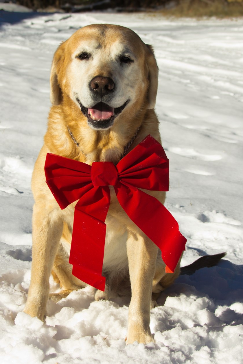
So, now we are back in Florida. I’m getting old and tired. When we went to see the nice vet lady, she said I have bulging discs in my neck, I guess that explains why things hurt more than they used to. Getting old ain’t for sissies! Next week, mom and dad are going to start their trip to Alaska, I won’t be going with them. My story ends here, in Florida. But don’t be sad cause I’ve had a ball!
In the middle of our Big Cypress adventure, we decided to take a road trip. Yes, we were already on a road trip, but this time we wouldn’t be taking Waldo. According to the map, Key West was only about 4 1/2 hours south. A little long for a day trip, but not quite long enough to make it worth packing up Waldo for an overnight. It had been about 25 years since I had been there and Steve hadn’t ever been there. I didn’t really give much thought to how much thing change in 25 years. Mistake number 1!
With Waldo safely tucked in at Burns Lake Campground, we set off early in the Jeep for our trip south. Key West, here we come!
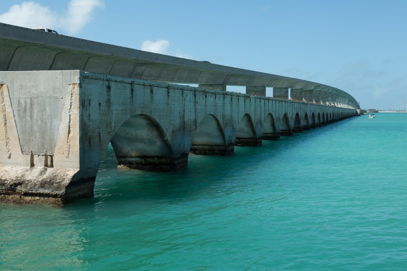
Once we got south of Homestead, traffic began to back up. We crawled along as the scenery changed from mangrove swamps to views of the Atlantic Ocean on one side and the Gulf of Mexico on the other. We stopped at a pull off and saw the remains of the old bridge to the Keys…
Many of the old bridges have been converted into fishing piers
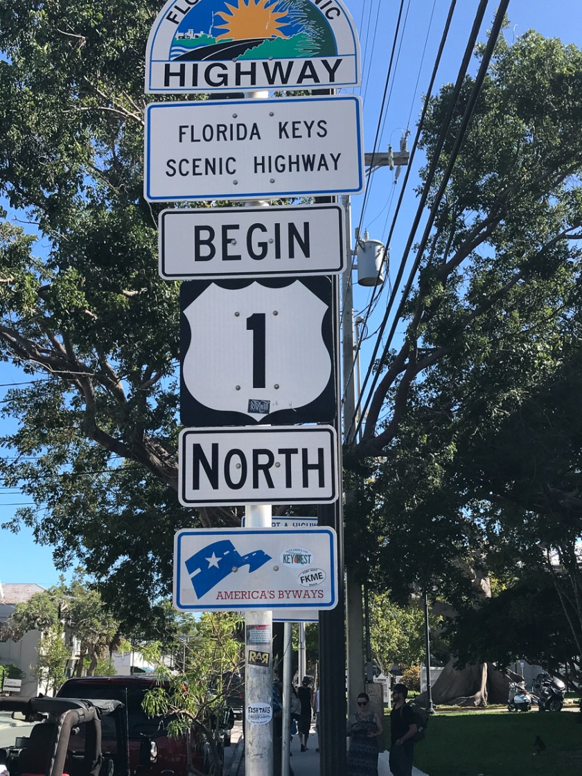
There are over 1700 islands in what is collectively known as “The Keys”. The road through the Keys is called The Overseas Highway, also known as US Route 1. Seven Mile Bridge being the longest of the 43 bridges along the way. If you glance towards the Gulf of Mexico while you are on Seven Mile Bridge, you will see Pigeon Key. Notice the gaping hole in the old bridge. Pigeon Key is now a marine research facility and only accessible by ferry.
There was still plenty of evidence of the destruction caused by hurricane Irma, travel trailers on the side of the road and boats yet to be recovered.
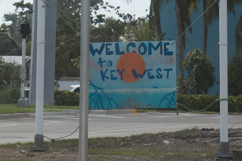
Finally, we made it…Welcome to Key West!
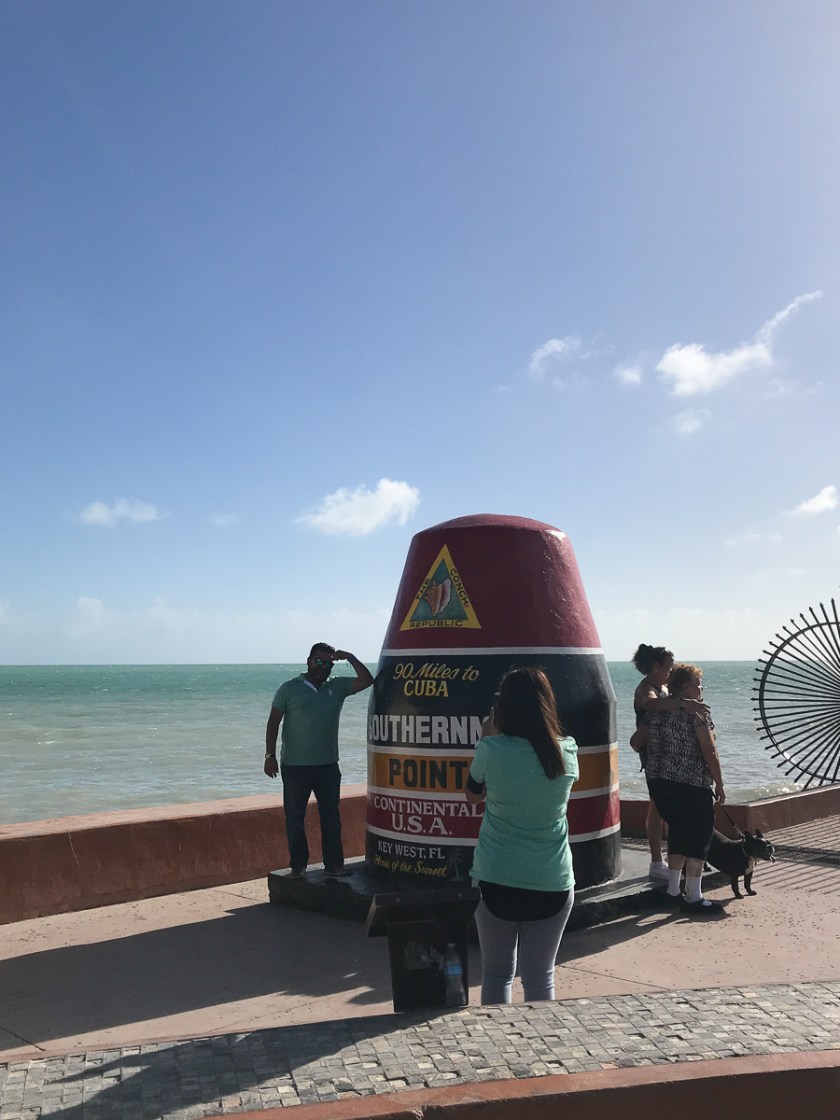
We spent the first hour or so just driving around. We drove by the marker for the southern most point in the continental United States. I snapped a quick picture with my phone, thinking we would come back to it later for a proper picture. It’s a good thing I did because when we drove by the following day and the line to get a picture was huge.
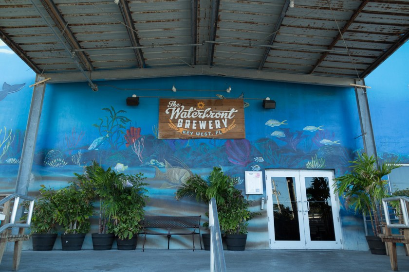
Since we had been driving for hours, we decided to find a place to park and walk around. We found a spot in Old Town near the Waterfront Brewery. I loved the murals on the building…
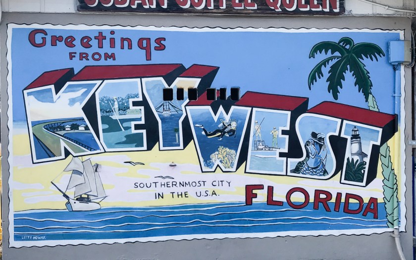
The wall of the Cuban Coffee Queen building offered tourists a neat place for a photo op.
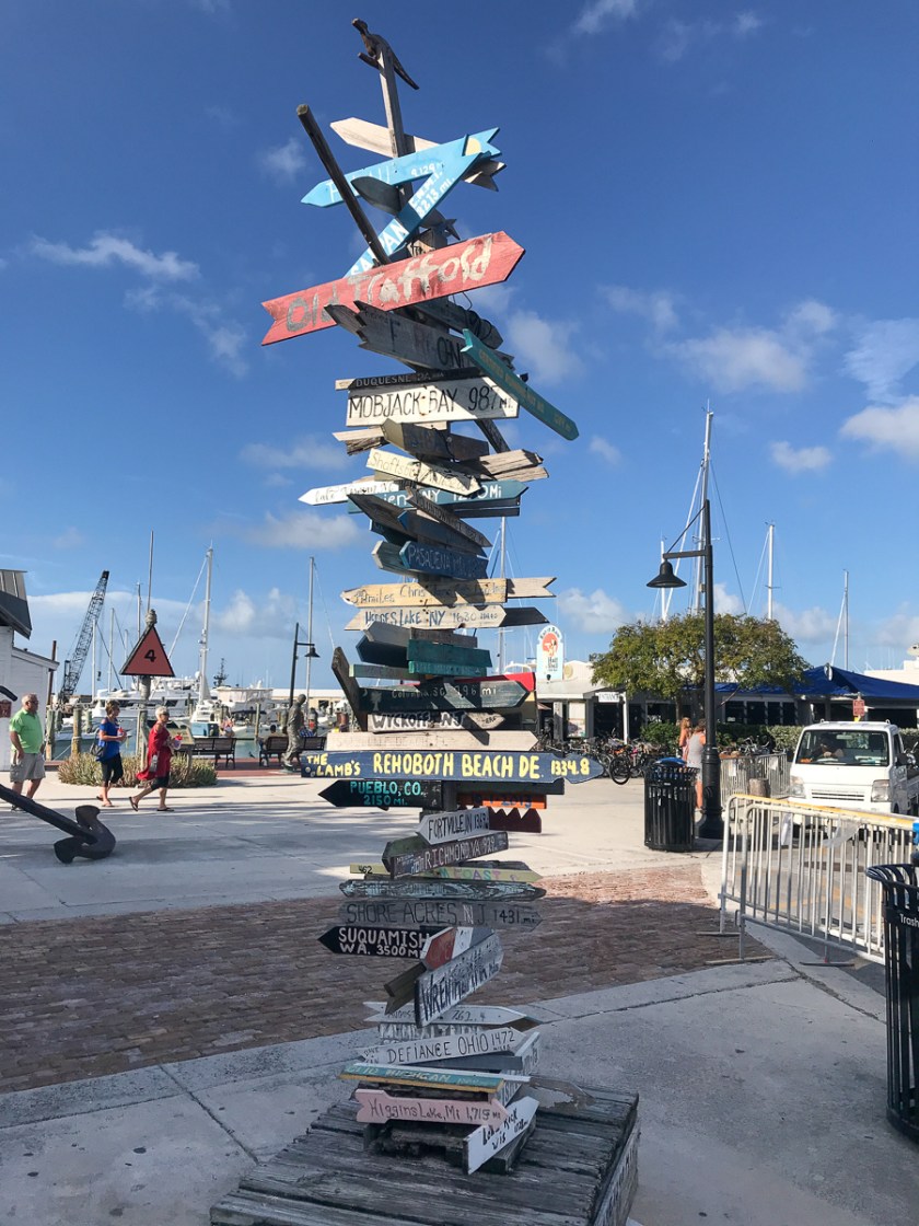
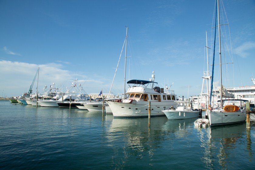
The waterfront was packed with shops and eateries. So much to see…
And all types of boats line the docks at the marina…
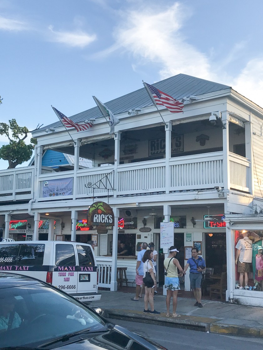
Instead of thinking about where we were going to spent the night, we headed over to Duval Street, probably the most famous street in Key West. It runs north/south and stretches from the gulf to the ocean. Stretches may not be the right word since it is only 1 1/4 miles long, but what makes it so famous is the fact it is lined with bars. Both sides of the street, for its entire length – bar after bar after bar! Every kind of bar you can think of, from an upscale piano bar to a gentleman’s club. Duval Street has it all.
If you had one beverage at every establishment, 43 drinks later, you would have completed what is known as the Duval Crawl. We didn’t crawl!
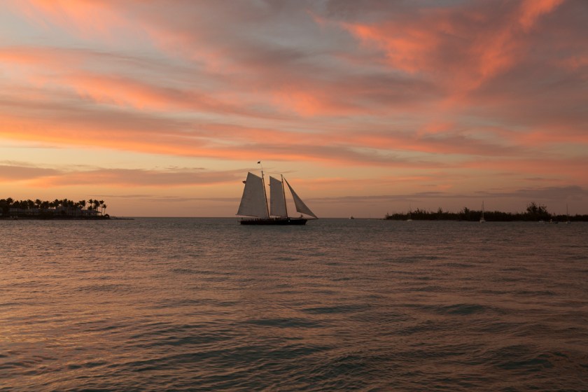
With sunset coming quickly, we walked through Mallory Square and found a place to enjoy it…
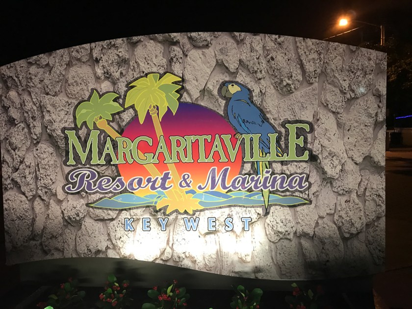
After sunset, we began to think about a place to spend the night. 25 years ago, there were lots of, how should I put this, hole-in-the-wall places. You know, the kind that line every beachfront everywhere. Well…not anymore…not in Key West! A quick internet search told us the average price for a room in the cheapest of hotels was going to run us about $400 for ONE NIGHT. I almost choked on my beer! We talked about driving north until the prices dropped some. Another internet search told us that wouldn’t happen until we were off the Keys. It was getting late, we were tired and I was getting a little cranky. This all brings us back to that mistake number 1. After 25 years, things change! Finally, with the help of my Hotels Tonight app, we pried $300 out of out wallet and got a room at the Margaritaville Resort. It was a nice room, not $300 nice but that was better than the regular price of nearly $600.
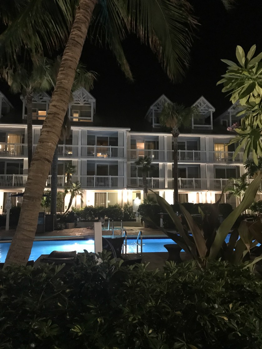
The view from our room
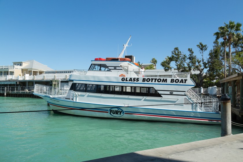
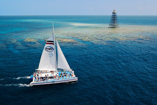
Wanting to make the most of our last day, we booked a trip with Fury Water Adventures and it didn’t go out until noon and the resort was nice enough to let us leave the Jeep there. We walked around Mallory Square and killed time until the trip went out. Pride of Key West is the name of the glass bottom boat and we found it at the dock…
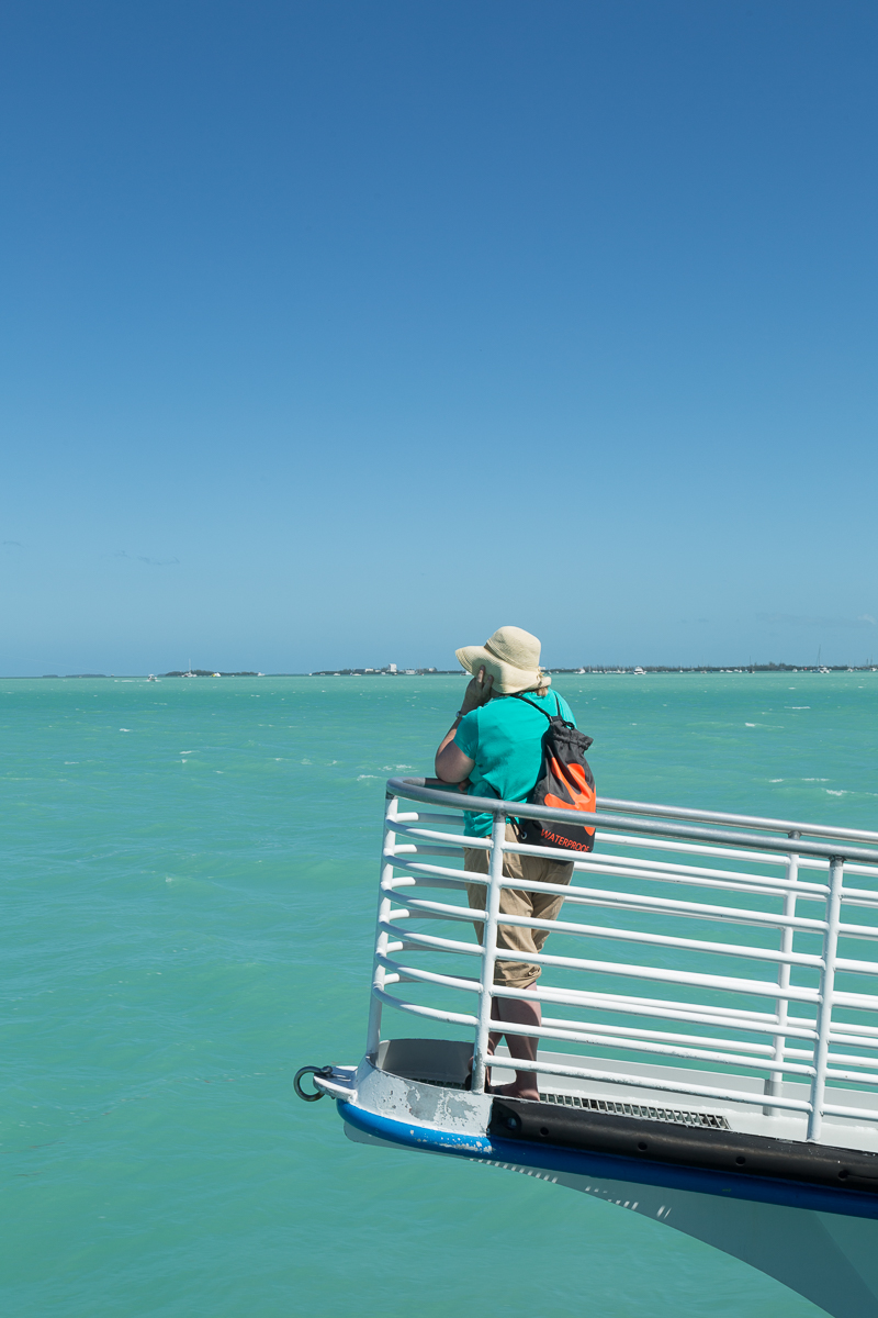
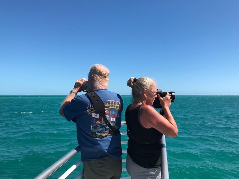
After we boarded, Steve and I split up. He stayed on the upper patio and I was lucky enough to get a spot at the bow. This lady held the other great spot on the bow…
As we were going out, we passed another Fury boat heading in…
Once we reached the coral garden, the captain did a great job of drifting us over the sea floor and the presentation given was excellent…
On the way back to shore, Steve and I posed for this picture before relinquishing out spot on the bow…
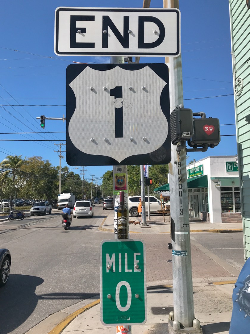
Although we still had over a 4 hour drive ahead of us, there were a couple places we wanted to hit before we left the island…
Is it the end of the road?Or the beginning?
I guess it all depends on if you are going north or south. The other place we wanted to get a picture of was the lighthouse…
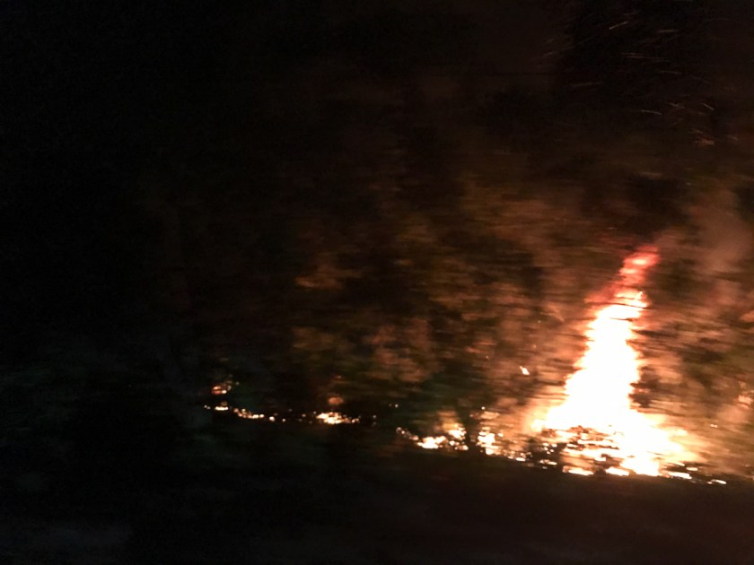
Our Key West adventure was over and it was time to head back to Big Cypress. Here is where we made mistake number 2. We hadn’t listened to any local news. If we had, we would have been forewarned about the wildfires. The traffic came to a complete stop when we got to Key Largo and we had no idea why. Up ahead, we could see flashing lights and detour signs. Route 1 was closed – completely! But we still didn’t know why. We followed the traffic and found ourselves on Sound Card Road, the only other way off the Keys. We soon discovered the source of the problem, a wildfire…
I sincerely hope it is the only wildfire we ever drive through! It was more than a little scary since the top was off the Jeep, as were the doors. Smoke blanketed the road. We could feel the heat and hear the crackle of the flames. I read later, there were actually 2 separate fires and we lucked out because both Route 1 and Sound Card Road had been closed earlier. Had we checked the news, we would have known.
It was late when we finally made it back to Waldo, but we made it. We really had a good time in Key West, but learned a little planning goes a long way and nothing stays the same for 25 years!
Have you ever been to the end of the road? Or done the Duval Crawl?
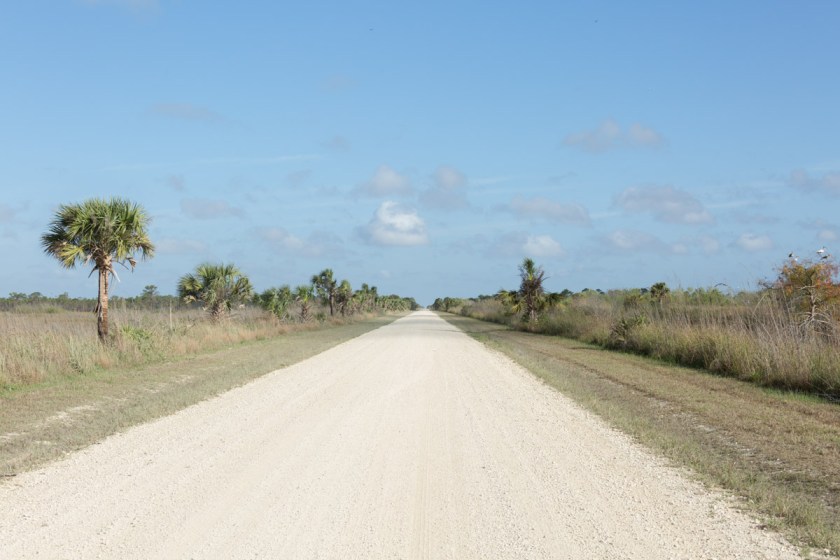
If you missed part 1, you can find it here. Big Cypress encompasses several different environments, and they each require a specific mode of transportation. Many places are accessible with your own vehicle, despite any warning signs you might see…
Many of the roads are hard packed sand and are easy to navigate…
They offer a stunning array of scenery and wildlife opportunities…
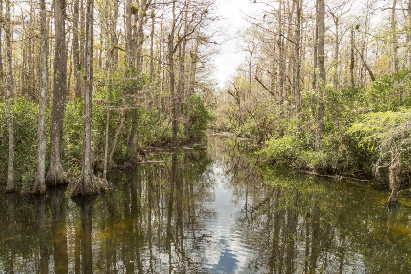
Other areas can only be reached via hiking trails. We started out on the Gator Hook Trail. At the start, it looked something like this…
With scenery like this…
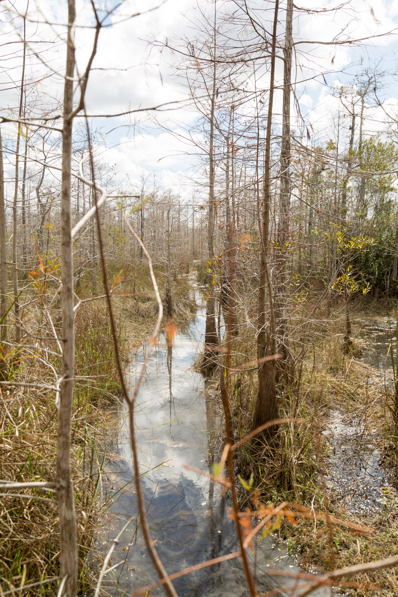
Then it became a bit muddier…
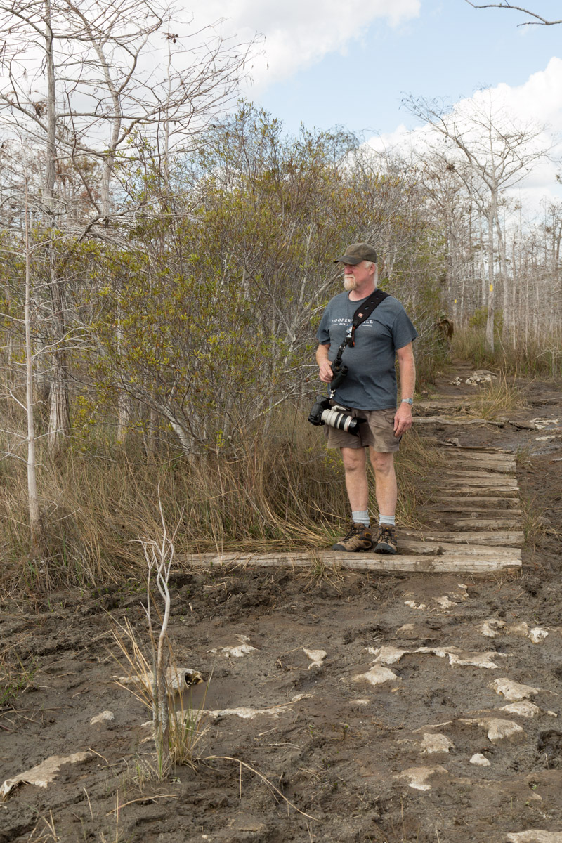
As you can see, Steve is having second thoughts about this hike. And with good reason, the rest of the trail looked like this…
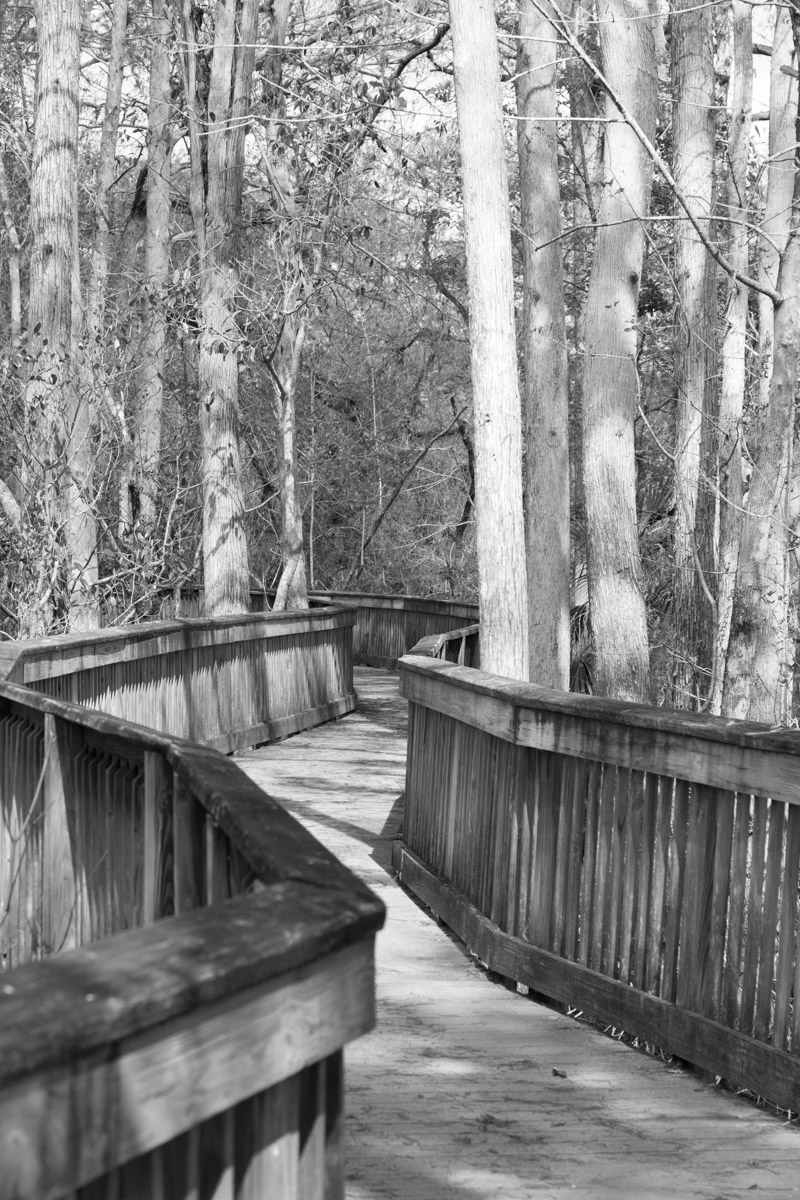
We hadn’t really planned for a wet hike, so we decided to head back and check out some of the other trails. One of the neat things about Big Cypress is they have several boardwalk hikes. Most are less than a mile and are wheelchair accessible. You can see almost all of the same scenery, but with dry feet.
What do you think of this in black and white?
The boardwalk at the Kirby Storter Roadside Park has a chickee near the beginning of the trail…
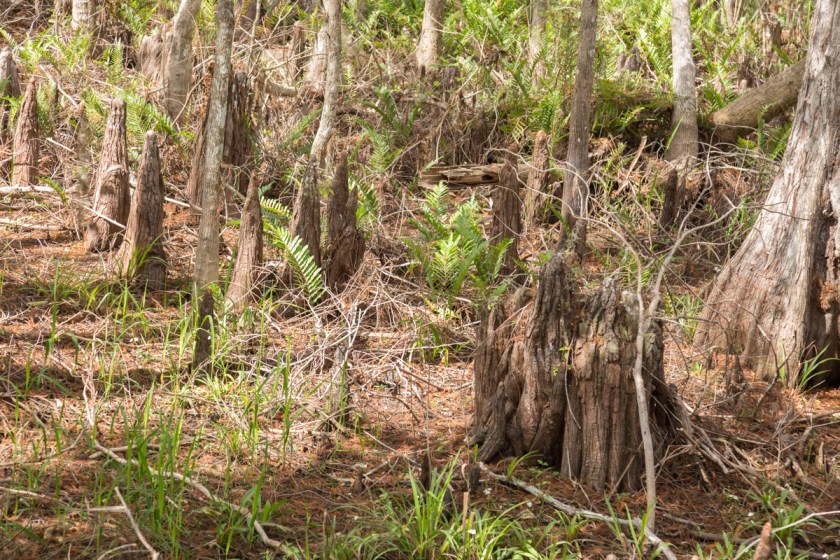
As the boardwalk meanders through the forest/swamp, you can’t help but notice the changes in the landscape. Cypress knees begin cluttering the forest floor…
Most of the cypress trees were logged out during the late 1800’s. But every now and then, you can find one that has been around a while. I have no idea how old this tree is, but the plastic water bottle near the base of it gives something for scale. (There was actually very little litter in the preserve)
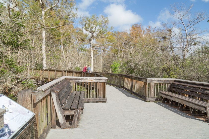
The boardwalk ends at a large viewing platform with several benches…
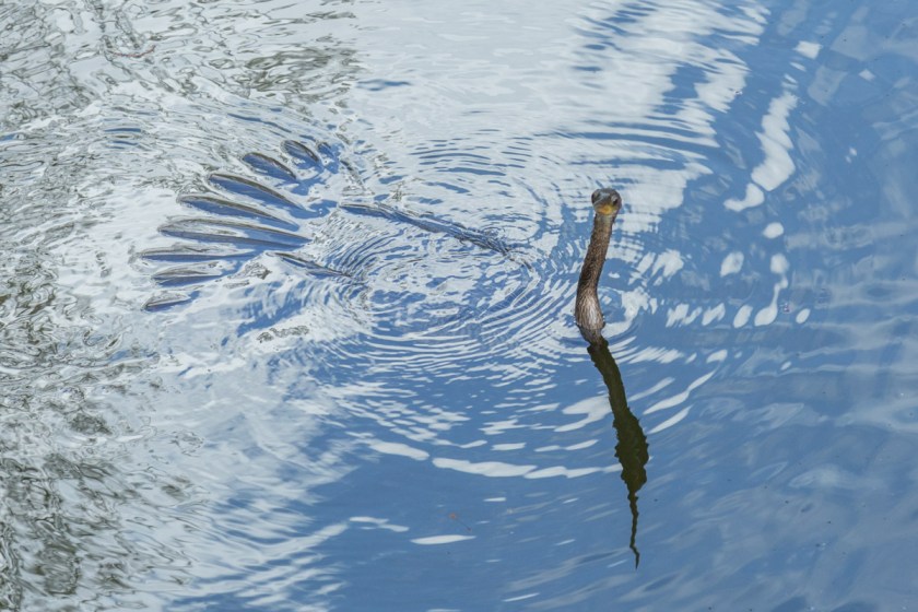
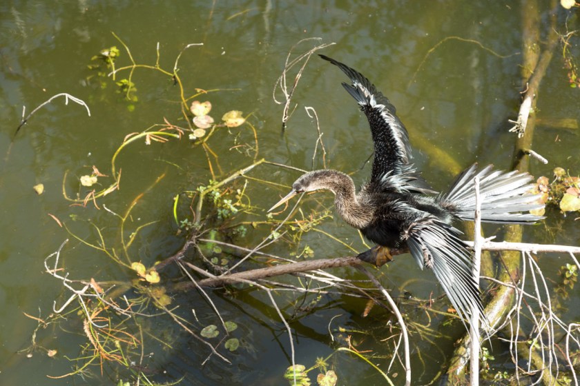
While Steve was talking with another visitor, I watched the anhinga looking for its lunch…
Another day, Steve and I hiked out to Deep Lake. Since we were there during the dry season, the path was pretty easy to walk. There were a few places where getting wet was the only option. At least we were prepared this time…
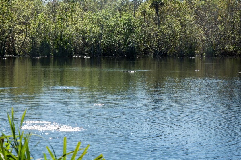
Deep Lake is a naturally occurring sinkhole lake and is over 90 feet deep.
How many alligators do you see? Hint, there are more than 5
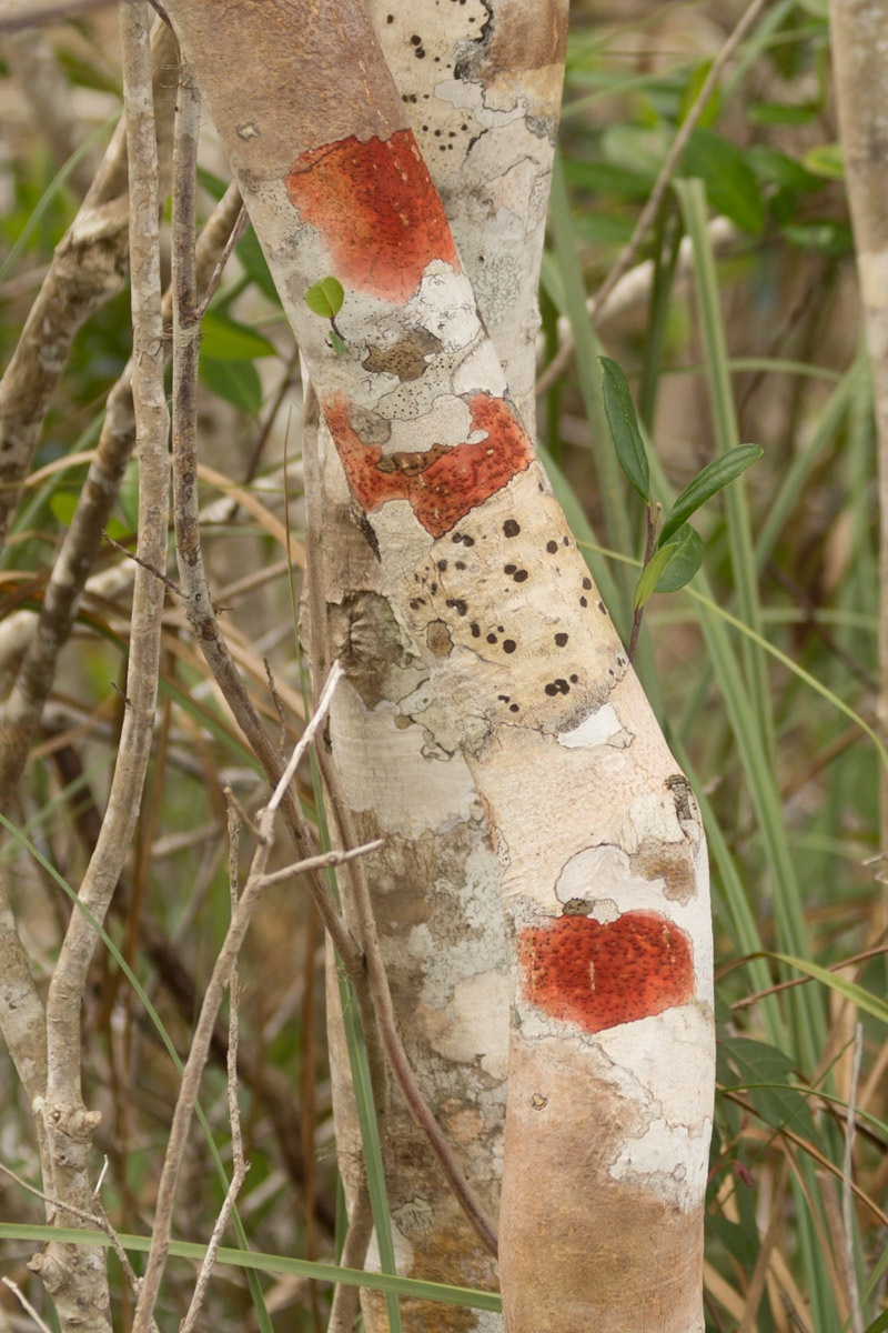
One of the benefits of hiking versus driving, is you can just stop and check things out. You will see things you would have otherwise missed. Like the neat pattern the fungus made on this tree…
Or the blooms of the bromeliads…
Or the lizards,
A strangle fig with its victim,
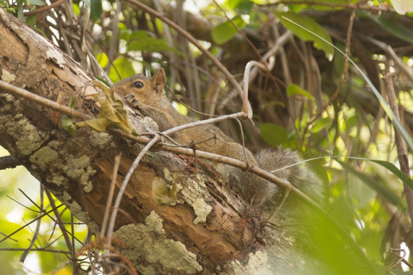
A squirrel hiding in a tree,
Or a liguus tree snail…
For me, kayaking is probably the next “slowest” way to take in the sights.
I imagine during the wet season, all of this is underwater.
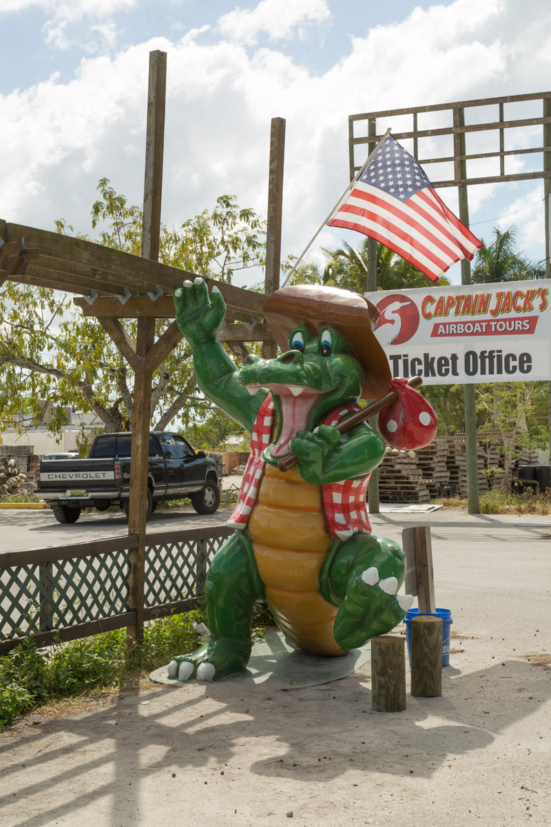
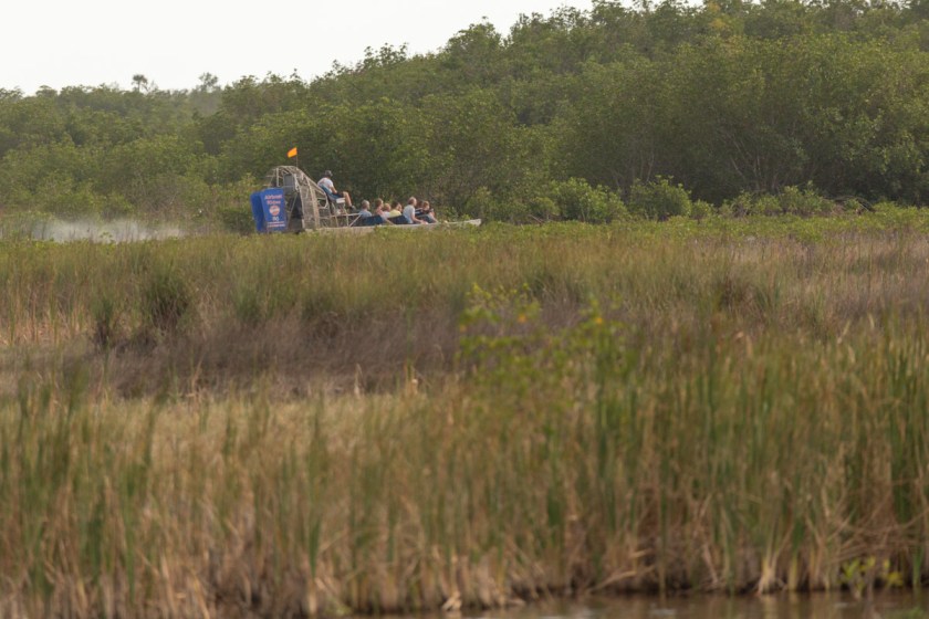
Other ways to get into the “back country” are airboats…
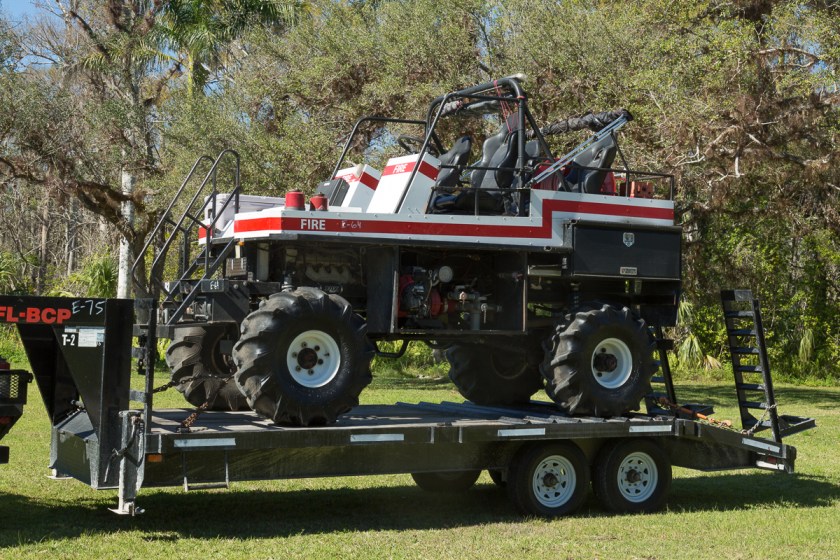
And my personal favorite – swamp buggies…
There are lots of places you can take airboat or swamp buggy eco tours, but we opted not to on this trip. Maybe next time!
Until then…
We say “Thanks for coming along!” and we always love reading your comments!
Everyone has heard of “The Everglades National Park”. But did you know there is another , equally beautiful, tract of land just east of the Everglades called Big Cypress National Preserve? What’s the difference between a national park and a national preserve? Land use is restricted more tightly in a national park, for example you can not legally hunt in most national parks, but you can in national preserves. Big Cypress was the first national preserve, established Oct. 11, 1974.
“The concept of a Preserve was born from an exercise in compromise. Everyone saw the importance of protecting the swamp, but many did not want this region merely added to nearby Everglades National Park that was created in the 1940s. Many felt that national parks were managed in a restrictive manner and access to the swamp would be lost. The resulting compromise created a new land management concept – a national preserve. An area that would be protected, but would also allow for specific activities that were described by Congress within the legislation that created the Preserve.”
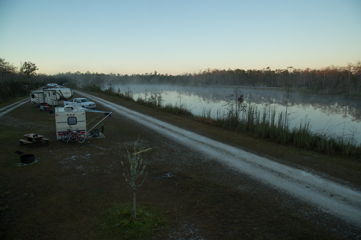
Steve and I recently spent 10 days exploring Big Cypress. We stayed at Burn Lake Campground which was a perfect jumping off spot for our day trips. There are no services at Burns Lake (electric, water or sewer), perhaps that is why it was so much less crowded than some of the other campgrounds. With only 10 RV sites (sites 1 & 2 are reserved for camp hosts) and 6 tent sites crowding is seldom an issue. Several nights during our stay, we were the only RV in the campground other than the camp hosts.
No matter where you travel within the park, you are guaranteed to see 2 things – alligators and birds!
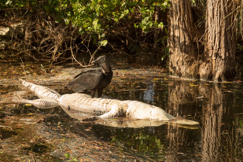
Frequently near each other. These wood storks aren’t paying any mind to the alligator on the shore. I don’t know how often a bird becomes a snack but…
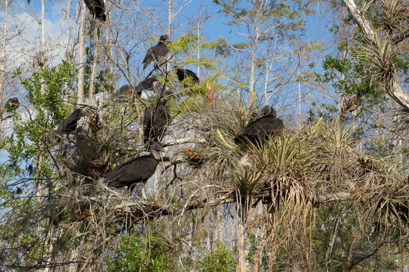
This vulture was more than happy to feast on these alligator remains, while the rest of the flock waited their turn…
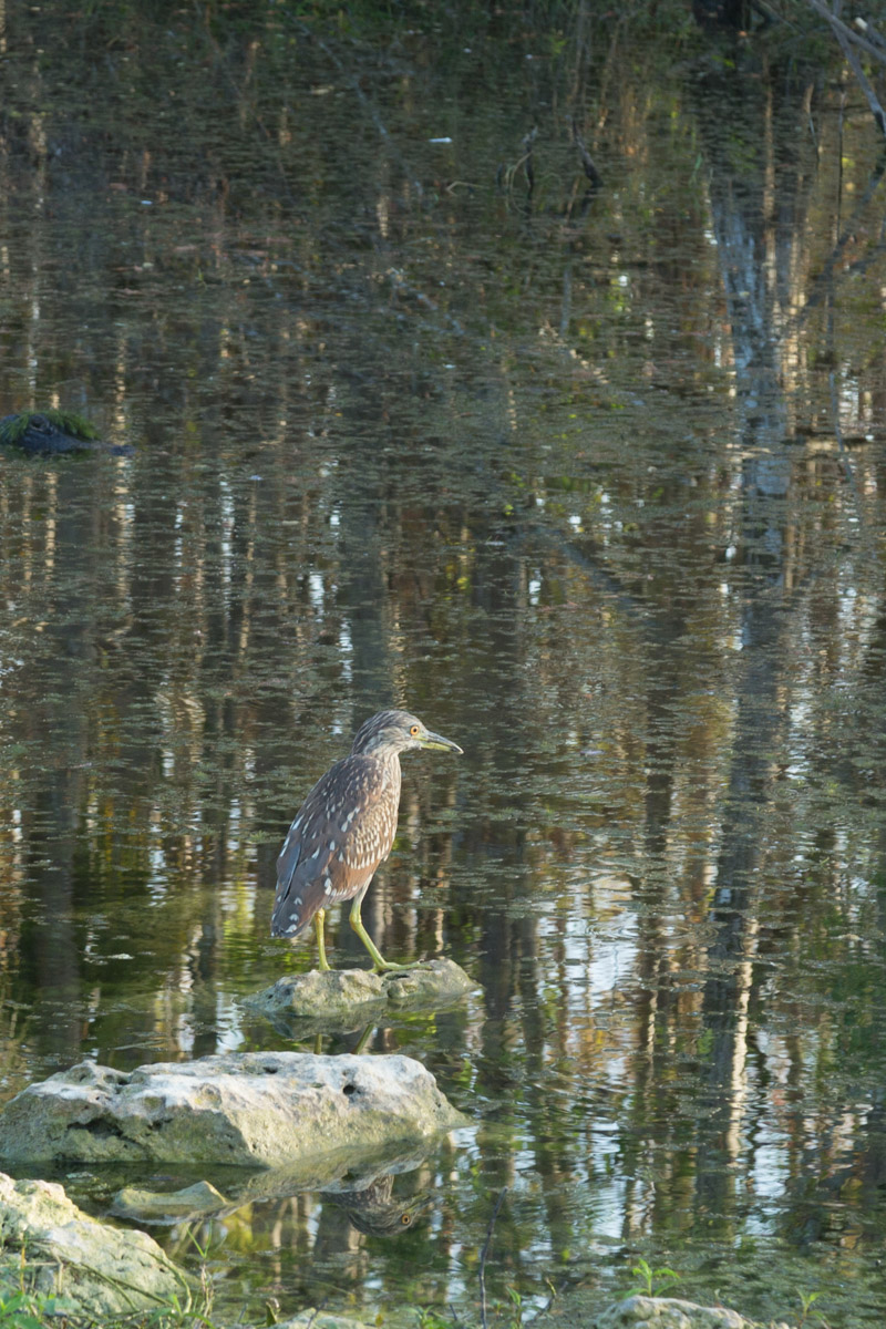
While many of the birds are out in the open and easily seen…
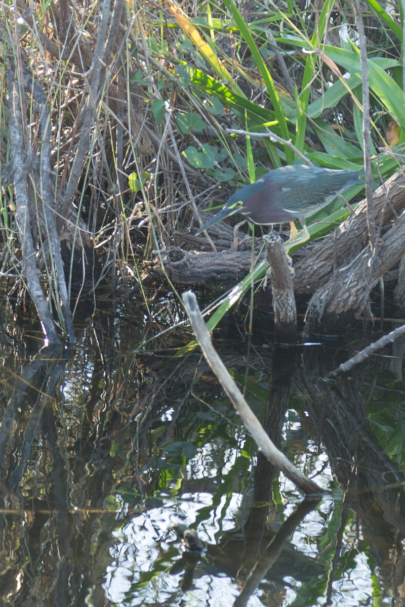
Others challenge you to find them…
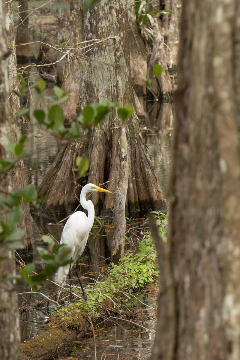
Some birds strike regal poses for you…
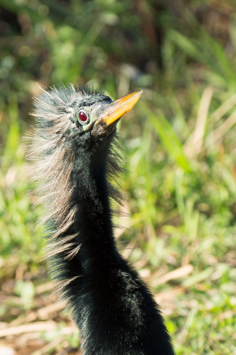
While others appear to be having a “bad feather” day…
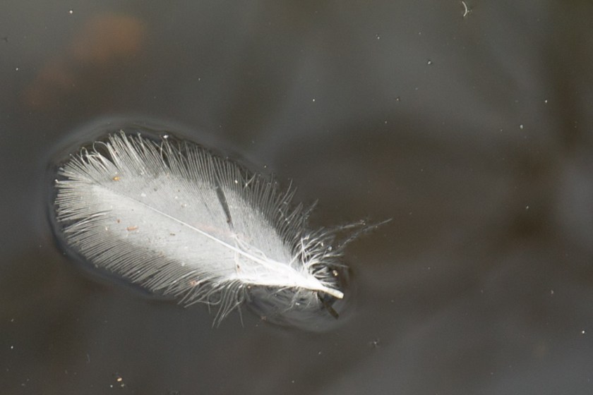
And speaking of feathers, I loved the way this one was drifting along in the current…
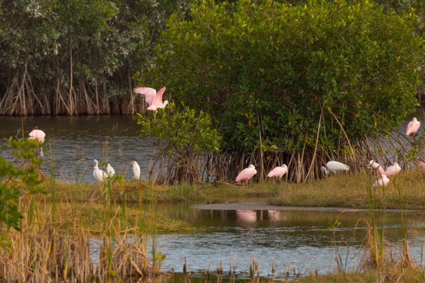
Some of the other birds we saw…
But, the most exciting bird encounter we had was at nearby 10,000 Islands National Wildlife Refuge. Steve and I had been there several days earlier, but wanted to go back for a sunrise view from the observation platform. While the sunrise was beautiful, I didn’t really get any images I thought were spectacular. Not wanting to waste our visit, we walked along the refuge’s Marsh Trail. We stopped for a time to enjoy the peaceful surroundings…
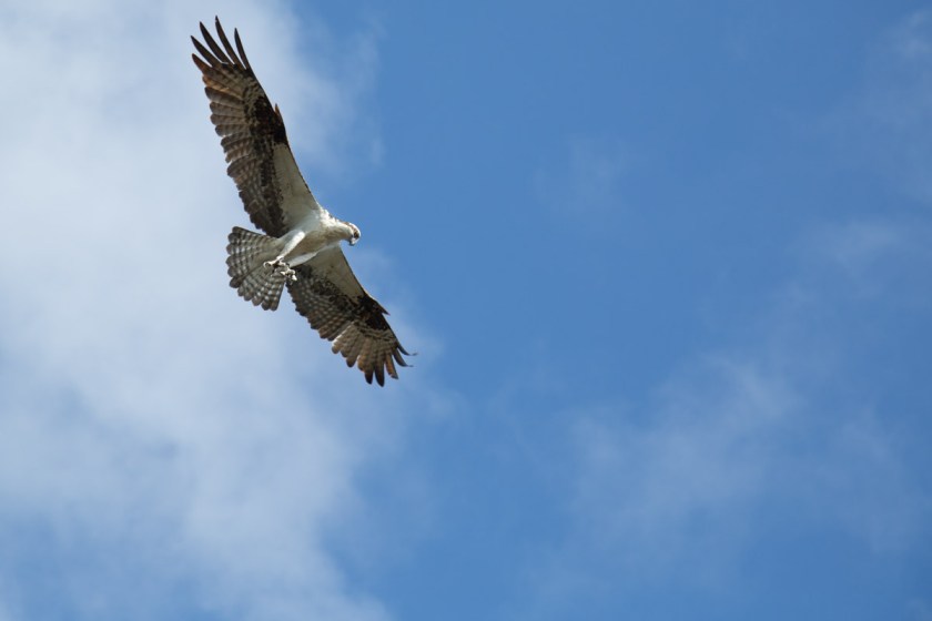
When to our amazement, an osprey decided to search for breakfast right next to us! The scene went something like this. The osprey flies in, literally, not more than 20 feet over my head…
Sees something good to eat and prepares to dive…
Gaining speed…
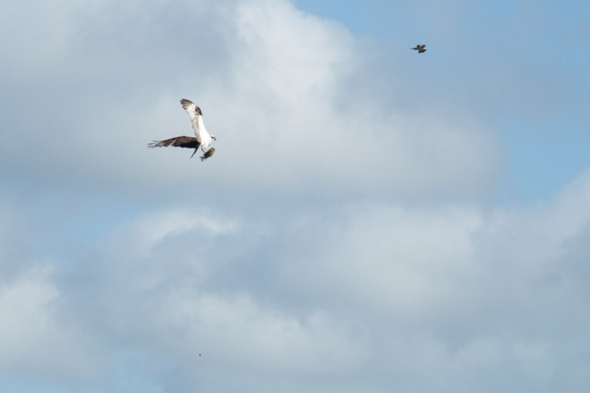
I lost sight of him in the brush, but I heard the splash. Then he re-emerges and flies off with breakfast…
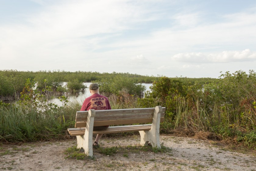
Steve and I were stunned to witness this so closely! On our way back to the Jeep, we stopped at the observation platform and I think this picture is perfect. To me it shows what a wide variety of people enjoy the refuge…
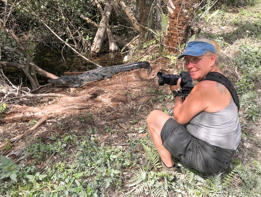
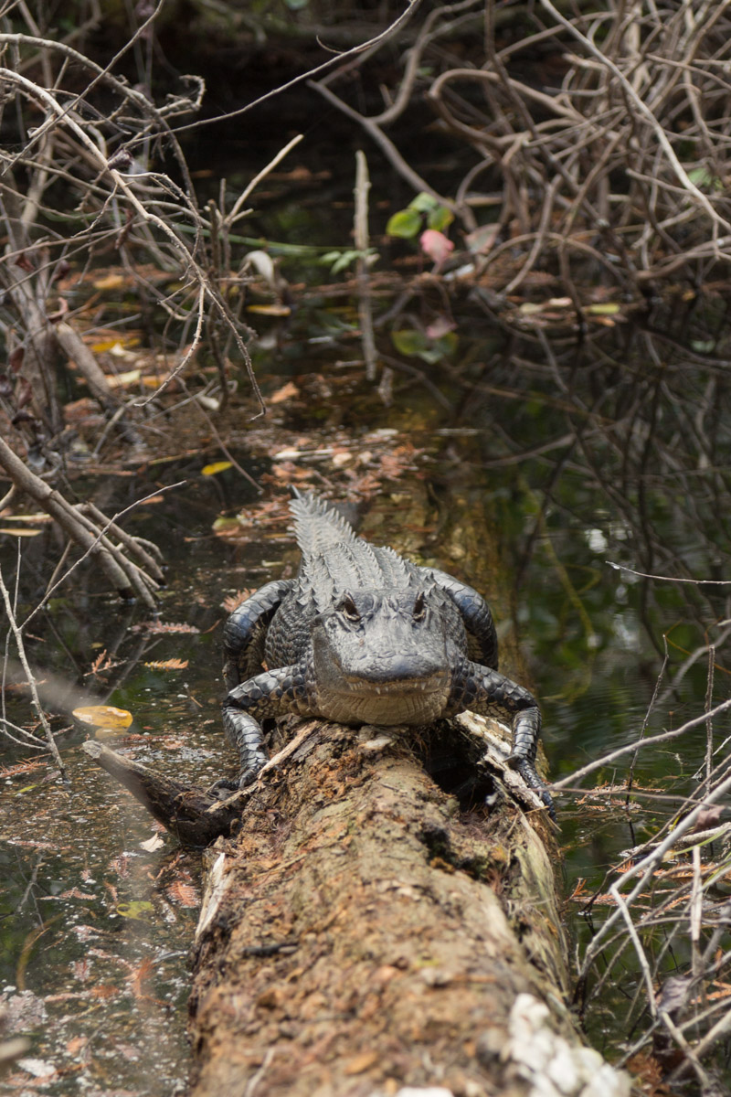
Ok, so about those alligators. There are signs everywhere, warning people not to feed or harass the alligators. In the visitor’s center, they tell you to stay at least 10 feet away from them. That’s it? 10 feet? Hmmm, okay. My picture…
Sorry, wrong one. My picture…
And my proof I was 10 feet away…
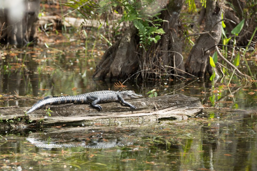
We happened upon lots of gators soaking up the sun…
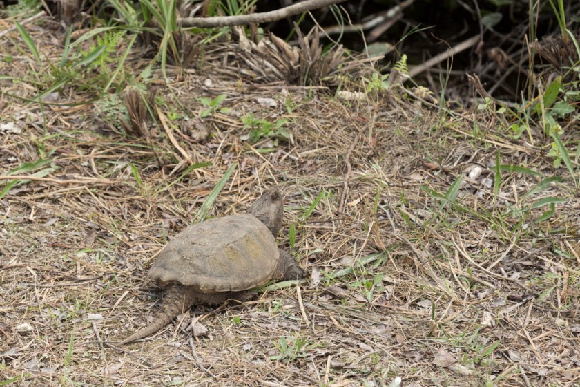
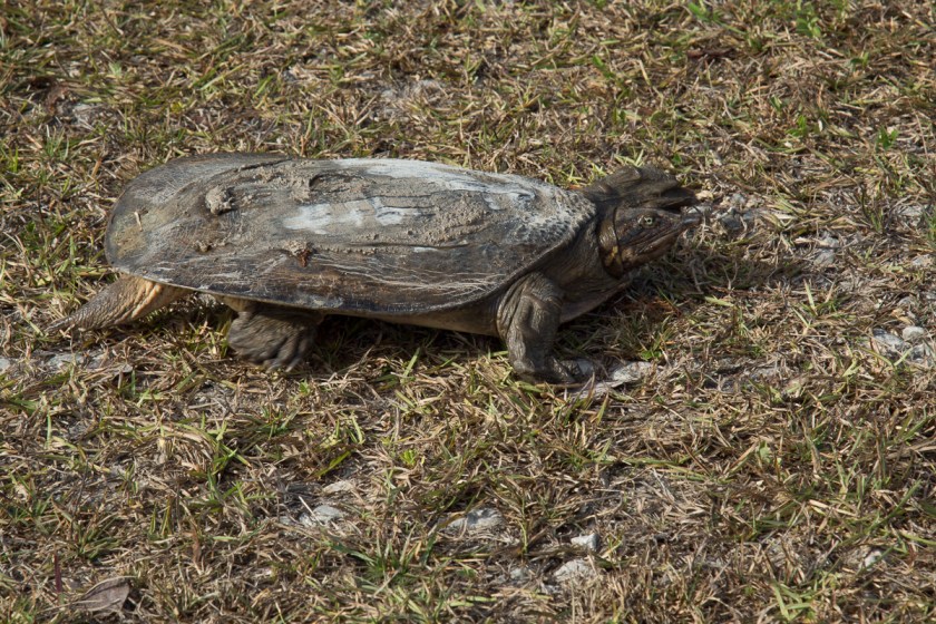
One of the hardest animals to get any photographs of were the turtles. Yep, the turtles! Nearly every time I would see one, Steve would stop the Jeep and they would disappear into the water. I did manage to get a few images…
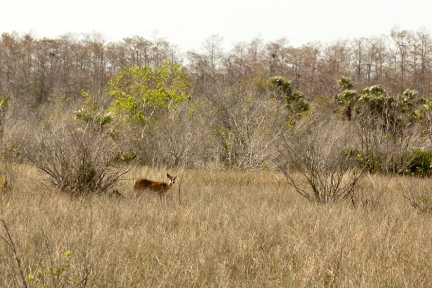
If you are lucky, you might get a chance to see some of the other animals in the preserve. While we did not see any bears or panthers, we did see a few deer off in the distance…
What else is there to see and do? Stay tuned for Part 2!


 Steve and I were stunned to witness this so closely! On our way back to the Jeep, we stopped at the observation platform and I think this picture is perfect. To me it shows what a wide variety of people enjoy the refuge…