Joining the 30% Club

We feel downright privileged to have been inducted into the 30% club! When we first arrived in Alaska, we had no idea such a club existed. The chalets where we worked were usually the final destination for our guests. They had already explored Fairbanks, Denali National Park and Anchorage. The Kenai Peninsula was the end of their adventures. Time after time, we heard stories of visiting Denali NP only to be terribly disappointed they didn’t get to see Mt. Denali. I mean, after all, it IS the tallest mountain on the continent – how can you not see it?!?!?

Mt Denali is 20,310 feet tall, that’s about 3 1/2 miles. Its 2 peaks are over 2 1/2 miles apart. It’s hard to imagine you couldn’t see it! But the fact is, given its location and size, it creates its own weather.

“Denali is so massive that it generates its own weather; much the way a huge boulder submerged in a river creates whitewater rapids. All mountains deflect air masses and influence local conditions, but Denali rises so abruptly and so high that this effect is more dramatic here than perhaps anywhere else on Earth. Storms barrel in from the Gulf of Alaska and the Bering Sea and collide with Denali’s towering mass. Weather can quickly change from sunny and clear to blizzard conditions with fierce winds, intense cold, and heavy snowfall.”

                                                         From The Alaska Range and Denali: Geology and Orogeny

This pattern of weather convergences means it can be sunny and 70˚ in town and Mt Denali could be obscured by fog and clouds. It’s estimated only 30% of visitors actually get to see Mt. Denali. We were in that 30% – FOR 3 DAYS IN A ROW!!!!   Denali means “the high one” in Koyukon, a subset of the Athabaskan language family, sometimes thought to mean “the great one.” Every time we got to see Mt Denali, I was in awe.

The park has an incredible history and many of the stories can be found here.

The First 15 Miles

a map showing the predominately east-west road through denali national park

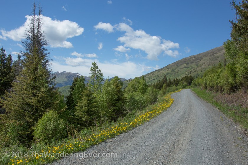
Private vehicles can only be driven on the first 15 miles of the 92 mile park road. To go beyond Savage River, you must take the park shuttle or hike. We spent our first day driving those 15 miles and seeing all we could see…

Denali NP-9232
The view on the left side of the road
Denali NP-9244
Compared to the view on the right side of the road

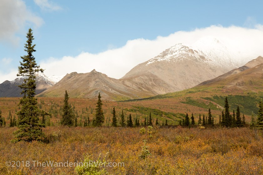
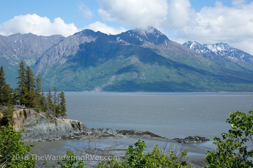
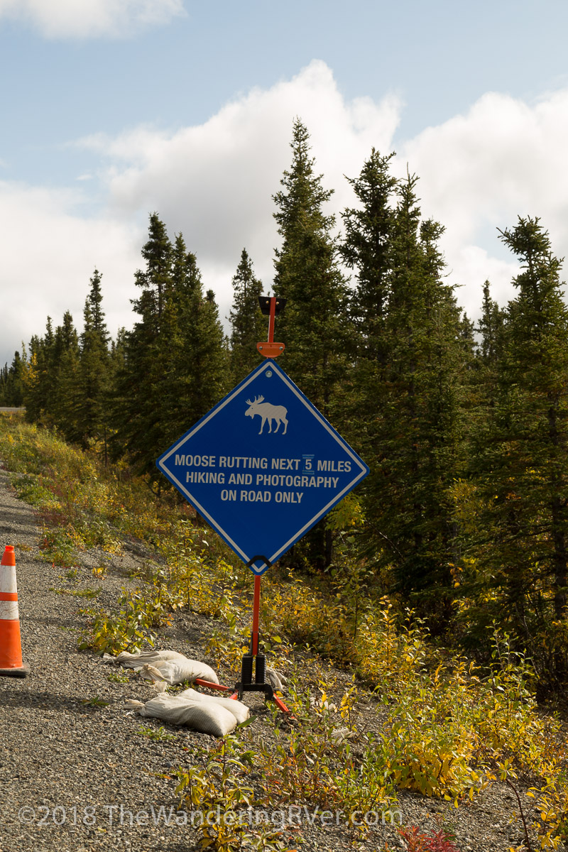
It was strange how the left side of the park was in bathed in dappled sun while the right side was shrouded in clouds. There would be no view of Denali today, but, we did get to see some informative signage…

Denali NP-9242

And when we made it to Savage River, we were treated with a surprise…

Denali NP-9238
A rainbow over Savage River

We weren’t worried we didn’t see any wildlife on the first day. Guided by the weather forecast, the next day we planned a trip on the shuttle to the Eielson Visitor’s Center – Park Road Mile 66.

The First 66 Miles

We opted for the transit bus, as opposed to the narrated tour bus. The up side of the transit bus is you can disembark, hike, then grab another bus, while you have to remain on the tour bus. We promptly departed at 7:30am, along with 58 of our newest friends. Our shuttle driver Annie filled us in on what to expect, she said we’d stop for all wildlife sightings and several scenic overlooks, in addition to potty breaks for the 8 hour ride.

Denali NP-9247

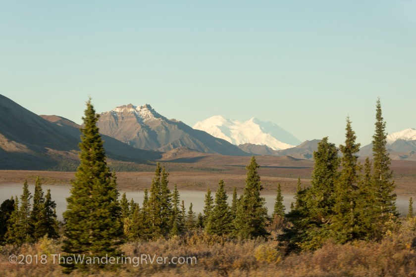
Our first view of Mt Denali was over the mist settled in the valley. But, we had seen it! Already a member! As the morning worn on, we stopped for several wildlife encounters…

Denali NP-9262
Meet Mr Caribou
Denali NP-9289
Those 2 black dots at 2 o’clock and 8 o’clock are grizzly bears

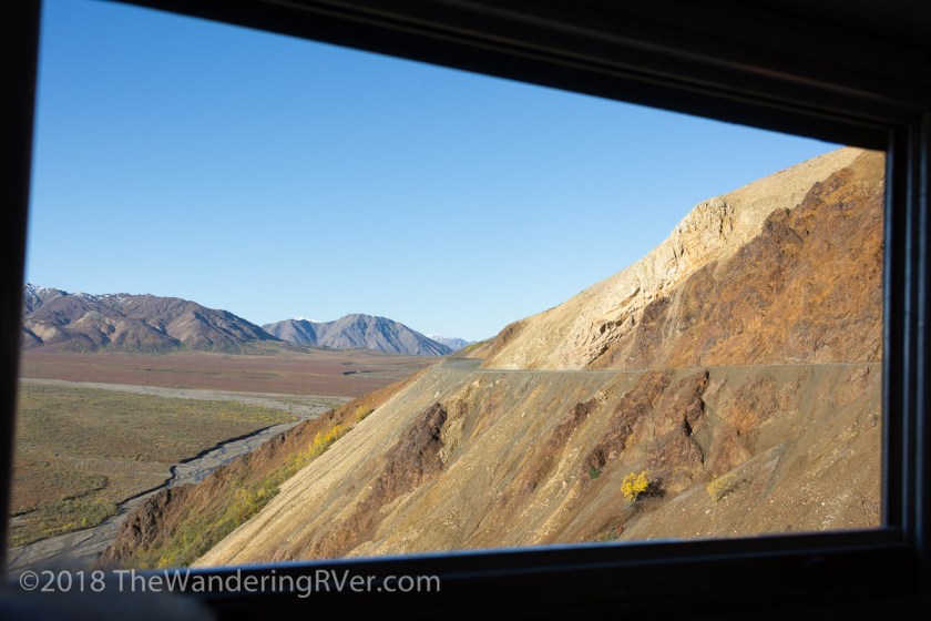
It was a bit frustrating for me, jostling for a view out the window, but we made it work.

Denali NP-9295
Those white dots in the center are Dahl Sheep

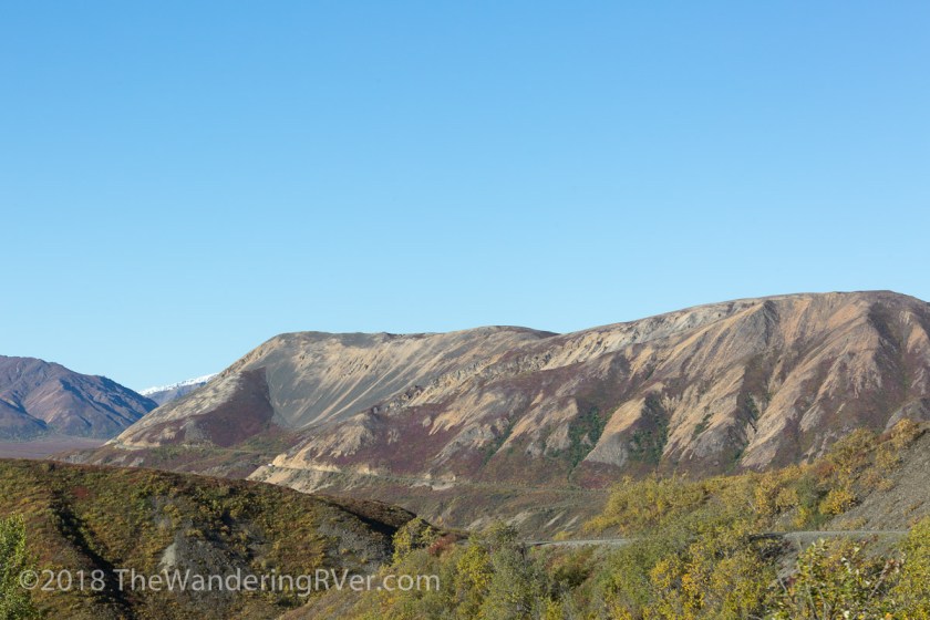
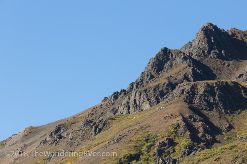
Are you noticing a pattern? Lots of dots. The colors on the mountains reminded me of Death Valley, except this color came from brightly colored fall foliage instead of minerals…

Denali NP-9299

Denali NP-9302
The park road winds past colorful mountains

A good part of our day was spent taking pictures like this…

Denali NP-9307

At mile 46, we stopped to check out Polychrome Overlook. The myriad of colors were astounding…

Denali NP-9309Denali NP-9321

Denali NP-9318
Lots of buses filled with tourists

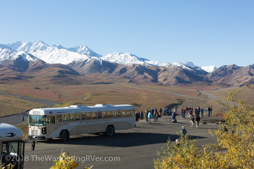
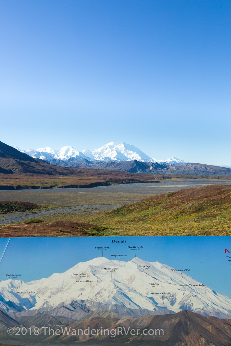
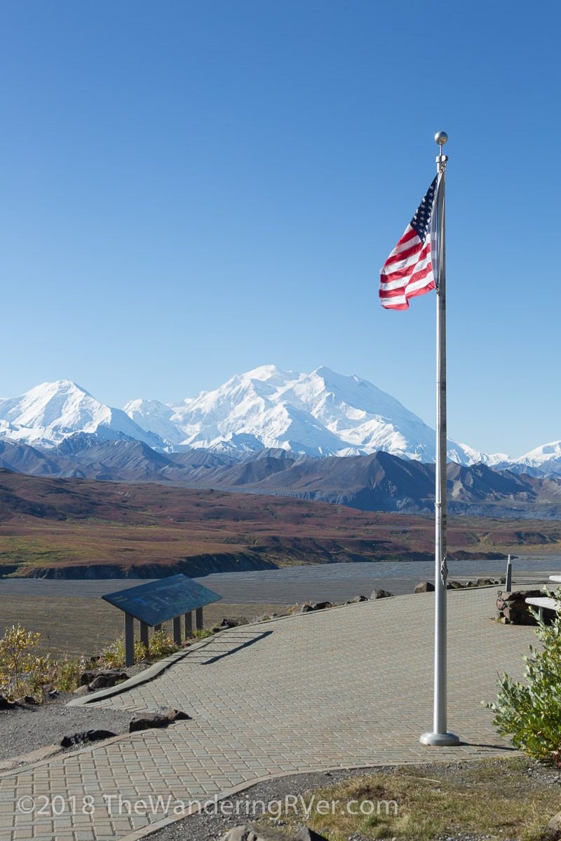
We also stopped along the route for the iconic picture of the park road with Mt Denali in the background. Yes, everyone else has taken this picture, but I couldn’t resist…

Denali NP-9374

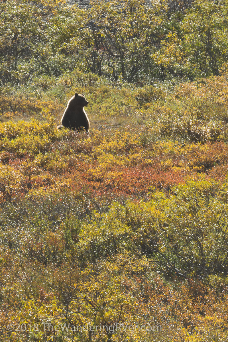
We did get a closer view of some grizzly bears, but unfortunately, the sun was shining toward us and the bears ended up with a halo…

Denali NP-9360Denali NP-9356

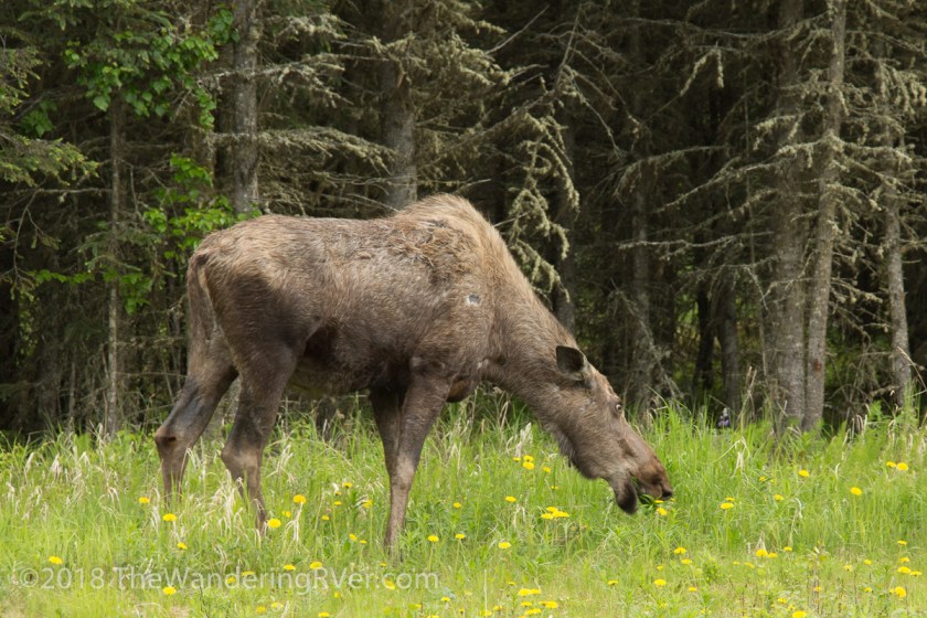
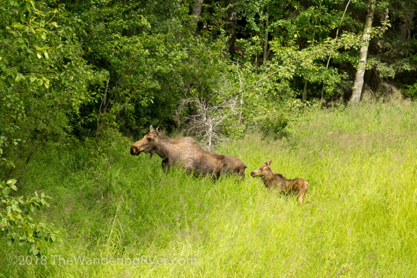
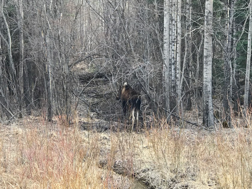
We also saw a couple moose in the distance…

Denali NP-9327

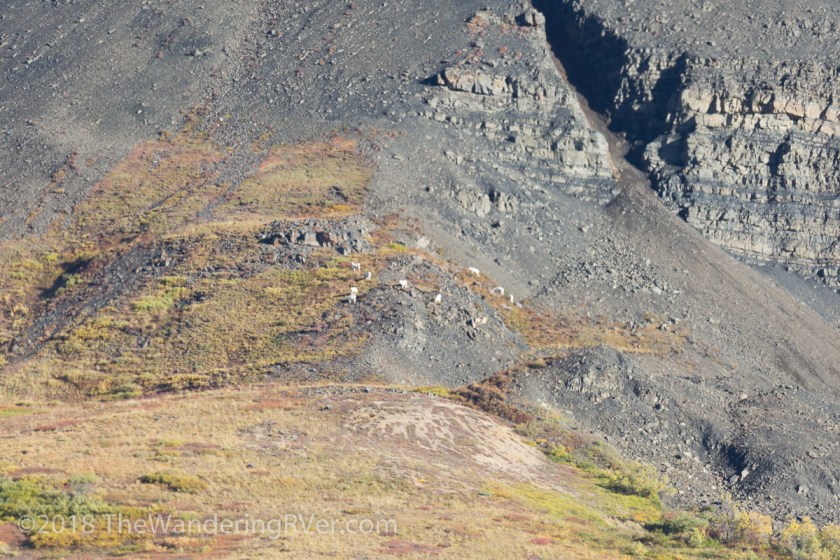
And lots more “dots” on the mountains…

Denali NP-9343Denali NP-9336

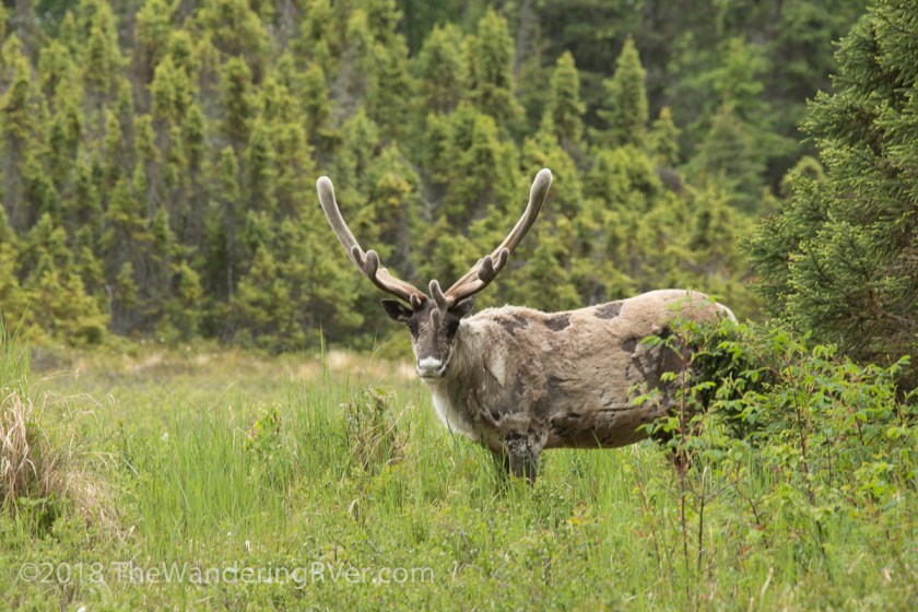
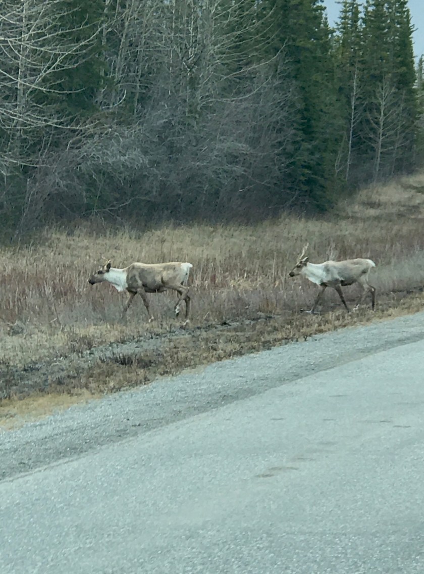
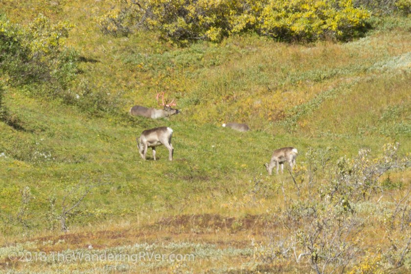
I loved watching this group of caribou. With winter around the corner, they are beginning to shed the velvet covering their antlers. It’s  not a good picture, but the antlers were almost orange…

Denali NP-9392

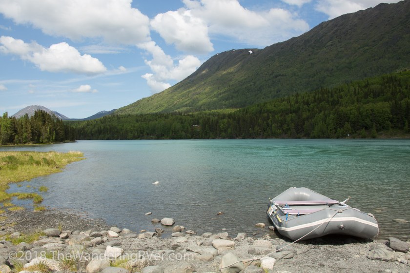
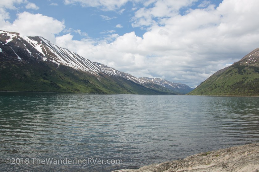
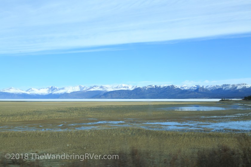
The views, despite being out the window, were breathtaking…

Denali NP-9322

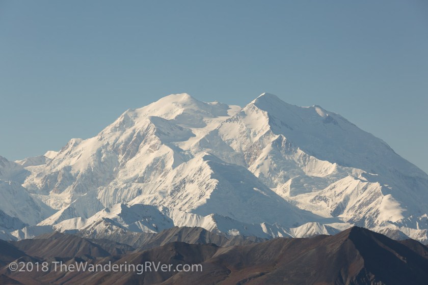
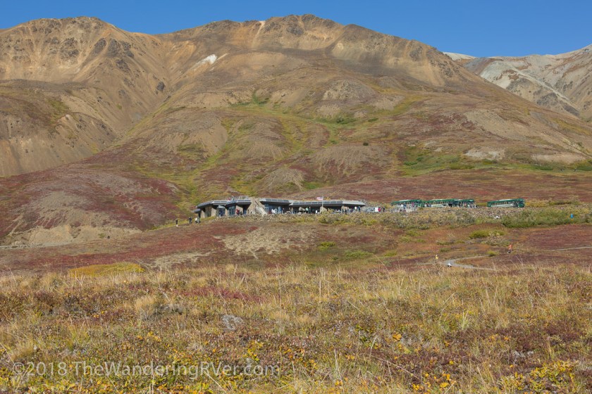
When we arrived at the Eielson Vistor’s Center, Mt Denali provided an amazing backdrop…

Denali NP-9399Denali NP-9403Denali NP-9411

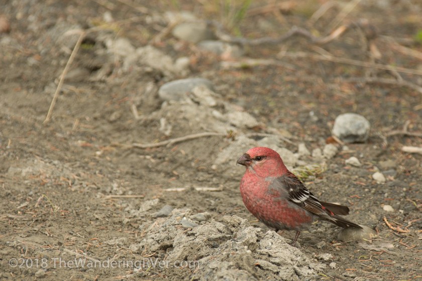
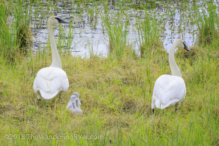
We decided to stay at the vistor’s center and catch a later shuttle. We were treated with a couple minutes of solitude before the next bus arrived. While we were basking in the splendor of Mt Denali, some of the wildlife posed for a closeup…

Denali NP-9427
An Arctic Squirrel
Denali NP-9423
Munching away on an apple peel someone had carelessly or purposely dropped

The park rangers go to great length to educate the public about the dangers of feeding ANY of the animals. Annie had reminded us time and again, it was best to eat on the bus so as not to leave so much as a crumb for the critters. But, you know people, some of them just can’t help themselves.

We walked along the trail and looked back at the visitor center…

Denali NP-9435

And ahead to the 33 more miles to the base of Mt Denali…

Denali NP-9434
Hard to imagine, Mt Denali is still 33 miles away!

One of the interesting things about Denali NP is the fact it is a “trail-less” park, with a few exceptions near the entrance. People are encouraged to find their own path. Go out and walk on the tundra. Feel the springiness of it under you feet. Enjoy it in your own responsible way.

It was time to head back. We had seen everything we had hoped to except the wolves. Pretty darn good day!

Up next…Cruising the Denali Highway and Abandon Igloos

Are you a member of the 30% club? Did you even know there is such a thing? I’d love to hear your thoughts.


Where are the Bears?

In an effort to get caught up, this post is going to be about several day trips we’ve taken around the Kenai Peninsula. We are always on the lookout for wildlife, particularly bears. Black and brown bears (grizzlies) live on the peninsula and we spend a lot of time exploring the area looking for them. We’d been told the Kenai National Wildlife Refuge was famous for bear sightings. We set off early one morning to drive Skilak Lake Road, an 18 mile dirt road in the refuge. We had barely gotten a half mile from Waldo when I had to stop and admire the reflection on Upper Trail Lake…

Skilak Lake Road-7939

When we finally arrived at Skilak Lake Road, I realized something – it was Memorial Day weekend. There were people everywhere, the campgrounds were packed and the bears were in hiding! But, the scenery was lovely…

Skilak Lake Road-7961

Skilak Lake Road-7956
Mt Redoubt, in the background, is a volcano – it last erupted in 2009

We did finally get to see some wildlife…

Pine Grosbeak-7949

Oh ya, and we did see a squirrel, but i didn’t get any pictures of it. Another day, the town of Hope was our destination. The Alaskan gold rush began in Hope and there are lots of places to explore. After we turned off the Seward Highway, we were treated to some stunning vistas overlooking Turnagain Arm…

Hopw-8209

Usually, we make sure we have a full tank of gas before we head off to do any exploring but we had both verified there was a gas station in Hope, so we didn’t top off the Jeep. What we didn’t know was the price of gas in Hope was $4.50 a gallon! Holy crap! Over a dollar more than in Seward. AND – cash only! That’ll teach us! After we emptied our wallets, we drove along Palmer Creek Road…

Hopw-8241

Hopw-8247

Hopw-8212

The breathe taking views eventually led us to a hiking trail. There were quite a few cars parked at the trail head, but we grabbed the bear spray and our cameras and started down the trail…

Hopw-8215

It didn’t take too long to realize the snow covering the trail was too deep for us to enjoy the walk. As we were debating turning around, I caught movement in the brush…

Hopw-8231

This willow ptarmigan was foraging in the underbrush, making way more noise than you would have thought for something that small. We watched until it disappeared and headed back to the Jeep. Since it was getting late in the day, we decided to head back home. As we passed Tern Lake, I saw a pair of tundra swans. But, Steve saw what I had missed! The babies…

Mute Swans-8288

Mute Swans-8307

It didn’t take long for a crowd of onlookers to appear. It seems when one person stops along the road with a camera in hand, everyone stops. Apparently, I’m guilty of the same thing. We were driving along Kalifornsky Beach Road, just south of Kenai, when I saw a guy on the side of the road with his camera. Steve and I turned around to investigate – was it a bear? Nope, but almost as cool. It was a caribou, munching away on the tender new shoots…

Kenai-8495

We hadn’t driven 3 miles further down the road when we saw Ms. Moose doing her part to control the dandelions…

Kenai-8499

After turning off of Kalifornsky Beach Road, we headed north to Captain Cook State Recreation Area. The weather wasn’t the best, so we didn’t have a very good view across Cook Inlet, but we did see some more wildlife…

img_5653

We finally got a few sunny days and we headed to Cooper Landing. We stopped at the boat launch and watched as the rafters and fishermen began their journey to the Upper Kenai River…

Cooper Landing-8354

Steve decided to drive down Snug Harbor Road which follows the back side of Kenai Lake.  I was enjoying the scenery when Steve abruptly did a u-turn. Why? Was it a bear? Nope (again) it was a beautiful waterfall that couldn’t be seen from  the passenger side of the Jeep…

Cooper Landing-8368

We finally made it to the end of the 18 mile road and found Snug Harbor…

Cooper Landing-8382

img_5610

While we were sitting there, a couple in a canoe returned to shore, only to find out their battery was dead…

img_5625

We tried to jump start them, but to no avail. We ended up giving them a ride back to Cooper Landing so they could call for a tow. They were grateful we were there, it would have been a very long walk back to town!

Another day, we when were looking for bears, we saw mama moose and her baby…

Kenai NWR-8737

So, we’ve done all this driving around Kenai Peninsula looking for bears when we could have stayed at home and let them come to us…

img_5670

I took this picture in our driveway! I watched until I thought it was gone. Steve drove to the bottom of the hill and didn’t see it anymore, so we figured it had moved on. Come to find out, it had circled back to Waldo and checked out our grill…

img_5673
Like the bear print on the lid to the grill?
img_5672
 I guess it was unhappy dinner wasn’t ready!

One of our guests shared this picture with me…

img_5669

Now we know where the bears are!


Hanging Out the Window

Time was getting short and we still had almost 3000 miles to go. We were due to arrive at our job in Moose Pass as close to May 1st as possible. Here it was the last week of April and we were only half way there. Of course, we had taken the really long way. From here on out, it would be one night stops, often not even unhooking the Jeep. Our planned travel route would take us through about 13 miles of Idaho. What could possibly happen in 13 miles? Just before we crossed the state line, I saw a sign stating all boats MUST stop and be checked for invasive species. My first (and only) thought was “Gee, glad they are taking it so seriously.” What I never gave a thought to was our 2 kayaks strapped to the roof of the Jeep. I mean they hadn’t been in the water since we left Florida. We were half way though our 13 miles when Steve pulled over to give the car with the red flashing lights pass by. Much to our surprise, they pulled right in behind us. What had he done? He wasn’t speeding or driving erratically. Nope – kayaks are boats and we hadn’t stopped. The sheriff was very pleasant about it, but we had to turn around and go back to the state line. The kayaks were inspected and we got a little sheet of paper stating so. I threw it on the dash as we began our 13 mile drive though Idaho again. We breezed through Oregon and Washington state before I ever thought about that little scrap of paper again. Several times I remarked to Steve that the landscape wasn’t what I had pictured. There were no tree covered mountains or lush forests. Only more of what we’d been seeing all along, giant rocky mountains with little or no vegetation. We finally got to the border crossing, produced our passports and were welcomed into British Columbia, Canada. For the first hour or so of the drive, we passed grove after grove of fruit trees. Every kind you could imagine. Apples, peaches, plums, pears. All in bloom, waiting for pollinators to do their jobs. I didn’t get any pictures because there just never seemed to be a good spot to pull over. We knew our biggest problem would be finding campgrounds that were open in April, most of them don’t open until May. I had picked out a few possibilities and figured we’d just stop in rest areas or truck stops if they didn’t work out.

We got to see our first wildlife in BC. Large herds of wood bison hanging our on the side of the road…

BC-Yukon-6805

BC-Yukon-6808

As the scenery began to resemble more what I had expected, I spent a lot of time trying to capture it…

BC-Yukon-6787

BC-Yukon-6791

BC-Yukon-6800

Our best stop in BC was at Liard River Hotsprings. The provincial park wasn’t open yet for camping, but they had a large parking lot we were told we could dry camp in. In the morning, we headed over to check out the springs…

img_5272

img_5274
The boardwalk to the springs

img_5273

img_5279
Taking a nice soak

In a word – it was awesome! We were so tempted to spend another night, but we really did have to move on. We got to see a little more wildlife…

img_5263

img_5265

We didn’t see near as much wildlife as I thought we would. Maybe it was too early in the season.

We crossed into the Yukon and stopped for the obligatory picture…

img_5330

I spent much of the next few days hanging out Waldo’s window. Every time I thought the scenery couldn’t get any better, it did!

img_5320
Yes, that’s me with my camera out the window

When we got to Watson Lake, we stopped at the Sign Post Forest. It’s hard to describe and the pictures don’t really do it justice…

BC-Yukon-6826

img_5297

I don’t know how many signs there are, but I can tell you, it is A LOT! It took my quite a while to go through all of the pictures and here are some of my favorites from the Yukon…

BC-Yukon-6842

BC-Yukon-6859

BC-Yukon-6867

BC-Yukon-6880

BC-Yukon-6890

BC-Yukon-6897

BC-Yukon-6922

BC-Yukon-6950

BC-Yukon-6992

BC-Yukon-7009

BC-Yukon-7016

BC-Yukon-7084

And finally, we were heading back into the USA – Welcome to Alaska…

img_5331

Well, we made it to Alaska! Up next…Oh Waldo, you’re so……..