Georgia’s Waterfall Heaven

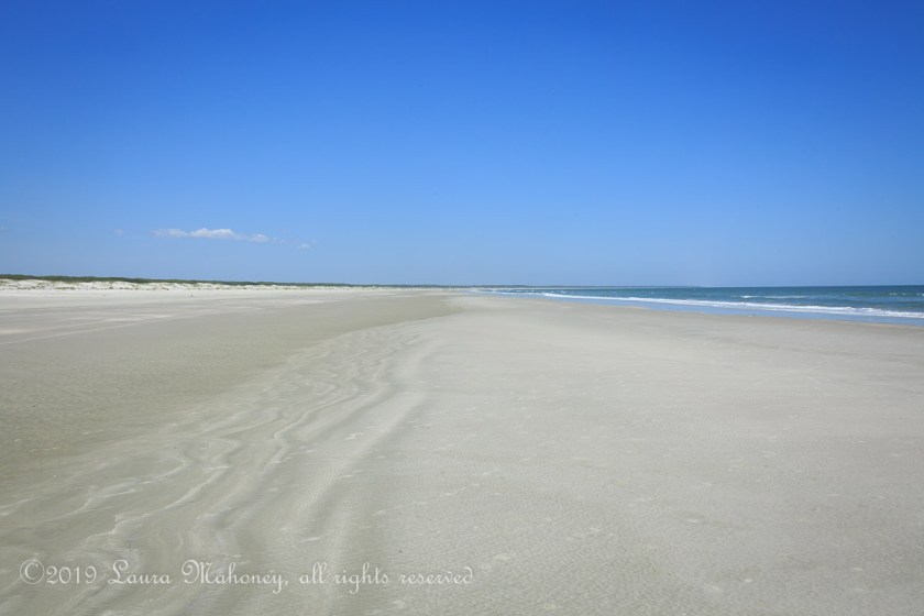
If there’s one item in nature I really enjoy photographing, it’s waterfalls. Big ones, little ones, roaring ones – I don’t care. During our visit to the Georgia coast, Steve picked up a tourist magazine with an ad for the Georgia mountains featuring, you guessed it, waterfalls.

As we made our travel plans for heading north, we decided to stay a week at the southern end of the Blue Ridge Mountains in Georgia. A quick search on Google maps showed there were well over a dozen waterfalls we could visit. One of the determining factors for me was how strenuous was the hike? Anything over easy/moderate and I’m out. One review I read on a hiking forum stated “trail is difficult to follow, not well marked and dangerous”. Needless to say, we skipped that one!

On Monday, we headed out to Anna Ruby Falls, only to discover it is currently closed on Mondays. So we stopped at Fred’s Famous Peanuts to check out their store and waterwheel…

Fred's Famous Peanuts-3589

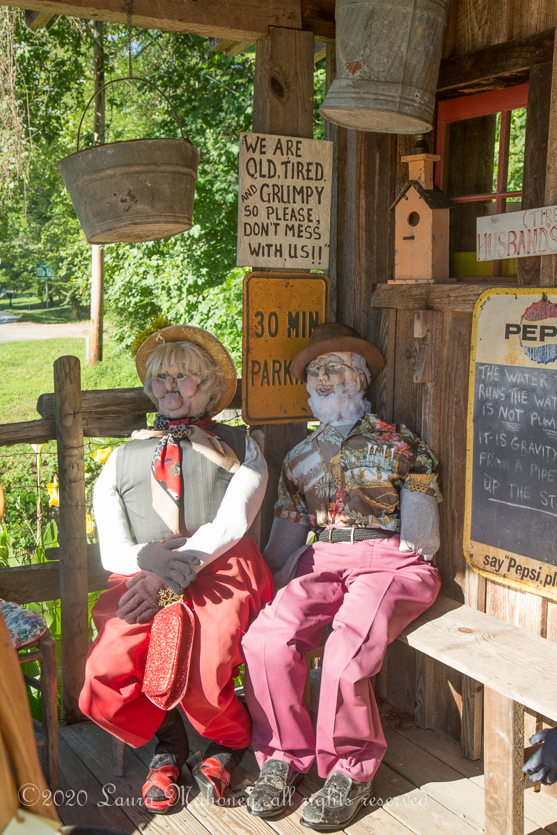
I may put that sign on Waldo!

Freds Famous Peanuts-8725

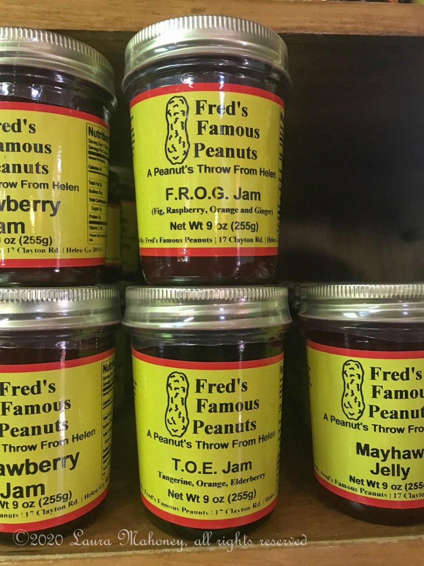
Care for some TOE or FROG Jam?

Freds Famous Peanuts-8724

We did skip the boiled peanut samples, they just aren’t my thing, but the store was a neat stop on the way to the next falls.

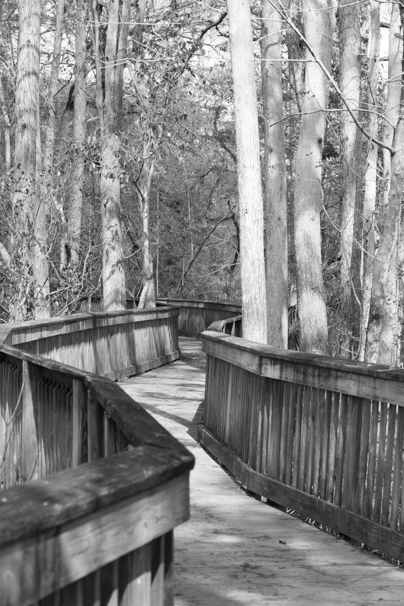
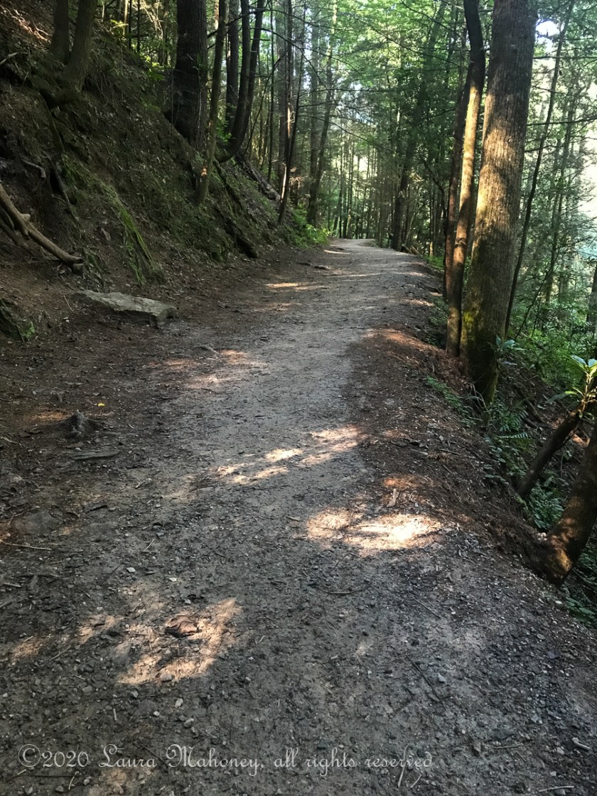
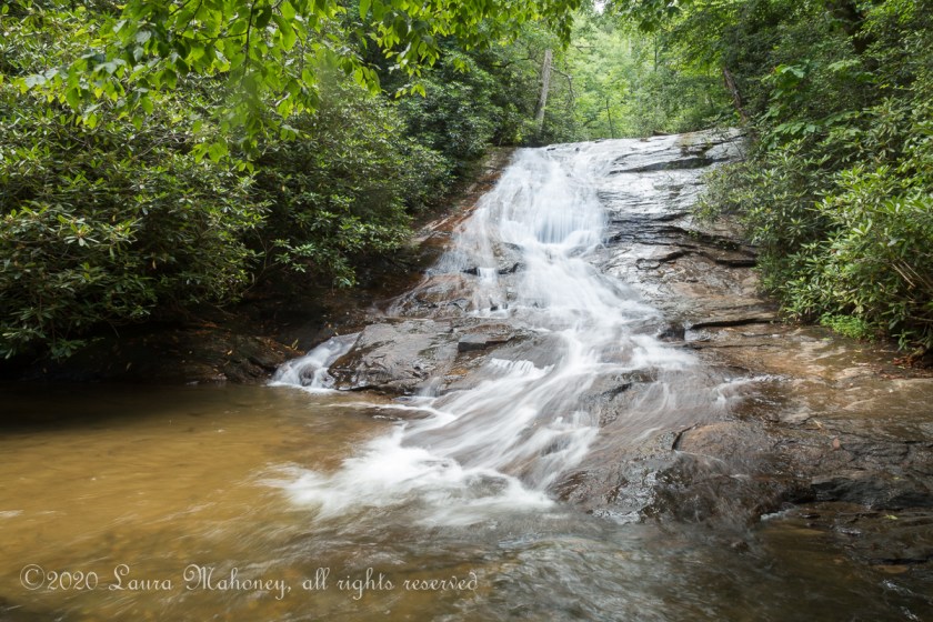
The trail to Dukes Creek Falls starts off with an easy boardwalk and switch backs several times, making it more like a 2 mile walk in the woods (round trip) than a hike…

Dukes Creek Falls-8727

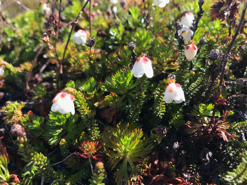
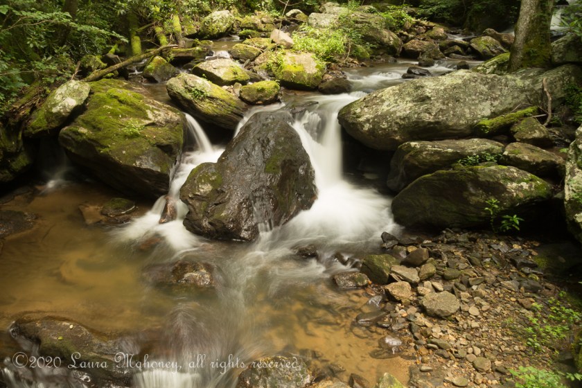
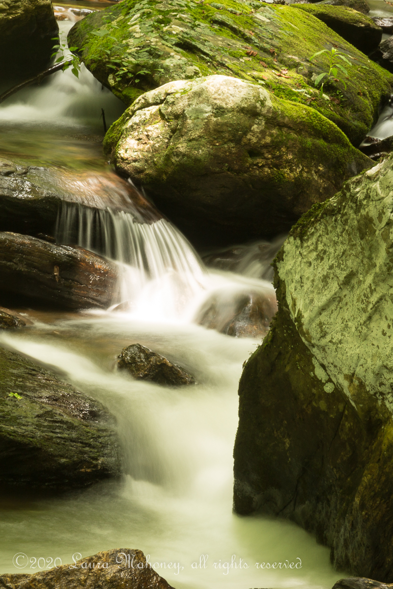
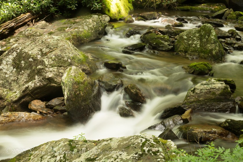
Once we reached the viewing decks, we did come across a few other people, but it was still fairly peaceful. I’m a huge fan of long exposure shots of water…

Dukes Creek Waterfall-3600

Dukes Creek Waterfall-3610

Dukes Creek Waterfall-3609

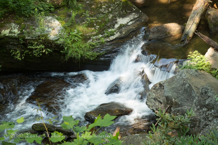
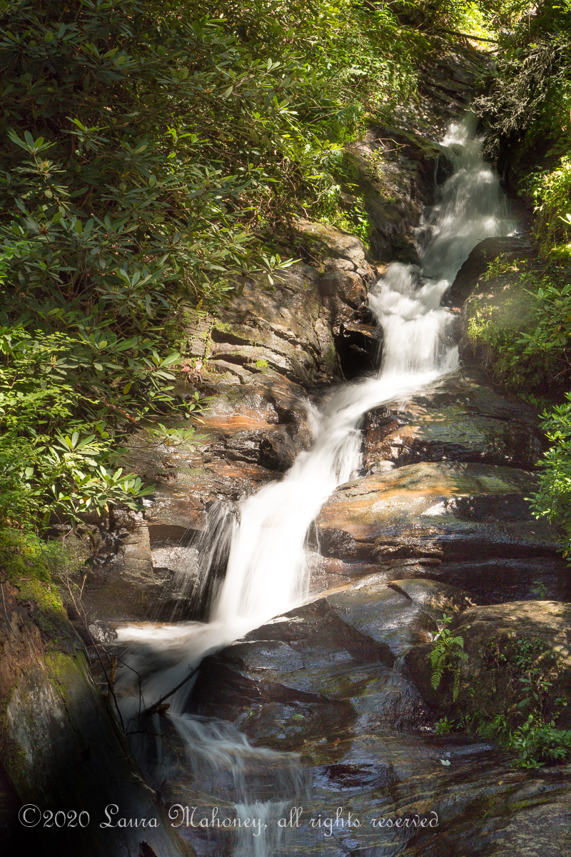
But, sometimes, it can add a bit of weird…

Dukes Creek Waterfall-3593

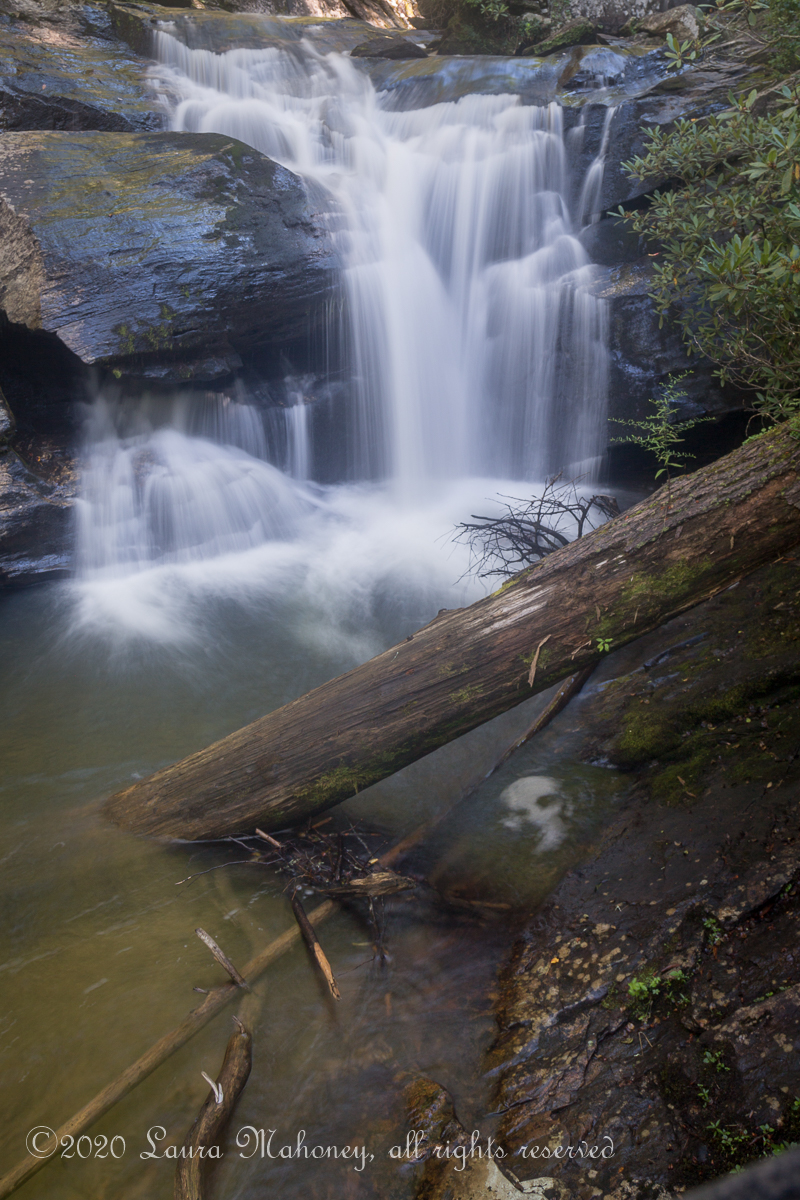
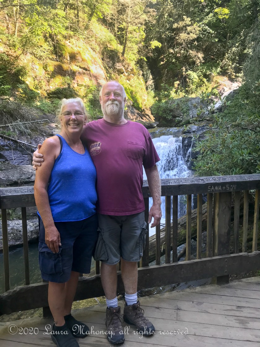
Over the 2 1/2 seconds it took to take this image, the swirling bubbles in the water created a face. I didn’t see it until I downloaded the picture onto the computer. A lady there was kind enough to take a picture with my phone for us…

Dukes Creek Falls-8739

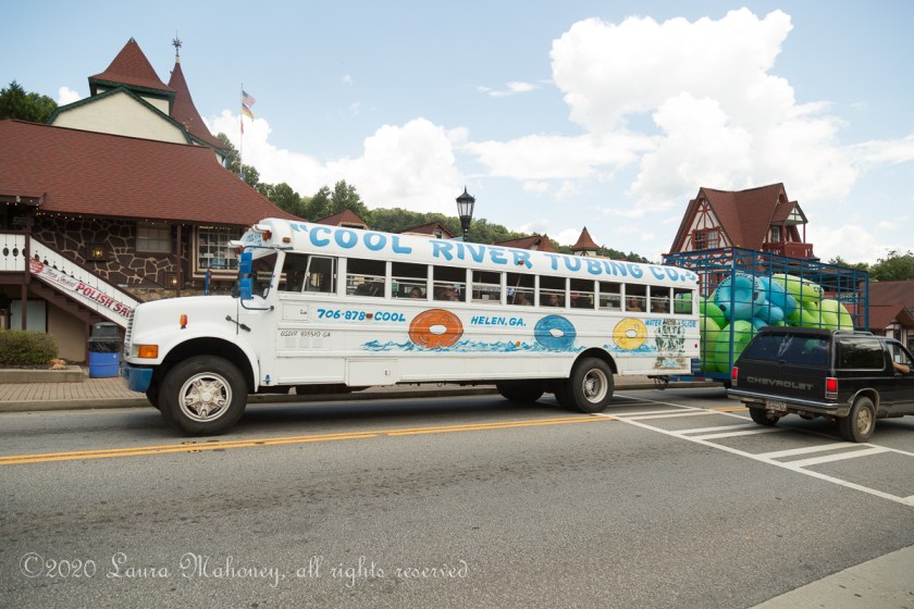
Since it was still early when we got back to the Jeep, we decided to try and get 2 waterfalls in one day. We headed to Horsetrough Falls, only to find the Forest Service road blocked off. On the way back to Waldo, we stopped off in the town of Helen. It seemed like a strange place to have an alpine Bavarian style town…

Helen-8830

Helen-3615

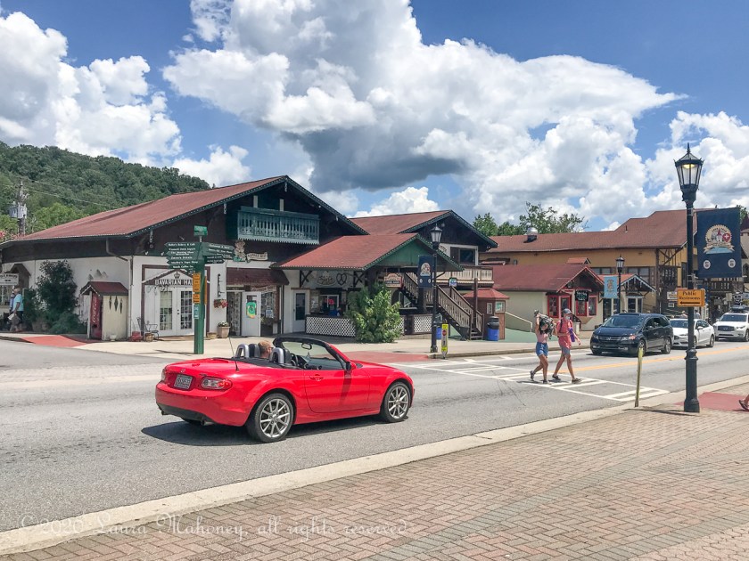
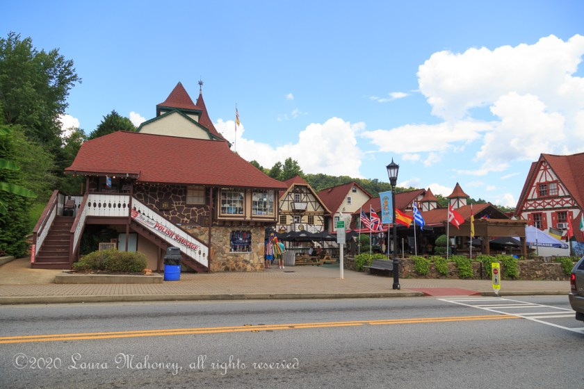
But it was fun to walk around. We found an outdoor bar/grill and enjoyed the rest of the afternoon just relaxing. River tubing is a big draw in Helen and shuttle buses run constantly…

Helen-3614

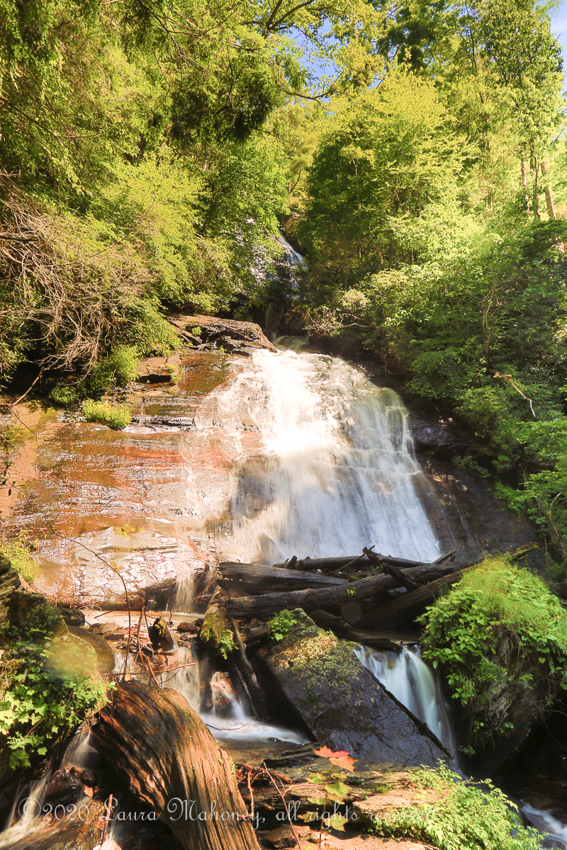
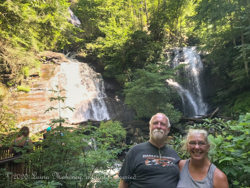
Tuesday we headed back to Anna Ruby Falls. They are only allowing 65 cars in the parking lot at a time to help people keep socially distant, so I can’t imagine how crowed the trail would have been otherwise! The trail is paved the entire way, but, holy hell, it is steep! Thankfully, there are lots of benches along the way and interesting signs to read while you give your legs a rest. Anna Ruby is a double falls and it was difficult to get a good picture of them both with the sun shining on one and not the other…

Anna Ruby Falls-3651

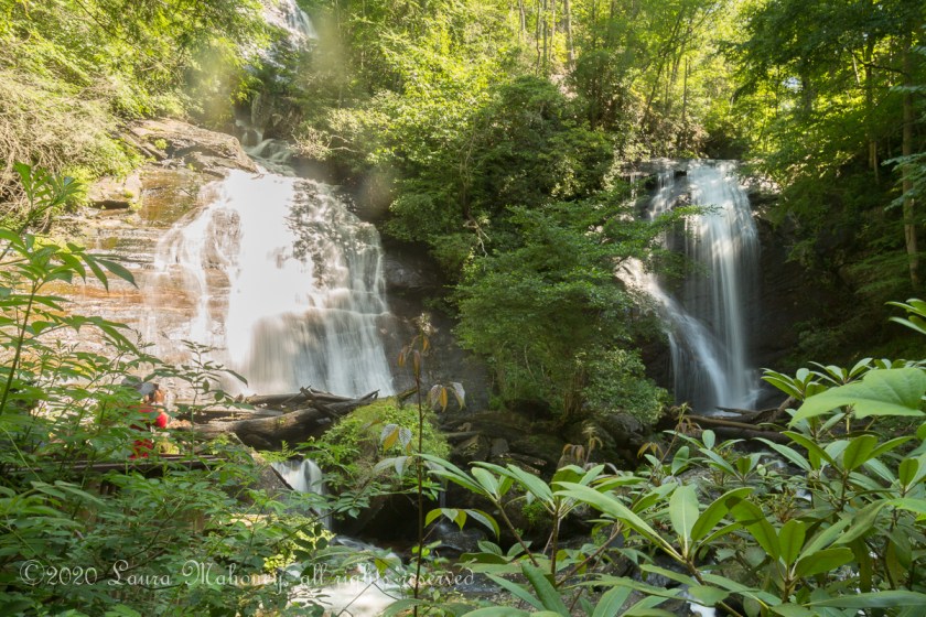
So, I contented myself with individual shots of the falls…

Anna Ruby Falls-3641

Anna Ruby Falls-3636

Anna Ruby Falls-8846

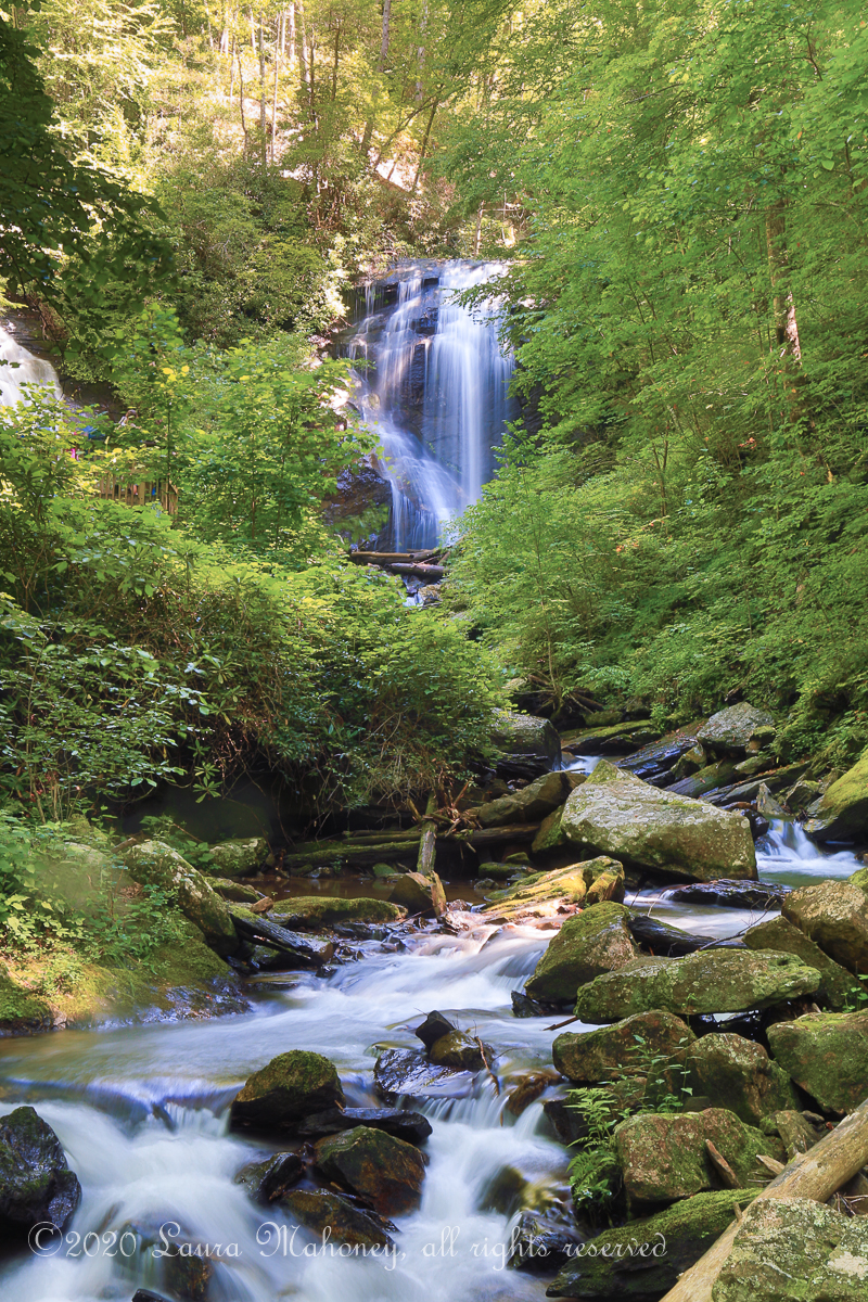
The trail follows the river and I took quite a few pictures of the rushing water. These are some of my favorites…

Anna Ruby Falls-3677

Anna Ruby Falls-3671

Anna Ruby Falls-3660

My favorite hike was to Helton Creek Falls. 3 miles down a narrow dirt road you find the parking area. There are upper and lower falls and it is a pretty easy walk to them. People generally stop quickly at the lower falls, snap a few selfies then head up to the upper falls with its swimming area.

Helton Creek-3684

Helton Creek-8861

Since we didn’t plan on swimming, I liked the lower falls better.

Helton Creek-3692

Helton Creek-3697

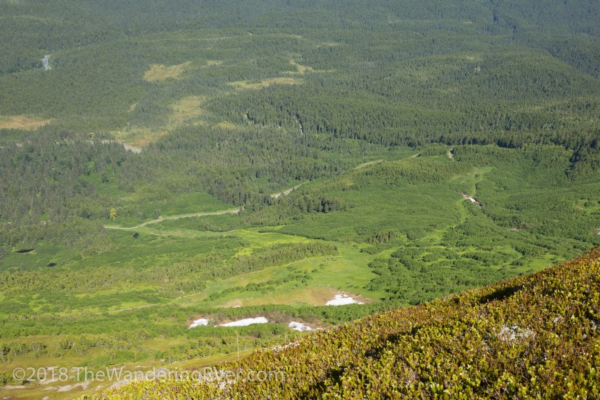
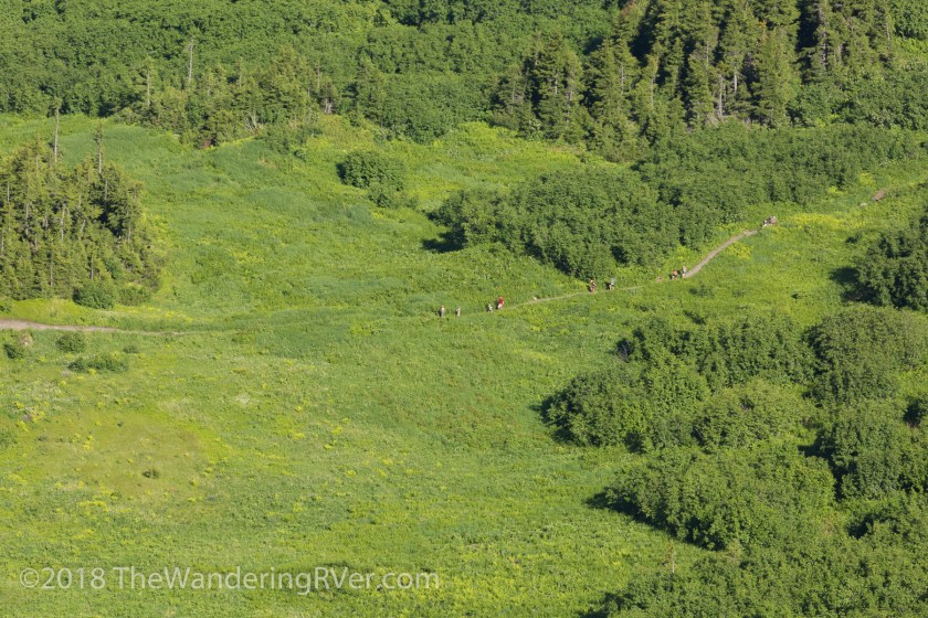
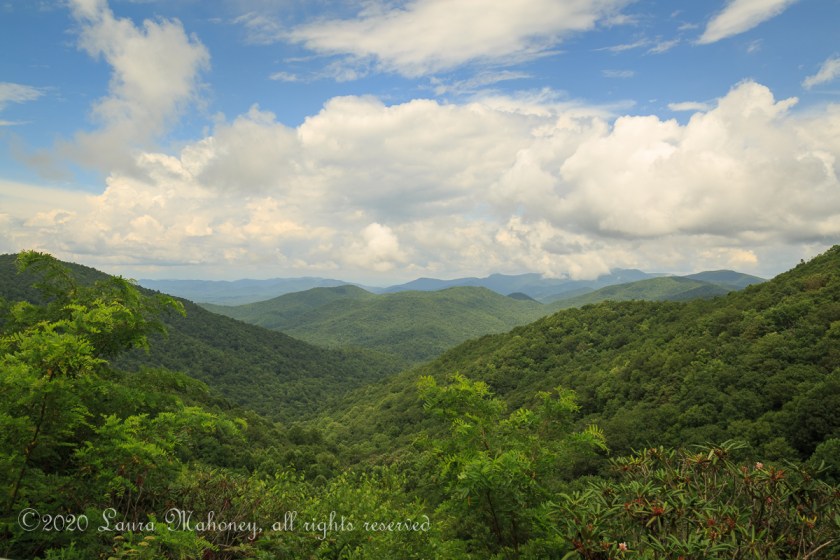
We were running out of days, but definitely not waterfalls. We opted to spend our last day just driving around. The Russell–Brasstown Scenic Byway was twisty, turn-y and steep but definitely worth the drive. There is a scenic overlook at the top and you are treated to a stunning view of Hogpen Gap…

Helton Creek-3712

The list of places I’d like to return to some day keeps growing. I call it “Bucket List 2.0”

Have you ever visited northern Georgia? What was your favorite place?

Up next – New Hampshire bound


Horsing Around on Cumberland Island

Since nobody seemed to be a fan of kayaking with alligators, I thought I’d go with something cuter. Our last adventure in Georgia was one I had been waiting for for a very long time. Cumberland Island National Seashore has been on my list of “must visit” places for years. Every time I drove from New Hampshire to Florida I wanted to fit it in but just never could. Since we were already adventuring in Georgia, I would not be denied! Cumberland Island or Bust!

Cumberland is the largest and southern most of Georgia’s barrier islands. We would only have one day to explore and I was determined to make the most of it. We boarded the 9 am ferry in St. Mary’s and began our relaxing 45 minute journey to the island. Our fellow 148 passengers were quite a diverse group. There were cyclists, campers, hikers, fishermen and even a couple getting married.

After disembarking, we started out on the River Trail…

Cumberland Island-1996

We stopped near the edge of the sound and watched as the Cumberland Queen II headed back to St. Mary’s…

Cumberland Island-2004

The trail ends at the Ice House, this is where we got our first glimpse of the famed wild horses of Cumberland Island…

Cumberland Island-2017

Horses were originally brought to the island in the 1700’s. Now, a herd of feral horses resides on the island. They are left to there own device with no help from the National Park Service. Some of the horses we saw seemed a bit thin, but overall looked to be in decent health. And obviously are healthy enough to mate and produce colts. Steve sat down to watch at one of the picnic tables and I noticed how huge the live oak tree next to him was. I had to back up so far to get most of the tree in, you can hardly see him…

Cumberland Island-2008

You are warned to keep at least 50′ from the horses, after all, they are wild. But what do you do when you are taking a picture of the beautiful lane, lined with spanish moss laden trees…

Cumberland Island-2013

And the horses suddenly decide to cross the road, right where you are standing?

Cumberland Island-2020

You do what I did and hide behind a tree! We continued on towards the ruins of the Dungeness Mansion. Since it was nearly noon, we stopped at a picnic area and had our snacks. As I was reading the signs about the wildlife, another group of horses came by. This foal couldn’t have been more than 6 weeks old…

Cumberland Island-2066

In 1736 James Oglethorpe built a hunting lodge he called Dungeness. In 1796 Phineas Miller and his wife built a 4 story mansion on the site and named it after the lodge. In 1884 Thomas Carnegie, brother of steel magnate Andrew Carnegie, and his wife Lucy bought Dungeness and raised 9 children there. Today all that remains of Dungeness is a sprawling shell …

Cumberland Island-2071Cumberland Island-2074Cumberland Island-2094

There was a time, it looked like this…

Dungeness Mansion

Some of the outbuildings remain, as well as some of the statues…

Cumberland Island-2083

Cumberland Island-2078Cumberland Island-2093

There are several other buildings from that era which are still in use. While we were walking around the mansion, I spied another family group of horses. I thought the colt was beautiful and spent lots of time taking pictures of it…

Cumberland Island-2056Cumberland Island-2061

We were almost done checking out the mansion when an altercation broke out between the horses, I have to tell you, the horses scared me way more than the alligators!!!

Cumberland Island-2100

We continued on to the Dungeness Beach boardwalk…

Cumberland Island-2111

I watched as the fiddler crabs defended their territory in the marsh…

Cumberland Island-2108

At the end of the boardwalk, sand dunes create a barrier to the interior of the island…

Cumberland Island-2110

When we finally reached the beach, it seemed deserted. One of the benefits of limiting the number of visitors to the island each day is you get to see this…

Cumberland Island-2113

Unspoiled, salty air bliss. We walked over a mile and a half on the beach and only saw a handful of other people. We did see a horseshoe crab skeleton…

Cumberland Island-2114

And one of the few people we did see was kind enough to take this picture for me…

cumberland

As we neared Seacamp Beach Campground, I stopped again to marvel at the gnarled live oaks and their spanish moss adornments…

Cumberland Island-2118

Our day was nearly over, the 4:45pm ferry would soon take us back to the mainland. Cumberland Island was everything I had imagined and more. We had walked about 6 1/2 miles and taken countless pictures to go through later.

If you’ve been thinking about visiting Cumberland Island, all I can say is DO IT! Hopefully we will return again another time to see the north end of the island.

My friend Dawn, from Random Bits of Trial and Error wrote a lovely post about her adventures on Cumberland Island, read about it here.

Thank you for coming along.

I’m a couple weeks behind, we are currently at our summer job in Wisconsin. I can’t wait to tell you about it!

What are you more afraid of feral horses or alligators?

Joining the 30% Club

We feel downright privileged to have been inducted into the 30% club! When we first arrived in Alaska, we had no idea such a club existed. The chalets where we worked were usually the final destination for our guests. They had already explored Fairbanks, Denali National Park and Anchorage. The Kenai Peninsula was the end of their adventures. Time after time, we heard stories of visiting Denali NP only to be terribly disappointed they didn’t get to see Mt. Denali. I mean, after all, it IS the tallest mountain on the continent – how can you not see it?!?!?

Mt Denali is 20,310 feet tall, that’s about 3 1/2 miles. Its 2 peaks are over 2 1/2 miles apart. It’s hard to imagine you couldn’t see it! But the fact is, given its location and size, it creates its own weather.

“Denali is so massive that it generates its own weather; much the way a huge boulder submerged in a river creates whitewater rapids. All mountains deflect air masses and influence local conditions, but Denali rises so abruptly and so high that this effect is more dramatic here than perhaps anywhere else on Earth. Storms barrel in from the Gulf of Alaska and the Bering Sea and collide with Denali’s towering mass. Weather can quickly change from sunny and clear to blizzard conditions with fierce winds, intense cold, and heavy snowfall.”

                                                         From The Alaska Range and Denali: Geology and Orogeny

This pattern of weather convergences means it can be sunny and 70˚ in town and Mt Denali could be obscured by fog and clouds. It’s estimated only 30% of visitors actually get to see Mt. Denali. We were in that 30% – FOR 3 DAYS IN A ROW!!!!   Denali means “the high one” in Koyukon, a subset of the Athabaskan language family, sometimes thought to mean “the great one.” Every time we got to see Mt Denali, I was in awe.

The park has an incredible history and many of the stories can be found here.

The First 15 Miles

a map showing the predominately east-west road through denali national park

Private vehicles can only be driven on the first 15 miles of the 92 mile park road. To go beyond Savage River, you must take the park shuttle or hike. We spent our first day driving those 15 miles and seeing all we could see…

Denali NP-9232
The view on the left side of the road
Denali NP-9244
Compared to the view on the right side of the road

It was strange how the left side of the park was in bathed in dappled sun while the right side was shrouded in clouds. There would be no view of Denali today, but, we did get to see some informative signage…

Denali NP-9242

And when we made it to Savage River, we were treated with a surprise…

Denali NP-9238
A rainbow over Savage River

We weren’t worried we didn’t see any wildlife on the first day. Guided by the weather forecast, the next day we planned a trip on the shuttle to the Eielson Visitor’s Center – Park Road Mile 66.

The First 66 Miles

We opted for the transit bus, as opposed to the narrated tour bus. The up side of the transit bus is you can disembark, hike, then grab another bus, while you have to remain on the tour bus. We promptly departed at 7:30am, along with 58 of our newest friends. Our shuttle driver Annie filled us in on what to expect, she said we’d stop for all wildlife sightings and several scenic overlooks, in addition to potty breaks for the 8 hour ride.

Denali NP-9247

Our first view of Mt Denali was over the mist settled in the valley. But, we had seen it! Already a member! As the morning worn on, we stopped for several wildlife encounters…

Denali NP-9262
Meet Mr Caribou
Denali NP-9289
Those 2 black dots at 2 o’clock and 8 o’clock are grizzly bears

It was a bit frustrating for me, jostling for a view out the window, but we made it work.

Denali NP-9295
Those white dots in the center are Dahl Sheep

Are you noticing a pattern? Lots of dots. The colors on the mountains reminded me of Death Valley, except this color came from brightly colored fall foliage instead of minerals…

Denali NP-9299

Denali NP-9302
The park road winds past colorful mountains

A good part of our day was spent taking pictures like this…

Denali NP-9307

At mile 46, we stopped to check out Polychrome Overlook. The myriad of colors were astounding…

Denali NP-9309Denali NP-9321

Denali NP-9318
Lots of buses filled with tourists

We also stopped along the route for the iconic picture of the park road with Mt Denali in the background. Yes, everyone else has taken this picture, but I couldn’t resist…

Denali NP-9374

We did get a closer view of some grizzly bears, but unfortunately, the sun was shining toward us and the bears ended up with a halo…

Denali NP-9360Denali NP-9356

We also saw a couple moose in the distance…

Denali NP-9327

And lots more “dots” on the mountains…

Denali NP-9343Denali NP-9336

I loved watching this group of caribou. With winter around the corner, they are beginning to shed the velvet covering their antlers. It’s  not a good picture, but the antlers were almost orange…

Denali NP-9392

The views, despite being out the window, were breathtaking…

Denali NP-9322

When we arrived at the Eielson Vistor’s Center, Mt Denali provided an amazing backdrop…

Denali NP-9399Denali NP-9403Denali NP-9411

We decided to stay at the vistor’s center and catch a later shuttle. We were treated with a couple minutes of solitude before the next bus arrived. While we were basking in the splendor of Mt Denali, some of the wildlife posed for a closeup…

Denali NP-9427
An Arctic Squirrel
Denali NP-9423
Munching away on an apple peel someone had carelessly or purposely dropped

The park rangers go to great length to educate the public about the dangers of feeding ANY of the animals. Annie had reminded us time and again, it was best to eat on the bus so as not to leave so much as a crumb for the critters. But, you know people, some of them just can’t help themselves.

We walked along the trail and looked back at the visitor center…

Denali NP-9435

And ahead to the 33 more miles to the base of Mt Denali…

Denali NP-9434
Hard to imagine, Mt Denali is still 33 miles away!

One of the interesting things about Denali NP is the fact it is a “trail-less” park, with a few exceptions near the entrance. People are encouraged to find their own path. Go out and walk on the tundra. Feel the springiness of it under you feet. Enjoy it in your own responsible way.

It was time to head back. We had seen everything we had hoped to except the wolves. Pretty darn good day!

Up next…Cruising the Denali Highway and Abandon Igloos

Are you a member of the 30% club? Did you even know there is such a thing? I’d love to hear your thoughts.


No, We Didn’t Win the Lottery

After reading about all of the adventures we’ve had this summer, you must be thinking we hit the lottery. I mean, really, who could afford to do all of those things?

Links go to the blog post I wrote about the adventure.

Two glacier cruises…

Kenai Fjords Glacier Cruise-7651
Our cruise with Kenai Fjords Tours
IMG_4499
Our cruise with Major Marine

Two Helicopter tours…

Marathon Helicopter-8414
Marathon Helicopter tour
Seward Helo Dog Sled-8646
Seward Helicopter Tours

Dog sledding…

Seward Helo Dog Sled-8662
Turning Heads Kennel

Rafting…

img_5833
Rafting with Alaska River Adventures

Took the tram…

Alyeska Tram-8545
Riding the Tram

Visited the wildlife center

AWCC-7384
Alaska Wildlife Conservation Center

And did sight seeing on our own…

Whittier Glacier Cruise-8041

img_5653

Kenai NWR-8737

Kenai-8495

Hopw-8247

Hopw-8215

Drive From Anchorage-7268

Homer-9071
11 1/2 week old eagle in Homer

6J2A1219


One thing I haven’t written much about is the fact we are working. For May, June and most of July, we worked full time, 40 hours a week. We are the “On Site Hosts” at the Spruce Moose Chalets in Moose Pass. What does an on site host do, you ask? Well, lots of things. But one of the major things we do is be an ambassador for the area. Chalet guests come from all over the world and want to have the best experiences possible. But how can we recommend an excursion if we haven’t tried it ourselves? Would you recommend a restaurant you’ve never eaten at? No! So what I did was contact all of these businesses and explained to them we would be here for the summer and wanted to be able to tell our guests about our adventures. I asked if they would be willing to give us a discount in exchange for our testimony. Simple as that! Nearly every place I contacted offered us a deal and discounts varied from place to place.  We never would have been able to afford to do all these things if I hadn’t been able to leverage our position as the on site host.

I still have one more post to write (maybe two) about our time but I am pretty much caught up. Finally!

Our job contract here is almost up. We will be leaving Moose Pass on Sept. 4th, but our adventures are far from over! We are heading up to Denali for a week (where we have an interview for a job next summer), then we will be heading down to Haines for 4 days. I have mapped out a pretty ambitious trip back to Florida, 4 National Parks and lots of cool sights along the way. I hope you continue to follow our adventures!

We’d love to hear your comments!

The Alyeska Tram

We had the morning off, but had to be back at the chalets to meet incoming guests by 4 pm and we needed to stay within cell coverage in case the guests needed any directions. So – what to do? Where to go?

We decided to drive over to Girdwood and take the tram ride at the Alyeska Ski Resort. Since it was a beautiful, sunny day, we figured the scenery would be worth the hour drive. And boy was it ever!

Once we found a parking spot and bought our tickets, we got in line for the next tram. They run every 15 minutes, so we didn’t have to wait too long. When we got to the top, the first thing I saw was an interesting sign…

Alyeska Tram-8519

Hmmm – okay. Note to self, don’t play with unexploded artillery shells. There were so many trails to chose from…

img_5776

The tram operator said his favorite trail was the Mountain Top Trail. He said it was a bit steep, but the view would be worth it. Before we started up the trail, we walked around the tram building and took in the sights…

Alyeska Tram-8525
Steve lining up his shot
IMG_4730
Wow!

There was still some snow at the beginning of the trail and Steve was wishing he hadn’t worn sandals, but I was ready to start our climb…

Alyeska Tram-8530

The trail was constantly switch-backing, so the climb wasn’t too steep. We stopped several times along the way to gawk at the view…

Alyeska Tram-8533

Alyeska Tram-8545

Alyeska Tram-8531

Are you noticing a trend here? Every time I turned around, Steve was sitting down taking pictures. But you can’t argue with the results!

IMG_4718

Alyeska Tram-8521

When we got almost to the top, we stopped for “our selfie to prove we were there”…

img_5679

Then, Steve took a seat (again) while I took a closer look and the flowers covering the mountain side…

Alyeska Tram-8548

img_5682

Far below us, others were hiking through the fields and forests…

Alyeska Tram-8541

Can you spot the hikers? Wait, let me zoom in a bit…

Alyeska Tram-8540

After our climb, we stopped for a quick beer at the Bore Tide Deli & Bar before we took the tram back to the base.

The guests had texted me they were leaving Anchorage, so I knew we’d better head back to the chalets. In the end, we pulled in almost right behind them. Talk about timing!

The Alyeska Tram is a great way to spend the day and you just can’t beat the views!


It’s OK – It’s a Dry Heat – Part 1

It was kinda of sad leaving Sunny Valley. We had such a great time with Mike and Dawn (read Dawn’s take on our meeting here), it was hard to say “until we meet again”.

We spent the night in Kingman, AZ so we could have dinner with family…

img_5058

Our plan was to spend the next week exploring Death Valley. Death Valley is the 5th largest National Park in the United States and the largest in the lower 48. It covers 5262 square miles (roughly 3.4 million acres). It is 140 miles long and about 75 miles across at its widest.

img_5405

We decided Beatty RV Park in Nevada would be the perfect jumping off point for our explorations.  On our way to Beatty, we passed the Hoover Dam…

img_5154

And drove through Las Vegas. It was noon when we pulled into the park. We got set up in our site and headed into town, actually, to be completely honest, we were looking for a liquor store. The camp host told us we could probably buy liquor at the casino. My first thought was, yeah, what would THAT cost. After we drove around town a bit, we headed to the Stagecoach Hotel and Casino. Just for fun, we put $6.00 (big spenders, right?) into the one-armed-bandit and hit on the 3rd pull. Woohoo. Let’s cash out of this machine! And so it went. A few bucks here, a few bucks there and at the end of the afternoon, we were up enough to cover the cost of the bottle, which wasn’t as expensive as I imagined. When we got back to Waldo, there were wild burros across the street, which I thought was really neat…

Death Valley-6454
I can just hear the burro, “What, haven’t you ever seen an ass before?”

The next day, we headed into Death Valley…

Death Valley-6352

Once we passed through Hell’s Gate, the temperature started to climb. It was 58 degrees in Beatty and 75 degrees on the valley floor. The wind had been kicking up for days and it was really noticeable in the valley. I knew it would be hard to get great pictures of the overall landscape because of the haze…

Death Valley-6271
Mesquite Flat Sand Dunes

So, I tried to focus on the smaller scenes…

Death Valley-6266

Our next stop was Mosaic Canyon, a 4 mile round trip through narrow slot canyons and polished rock walls…

Death Valley-6277
Looking back toward the parking area
Death Valley-6280
The canyon walls, smoothed by rushing waters
Death Valley-6287
Steve getting a picture of the landscape

From there, we walked the Salt Creek Interpretative Trail.

Death Valley-6295

Since it was only April, there was still plenty of water flowing. The water is 4x saltier than the ocean. In spite of that, it is home to the Salt Creek pupfish…

Death Valley-6297
Not a great picture, but you can see several pupfish

April is the beginning of mating season and the males were a beautiful shade of blue. As we were walking along, I could have sworn I saw a gorilla face in the mountains…

Death Valley-6301
Do you see a gorilla or was I imagining it?

I was in sensory overload, it’s hard to take in all the naked beauty at once.

It was several days before we got back to exploring. Before you get into Death Valley, there are 2 must see places. The first is the Goldwater Open Air Museum. It seems a strange place for an art museum, in the middle of nowhere, but it is definitely worth the stop…

Death Valley-6307
Fred Bervoets’s  Ode to Shorty
Death Valley-6308
Charles Albert Szukalski‘s Ghost Rider
Death Valley-6312
Charles Albert Szukalski‘s The Last Supper
Death Valley-6315
A very large metal origami crane
Death Valley-6316
Dr. Hugo Heyrman‘s Lady Desert The Venus of Nevada
Death Valley-6317
Onny Huisink’s The Beauty of Decay
Death Valley-6318
Sofie Siegmann‘s Sit Here

Just passed the museum we discovered several abandon homes and vehicles…

Death Valley-6323

Death Valley-6324

Death Valley-6322

This was a prelude to the ghost town of Rhyolite. The town boomed into existence in 1904 and had burnt itself out by 1916. Remains of several of the buildings give us an idea what town was like in its heyday…

Death Valley-6340

Death Valley-6347

Death Valley-6348

Death Valley-6336

I thought one of the neatest buildings was Tom Kelly’s bottle house

Death Valley-6331

Despite the fact electricity to the town had been shut off in 1916, the last tenets of the house lived there until 1969. Tommy Thompson and his family added miniature houses to the property…

Death Valley-6332

Death Valley-6335

From Rhyolite, we headed back into Death Valley. We drove along Mustard Canyon Road…

Death Valley-6364

Death Valley-6366

Then visited Harmony Borax Works

Death Valley-6368

Death Valley-6369
The iconic 20 Mule Team wagon used to transport the borax

Death Valley-6358

Even in this harsh environment, flowers still find a place to bloom…

Death Valley-6360

Our final hike of the day was to the natural bridge…

Death Valley-6392

I’m going to wrap up Part 1. There is still so much to tell you about! So here is my closing shot until I get to Part 2…

Death Valley-6451

Have you visited Death Valley?

Palo Duro Canyon State Park

After New Orleans, we were ready for a little quiet time. We thought stopping at Wind Point Park for a few days would provide us with that. Boy were we wrong! 4 non-stop days of catching up with friends. 3 non-stop nights of bonfires and brews. It was awesome to visit the place we worked for 5 1/2 months and to see the people we’d become friends with, but damn, was I tired when we left! Our next stop was guaranteed to give us the down time we needed.

Palo Duro Canyon State Park

Driving along the north Texas plain, the scenery can be a bit – well – boring. Sorry Texas! But miles and miles (and miles) of this…

img_4899

can give you the feeling the scenery will never change. I was sitting in my customary position, foot rest up-seat tilted back just so, just comfortable enough to doze occasionally. I was jolted awake from my snooze when Steve hit the brakes on Waldo a little harder than normal. I was STUNNED. The scenery had gone from miles of flat nothing to a mesmerizing view of the canyon…

img_4912

I had taken advantage of our Texas State Park pass when I made our reservation. All we had to do was check in at the ranger station and get our site number. Sites are assigned on a first come first served basis. In 2019, you will be able to reserve a specific site but for now it is pot luck. I think we did OK!

img_4923

Looking back, I wrote in my journal, “It is not a hard thing to wake up to.” Peace and quiet! Only a few friendly neighbors. Our first full day in the canyon had us scouting out possible hikes, nothing too strenuous, but trying to take in everything we could. I got a bit frustrated because they give you 2 maps. One of the campgrounds and one of the hiking trails. It’s really hard to match the maps up and the signage wasn’t as good as it could be. We drove through the park first, getting the lay of the land, so to speak. It was hard to get anywhere, because I kept saying “Stop, I want to take a picture.” With sights like this, how could I not?

Palo Dura Canyon-6068
The setting moon

Palo Dura Canyon-6089

Palo Dura Canyon-6084

Our first hike was to “The Big Cave”. We parked on the side of the road and started up the trail…

Palo Dura Canyon-6082

Palo Dura Canyon-6072


I climbed to the mouth of the cave first and looked back to make sure Steve was coming…

Palo Dura Canyon-6074
Steve trying to decide the best route
Palo Dura Canyon-6081
Looking back towards the Jeep. Can you see it?
Palo Dura Canyon-6076
I couldn’t get far enough back into the cave to get the entire opening

From a distance, the rock looks smooth. When you get close up, it looks like this…

Palo Dura Canyon-6079

From here, we walked along the Juniper Riverside trail…

Palo Dura Canyon-6087

Palo Dura Canyon-6086

While the scenery was spectacular, I was getting tired so returned to the Jeep. I’ve been fighting a sore throat and a sinus infection, so this was enough walking for one day.

Once back at Waldo, we set our chairs in the shade and relaxed! As we were sitting there chatting, I spied something out of the corner of my eye. I wasn’t sure what it was and I nudged Steve to look in that direction. A few moments later, a little head popped out of the ground, looked around then dropped back into the hole. I sat with the camera trained on the hole, waiting for the critter to reemerge. He did, but from another hole. It took me a while, but here is our visitor…

Palo Dura Canyon-6106

It is called a pocket gopher. Come to find out, there must have been dozens them. As we sat there quietly, they popped up and down like the game of whack-a-mole. Right after Steve put my camera away, we had another visitor, so this is a cellphone pic…

img_4925

Roadrunners crack me up. I love watching them. The next morning, I looked out the window towards the tent across the way. If the folks sleeping inside had been awake, they could have reached out and petted the mule deer who was grazing at their front door. I was loving all the wildlife. This what exactly the relaxation we had been needing.

We spent most of the day driving through the park. We stopped at the visitor center and learned a lot about the fascinating history of the park. I had heard of the Civilian Conservation Corps, but never realized what an impact they had on our park system. They spent 5 years working on Palo Duro Canyon State Park. Many of the building are still in use today. Below is a picture of what is left of the mess hall. 85 years later, this chimney is still standing…

Palo Dura Canyon-6097

As we were driving along, I had Steve pull over and give me the binoculars.

Palo Dura Canyon-6094-Edit

Yes, the arrow is pointing to a person! I’ll bet the view was amazing, but, not my kind of hike!

Our final morning found us wishing for more time to explore. More time to just relax and spend quality time together, but we still have a long way to go. (4,698 mile to be exact) We had one last visitor before we left…

img_4933
Another cellphone pic, but you get the idea

The road in and out of the canyon is steep and full of switchbacks. We decided not to hook up the jeep and force Waldo to tow it out. So, with me driving the Trouble, I followed Steve out of the canyon. Just to give you an idea, here is a short video I shot out the window as I was following…

Steve almost gave me a heart attack when the rear wheel slipped into the culvert! Once we were at the top, we hooked up and headed towards Amarillo. Not surprisingly, I had him pull over once again for a picture. What gave me pause was thinking about how much is the same and how much has changed. Two windmills, both harnessing power, the old and the new…

Palo Dura Canyon-6108

Up next…a really cool RV museum in Amarillo.

I know I am really behind in keeping up with our travels. We were at Palo Duro Canyon April 4-6th. We’ve seen so much since then! Right now we are in Winnemucca, Nevada, but I don’t want to get too ahead of the story! If you want more up-to-date information on our adventures, Like TheWanderingRVer on Facebook

Exploring Big Cypress National Preserve, part 2

If you missed part 1, you can find it here. Big Cypress encompasses several different environments, and they each require a specific mode of transportation. Many places are accessible with your own vehicle, despite any warning signs you might see…

Big Cypress-4454

Many of the roads are hard packed sand and are easy to navigate…

Big Cypress-4622

They offer a stunning array of scenery and wildlife opportunities…

Big Cypress-4466

Big Cypress-4434

Big Cypress-4518

Big Cypress-4663

Other areas can only be reached via hiking trails. We started out on the Gator Hook Trail. At the start, it looked something like this…

Big Cypress-4457

With scenery like this…

Big Cypress-4466

Then it became a bit muddier…

Big Cypress-4463

As you can see, Steve is having second thoughts about this hike. And with good reason, the rest of the trail looked like this…

Big Cypress-4469

We hadn’t really planned for a wet hike, so we decided to head back and check out some of the other trails. One of the neat things about Big Cypress is they have several boardwalk hikes. Most are less than a mile and are wheelchair accessible. You can see almost all of the same scenery, but with dry feet.

Big Cypress -5232
What do you think of this in black and white?

The boardwalk at the Kirby Storter Roadside Park has a chickee near the beginning of the trail…

Big Cypress -5193

As the boardwalk meanders through the forest/swamp, you can’t help but notice the changes in the landscape. Cypress knees begin cluttering the forest floor…

Big Cypress -5247

Most of the cypress trees were logged out during the late 1800’s. But every now and then, you can find one that has been around a while. I have no idea how old this tree is, but the plastic water bottle near the base of it gives something for scale. (There was actually very little litter in the preserve)

Big Cypress -5198

The boardwalk ends at a large viewing platform with several benches…

Big Cypress -5204

While Steve was talking with another visitor, I watched the anhinga looking for its lunch…

Big Cypress -5222

Another day, Steve and I hiked out to Deep Lake. Since we were there during the dry season, the path was pretty easy to walk. There were a few places where getting wet was the only option. At least we were prepared this time…

Big Cypress-5849

Deep Lake is a naturally occurring sinkhole lake and is over 90 feet deep.

Big Cypress-5844
How many alligators do you see? Hint, there are more than 5

One of the benefits of hiking versus driving, is you can just stop and check things out. You will see things you would have otherwise missed. Like the neat pattern the fungus made on this tree…

Big Cypress-4656

Or the blooms of the bromeliads…

Big Cypress-4659

Or the lizards,

Big Cypress-4652

A strangle fig with its victim,

Key West iPhone-2-33

A squirrel hiding in a tree,

Big Cypress -5332

Or a liguus tree snail…

Big Cypress-5627

For me, kayaking is probably the next “slowest” way to take in the sights.

Big Cypress-5806

I imagine during the wet season, all of this is underwater.

Big Cypress-5821

Other ways to get into the “back country” are airboats…

Big Cypress -5350

And my personal favorite – swamp buggies…

Big Cypress-5838

There are lots of places you can take airboat or swamp buggy eco tours, but we opted not to on this trip. Maybe next time!

Until then…

Key West iPhone-2-2


We say “Thanks for coming along!” and we always love reading your comments!