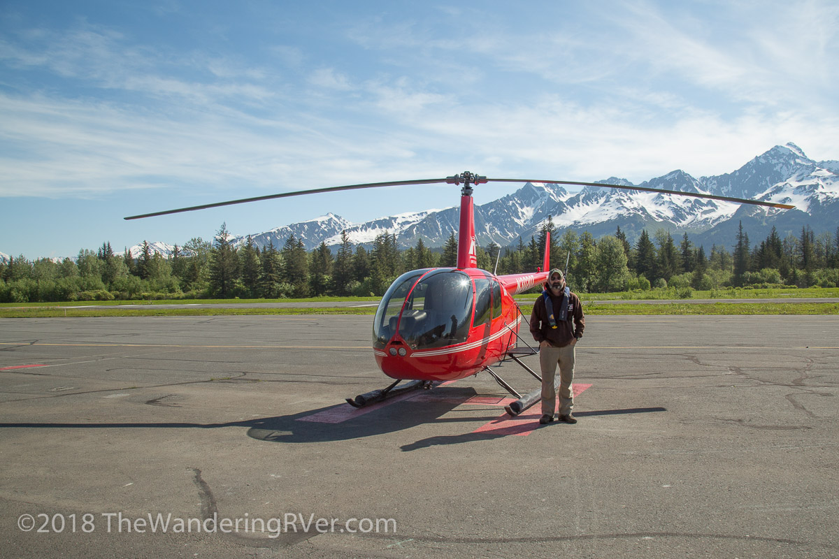
Our adventurous side was calling and Marathon Helicopter Tours answered! We’d seen Resurrection Bay up close on our glacier cruise, but seeing it from the air was an entirely different experience.We checked into their office at the airport, received our safety briefing and were soon ready to take to the air. Our pilot, Mike, has been flying helicopters since 2006 and moved to Seward in 2012. He clearly loves what he does! As we lifted off, he pointed out various Seward landmarks, giving a running commentary on the landscape…
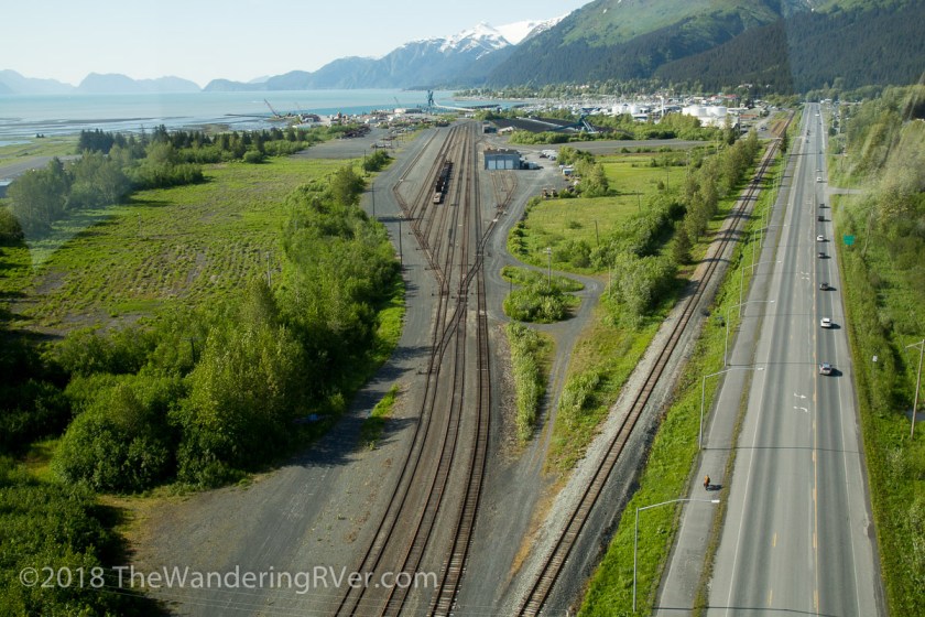
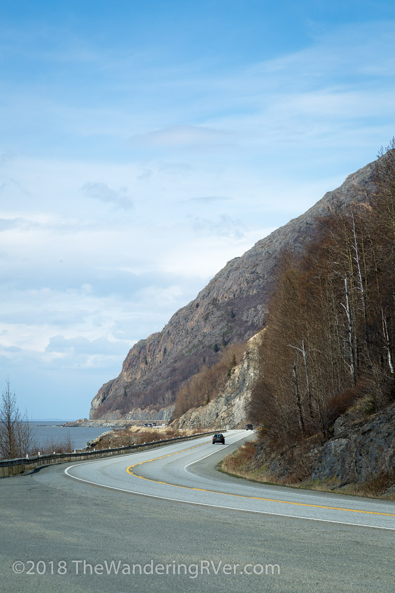
We hugged the shoreline as he told us how the 1964 earthquake forever changed the face of Seward (and all of southern Alaska).
We flew over some kayakers enjoying the first sunny day we’d had in a while…
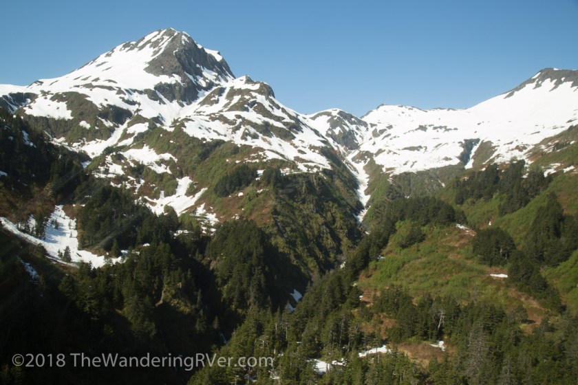
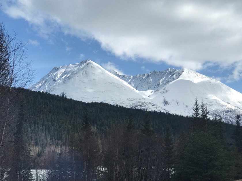
Soon, we made our way up into the mountains, with stunning views of Resurrection Bay for contrast…
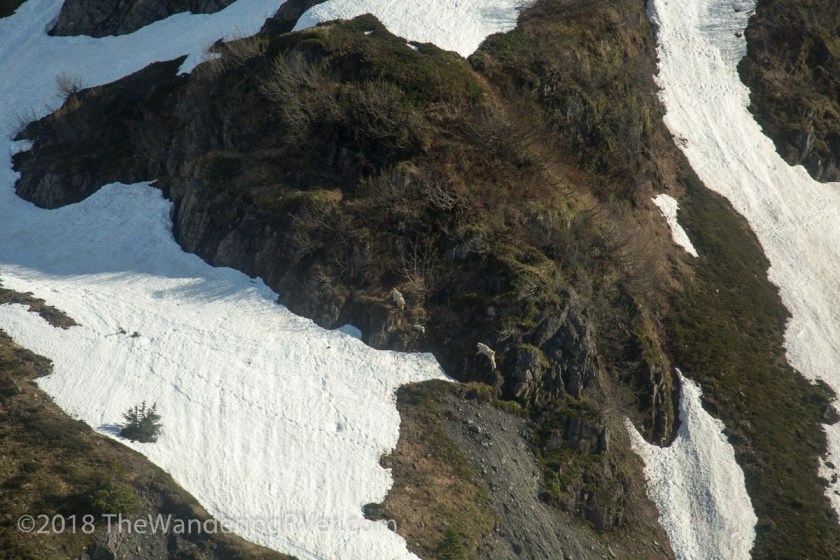
We saw mountain goats, deftly crossing the rocky outcroppings…
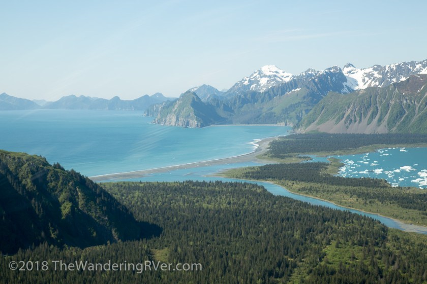
As the mountains gave way, we got our first look at Bear Glacier and its bay…
With a practiced ease, Mike swung his flying machine towards the glacier, giving us a close-up view of its beauty…
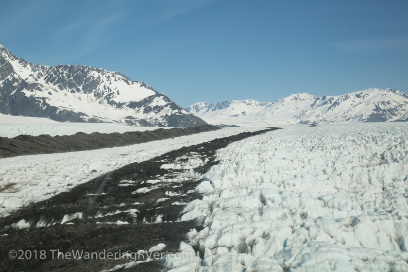
Mike explained the ridge of dirt on the glacier is a medial moraine. A moraine is the accumulation of dirt and debris on an icefield. When it is on the edge of the glacier, it’s called a lateral moraine and when 2 glaciers combine, their edges become the middle and a medial moraine is formed…
As we flew near the edge of the glacier, we could see the lateral moraine forming…
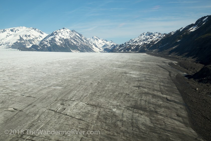
The landscape seemed other-worldly, as if Mike had transported us to another planet…
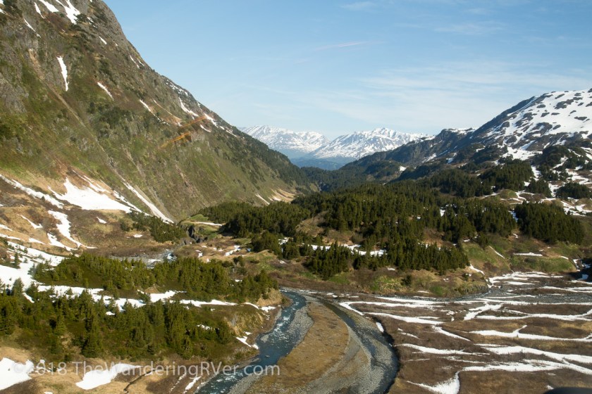
As we crossed into the airspace over Kenai Fjord National Park, we were treated with the sights of glacial lakes and rivers…
Mike’s in depth knowledge and humorous commentary is only surpassed by his ability to spot wildlife far below of the forest floor…
We knew our adventure was nearly over as we flew along the Resurrection River with its many creeks and streams…
It was an amazing adventure! Mike, in one word – AWESOME! The scenery so breathtaking, I’m still winded. If you’re ever in Seward, stop by Marathon Helicopter Tours and they will take you on an Alaska adventure you’ll never forget!
Have you ever been on a helicopter tour? Was your adventure as fun as ours? I’d love to hear about it!
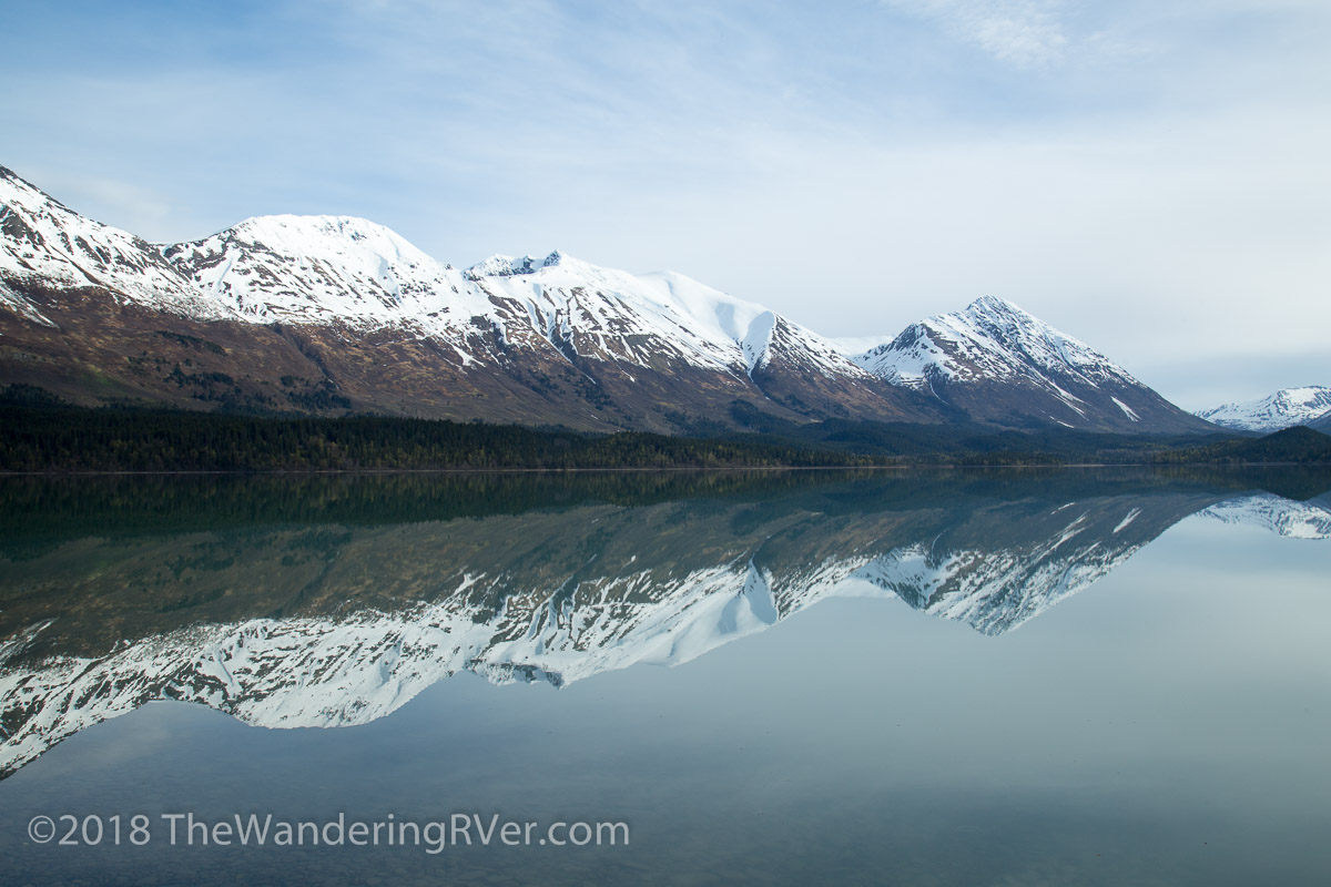
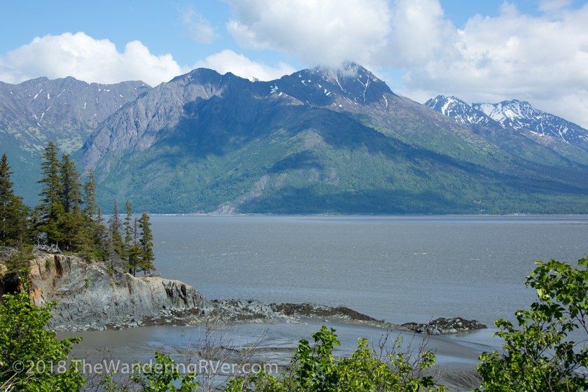
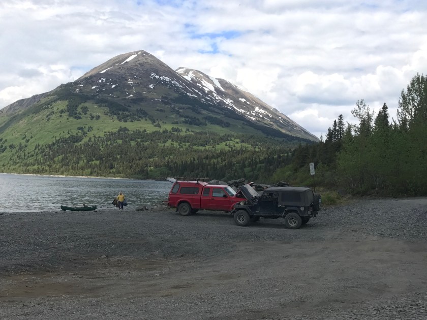
In an effort to get caught up, this post is going to be about several day trips we’ve taken around the Kenai Peninsula. We are always on the lookout for wildlife, particularly bears. Black and brown bears (grizzlies) live on the peninsula and we spend a lot of time exploring the area looking for them. We’d been told the Kenai National Wildlife Refuge was famous for bear sightings. We set off early one morning to drive Skilak Lake Road, an 18 mile dirt road in the refuge. We had barely gotten a half mile from Waldo when I had to stop and admire the reflection on Upper Trail Lake…
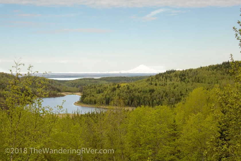
When we finally arrived at Skilak Lake Road, I realized something – it was Memorial Day weekend. There were people everywhere, the campgrounds were packed and the bears were in hiding! But, the scenery was lovely…
Mt Redoubt, in the background, is a volcano – it last erupted in 2009
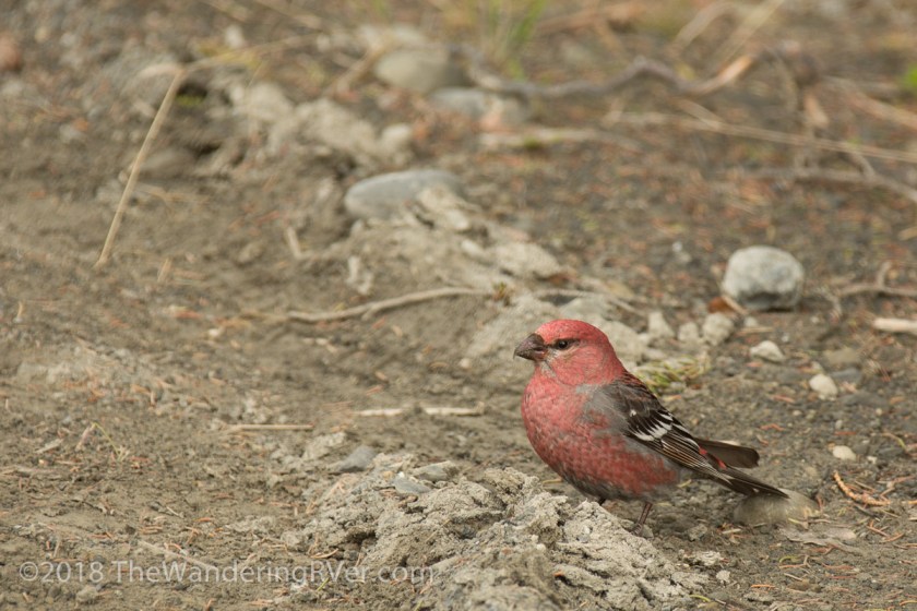
We did finally get to see some wildlife…
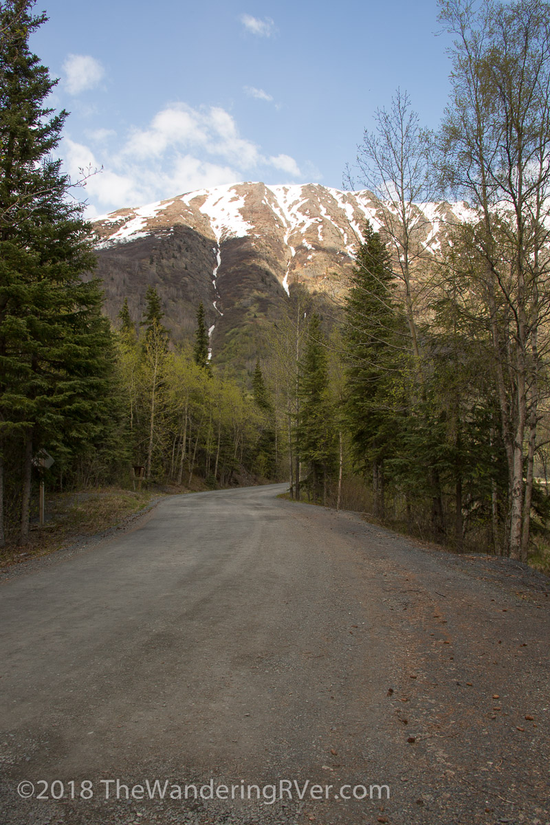
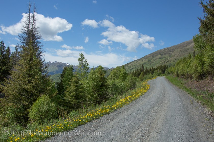
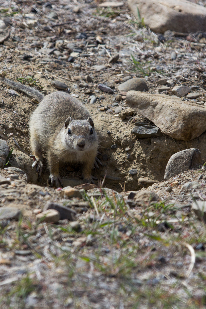
Oh ya, and we did see a squirrel, but i didn’t get any pictures of it. Another day, the town of Hope was our destination. The Alaskan gold rush began in Hope and there are lots of places to explore. After we turned off the Seward Highway, we were treated to some stunning vistas overlooking Turnagain Arm…
Usually, we make sure we have a full tank of gas before we head off to do any exploring but we had both verified there was a gas station in Hope, so we didn’t top off the Jeep. What we didn’t know was the price of gas in Hope was $4.50 a gallon! Holy crap! Over a dollar more than in Seward. AND – cash only! That’ll teach us! After we emptied our wallets, we drove along Palmer Creek Road…
The breathe taking views eventually led us to a hiking trail. There were quite a few cars parked at the trail head, but we grabbed the bear spray and our cameras and started down the trail…
It didn’t take too long to realize the snow covering the trail was too deep for us to enjoy the walk. As we were debating turning around, I caught movement in the brush…
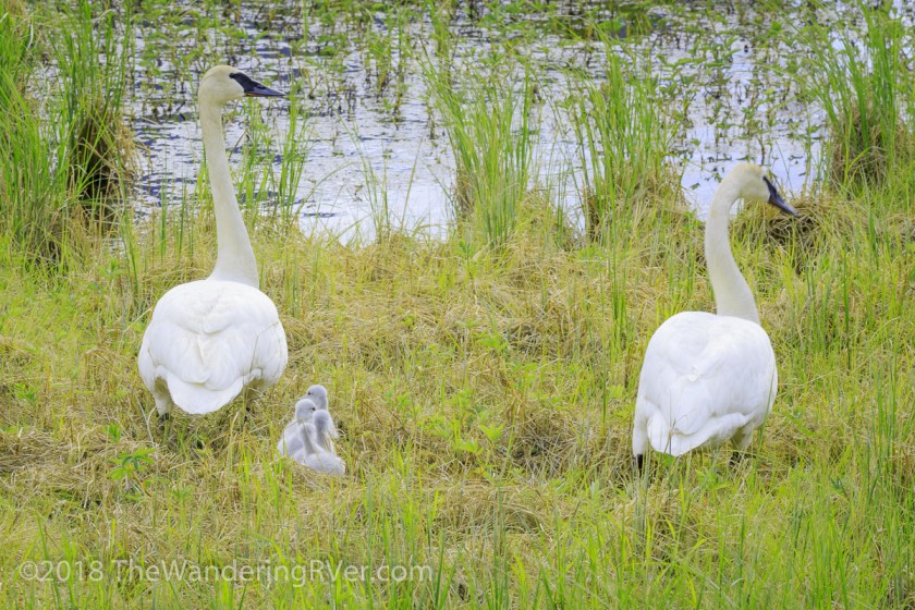
This willow ptarmigan was foraging in the underbrush, making way more noise than you would have thought for something that small. We watched until it disappeared and headed back to the Jeep. Since it was getting late in the day, we decided to head back home. As we passed Tern Lake, I saw a pair of tundra swans. But, Steve saw what I had missed! The babies…
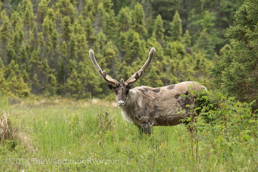
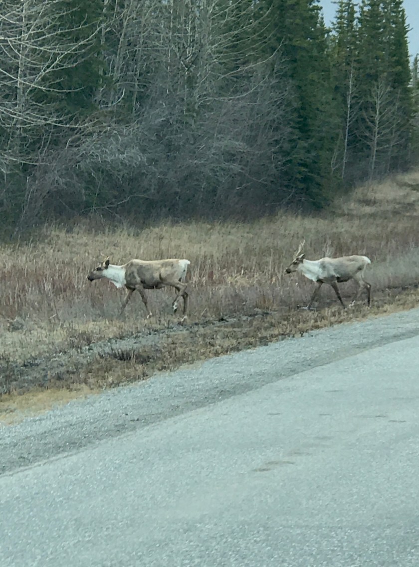
It didn’t take long for a crowd of onlookers to appear. It seems when one person stops along the road with a camera in hand, everyone stops. Apparently, I’m guilty of the same thing. We were driving along Kalifornsky Beach Road, just south of Kenai, when I saw a guy on the side of the road with his camera. Steve and I turned around to investigate – was it a bear? Nope, but almost as cool. It was a caribou, munching away on the tender new shoots…
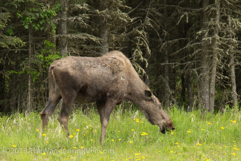
We hadn’t driven 3 miles further down the road when we saw Ms. Moose doing her part to control the dandelions…
After turning off of Kalifornsky Beach Road, we headed north to Captain Cook State Recreation Area. The weather wasn’t the best, so we didn’t have a very good view across Cook Inlet, but we did see some more wildlife…
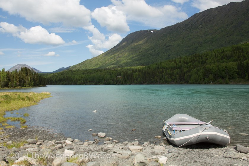
We finally got a few sunny days and we headed to Cooper Landing. We stopped at the boat launch and watched as the rafters and fishermen began their journey to the Upper Kenai River…
Steve decided to drive down Snug Harbor Road which follows the back side of Kenai Lake. I was enjoying the scenery when Steve abruptly did a u-turn. Why? Was it a bear? Nope (again) it was a beautiful waterfall that couldn’t be seen from the passenger side of the Jeep…
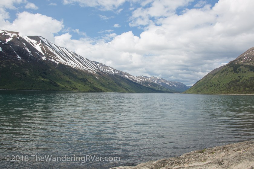
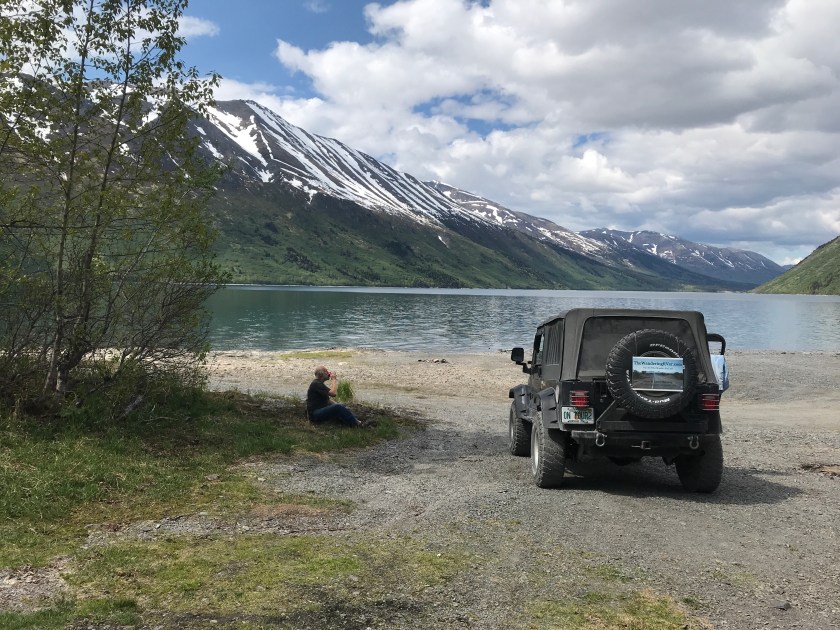
We finally made it to the end of the 18 mile road and found Snug Harbor…
While we were sitting there, a couple in a canoe returned to shore, only to find out their battery was dead…
We tried to jump start them, but to no avail. We ended up giving them a ride back to Cooper Landing so they could call for a tow. They were grateful we were there, it would have been a very long walk back to town!
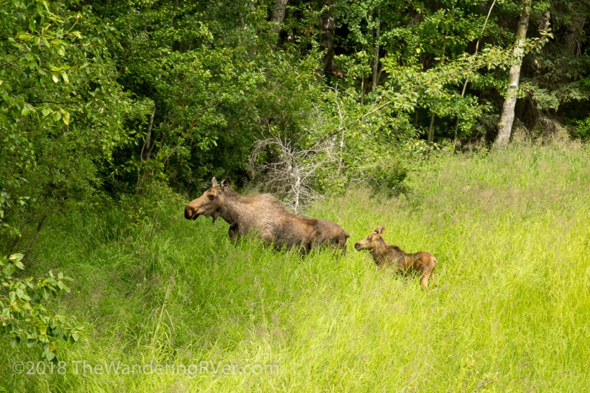
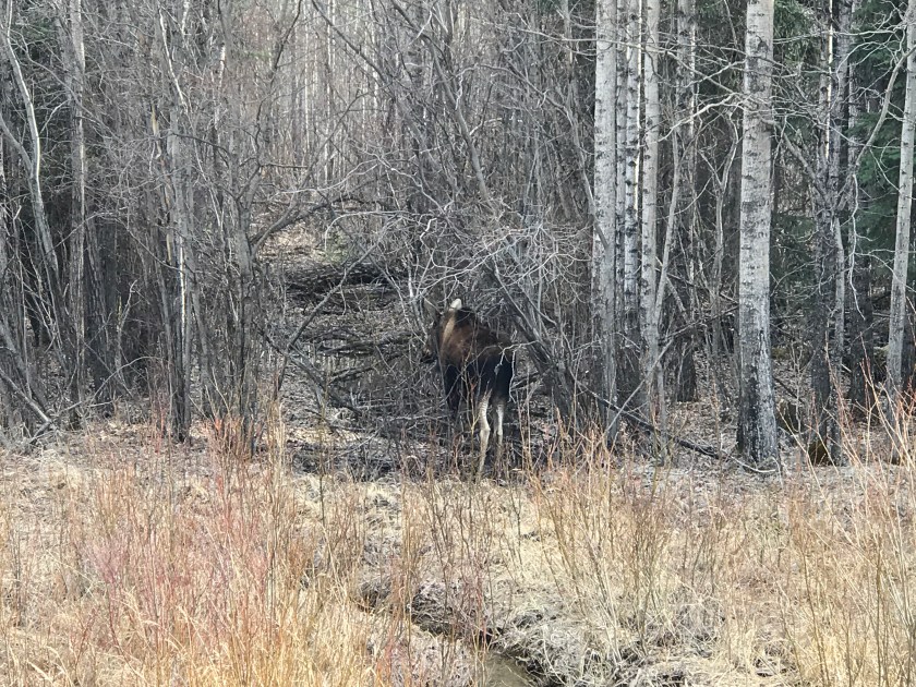
Another day, we when were looking for bears, we saw mama moose and her baby…
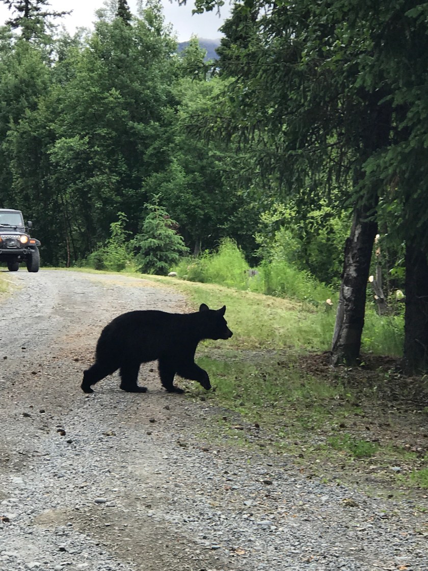
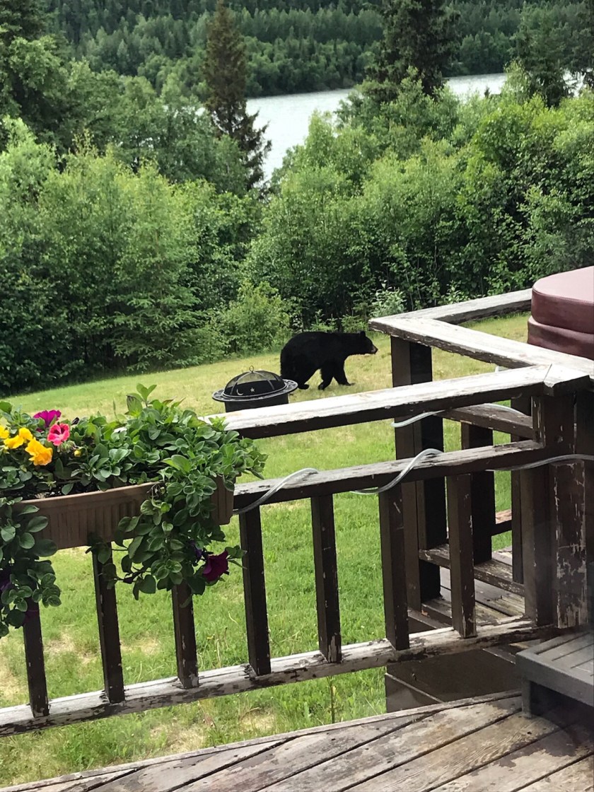
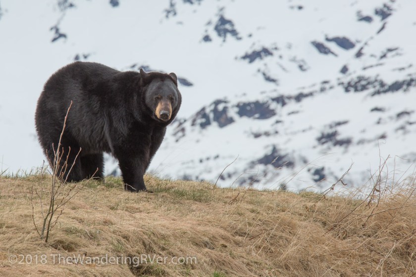
So, we’ve done all this driving around Kenai Peninsula looking for bears when we could have stayed at home and let them come to us…
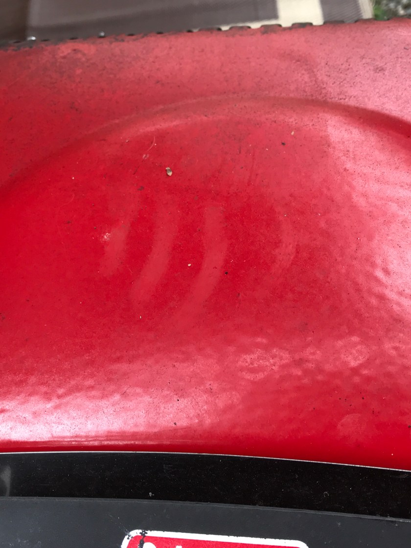
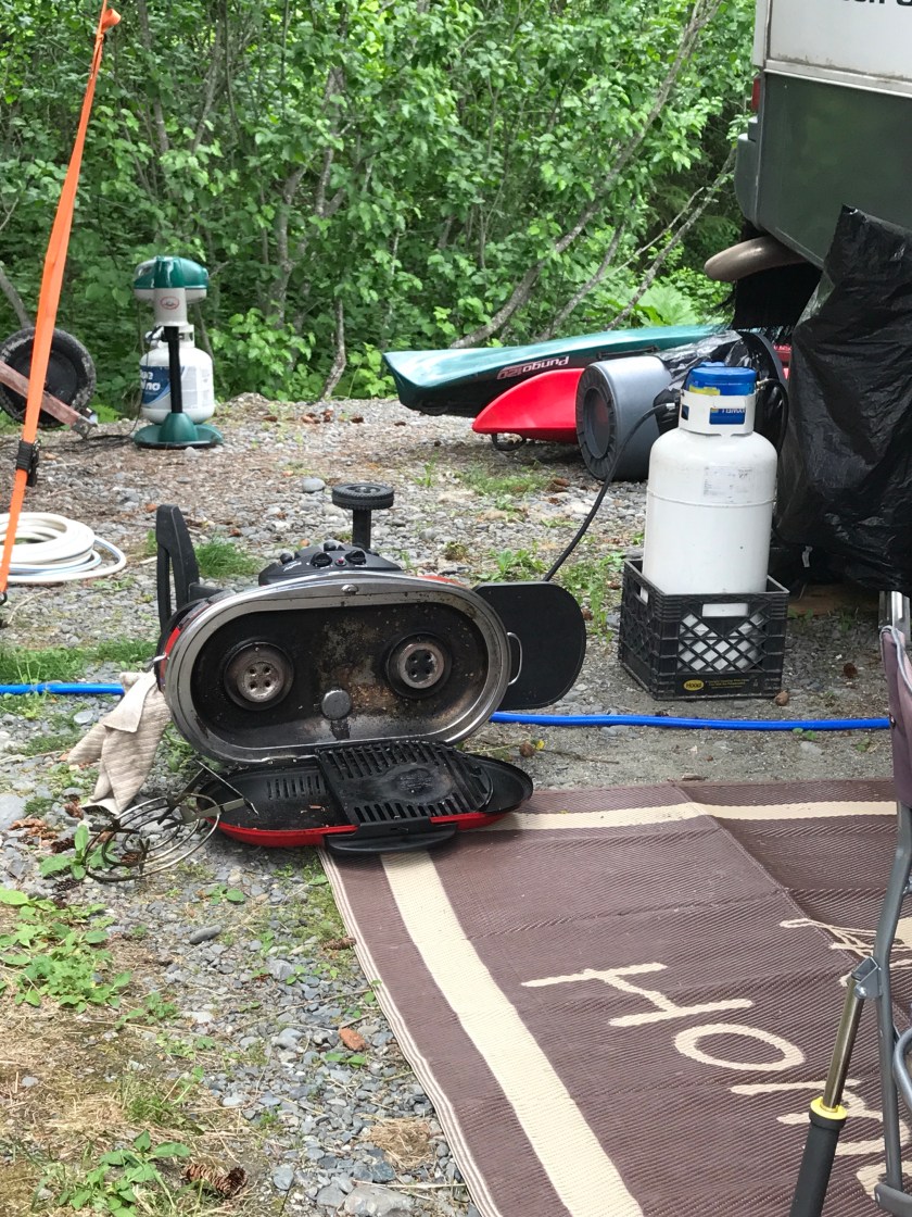
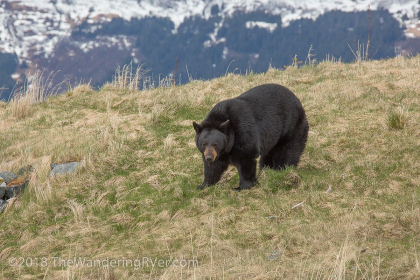
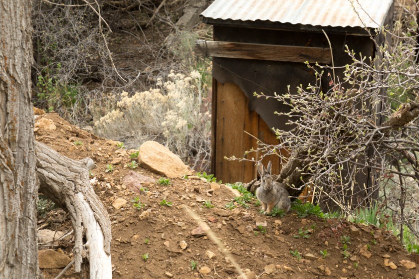
I took this picture in our driveway! I watched until I thought it was gone. Steve drove to the bottom of the hill and didn’t see it anymore, so we figured it had moved on. Come to find out, it had circled back to Waldo and checked out our grill…
Like the bear print on the lid to the grill? I guess it was unhappy dinner wasn’t ready!
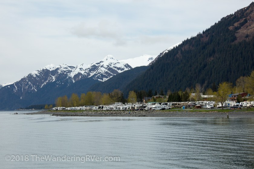
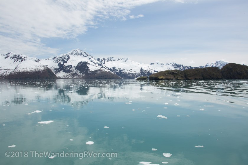
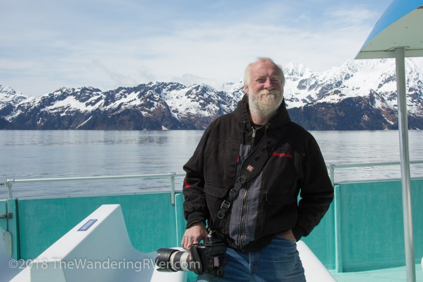
The town of Seward is about 26 miles south of us and is the heart of Resurrection Bay. There are glacier cruises, fishing charters, kayak adventures – nearly anything you’d like to do on the water in Resurrection Bay is found in Seward. In late May, Steve and I went out With Kenai Fjords Tours hoping to see some wildlife and knowing we’d get to see several glaciers.
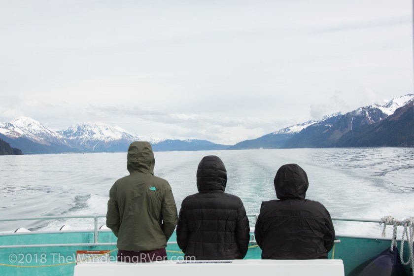
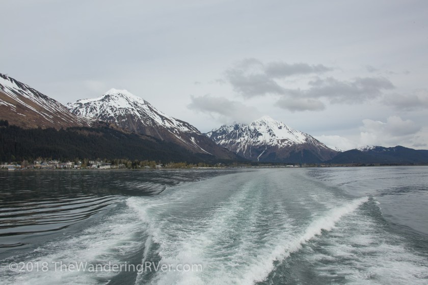
Our cruise left Seward at 10 am and I didn’t have great expectations about the weather. It was overcast, cold and windy.
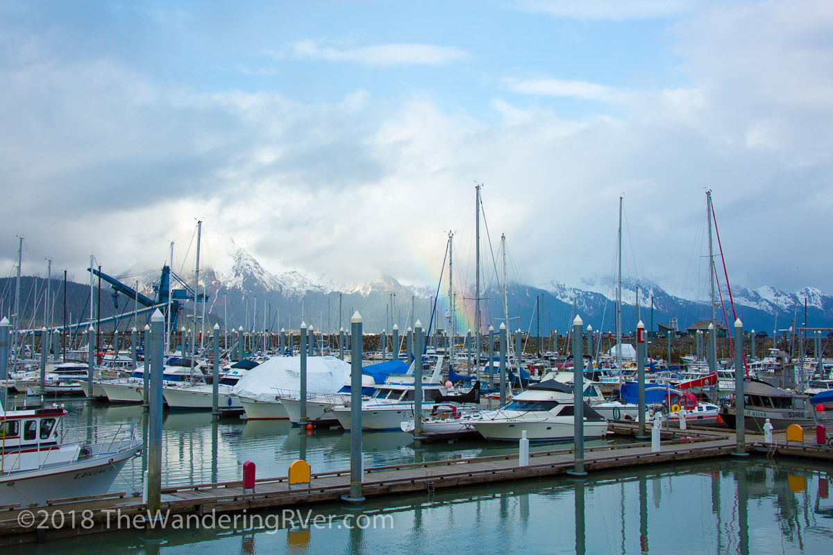
Everyone was bundled up! As we left the harbor, we had a great view of the town’s waterfront RV park (a place I’d love to spend some vaca time!)
Looking back at the pictures I took, I was really disappointed. I don’t think any of them captured the beauty and excitedness we saw and felt.
We hadn’t even gotten out of the harbor when we saw our first wildlife – sea otters…
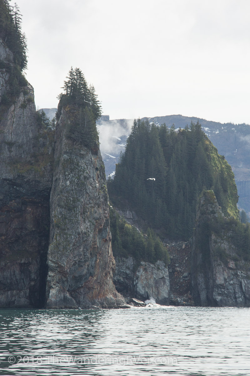
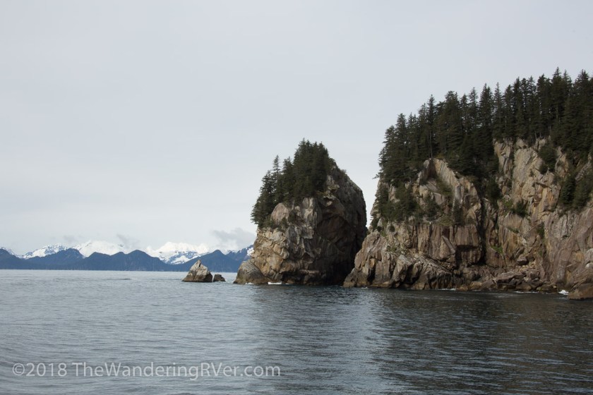
The captain and crew gave a first rate running commentary on everything we were seeing and made every attempt to get us as close to the wildlife as was possible without disturbing them. Despite the crappiness of the weather, there is no denying the beauty of the scenery…
Our next wildlife encounter was a group of Dall’s porpoises. They seemingly played in the boat’s wake, riding the waves and swimming along side of us, as if to race…
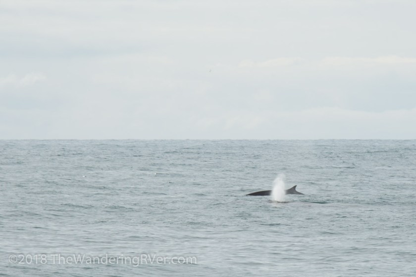
With their black and white bodies, if you look quick and don’t know the difference, you might think they were killer whales (orcas). The porpoises finally tired of playing with us and we moved on. Our next sighting was special because it isn’t often the endangered fin whales are this close to shore. Fin whales are the second largest creature to ever live on earth!
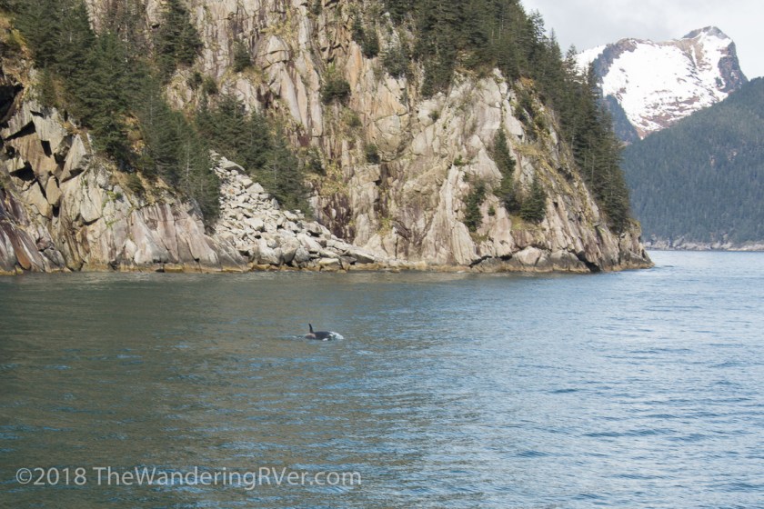
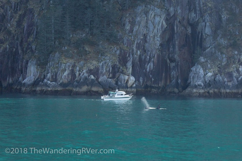
Leaving the fins behind, we came upon a pod of killer whales, aka orcas. Killer whales aren’t whales at all, they are members of the porpoise/dolphin family.
As we were watching, a smaller boat drifted in. They got a close up view…
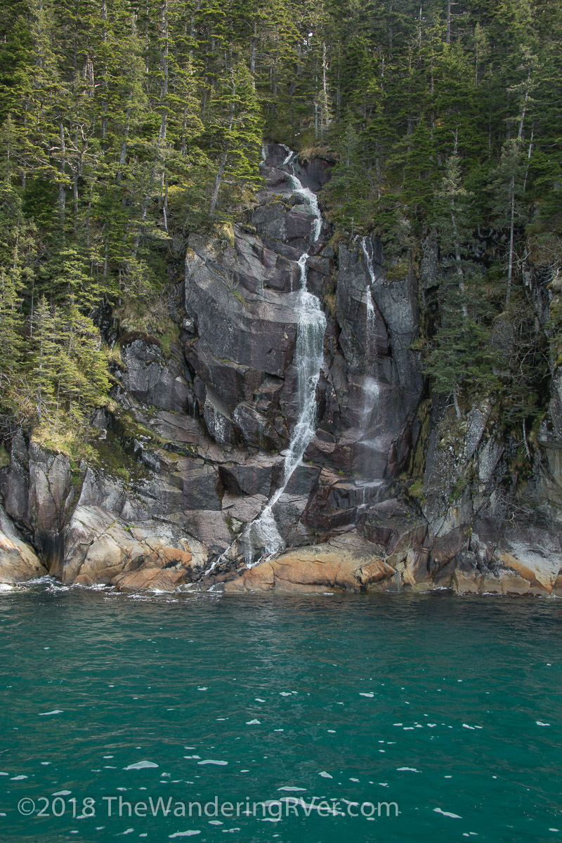
As if the dramatic cliffs and soaring, snow capped peaks weren’t enough scenery to make your jaw drop, the captain brought us into a cove with a glacier fed waterfall…
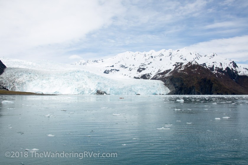
All this excitement and we hadn’t even gotten to the glacier yet. Our destination was Aialik Glacier, deep in Kenai Fjords National Park. The closer we got, the more ice we came across and, luckily, the bluer the skies became…
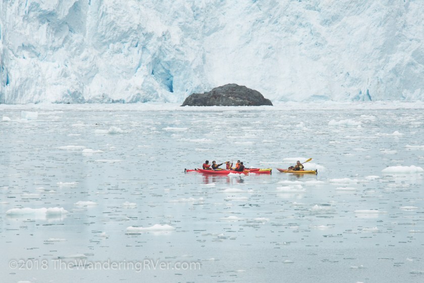
And then, there was Aialik Glacier…
See the group of kayakers near the center of the picture? No thanks! As much as I enjoy kayaking, that wouldn’t be for me!
We didn’t get too witness any calving of the glacier, but the abundance of ice in the water suggested it had been active recently.I’m pretty sure Steve was enjoying himself, what do you think?
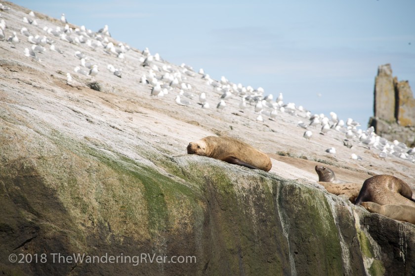
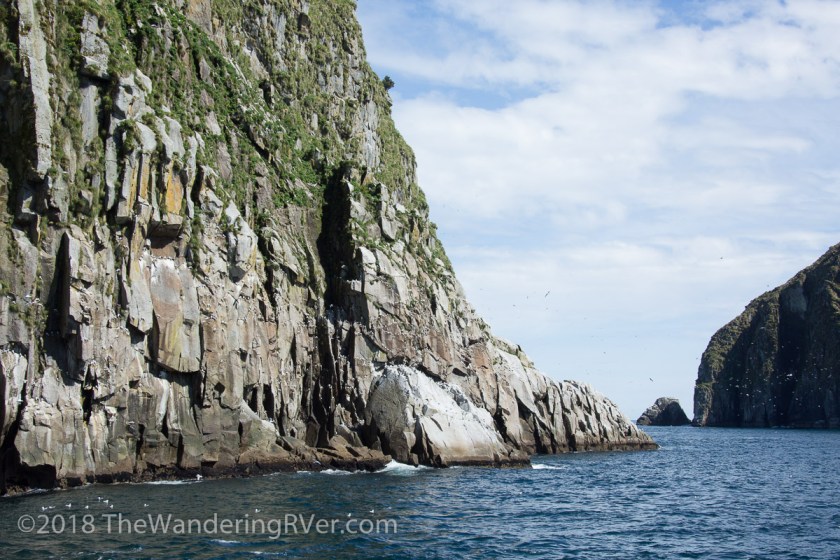
We were about half way through our cruise, but there were plenty of things yet to see. On our way back towards Seward, we motored around several of the islands. My favorite was the one with all the steller sea lions on it…
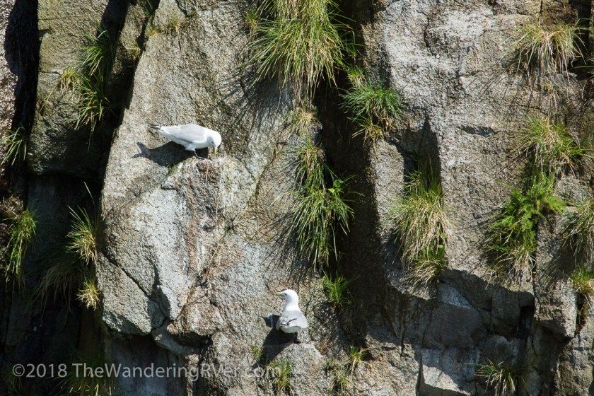
And the colony of kittiwakes nesting on the face of the cliffs…
But, our luck hadn’t run out yet, we came across a humpback whale…
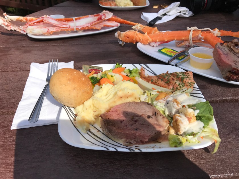
One of the reasons we chose this tour over some of the others, was this tour stopped at Fox Island for an all you can eat prime rib and salmon buffet. I would have taken more pictures of Fox Island, but I was too busy stuffing my face! Steve and I both opted to add the king crab legs (at $15 a person, how could we not!)
We were almost back to Seward when we got our final wildlife encounter. There were mountain gloats high above us on the rocky outcropping…
All in all, even if I think the pictures don’t do it any sort of justice, it was an amazing cruise with stunning scenery and more wildlife than I ever expected.
So we crossed from the Yukon into Alaska on May 1st. Here it is July 1st and I am posting about our first day trip on May 12th. Reminds me just how far behind I am.
We’ve actually been in Alaska for 8 weeks and we’ve been on several day trips now. One thing I have decided is that Nat Geo has been lying to us for years! There is not a moose standing in the road around every bend and there aren’t bears catching salmon in every river and creek. As a matter of fact, I saw my first wild bear just this week. That being said, if you want to make sure to see all of the Alaskan wildlife, you need to take a day trip to the Alaska Wildlife Conservation Center.
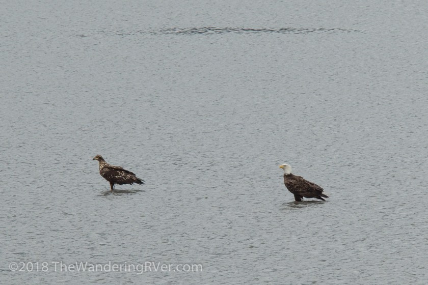
We drove past the entrance to the AWCC because we had heard there were a bunch of eagles in Turnagain Arm. The tide was out and, who knew that eagles will stand in the shallow waters to hunt…
It was amazing to see so many eagles in such a small area.
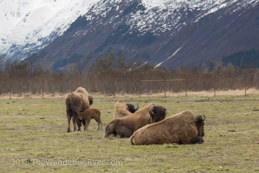
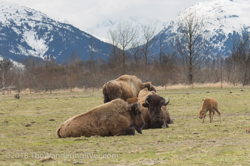
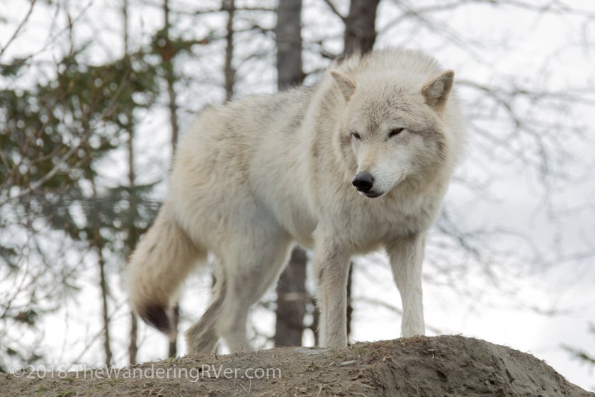
It was a cold, raw day and the skies kept threatening to drench us. We had dressed for it and were ready to explore the AWCC. The conservation work being done there is truly impressive. They have helped re-introduce wood bison and other large game back into the wilderness. Some of their wildlife are movie stars, having been on loan for the filming of Into The Wild.
I loved how much room the animals had and how natural their habitats were. Here are my favorite pictures from our day…
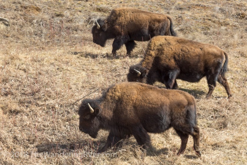
ElkMusk OxGrizzly bearsBlack bearLooking for lunchSomething’s on the windPart of the caribou herd – I think they see the lunch truck comingWood bison with nursing babyLearning to walk
Successful fishing in Turnagain ArmWolf surveying his domain
There were several other species I didn’t get any decent shots of, like moose, lynx, porcupine and reindeer.
I’m hoping to see most of these animals in the wild and if you’ve been following me on Facebook or Instagram, you’ll know which ones I’ve seen so far.
As we passed from the Yukon back into the USA, not much changed scenery wise.
One thing was certain, the road conditions turned to crap. The Yukon has done a great job of road repair and Alaska – not so much! But that’s okay – we were in ALASKA!!! After two months and over 6000 miles we were within a day or two of being at our summer home. Or so I thought. We woke up on May 1st, our first full day in Alaska, to some seriously ominous skies. Then it began…
Snow so thick we could hardly see the road. This wasn’t what I had planned! But, you know what, it was the 1st of May and had to be expected. We were trying to reach Anchorage, where we would resupply before heading to Moose Pass. Once you get on the Kenai Peninsula, shopping become more expensive in two ways: 1 you have to pay the tax and 2 you have to drive at least 45 minutes to get to the nearest store. We were just about to crest a big hill we’d been climbing when Steve got very serious looking. He pulled over as best he could and I asked what was wrong. Waldo had lost it’s power steering – completely. We got out to see what had happened and found a giant puddle of oil under Waldo. Oh man, this isn’t good! We were in the middle of nowhere! Glenallen was an hour behind us and Anchorage was 2 1/2 hours in front of us. We called for roadside assistance from Good Sam’s and waited. And waited. And argued with them on the phone about exactly where we were. I gave them our GPS coordinates and told them we were at mile marker 37. Yes, 37 – I can see it from here! Finally, the tow truck arrived and Waldo got carted off…
We were towed back to Glenallen, the closest “qualified repair center”. I was not a happy camper! Despite the bad luck of being broken down, we had the good luck of being towed to Glenallen Fuel and Service. First thing in the morning, the lead mechanic, Dawson, came out to talk to Steve. While the 2 of them conversed, I sat in Waldo and stewed about our situation. It could have been a lot worse. GF&S let us stay in Waldo in their parking lot, so we weren’t “homeless” When Steve came back inside, he explained what had happened. A bolt had come backed of the power steering pump and broke the other bolt holding drive on the pump. I just nodded my head as if it meant something to me. How long to fix it – that was my question! The part we needed was in Anchorage, naturally. But again, luck was with us. Scott, the tow truck driver, had to go to Anchorage anyhow, he’d pick it up for us. Dawson was quite happy to let Steve do all of the work he was capable of and loaned him any tools he didn’t have.
All in all, we ended up being there 3 days and with Steve doing most of the work, it wasn’t as expensive as it could have been. We were back on the road and I was just blown away by the scenery. Every time I thought the view couldn’t get any better, it did!
We finally made it to Anchorage and got all the shopping out of the way. Only an hour and a half until we are home for the summer! Yea! I wasn’t prepared for the amazing scenery yet to come…
The Seward Highway leaving AnchorageDriving along Turnagain Arm
Well, here we are in Moose Pass. We parked at the bottom of the driveway and walked up to meet our new bosses, Gary and Treva. They pointed out our spot and Steve brought Waldo up the hill. I wasn’t sure Waldo could make the turn and get enough traction in the dirt drive, but he made it…
Whew, that was a climb. But what a view…
Our backywardOur front yard
Wow. Now that we made it, it’s time to go to work. Up next – settling in.
Thanks for coming along. I’m getting caught up on posts, I’m only 4 or 5 behind now. If you want the latest, follow us on Facebook or Instagram!
Time was getting short and we still had almost 3000 miles to go. We were due to arrive at our job in Moose Pass as close to May 1st as possible. Here it was the last week of April and we were only half way there. Of course, we had taken the really long way. From here on out, it would be one night stops, often not even unhooking the Jeep. Our planned travel route would take us through about 13 miles of Idaho. What could possibly happen in 13 miles? Just before we crossed the state line, I saw a sign stating all boats MUST stop and be checked for invasive species. My first (and only) thought was “Gee, glad they are taking it so seriously.” What I never gave a thought to was our 2 kayaks strapped to the roof of the Jeep. I mean they hadn’t been in the water since we left Florida. We were half way though our 13 miles when Steve pulled over to give the car with the red flashing lights pass by. Much to our surprise, they pulled right in behind us. What had he done? He wasn’t speeding or driving erratically. Nope – kayaks are boats and we hadn’t stopped. The sheriff was very pleasant about it, but we had to turn around and go back to the state line. The kayaks were inspected and we got a little sheet of paper stating so. I threw it on the dash as we began our 13 mile drive though Idaho again. We breezed through Oregon and Washington state before I ever thought about that little scrap of paper again. Several times I remarked to Steve that the landscape wasn’t what I had pictured. There were no tree covered mountains or lush forests. Only more of what we’d been seeing all along, giant rocky mountains with little or no vegetation. We finally got to the border crossing, produced our passports and were welcomed into British Columbia, Canada. For the first hour or so of the drive, we passed grove after grove of fruit trees. Every kind you could imagine. Apples, peaches, plums, pears. All in bloom, waiting for pollinators to do their jobs. I didn’t get any pictures because there just never seemed to be a good spot to pull over. We knew our biggest problem would be finding campgrounds that were open in April, most of them don’t open until May. I had picked out a few possibilities and figured we’d just stop in rest areas or truck stops if they didn’t work out.
We got to see our first wildlife in BC. Large herds of wood bison hanging our on the side of the road…
As the scenery began to resemble more what I had expected, I spent a lot of time trying to capture it…
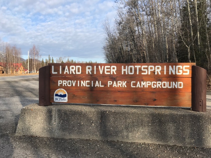
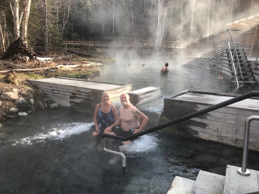
Our best stop in BC was at Liard River Hotsprings. The provincial park wasn’t open yet for camping, but they had a large parking lot we were told we could dry camp in. In the morning, we headed over to check out the springs…
The boardwalk to the springs
Taking a nice soak
In a word – it was awesome! We were so tempted to spend another night, but we really did have to move on. We got to see a little more wildlife…
We didn’t see near as much wildlife as I thought we would. Maybe it was too early in the season.
We crossed into the Yukon and stopped for the obligatory picture…
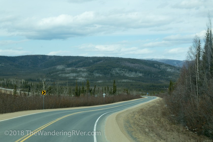
I spent much of the next few days hanging out Waldo’s window. Every time I thought the scenery couldn’t get any better, it did!
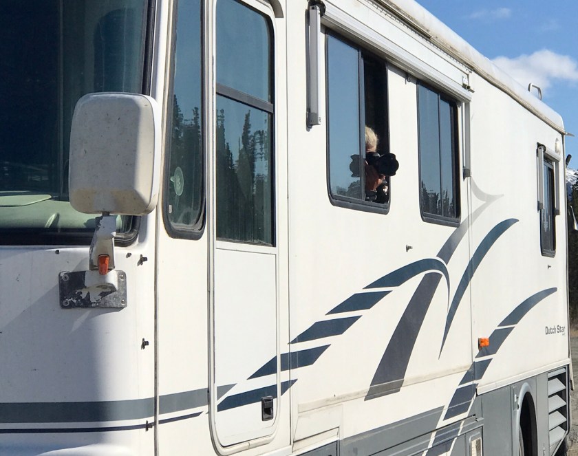
Yes, that’s me with my camera out the window
When we got to Watson Lake, we stopped at the Sign Post Forest. It’s hard to describe and the pictures don’t really do it justice…
I don’t know how many signs there are, but I can tell you, it is A LOT! It took my quite a while to go through all of the pictures and here are some of my favorites from the Yukon…
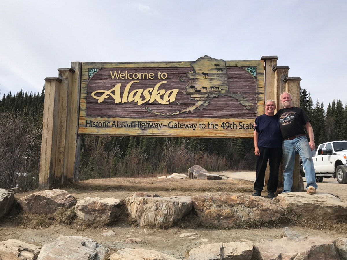
And finally, we were heading back into the USA – Welcome to Alaska…
Well, we made it to Alaska! Up next…Oh Waldo, you’re so……..
Page had told us about another drive we would enjoy. “If you follow the road through Paradise Valley, you will come to the base of Hinkey Mountain. There is a road to the summit, your Jeep wouldn’t have any trouble,” he said. Frankly, the prospect of getting to do a little 4-wheeling really appealed to me.
First we had to find the road to Paradise Valley. Page had said it was easy. “Head out Hwy 95 for 25 miles or so, when you see a gas station in the middle of nowhere, take that left. That’s the road to Paradise Valley.” Seems simple enough. Steve and I were enjoying the drive, just chatting about our adventures the previous day (you can read about that here) when I noticed these tiny heads popping up along the side of the highway. “Did you see that? What are those? Look, there’s another one. Slow down, I want to see what it is.” Well, there were cars coming up behind us so slowing down wasn’t an option. Lucky for me, our “middle of nowhere” gas station was just up ahead. Hopefully when we made the left, there would be more heads popping up. Sure enough, as we made our way down Paradise Valley Road, there they were. Steve pulled to the side of the road and I waited anxiously for the critter to makes its appearance. I didn’t have to wait too long…
They reminded me of the pocket gophers we had seen in Texas but these were prairie dogs. It was comical to watch them pop up and scurry around, only to disappear into another burrow. We watched for a bit then resumed our drive. All the sudden, without a word, Steve banged a u-turn. Huh? What had he seen that I missed? He pulled over again and pointed to one of the prairie dog holes and said “Isn’t that an owl?” We got out the binoculars and sure enough, it was a burrowing owl. The problem was, it wasn’t feeling like being social. Every time we tried to get a picture it either dropped back down into the hole or it would fly off to a fence post just out of camera range. With a little patience we were finally able to get a few shots…
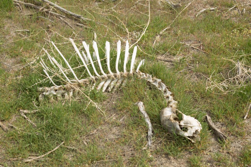
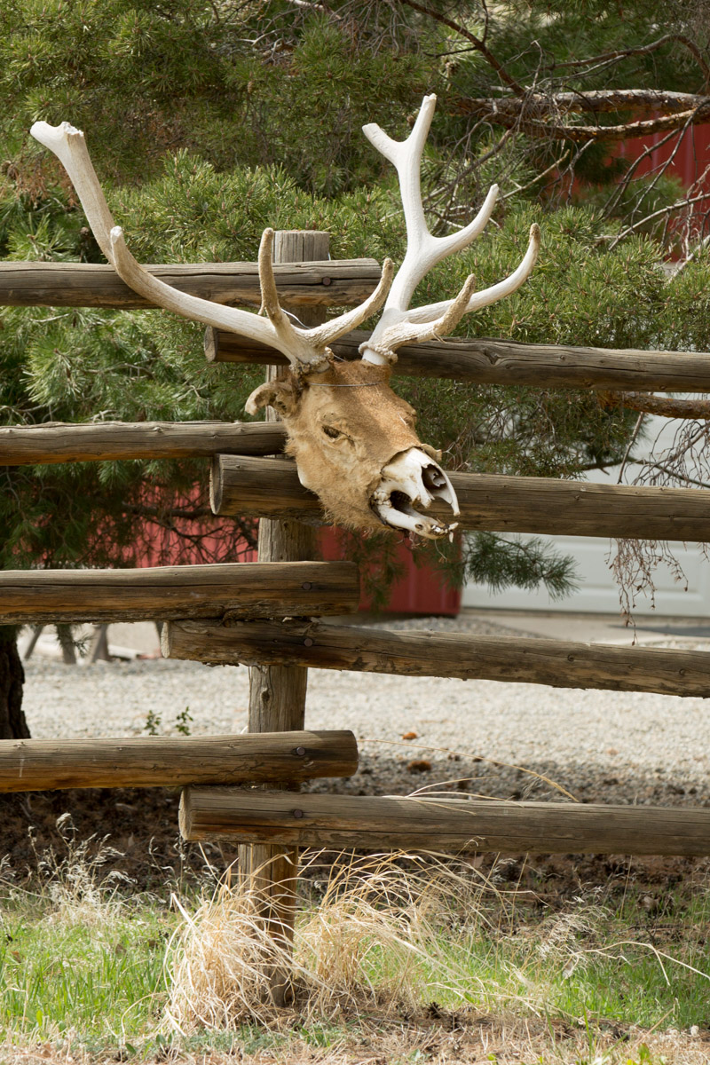
Leaving the owls to their activities, we drove on. I was thinking “Wow, Hon, get catch with the owls!” when a pheasant flew into the road. Naturally, it didn’t stay long enough for either of us to get a shot. Now it was my turn…”Pull over!” I wasn’t sure what I had seen, but I wanted a closer look. When I walked over to the fence line, this is what I had seen…
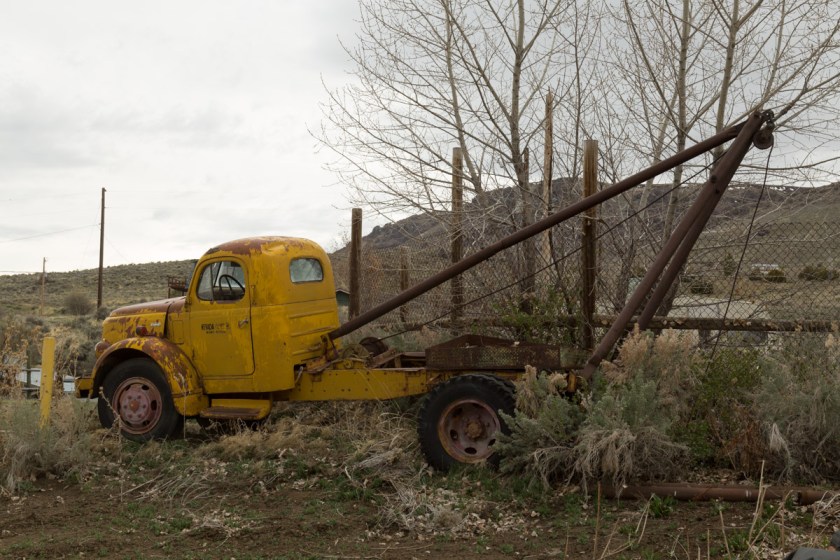
Hey, it’s still wildlife, it’s just long dead wildlife. As I was getting ready to get back into the Jeep, I looked down the fence line and saw something a little more photogenic…
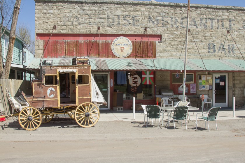
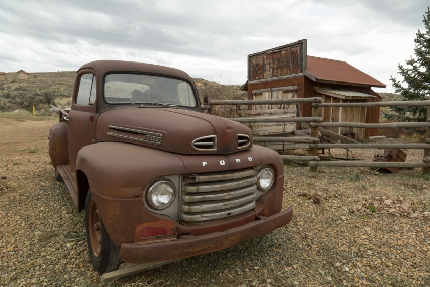
Wow, I was loving all this wildlife! Once again, we started back towards Paradise Valley. Finally, we made it and had to get a few pics while we were there. It is another ‘has been’ town with more abandon houses/businesses then occupied, but it has a saloon too…
We finally found Hinkey Summit Road. It wasn’t going to be 4-wheeling unless the road got a heck of a lot worse further on. With no other vehicle in sight, we crawled along, ever ready for our next wildlife encounter. Steve stopped by a pond and I got out to check it out. Lots of ducks and geese and a couple birds I couldn’t identify at the time…
American Avocets – Thanks Google!
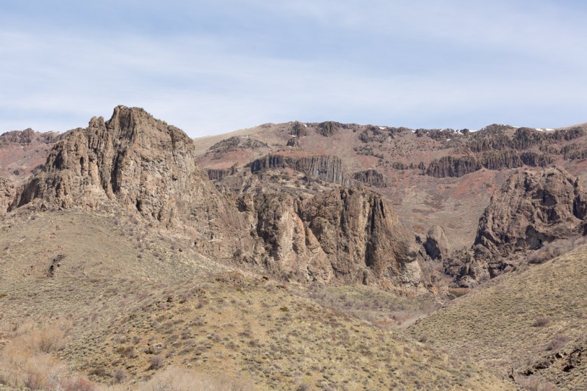
We came to the entrance to Homboldt National Forest where the road to the summit truly began. I oohed and aahed at the scenery…
I took pictures of the winding road…
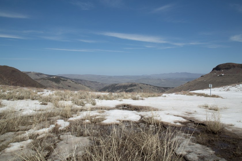
As we neared the summit, I noticed a natural bridge…
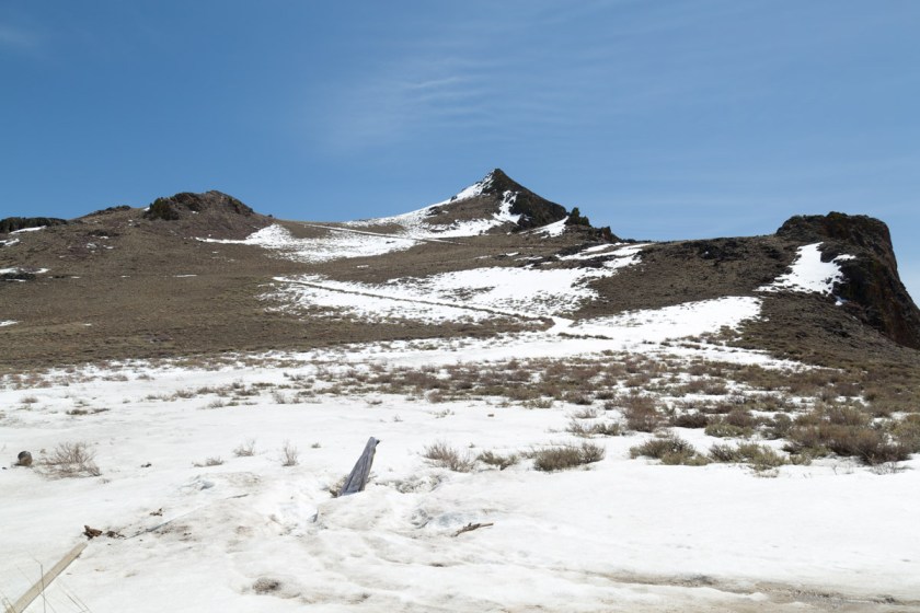
At the summit, we almost got to go 4-wheeling. There was still snow to play in…
OK, not really enough snow to 4-wheel in. Perhaps it was the elevation getting to me but I had an idea – I would take a video on the way back down the mountain. Maybe not my best idea ever, but what do you think…
Thanks for coming along.
I am almost caught up. I have one more post about our trip then I will start on arriving in Alaska and our adventures so far (there have been some cool ones!)
We left Beatty (and hopefully all of Waldo’s troubles) and headed north. So far, most of our getting to Alaska trip had been west. Now it was time to go north. The drive from Beatty was hundreds of miles of absolutely nothing but breathtaking scenery. Once again we were on the side of the road, but this time for a good reason. I wanted pictures of the amazing landscape around us…
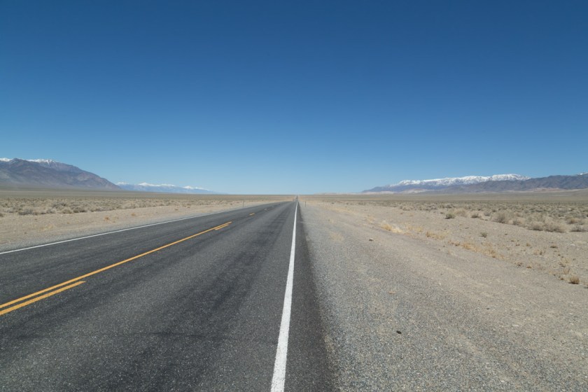
We were traveling on Hwy 376 when the GPS said to take the next exit onto The Loneliest Road in America. I looked at Steve and asked “What did the GPS just say?” Sure enough, the stretch of Route 50 through Nevada is called The Loneliest Road in America! Some day, I’d like to travel the entire 3000 mile of Route 50. It goes from Ocean City, Maryland to West Sacramento, California.
When I was researching our stops, I found a New Frontier RV Park in Winnemucca. Originally, we were just going to spend the night and move on, but it looked like there were lots of things to do and see there. I had picked up a bunch of brochures at the office and we spent our first evening there trying to decide what adventure would be first on the list. In the morning, we decided to visit some of the ghost towns in the area. While I was pouring over the brochures, Steve was searching AtlasObscura.com. What he found sounded way cooler than what I had found. A ghost town that wasn’t a ghost town! And, it had a saloon! Before we headed out to find the saloon, we had to pick up some supplies. We were looking for a hardware store and someone said there was an ACE Hardware nearby. Now, that doesn’t sound all that exciting I know. You are probably wondering why I’m mentioning it at all. But…the ACE Hardware was inside of Riddley’s Family Market. Yep, a hardware/grocery store. The only place where you can get pipe fittings and pickles all in one stop. (Thank you Josie) I loved it! With our shopping done, we went in search of a cold beer.
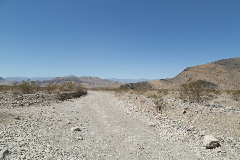
Midas can’t truly be called a ghost town because there are still 9 full time residents. As we made our way further into Nevada’s back country, we passed all sorts of places. Some where beautiful scenery, others made me scratch my head a bit…
I wonder how many people drive down this dirt road and think “Yeah, I want to buy that”
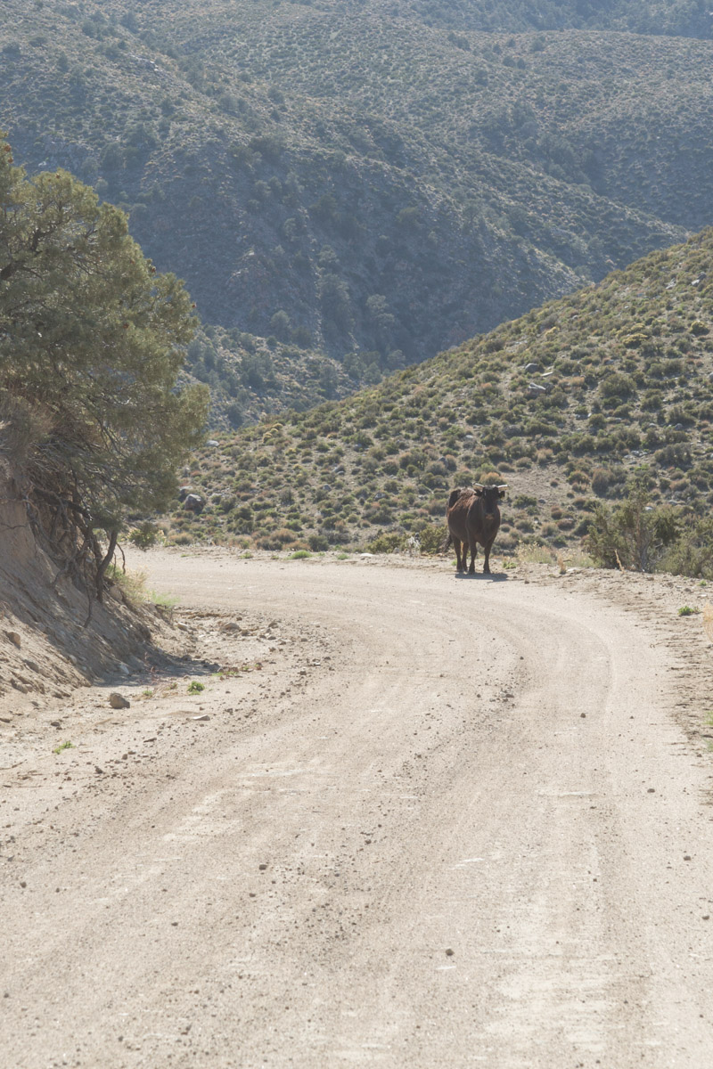
We had to stop for the free range cattle a few times
We were almost to Midas when a tumbleweed blew by us. I’ve seen lots of tumbleweeds in the movies and wanted to see one up close…
So, the funny thing about this picture is while I was standing there holding a tumbleweed, some of the “locals” drove by. I can only imagine what they were thinking.
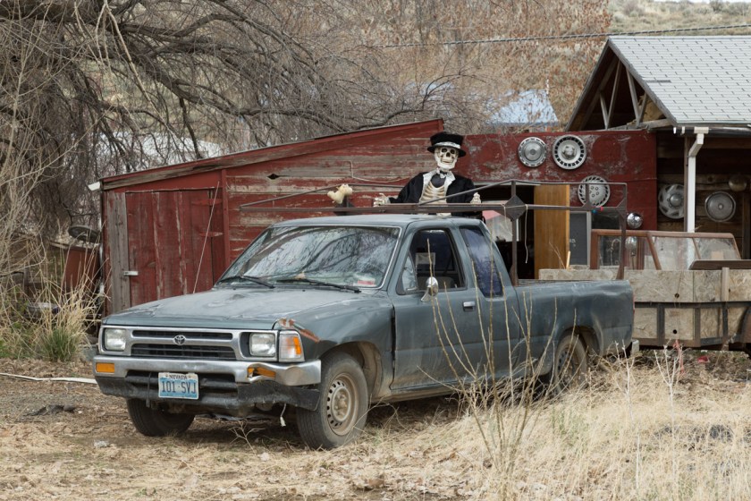
With only 3 miles to go, we wondered what we would find in Midas. Was there really a saloon in the middle of nowhere? Here are some of the things we saw when we got to “town”…
And YES, the saloon…
Notice the open sign!? Woohoo! Inside, the owner, Page, popped open a couple cold ones for us. We spent the next several hours talking with Page. He was a retired electrician. He had spent 30 years working for a gold mine operation and now owned the saloon. He told us Nevada is the worlds 4th largest gold producer. An article I found confirms this…
4th largest gold producing country
In fact, if Nevada was a country, it would be the world’s fourth-largest gold producer, behind China, Australia and Russia, according to the US Geological Survey. Reported gold reserves (resources that are economical to mine) at the end of 2015 were about 70 million ounces, enough to sustain gold production near current levels for the next 12 to 15 years, reads a 2016 report from the Nevada Bureau of Mines and Geology (NBMG).
Wow! I went out to check out more of the town while Steve continued to chat with Page. And who did I see? The folks who had driven by while I was chasing down the tumbleweed. They were nice enough to let me take a picture of their truck…
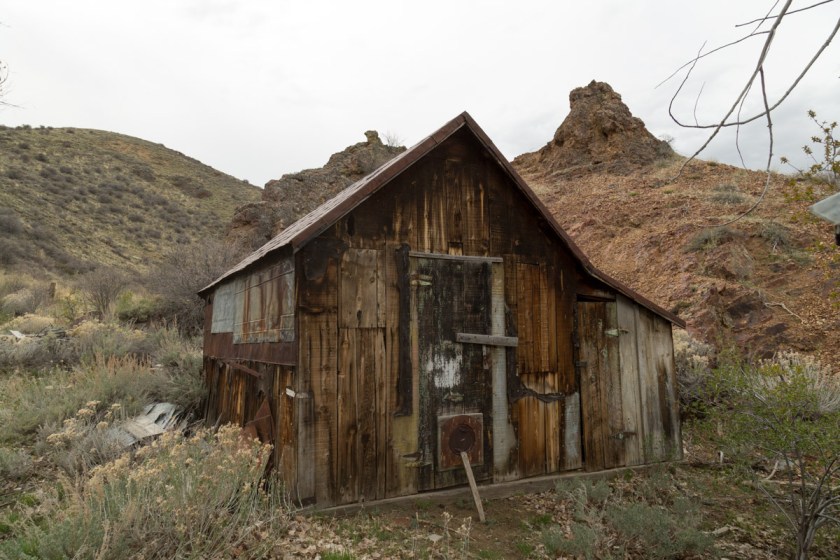
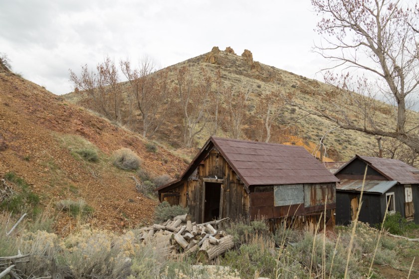
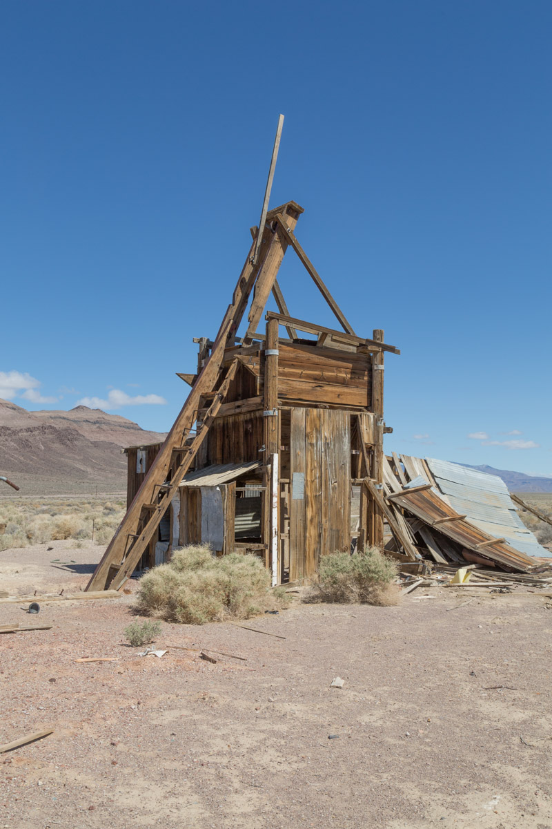
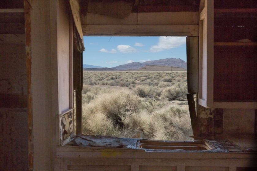
Page told us about lots of things we could find near the town, but in the end, we spent so much time chatting with him, we only had time to go to the far north end of town. Here we found the abandon part of town…
One of the entrances into the mine
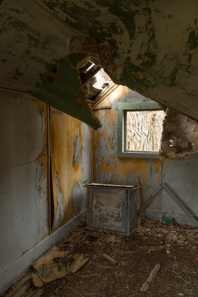
You know I had to go inside and look around!An old star drill bitMr. Bunny was kind enough to pose for me
I think this sign was one of my favorite things I saw in Midas..
With the light and my energy fading, we began the drive back to Waldo. I wondered about the people who had once lived in Midas. Had they found their fortune? Or did they give up and leave everything behind? The town was such a strange mix of abandon, fixed up, new and cold beer. Our final run in with the locals came just as we were nearing the highway back to Winnemucca, riding off into the sunset…
Up next, our visit to Paradise Valley…
Have you ever gone to a ghost town for a cold beer?
Unfortunately, it isn’t near as sexy as it sounds. If you’ve following our travels, you know we have had a long time problem with Waldo overheating. There were travels days we spent more time on the side of the road than motoring. This has led to some very frustrating days, tears and more than my fair share of unlady-like fits of screaming.
I’ve tried to keep my posts happy and full of America’s breathtaking scenery, but I’ve decided that isn’t really a fair way to describe our lifestyle. Yes, for almost a year now, we’ve been exploring new areas of the country and having the time of our life. But – it isn’t all beauty and magic.
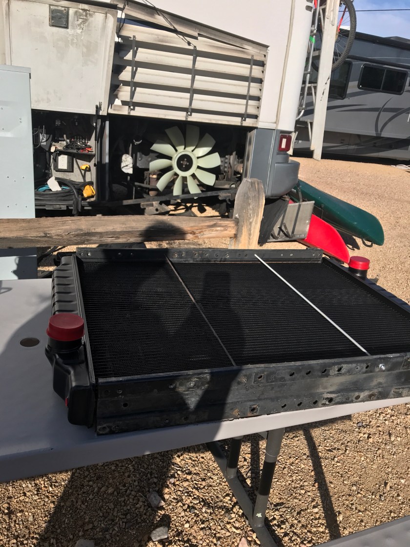
When we arrived in Beatty, it was in a fit of overheating. We are extremely fortunate Steve is a mechanic by trade. He has been working on cars, trucks and motorcycles for 40+ years. RV maintenance comes easy to him. Changing the oil and filters doesn’t require a trip to a shop. This has saved us countless dollars. But, this nagging overheat issue obviously wasn’t going away. He had already changed the thermostats, checked hoses and replaced the overflow tank, all to no avail. He came to the conclusion Waldo needed a new radiator. UGH! To make matters worse, we had taken Waldo to an oversized carwash to clean away some of the grease and grime which has accumulated around the giant CAT motor. Using the high pressure hose, he began spraying away, only to watch as parts of the fan blades fall to the ground. Great, now not only do we need a radiator, but we also need a new fan. Thanks Steve. But, to be fair to him, the blasted thing is 18 years old and has 190,000 miles on it.
We had only planned on staying in Beatty for 6 nights, but ended up staying for 9 nights. The 3rd day there, Steve called around for parts. We could get a new fan from Freightliner in Las Vegas, a mere 2 1/2 hours away. They could get us a new radiator as well, for the low cost of $2200. When he gasped at the price, the parts guy suggested he call a radiator shop, not far from Freightliner. The woman who answered the phone was beyond helpful! She was pretty sure she could get us a replacement for about half the cost. The catch was, she needed Steve to bring her the defunct radiator so she could check some measurements. So, with the limited tools Steve brought with him, he set out to dismantle Waldo’s cooling system. The camp host loaned us two 5 gallon buckets to drain the antifreeze. We were lucky the park let us work on Waldo there. Lots of places wouldn’t have. Once the radiator (and all the other miscellaneous crap was removed), Steve set off for Las Vegas. I was feeling more than a bit cranky and was content to let him make the trip alone. By the time he returned, a little before 10pm, I had calmed down – some. Both the fan and the radiator had to be ordered and wouldn’t be in for several days. We spent those days exploring Death Valley.
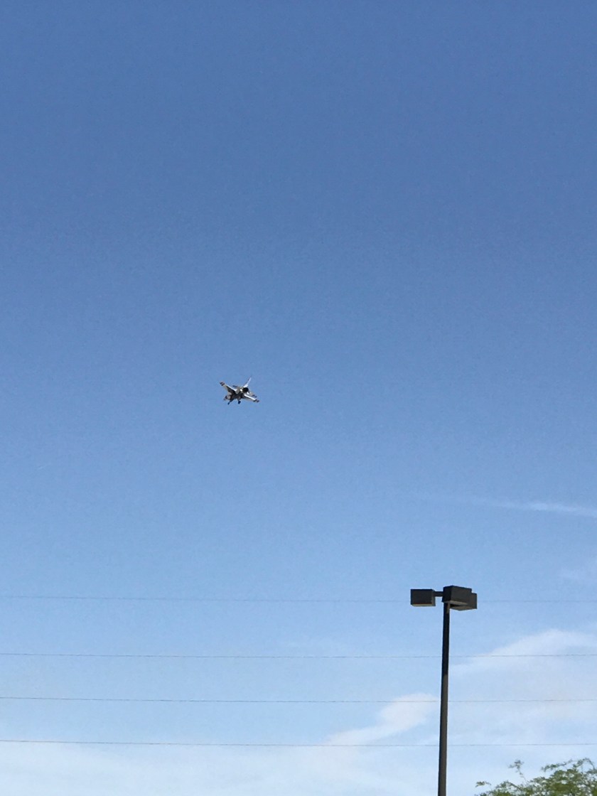
Wednesday finally rolled around and we headed back to Las Vegas. We picked up the fan and 15 gallons of antifreeze from Freightliner and called the radiator shop to check on the arrival status. It wasn’t in yet, but was on its way – another hour or so. Since we had time to kill, we went to WalMart and did some resupplying. As we were coming out of WalMart, I was nearly deafened by the sound of F-16s flying overhead. It was the Thunderbirds from nearby Nellis AFB. How cool is that?!?!? Since I hadn’t brought my camera, a crappy cellphone pic will have to do…
With the excitement over, we headed to the radiator shop. They were just taking it off the truck when we arrived. Perfect timing. With the Jeep loaded to capacity with parts and supplies, we headed back to Beatty. We had just dropped over $1500 in Las Vegas and never set foot inside a casino.
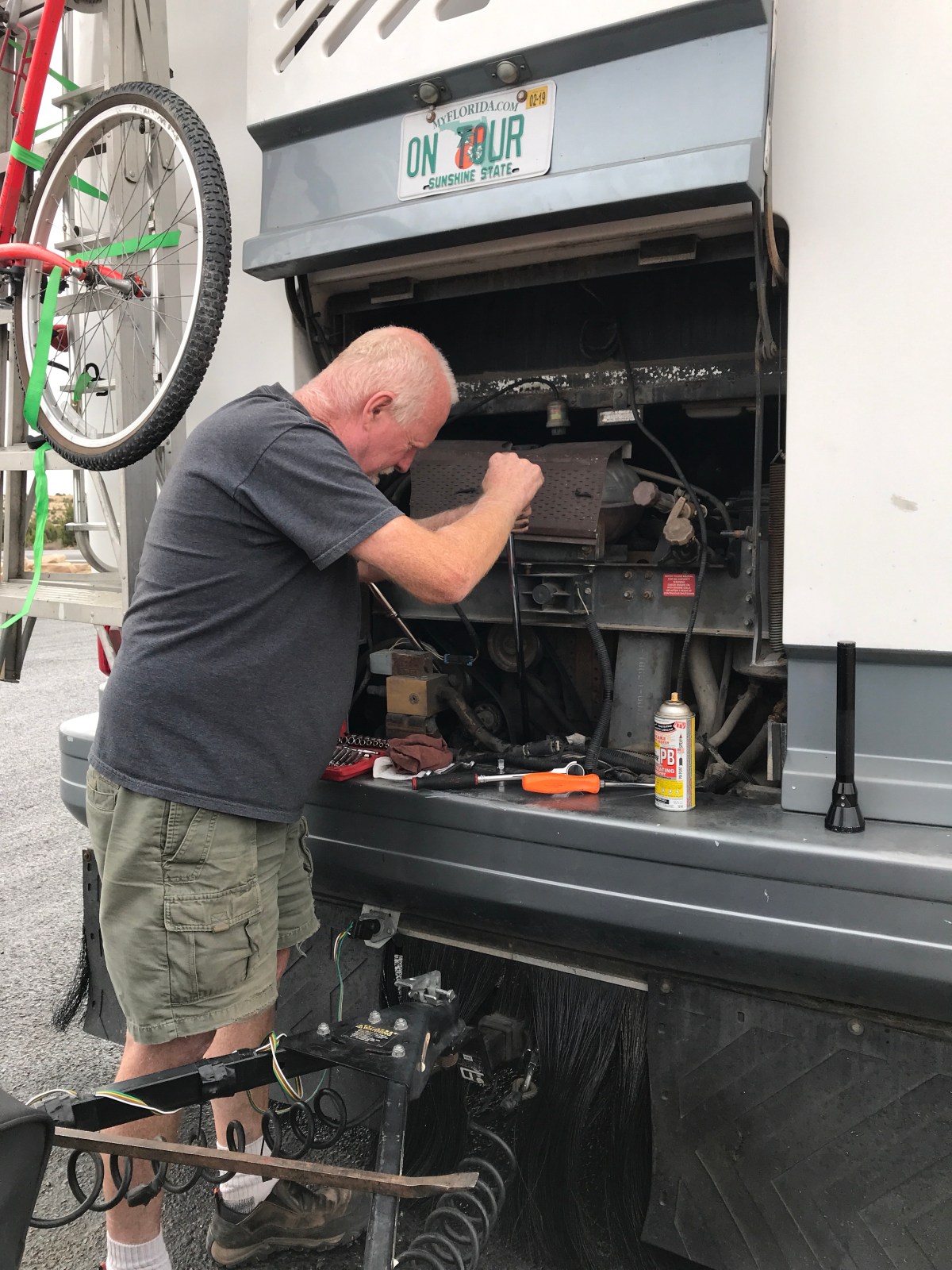
Thursday, Steve got right to work putting Waldo back together. New fan…check…
New radiator…check…
It took a little longer to put things back together then it did to take it apart. It always amazes me when Steve can take a pile of bolts and know which one goes where. I mean seriously, when he took it apart, he threw all of the bolts into a bucket. When I take things apart, I label everything and take pictures so I can put it back together, maybe that’s why I’m not the mechanic! Soon enough, Steve was ready to start the motor. I have to admit, I might have been holding my breath. But when the “Wait To Start” light went off, Waldo fired right up. We let it run for a while, satisfied everything was good. The real test wouldn’t come until we drove down the road. We have since traveled to Alaska and Waldo hasn’t overheated once, thanks to my wonderful mechanic, husband and best friend. His ability to handle the mechanical problems has saved us thousands of dollars. It is a comfort knowing he can do these things, but it doesn’t help my anxiety in the moment things fail. I’m working on handling things better, but for now, if you hear a scream of panic, it still might be me!
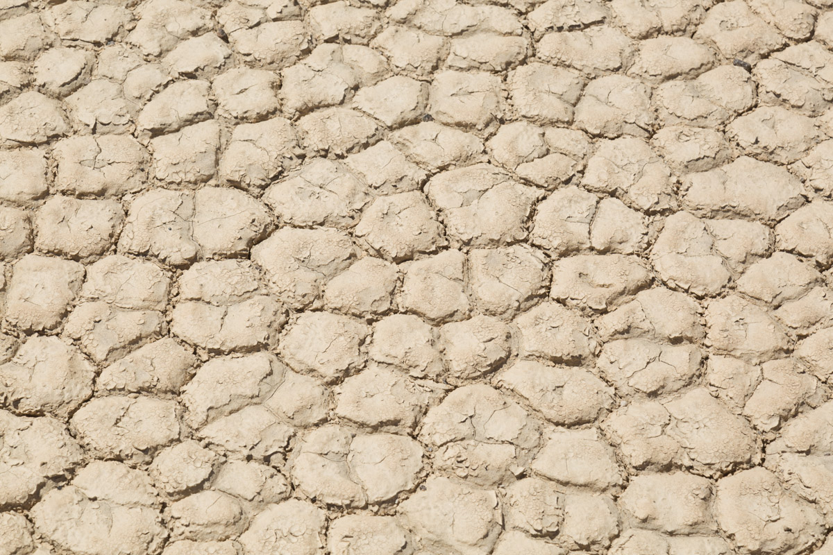
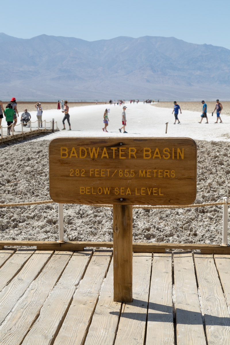
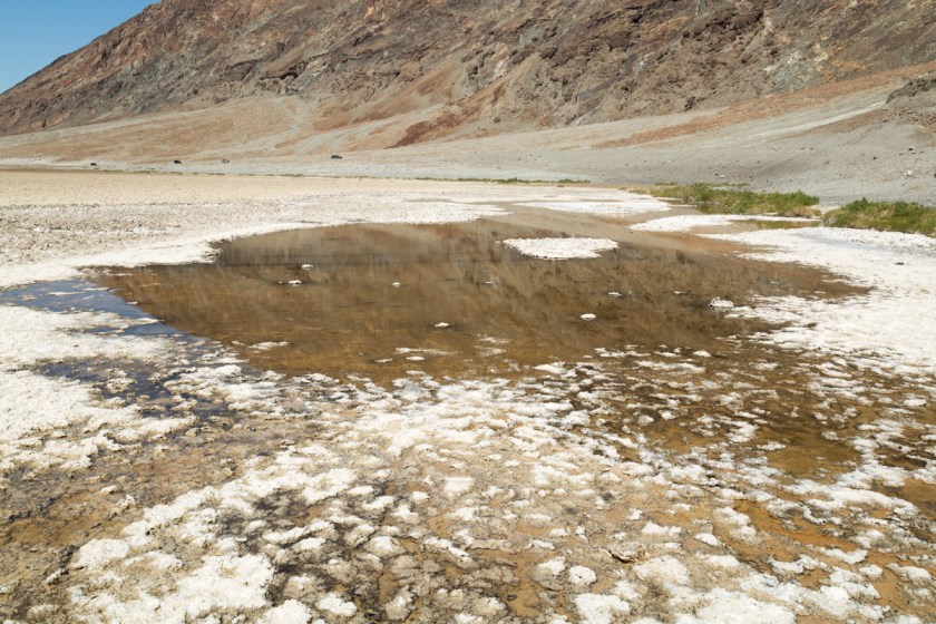
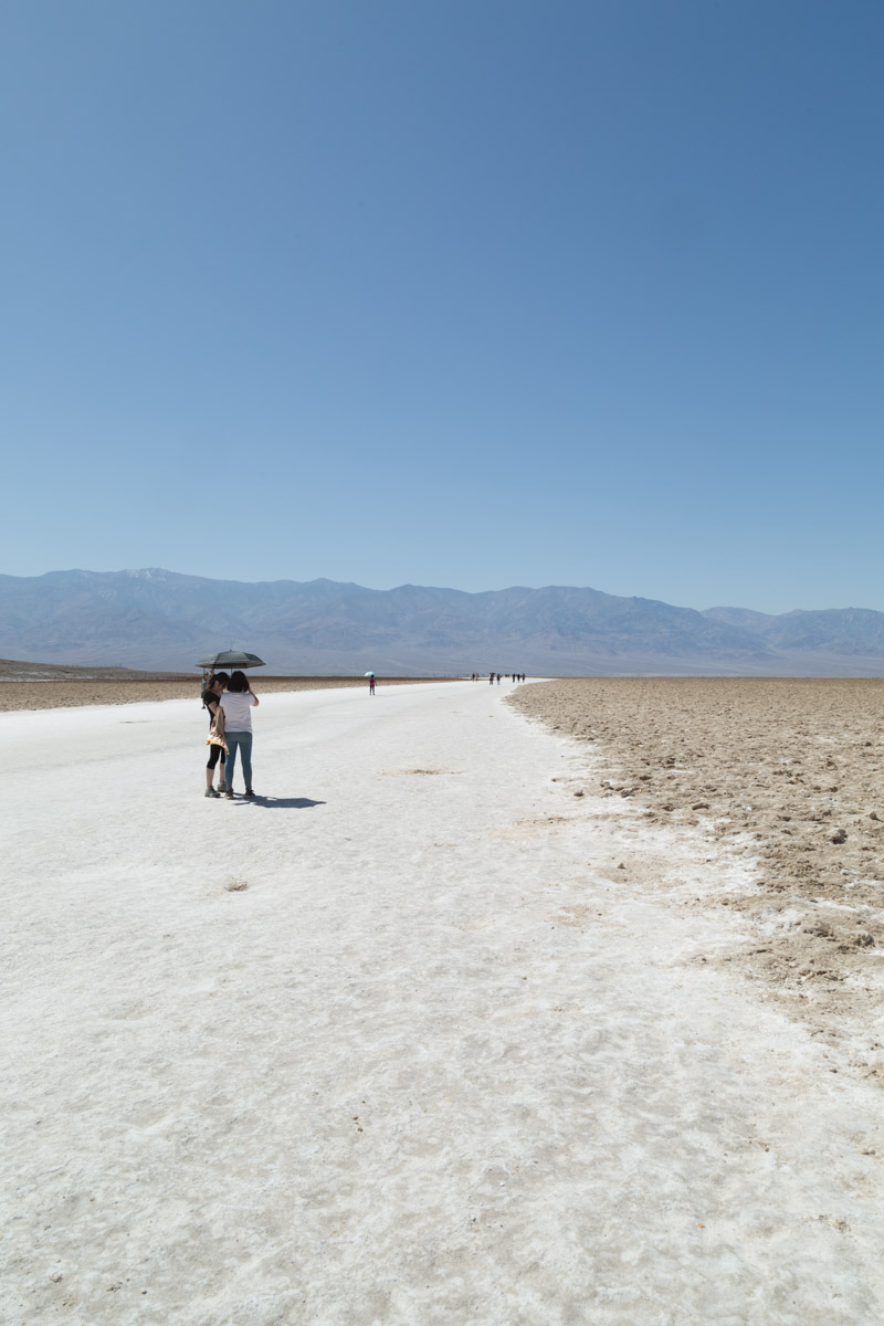
If you missed part 1 , you can catch up here. Badwater Basin is the lowest point in the United States, at 282 feet below sea level. The walk to the actual spot (about 1 1/2 miles from the marker sign) is along a salt packed trail. The shallow pools of water will evaporate over the summer leaving crusty salt mounds as far as you can see…
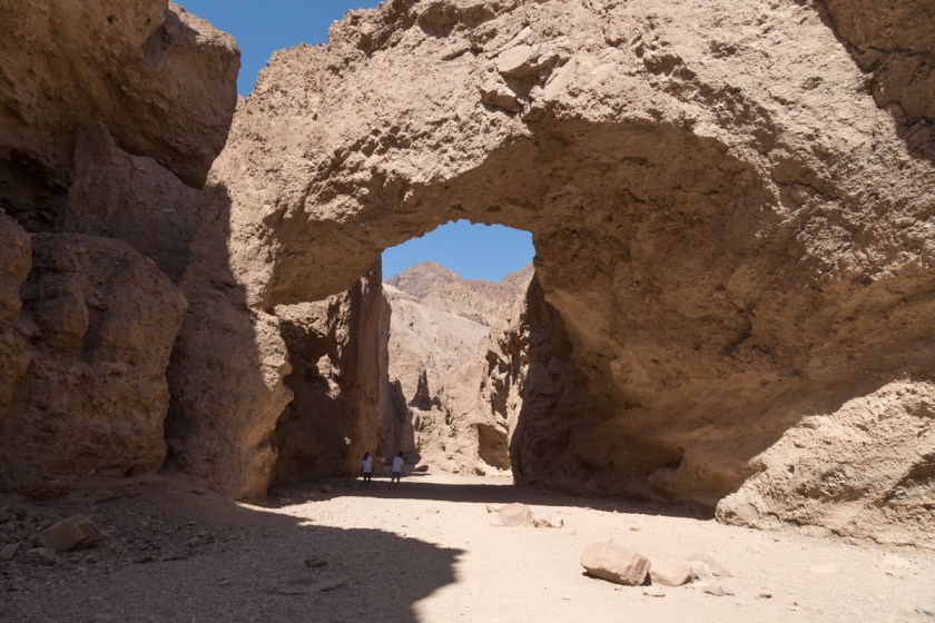
Since there was still so much we wanted to see, we didn’t walk all the way to the actual spot. We still had a couple hikes we wanted to do and with the temps pushing 90 degrees at 10 am we decided to move on. Our next stop was the natural bridge. It’s a fairly easy walk, despite being uphill. I can’t imagine the force of the water needed to carve such a bridge…
See the 2 hikers in the shadow of the bridge?
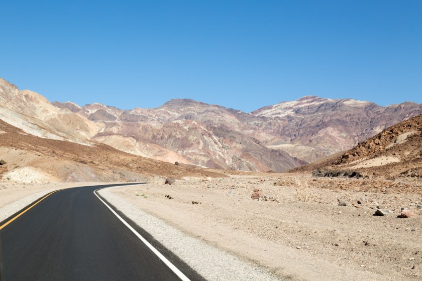
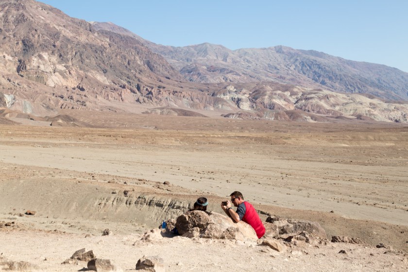
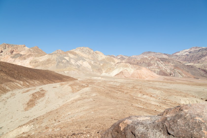
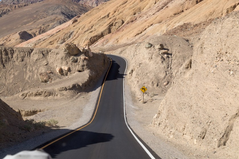
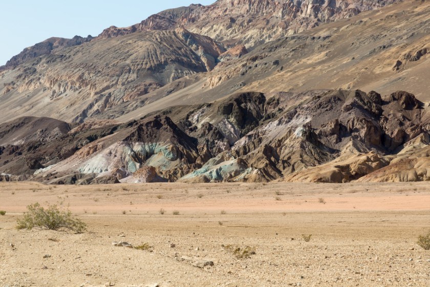
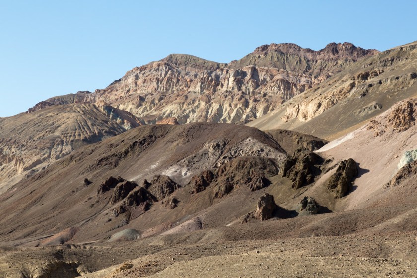
The National Park system did a great job of designing the scenic drives through the park. Most of them are one way and loop back to the main road. One such route is called Artists Drive. It is a 9 mile loop through some of the most colorful formations in the park. The narrow road winds through multi-hued volcanic and sedimentary hills…
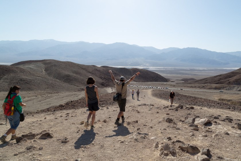
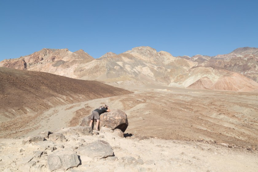
At the first pullout, we walked to the top of a fairly steep hill to get a better view of the landscape…
A great location to snap some memoriesSteve – finding his focus
Back on the road, I looked over and Steve was grinning, ear to ear. The twisting road had him itching to test the laws of gravity…
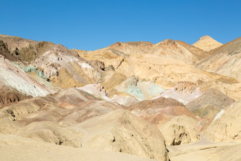
The next pullout is at a spot appropriately named Artist’s Palette. The colors were amazing. It’s like Mother Nature filled her paint brush with reds, browns, tans and greens, then spattered the colors much like a child fingerpaints…
As we were exiting the drive, the scenery changed yet again…
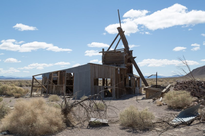
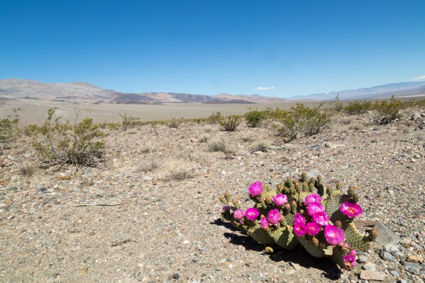
We were running out of time at Death Valley, but there was on more place I HAD to see – Racetrack Playa! (Read more about the interesting history and geology here) A playa is a dried lake bed and the Racetrack is nearly 3 miles long and 2 miles wide. Scientists estimate the dried beige mud is at least 1000 feet thick. The surface is so flat, it only varies 1 1/2 inches from end to end. We first attempted to reach the Racetrack via Scotty’s Castle Road. We were hoping the road closure signs meant the road was closed somewhere beyond the turn off to the Racetrack. A freak flood event happened in 2015 and destroyed the road and caused severe damage to Scotty’s Castle. (See pictures here). Of course, the road was closed prior to the turn off, so we had to settle on seeing more abandon buildings (I know, poor us, huh?)
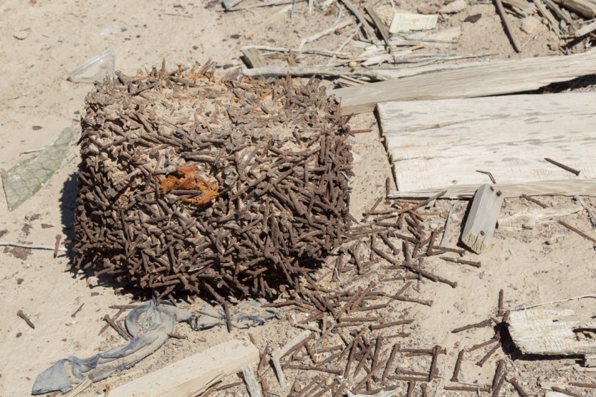
You know I had to go inside and look aroundHow long do you think these nails took to fuse together like this?
We had one more day and I was determined to get to the Racetrack. We checked the map and found an alternate route. One that comes with a warning…
“Caution: Rough and Remote Road
The road to the Racetrack is rough, and good tires, 4×4 and high clearance are usually required. Standard rental vehicles are not recommended, and often get flat tires. Use extreme caution on this road in the summer heat. There is no cell phone coverage in the area. Drive time from Furnace Creek is at least 3.5 hours each way. Other access roads make for even longer and more remote adventures. Driving offroad is strictly prohibited.”
OK…let’s go! When we left the pavement, the adventure began. I was finding it incredibly difficult to make any time. I kept having Steve stop the Jeep so I could take pictures…
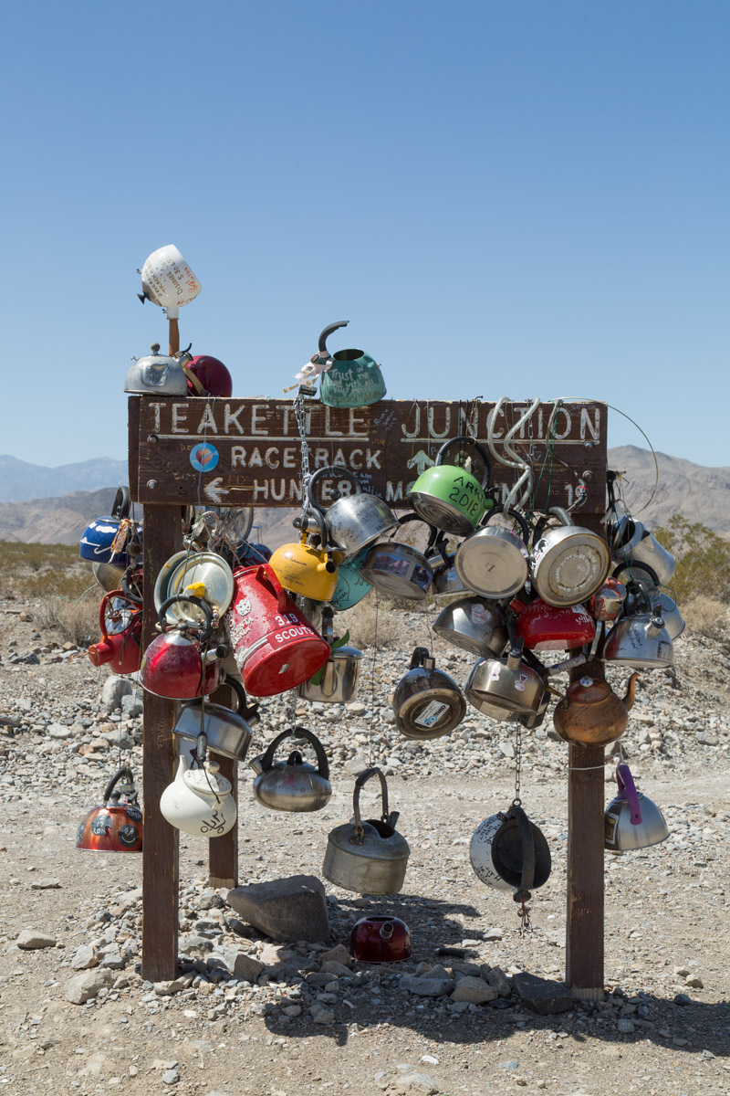
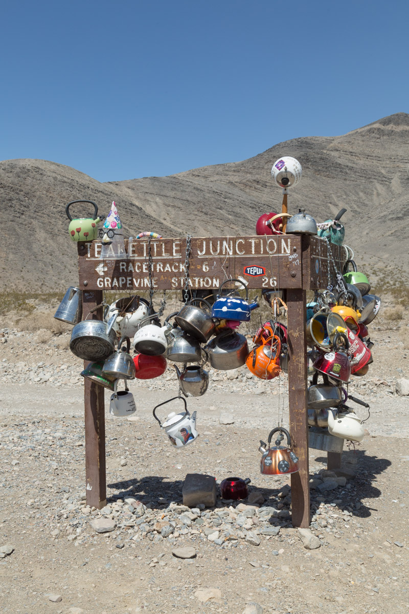
There is only one sign along the 26 mile route and I found it rather bizzare…
Legend says early travelers to the area put the first teakettles there to let others know there was water nearby. I don’t know if it is true or not, I never saw any water.
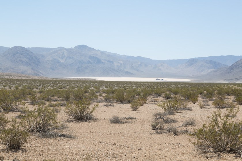
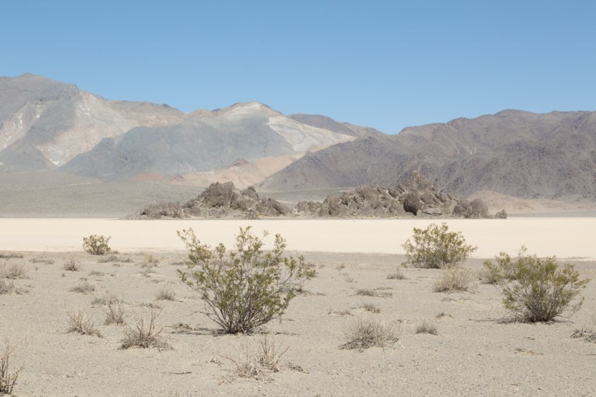
We were still 6 miles from the Racetrack, so off we went. As we rounded one curve in the road, we got our first view of Racetrack…
The outcropping of rocks in the middle is called the Grandstand…
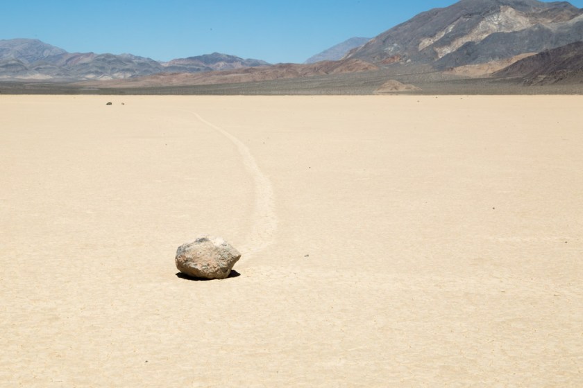
What is so fascinating about Racetrack is the mysterious moving rocks. Although the mystery of how/why the rocks move was solved in 2014 (Read about it here), it still boggles my mind…
See the tracks left by the moving rocks?
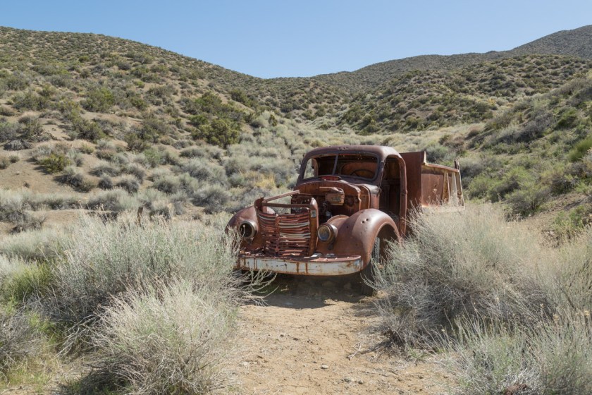
Two NPS Rangers were at Racetrack replacing a sign and we talked to them for quite a while. One of them said they have seen the playa completely under water and a day later, not a sign of water could be seen. He also said if people walk on it when it is wet, the footprints can stay there for years. The Jeep was just over half a tank of gas and we wondered if going back the same way we came was the best route. The ranger told us Hunter Mountain Pass was a drive we shouldn’t miss and we wouldn’t have a problem with 1/2 a tank of fuel. OK – Hunter Mountain it is! We drove back to Teakettle Junction and headed into the wild. As I mentioned before, there aren’t any road signs in the back country. Our GPS said we were on Hunter Mountain Road and I figured as long as it said that, we would be fine. Hmmm. When we came to the first split in the road, we went the werong way. That was ok, because it quickly dead ended at an abandon mine…
End of the line
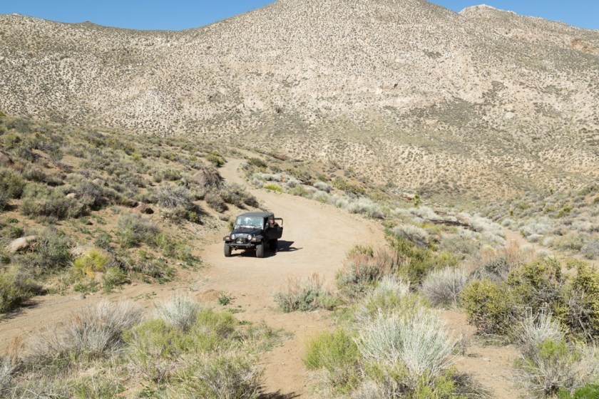
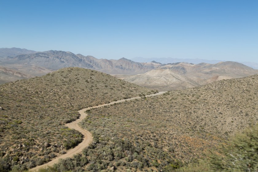
We got back on what we hoped was the right road and continued on. I could see the road off in the distance as it began to climb Hunter Mountain…
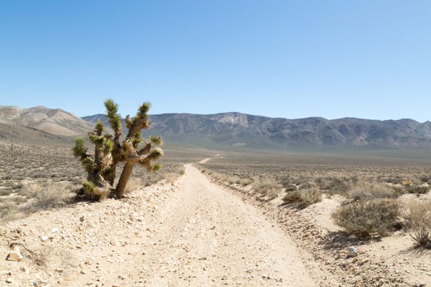
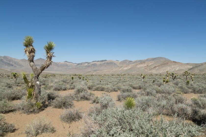
We passed a large area full of Joshua Trees…
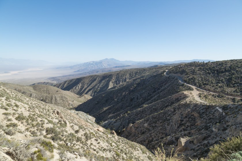
And began the climb. The road was barely wide enough for the Jeep and was a continuous set of switchbacks. The summit of Hunter Mountain is 7168 feet and the view is stunning…
I was beginning to worry we were on the wrong road and were bound to run out of gas. I had no interest in being stranded, with no cell service, miles from anywhere! Finally, we passed another vehicle. The folks assured us we were on the right road, but it was still 30 miles to Panamint Springs. We got a bit of a surprise as we rounded a corner – free range cattle in the middle of the road…
When we made it back to the pavement, we made a beeline for Panamint Springs and fuel. When we saw fuel there was $4.99 a gallon, we made the call to continue to Stovepipe Wells -another 28 miles. We made it just after the idiot light came on. But, I have to say, I was beginning to hold my breath a bit! Fuel was still $4.17 a gallon, so we only put in enough to get back to Beatty.
Our time was up in Death Valley. We had only seen about half of it, but we had a time-table to keep. We still had 3344 miles to go to get to Moose Pass, AK. I hope to go back and explore more some day!
Thanks for coming along, I hope you enjoyed our take on Death Valley!