Visiting the Texas Gulf Coast

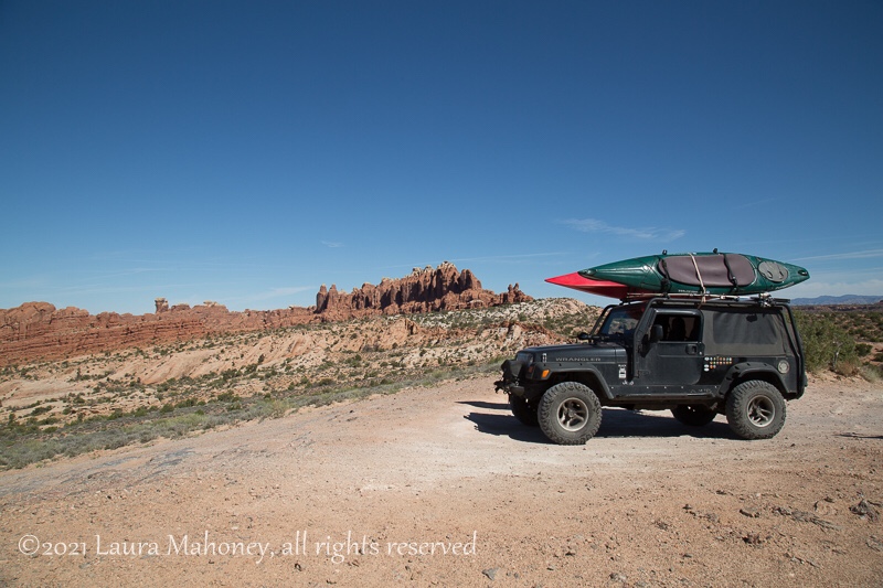
After leaving Louisiana, we headed for the gulf coast of Texas. There are 8 state parks along the coast and 6 of them have camping. Since we’d already been to Galveston Island SP two times, we decided to check out some of the other parks.

We started with Sea Rim SP in Sabine Pass.

I read reviews (usually) and nearly everyone complained about the nonstop barrage of mosquitoes year round. And, yep!, they are that bad!! But knowing in advance made it much more bearable. A liberal dose of bug spray and a bit of tolerance toned it down to mildly annoying.

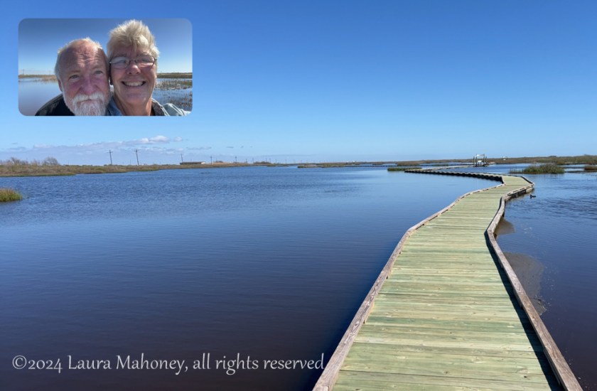
The Gambusia Nature Trail Boardwalk is named for the small gambusia fish you will see in the marsh. It has several interpretive signs and covered benches along the .7 mile trail.

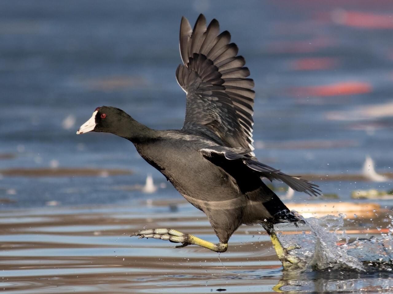
We saw plenty gambusia, along with a couple water snakes and some turtles. We only saw one small flock of American Coots. In case you ever wanted to know, a flock of coots is called a commotion! Most people assume coots are ducks but what makes then so different is the fact they do not have webbed feet…

This picture is from the Cornell University "All About Birds" website
This picture is from the Cornell University website “All About Birds”

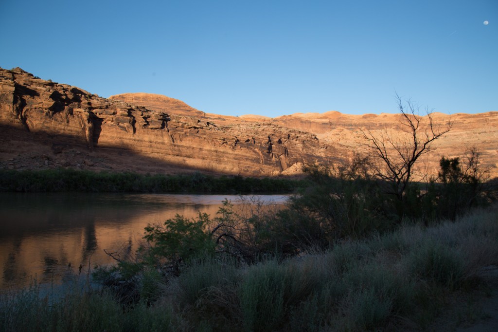
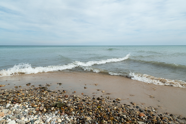
You can drive along the east and west beaches for miles, with the center section reserved for non-motorized travel. While we did in fact do that, I’ll be darned it I know what I did with the pictures!

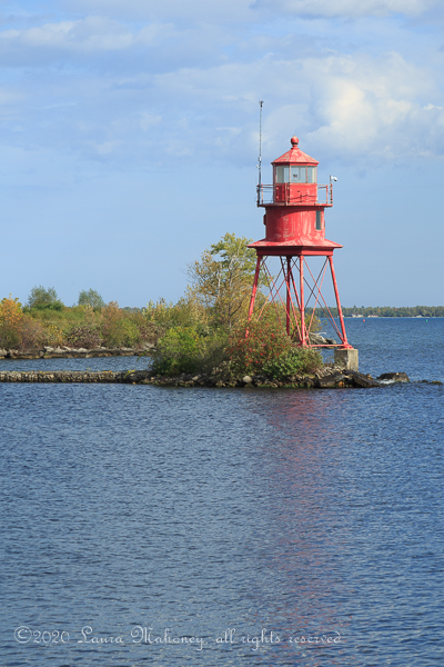
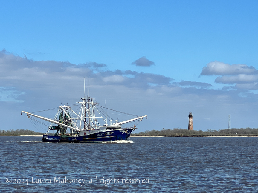
We set a day aside to go into Sabine Pass to see the lighthouse (which I believe is technically in Louisiana).

We were getting ready to leave when we saw the Lucky Johnny trawler heading out into the gulf.

Our time at Sea Rim was over much too soon, but that means we’ll just have to go back another time!

Our next stop was Mustang Island SP outside of Corpus Christi. This was a place that had been on my To-Do list for years and I was quite excited about our stay. Unfortunately, my excitement vanished when we arrived. Not because it wasn’t everything I had hoped. But because the transfer case in my Jeep had grenaded somewhere along the way. We now knew what that sound was we had heard 😦 He discovered when the t-case grenaded, it also took out the front drive shaft, ripped out several wires AND put a hole in the fuel line. Oh joy! He did all the repairs he could do at the campground and found a shop at our next stop to complete the job. So….he spent our time there “mechanic-ing” and I read books. I did manage a walk on the beach, but my heart just wasn’t into it but then I found something weird in the surf…

No one seemed to know exactly what is was/is, so I’ve dubbed it my Texas Gulf Coast Alien.

The only other picture I took the entire 4 days was an early spring promise of a beautiful yucca plant flower bud…

Looking back on it, it could have been so much worse. We could have been 5 miles down the beach when it happened or on the highway doing 60 mph. But knowing that did not help how I felt at the time! So,with high hopes of a repaired Jeep, we headed off to Laredo. More about that next time!

Where Have You Been the Last 2 Years?!?!?

I know, I know. We’ve been missing in action as far as updating the blog, but I am going to try to re-motivate myself. We’ve been lots of fantastic places and I’ve struggled with where do I pick back up. Do I go back to where we have been? Or do I just start with what’s been happening recently? The “plan” I’ve come up with is to get you all up to speed on where we are, what’s going on and what’s coming up first, then, throw in random places from the past. So with that in mind, here goes…

2024

We had a major change at the end of 2023, we opted to stop selling Christmas trees for Hayes Farms. It was a tough decision. It was a huge part of our lives for the last 5 years. We had gone to Florida in October with the plan of selling trees, but, things change. We still sell fireworks for New Years so we started 2024 in Florida. We spent our first night back on the road at our favorite Harvest Host, Southern Grace Lavender Farm. It is always a pleasure to stay there and it breaks up the long drive out of Florida. Then we headed west to Blakeley State Park in Spanish Fort, AL. From here, it was an easy drive into Mobile. We missed their Mardi Gras celebration by 1 day, which was kind of OK with me. I’m not a fan of big crowds or impossible to find parking. After doing a Google search, we found The Oyster City Brewing Company

This is Dane, our bartender. Apparently taking a selfie, before taking our picture sounded fun. It’s not the first time it has happened and I’m actually a bit disappointed now when it doesn’t happen.

We walked the boardwalk trail passed the “hiding tree”. It is said that it was a hiding place for Confederate soliders trying to escape capture after loosing the battle of Fort Blakeley….

Next, we headed to Palmetto Island State Park in Abbeville, LA. In case you don’t know, all Louisiana state parks offer a camping discount for people 62 and over! Score! It pays to have an old man for a husband, hehehe. My main reason for stopping there is they have 3 ponds/lakes that are connected by a kayak trail, but the weather had no plans to cooperated with me. Don’t let the patches of blue sky fool you, it was cold!

Instead we decided to check out the local, come on! you know what’s coming…brewery. Adopted Dog Brewery in Lafayette did not disappoint!

Josie

There are many impressive live oak trees in the area, but this one really stood out to me. It definitely has a desire to live!

Up next, 17 Days to Cross Texas

The Area Surrounding Moab

National parks aren’t the only reason to visit the Moab area.

The Upper Colorado River Scenic Byway (Hwy 128) is located on the edge of town. This 44.5 mile drive along the Colorado River, shouldn’t be missed. There are numerous camping areas along the river, as well as several boat launches. One of the beaches we passed had a couple families enjoying the spring weather…

I imagine in the heat of summer, this place would be packed!

Spring flowers added a splash of color against the red cliffs…

The snow capped mountains in the distance added another layer to the landscape…

Iron oxide colors the land a lovely shade of red…

Not too far off Hwy 170 you can find the remains of the coal mining town of Sego. Around 1910, Henry Ballard discovered an exposed vein of coal and began buying up the surrounding ranches. After mining for a year, he was bought our by investors from Salt Lake City. With grand plans, a boarding house, store and numerous other buildings were constructed. The first coal washing plant west of the Mississippi was also built. And a town was born. Originally named Neslen, in 1918 it was renamed Sego in honor of the sego lily that grows there. The mine changed hands several times before finally being abandon. Water shortages, mechanical problems and fires kept the mine in the red for most of its lifespan. A more complete history of the town can be found here. Today, there are few buildings still standing…

The Book Cliffs surround the ghost town of Sego and offer another reason to visit. Historians have identified 4 distinct styles of petroglyphs on the cliff faces.One can only imagine the stories that were being told…

Unfortunately, several have been defaced over the years .

I hope you enjoyed our journey through the Moab area. The national parks are why we decided to come here, but this area has so much more to offer.

I’d love to hear your thoughts!

Canyonlands National Park

A mere 28 miles from the entrance to Arches lies another, lesser known or visited park, Canyonlands National Park .

Canyonlands is divided into 4 districts, the Island in the Sky, the Needles, the Maze, and the Rivers (the Green and the Colorado). Island in the Sky is the most accessible with paved roads, scenic vistas and easy to reach hiking trails. Reaching the other districts requires 4×4, horses, overnight hikes into the backcountry and a special permit.

We only had one day to visit Canyonlands and decided to take the Islands in the Sky Scenic Drive. We chose to drive to the end and work our way back to the entrance. The park rangers has warned us about limited parking at the Mesa Arch Trailhead and , as expected, it was packed when we drove by. With stunning scenery at every turn, it’s hard to take it all in. From deep canyons to vast mesas, the views just keep coming…

The cyclist in the above picture, yes, that minuscule black dot, provides a sense of scale.

When sensory overload begs you to find a seat and just take it all in for a moment, find the best one you can!

If you think I’m crazy, at least I don’t have my back to the edge of the cliff while someone takes my picture…

While you are gawking at the landscape, don’t forget to take in the things at your feet…

In my opinion, cacti create some of the most beautiful flowers. You’re not going to pick a wildflower bouquet, but you might end up with a hundred or so pictures on your phone.

It was around 4pm by the time we made it back to the trailhead at Mesa Arch. With only a handful of cars remaining, we easily found a spot and hiked the .6 miles to the arch. While Canyonlands NP is obviously named for, well, its canyons, it does have 80 or so arches. In comparison, nearby Arches NP boasts over 2000 arches (the highest concentration in the world). We had no problem finding someone to take our picture…

Or taking crowd-less pictures of the landscape…

We still had a few hours of daylight left when we finished the Island in the Sky drive, so we decided to take the long way back to Waldo via Pucker Pass 4×4 trail.

We weren’t very far down the trail when we came across a possible problem. With the kayaks on the top, I wasn’t sure there would be enough clearance. Plus the trail at this point had turned a bit rough…

While we made it though without any problems, the vehicle you can see behind us turned around. Soon, we were back to switchbacks and more amazing scenes…

If you look closely, you can make out the trail near the bottom of the canyon. We found an area to pull off the trail and take the required selfie…

Moonrise over the cliffs signaled the impending sunset…

As the shadows began to lengthen, we knew it was time to move along…

The Colorado River signaled the end of the trail and our day’s adventures…

It would be easy to spend a week or more exploring Canyonlands. Maybe next time!

Up next – The Area Surrounding Moab

Thanks for coming along, I’d love to hear your thoughts on our adventure.

Arches National Park

Last year, we visited Arches National Park. OK, so I’m a little behind in posting but, in my defense, we did just spend 6 weeks with very limited connectivity. Anyhow, back to Arches. We stayed at Ballard RV Park in Thompson Springs, Utah. We chose Ballard because it was close to everything we wanted to see, but didn’t have the Moab crowding.

We drove into Moab to pick up information about Jeep trails and National Parks so we could plan how to make the best use of our week in the area. We were disappointed to learn the entrance to Arches was generally closed by 11am due to overcrowding in the park and usually reopened in the late afternoon. We passed the entrance to Arches on our way back to Ballard’s and the car lining up to get in for the afternoon was nearly a mile long. We weren’t too keen on the idea of sitting in line for hours!

The next day, we decided to take a BLM road that looked like it went all the way into Arches from the back side. As we rode along, we were treated to some of Utah’s wildlife…

As well as some wildflowers and incredible scenery…

When we reached the boundary of the park, we were quite happy to find an open gate and a sign stating this was a fee area. Since we have a National Park pass, we drove on in!

Our goal was to spend the day exploring and deciding which arch we wanted to photograph at sunrise a few days later. We drove the entire length of paved roads in the park and saw some amazing arches and a very appropriate warning…

Our sunrise photography decision was Turret Arch as seen through North Arch. With our decision made, we headed back to Waldo via paved roads. As we exited the park, I made a time lapse video of the line of cars waiting to get in…

Dang!!! Luckily, to get there and set up for sunrise photography, we’d be coming into the park at 4am, shouldn’t be too bad at that hour.

We arrived back in the park a few days later, well before sunrise. There were lots of cars in the parking lot, but the ranger had told us many of those would leave as soon as the sun rose above the horizon…

We to the base of North Arch in the dark and took up our wait for sunrise. As expected, there were lots of people waiting with us…

But, 10 minutes after the sun broke the horizon…

The crowd began to thin. Steve found a place he wanted to be and so did I. Two very separate places!

My patience paid off with my favorite shot of the morning…

Turret Arch seen through North Arch. Notice the lack of people!

With sunrise behind us, we set off for our next adventure…

I love my Jeep!! The pictures I took don’t really show how bad the road was…

But the road was definitely worth the views!

The only other way to get to Tower Arch is a 10 mile hike ~ no thanks! It was nearing noon, so Steve and I found a place for lunch…

Not a great picture, but you get the idea. We had about 5 more miles to go before we reached the park boundary and the scenery just kept being amazing…

We finally made it back to paved roads and called it a day.

Whether you are a hiker, a 4×4 enthusiast or a see it from the car kind of person, Arches National Park has something for you!

Up next…Canyonlands National Park

Fall In Michigan

September was passing us by much faster than we hoped. October was knocking on the door promising cooler weather and shorter days. You might remember, I don’t like the cold very much, actually not at all. I was fairly ready to join the southern migration!

One thing we hadn’t taken the time for yet, was another one of those “Michigan things”. We had to go to Cops & Doughnuts! The first Cops & Doughnuts opened in Clare, Michigan. The site had been a bakery since 1896. It was within weeks of closing when all nine members of the Clare Police Department decided to come to the rescue. According to their website, the business plan was written on the back of an empty pizza box. (I’ll bet they didn’t take that to the SBA) It didn’t take long for Cops & Doughnuts to become “a Michigan thing” We didn’t want to drive all the way to Clare, but lucky for us, the business has been so successful, they have opened up several other precincts, including Jay’s Precinct in Gaylord, MI.

Unfortunately, I was caught up in smells so good they aught to be illegal that I forgot to take any more pictures. The interior is decorated with police memorabilia and branded souvenirs. I ordered what they call a “Long John” It is their version of an eclair and Steve had a maple glazed cinnamon bun.You’ll just have to take my word for it, they were huge and delicious!

Only a few miles away was the other reason we had gone to Gaylord. The city maintains an 80 acre park for a herd of Elk. The city has been the caretaker of this herd since the 1980’s. There are several viewing areas where you can sit comfortably (aka warm) in your vehicle and watch the elk. Late September is mating season and we watched the dominant bull strive to defend his breeding rights. All of the cows were lazing up near the feeding area, every so often a bold young bull would walk up the hill to take his chances. Every time, the dominant bull would bugle and charge after him. Chasing him back down the hill to join the rest of the bulls. If one of the cows would wander to far, he would round her up and return her to the feeding area…

“Let’s go! Back up the hill with you.”
the dominant bull
young bulls
“Hey you with the camera, I’m only one years old. Aren’t I cute?”
“Hey babe, how’s about a kiss?”
“You always know just what to say handsome”
If you’ve never heard an elk bugle, this is what it sounds like

I really enjoyed watching the elk, but it was time to head back to Bambi Lake. We would be caravan-ning with Mike and Dawn to our next location and there was still plenty to pack up before we left.

Now, we were ready to say goodbye to Michigan (until next time)…

Up Next…

In a southwesterly direction

Captured On A Pirate Ship

Well, now we’ve done it. The pirates have locked us below deck while they go ashore, no doubt for a healthy ration of rum. Mike, Dawn, Steve and I only have one option, we have to figure out how to get topside and sail out of the harbor before the pirates return. The clock is ticking. We only have an hour to figure where the keys to freedom can be found. If the pirates return, they will surely make us walk the plank.

Why don’t we call for help you ask? They confiscated our phones! As we look around we are overwhelmed about where to even start…

We each pick a part of the room to search, nervous laughter escapes from us as we struggle to find the clues…failure is not an option. Then we could hear it, a soft voice whispering a clue…”I’ve heard pirates like to hide things under the stairs?” We followed the clues, deciphered the ciphers and solved the mind-bending puzzles only to get stuck on the very last lock. We could hear the pirates coming across the bay in their rowboat. Singing, “Yo, ho ho and a bottle of rum. Arrrrgggh” With only moments to spare, that faint whisper said “Follow the clue exactly, hurry” In our race against the clock, we had been overlooking one step on the lock. With literally seconds to spare, we burst through the door and made our way to freedom.

Well, how did we get into such a pickle to begin with? We had booked an adventure with Northern Michigan Escape Rooms, LLC in Grayling, MI. None of us had ever experienced an escape room first hand but we had all heard stories of how much fun it could be.

The Forrester family opened their escape adventure rooms in 2016. On the night we were there, it was Stan’s wife, Mary Jo who was the faint whisperer of clues and encouragement. She never gave us any direct answers, but her hints would spark an idea. Without her helpful prodding the pirates would have made us into shark stew for sure.

Mary Jo showed us the other escape rooms they offer. They have a speakeasy…

And a very cool room for two , submarine. A perfect date night adventure…

Mary Jo even showed us the newest room in progress, Hetephere’s Tomb. (Since completed) We were amazed at how resourceful the Forrester family is, nearly everything was either repurposed, recycled or homemade, but the results were incredible.

It was a fantastic way to spend an hour with friends. When we arrived, our attitude was, “What the hell, we’ll try it”, by the time we finished our attitude was “Wow! I’d do that again!”

Have you ever done an escape room? Did you enjoy it?

Up next…

A visit to Elk Park

A Lighthouse Road Trip On The Shores of Lake Huron

I love lighthouses. I always have. In fact if I were to go through my map collection, I would find several maps dedicated to lighthouse locations by state. I have lighthouse locator app on my phone. I even have a United States Lighthouse Society Passport.

We left Bambi Lake early one morning to start the hour drive that would lead us to the shores of Lake Huron. Lake Huron is the second largest of the great lakes, but has the longest shoreline, over 3800 miles.

Our first stop was the Sturgeon Point Lighthouse. The buildings were closed due to Covid, but the grounds were open for exploration.

Standing on the shore, it’s easy to understand why the EPA calls the great lakes “freshwater seas”. There is no land on the distant horizon and the waves crash to shore as if it were the ocean…

I spent more time than necessary walking along the shores picking up pretty rocks only to decide to leave them for the next person. After all, Waldo can only carry so much weight.

We had planned on going further north, but we realized we would definitely run out of daylight before we ran out of lighthouses to visit. Instead we headed south to Apena. The lighthouse there is at the mouth of the Thunder Bay River and can be seen by walking along a boardwalk atop of the Apena breakwater.

While the lighthouse isn’t as fancy as many, I still enjoyed seeing it.

Click here for more lighthouse info…

Our final destination for the day was Tawas Point State Park. There have been record high water levels in Tawas Bay and the evidence is plain to see…

After we parked, we walked along one of the nature trails to get to the lighthouse. Once again, the lighthouse was closed due to Covid, so no tours were being offered. We had to settle for an outside view…

It’s probably just as well, I think my days of climbing lighthouse stairs are over. But it is always neat to tour the light keeper’s residence.

We had ventured as far south as we thought we could and still make it back to Bambi Lake before dinner so with that, we left the shores of Lake Huron and returned to Roscommon.

Ah, so many lighthouses, so little time!

Up next…

We get locked in on a pirate ship, oh dear!

Pure Michigan!

We said goodbye to our new friend Eddie and headed north to meet up with some old friends, Mike and Dawn from Random Bits of Trial and Error. It had been a hot minute since we’d last had a chance to meet up and relaxing in northern Michigan sounded like just the ticket.

Mike and Dawn had been raving about Bambi Lake for years and we wanted to know what all the hoopla was about. Well, to start with, Bambi Lake is a privately owned lake, nestled in 240 acres of beautiful Michigan woodlands with direct access to several of the state’s ORV trails. After getting checked in, Mike guided us to our site. Since it was already mid-September, the campground was nearly deserted…

We spent lazy afternoons around the campfire and quiet evenings sharing meals with friends. Our original plan was to spend 2 weeks there, but somehow, it stretched into nearly 4 weeks.

Fall is a lovely time to be in Michigan. The changing leaves and crisp mornings leave you feeling alive…

And what could be better than an afternoon of fishing…

One of our day trips was a drive up to Mackinaw City. Our ultimate destination was St. Ignace on the Upper Peninsula for a pasty. Get your mind out of the gutter! Pasty rhymes with nasty NOT tasty. We were told the pasty is the quintessential Upper Peninsula food. If you’d like to read about the fascinating history of the pasty, click here. As we drove into Mackinaw City, we chose to pass on this lunch option…

One of the big draws of Mackinaw City is the Mackinaw (or if you prefer Mackinac) Bridge. With Lake Michigan on one side and Lake Huron on the other side, it is an impressive suspension bridge. It is 28′ short of being 5 miles long and is the longest suspension bridge between anchorages in the Western Hemisphere. While we had no fear of traversing the bridge, many do. At mid-span, the bridge deck is 199′ or 61 meters above the water. The Mackinac Bridge Authority used to offer an escort service for people who were afraid to drive across themselves, but it has been discontinued.

My blue dot locator button is on the bridge.

It was chilly when we started the day, so we definitely were dressed for the weather…

Here, we are on the Lake Huron side of the bridge

The city has several lovely parks along the shores. We saw lots of people taking advantage of them…

A short walk from this city park is Michilimackinac State Park where the Old Mackinac Point Lighthouse is…

The day had warmed up nicely and once we had our fill of parks and lighthouses we headed over the bridge to St. Ignace. Unfortunately, we only had enough time for a quick drive around town, but it certainly looked like a neat place to spend the day (or two). Upper Peninsula residents are called Yoopers. Yoopers refer to people who live in the Lower Peninsula as “trolls” since they live “under” the Mackinac Bridge. Apparently, Michiganders have a sense of humor. What they are VERY serious about is, you guessed it, pasties! Mike and Dawn have a favorite place satisfy their pasty cravings, Lehto’s.

We could smell the deliciousness as soon as we drove up! Mike was kind enough to take a shot of our first ever pasty experience…

All I can say if YUUUUMMMMMMY! It was so filling, we didn’t even have dinner that night.

With our bellies beyond full, we headed back to Bambi Lake in a bit of a food coma. But, dang, it was worth it! The setting sun provided us with a perfect ending to our day trip…

More Michigan Day Tripping

Back To Our Kentucky Adventures!

Before I got sidetracked, you may remember, we were having fun in Kentucky. I had written about mines and an abandon town, I had also written about a cave, a quarry and a new friend. What I hadn’t gotten around to sharing was the actual reason we went to Kentucky int he first place. A few years ago, I read a post from Justin and Stacy over at Opting Out of Normal. They have an entire series about finding “hidden gems” in their travels called “Off The Beaten Path“. When I read their post Off the Beaten Path in Kentucky. Our Top 5 Hidden Gems! I knew we’d have to go someday.

Well, someday finally rolled around. Their post says this hidden gem can be found at Grayson Lake. Hmmm, where? Grayson Lake is a 1500 acre lake with several boat launches. We drove to the Clifty Creek boat launch where we found a fairly busy launch and several friendly locals willing to share the mysterious location…

When I asked how “exactly” to get to the falls, no one could quite give me an answer but most peoples’ directions included things like “after you pass the big rock, you will see a cliff with a dead tree on top, go left there and you can’t miss it” or “paddle for about and hour and a half and take the waterway to your left, it’ll be right in front of you.” Ooooo-K. Easy-peasy. A few days later, we returned to the launch ready to find that waterfall!

It was a beautiful day and the paddling was easy and smooth. Clifty Creek is nestled in between wonderful sandstone cliffs which loom above you. Years of water and weather have carved them into some fascinating patterns…

Sometimes, we actively paddled, while other times, we just floated along and took in all the scenery…

There were several waterfalls along the way, but none of them were the one we came find…

One thing I began to realize is the fact that there are LOTS of “cliffs with a dead tree on top”! How would I know the right one when I saw it?

Is it this one?
Or maybe this one?

And, hey folks, they are ALL “big rocks”! I was beginning to think we would never find this hidden gem. Occasionally, we would pass another watercraft and every time I asked if we were heading the right direction, they would say yes. Ok, keep paddling. We rounded a small bend in the creek, we finally saw THE big rock…

A bit further and we came to an area where we could choose left or right. Everyone had said take the left, so we did. As I neared the what seemed to be a dead end, I began to hear what I was sure was a thundering waterfall, but where was it? When another kayaker seemed to appear out of nowhere, I knew what we had to do.

Watch what happens when you paddle into a “dead end”

I was astounded! This is what we came to find!! Grotto Falls! There wasn’t much room in the grotto. I doubt you could fit more than a couple kayaks in at a time. I paddled the kayak in a 360 to film the entire grotto…

Wow, just wow!

Not wanting to hog the grotto, we paddled back out to make room for others to enjoy the falls. I managed to get turned around quick enough to get a picture of Steve reappearing…

It had definitely been worth the paddle! Thank you to Opting Out of Normal for writing about this hidden gem! You were right on the money!

Up Next…

Heading to Michigan

Thanks for stopping by!